Fraud Blocker Skip to main content

Surveyor Collection (page 5)

"Surveyors: Mapping the World

Background imageSurveyor Collection: Farmer examining a young fruit tree

Farmer examining a young fruit tree

Background imageSurveyor Collection: HONG KONG: SURVEYORS, 1884. Team of surveyors plotting the route of the Peak Tramway

HONG KONG: SURVEYORS, 1884. Team of surveyors plotting the route of the Peak Tramway on Hong Kong Island, China. Photograph, 1884

Background imageSurveyor Collection: FRANCE: ROOFING, 1848. Surveyor and architect in the foreground with roofers working

FRANCE: ROOFING, 1848. Surveyor and architect in the foreground with roofers working on a cathedral in the Loire region; the workers are compagnons, members of secret trade-union organizations

Background imageSurveyor Collection: SURVEYING, 1598. A surveyor and his assistant take comfortable sightings on the

SURVEYING, 1598. A surveyor and his assistant take comfortable sightings on the countryside as a dial records distances by counting the revolutions of their carriage wheels. Woodcut, German, 1598

Background imageSurveyor Collection: WORLD WAR I: TRANSPORT. U. S. Army soldiers surveying the transportation of supplies

WORLD WAR I: TRANSPORT. U. S. Army soldiers surveying the transportation of supplies
WORLD WAR I: TRANSPORT. U.S. Army soldiers surveying the transportation of supplies through the European countryside during World War I. Photograph, c1918

Background imageSurveyor Collection: EDWARD RILEY STETTINIUS (1865-1925). American executive, Surveyor General of Army

EDWARD RILEY STETTINIUS (1865-1925). American executive, Surveyor General of Army Purchases during World War I. Photograph, early 20th century

Background imageSurveyor Collection: CHARLES P. STONE (1824-1887). American army officer, civil engineer, and surveyor

CHARLES P. STONE (1824-1887). American army officer, civil engineer, and surveyor. With his daughter Hettie. Photograph, 1863

Background imageSurveyor Collection: COLIN MACKENZIE (1754-1821). British Colonel and Surveyor General of India

COLIN MACKENZIE (1754-1821). British Colonel and Surveyor General of India. Colonel Colin Mackenzie and his Indian Pandits. Oil on canvas by Thomas Hickey, 1816

Background imageSurveyor Collection: JOHN WESLEY POWELL (1843-1902). American geologist. Down the Grand Canyon with a camera, 1871

JOHN WESLEY POWELL (1843-1902). American geologist. Down the Grand Canyon with a camera, 1871. Photograph by E.O. Beaman for Major Powells United States Topographical

Background imageSurveyor Collection: ANDREW ELLICOTT (1754-1820). American surveyor

ANDREW ELLICOTT (1754-1820). American surveyor

Background imageSurveyor Collection: SURVEYOR, c1890. Portrait of a surveyor with tools. Photograph. c1890

SURVEYOR, c1890. Portrait of a surveyor with tools. Photograph. c1890

Background imageSurveyor Collection: RAILROAD SURVEYORS. American; c. 1890

RAILROAD SURVEYORS. American; c. 1890

Background imageSurveyor Collection: CAMPING, c1872. Men, possibly surveyors, in their camp during the geological surveys

CAMPING, c1872. Men, possibly surveyors, in their camp during the geological surveys led by Ferdinand Vandeveer Hayden. Photographed by William Henry Jackson, c1872

Background imageSurveyor Collection: SIOUX CITIZENSHIP, 1907. A U. S. allotting surveyor (center) and his interpreter

SIOUX CITIZENSHIP, 1907. A U. S. allotting surveyor (center) and his interpreter
SIOUX CITIZENSHIP, 1907. A U.S. allotting surveyor (center) and his interpreter (left) granting citizenship to Oglala Sioux Native American chief American Horse on the Pine Ridge reservation in South

Background imageSurveyor Collection: THE GREAT WEST, 1881. American lithograph with scenes of farming, surveying, railroads

THE GREAT WEST, 1881. American lithograph with scenes of farming, surveying, railroads and river life, depicting the good life in the American West

Background imageSurveyor Collection: AD: SPORTING GOODS, 1890. American magazine advertisements for sporting goods, 1890

AD: SPORTING GOODS, 1890. American magazine advertisements for sporting goods, 1890

Background imageSurveyor Collection: A Plan of the City of New York from an Actual Survey. Engraved map of Manhattan, 1728

A Plan of the City of New York from an Actual Survey. Engraved map of Manhattan, 1728, from a survey by James Lyne
NEW YORK CITY MAP, 1728. A Plan of the City of New York from an Actual Survey. Engraved map of Manhattan, 1728, from a survey by James Lyne

Background imageSurveyor Collection: Two archaeologists working on a map of the Step House on Wetherill Mesa at Mesa Verde National Park

Two archaeologists working on a map of the Step House on Wetherill Mesa at Mesa Verde National Park
MESA VERDE: ARCHAEOLOGISTS. Two archaeologists working on a map of the Step House on Wetherill Mesa at Mesa Verde National Park. Photograph by Fred Mang, Jr. c1965

Background imageSurveyor Collection: Diagram illustrating ten different geological measurement devices, c1970

Diagram illustrating ten different geological measurement devices, c1970
GEOLOGICAL MEASUREMENTS. Diagram illustrating ten different geological measurement devices, c1970

Background imageSurveyor Collection: An Atlas-Centaur 4 lifts off

An Atlas-Centaur 4 lifts off from Launch Complex 36 at Cape Kennedy on 11 December 1964 Carrying a model of the Surveyor Moon lander. Date: 1964

Background imageSurveyor Collection: A surveyors level. From Gaultherus Rivius Architechtur... Mathematischen Kunst, Nuremberg, 1547

A surveyors level. From Gaultherus Rivius Architechtur... Mathematischen Kunst, Nuremberg, 1547
A surveyors level. From Gaultherus Rivius Architechtur...Mathematischen Kunst, Nuremberg, 1547. Engraving

Background imageSurveyor Collection: Surveying: Top: measuring angles using a quadrant. Bottom: obtaining levels and altitudes

Surveying: Top: measuring angles using a quadrant. Bottom: obtaining levels and altitudes using Hulsiuss planimeter. From Levinus Hulsius Instrumentorum Mechanicorum, Frankfort-am-Main, 1605

Background imageSurveyor Collection: William Smith (1769-1839) English geologist founder of stratigraphical geology

William Smith (1769-1839) English geologist founder of stratigraphical geology. His insight into geological strata was gained while he was working as a canal surveyor. From Life of Sir Roderick I

Background imageSurveyor Collection: Arthur Arnold (1833-1902)

Arthur Arnold (1833-1902) British surveyor and land agent: radical politician: Member of Parliament for Salford (1880-1885): Chairman of London County Council 1895-1896. Engraving. published 1896

Background imageSurveyor Collection: Brooklyn Suspension Bridge, illustration 1883

Brooklyn Suspension Bridge, illustration 1883
Brooklyn Suspension Bridge, New York: Designed and built by JA Roebling and his son WA Roebling, opened 1883. Wood engraving from " Scientific American", New York, 14 July 1883

Background imageSurveyor Collection: Sculpture representing an agrimensor (land surveyor)

Sculpture representing an agrimensor (land surveyor) Museo Della Civilta Romana (Museum of Roman Civilisation), Roman art

Background imageSurveyor Collection: Surveying Instruments and Techniques. C017 / 3438

Surveying Instruments and Techniques. C017 / 3438
Plate from 18th century encyclopedia showing illustrations of various surveying instruments and techniques. Diagrams show the use of chains to measure baselines

Background imageSurveyor Collection: DuPont Highway construction, 1910s C018 / 0610

DuPont Highway construction, 1910s C018 / 0610
DuPont Highway construction. View of the state of the roads prior to construction of the Coleman du Pont Road in Delaware, USA

Background imageSurveyor Collection: Allegory of geometry, 16th century C017 / 6991

Allegory of geometry, 16th century C017 / 6991
Allegory of geometry. 16th-century woodcut of an allegory on geometry, showing a woman holding a sextant and compass in her hands, facing a ship

Background imageSurveyor Collection: Gills Egypt baseline survey, 1875

Gills Egypt baseline survey, 1875
Gills Egypt baseline survey. British astronomer David Gill (1843-1914, centre) using an altazimuth to carry out a baseline survey in 1875 from the roof of the Hotel de L Europe

Background imageSurveyor Collection: Julius Hilgard, German-US surveyor

Julius Hilgard, German-US surveyor
Julius Erasmus Hilgard (1825-1890), German-US surveyor. Hilgard and his family settled in rural Illinois in 1835. After studying engineering

Background imageSurveyor Collection: Neanderthal excavation, Pinilla del Valle C015 / 6589

Neanderthal excavation, Pinilla del Valle C015 / 6589
Neanderthal excavation. Researchers carrying out excavations for prehistoric human fossils at the Pinilla del Valle site, in the Lozoya Valley, near Madrid, Spain

Background imageSurveyor Collection: Practical Geometry by Allain Manesson Mallet

Practical Geometry by Allain Manesson Mallet
" Practical Geometry" by Allain Manesson Mallet. Fol. 85 depicting the surveying of fields (1702). Engraving. FRANCE. Paris. National Library."

Background imageSurveyor Collection: A geologist (foreground) searches for an oil deposit in an American field with the help of his rod

A geologist (foreground) searches for an oil deposit in an American field with the help of his rod man
OIL SURVEYORS, c1944. A geologist (foreground) searches for an oil deposit in an American field with the help of his rod man. Photographed c1944

Background imageSurveyor Collection: Ufos / Hall / Boise

Ufos / Hall / Boise
At Boise, Idaho, surveyor E G Hall sees a UFO through his surveying instrument Date: 20 February 1948

Background imageSurveyor Collection: CHEYENNE MOUNTAIN, 1963. Construction of the North American Air Defense Command

CHEYENNE MOUNTAIN, 1963. Construction of the North American Air Defense Command (NORAD) headquarters in Cheyenne Mountain, Colorado Springs, Colorado, 1963

Background imageSurveyor Collection: Title page of a book of surveys started by George Washington at age seventeen, 1749

Title page of a book of surveys started by George Washington at age seventeen, 1749
WASHINGTON: BOOK OF SURVEYS. Title page of a book of surveys started by George Washington at age seventeen, 1749

Background imageSurveyor Collection: Young George Washington as a surveyor on the colonial frontier. Line engraving

Young George Washington as a surveyor on the colonial frontier. Line engraving
WASHINGTON AS SURVEYOR. Young George Washington as a surveyor on the colonial frontier. Line engraving, 19th cenetury

Background imageSurveyor Collection: Washington as Surveyor

Washington as Surveyor
WASHINGTON AS SURVEYOR. Young George Washington on a surveying expedition. Line engraving, 19th century

Background imageSurveyor Collection: CHARLES POMEROY STONE (1824-1887). American soldier, civil engineer and surveyor

CHARLES POMEROY STONE (1824-1887). American soldier, civil engineer and surveyor. Photographed as Brigadier General with his daughter Hettie, 1863

Background imageSurveyor Collection: JOHN FILSON (c1747-1788). American pioneer, surveyor, and author

JOHN FILSON (c1747-1788). American pioneer, surveyor, and author. Watercolor by Jacques Reich (1852-1923)

Background imageSurveyor Collection: MAP: WESTERN U. S. 1848. Map of the western United States, 1848, by Charles Preuss

MAP: WESTERN U. S. 1848. Map of the western United States, 1848, by Charles Preuss, surveyor on John C
MAP: WESTERN U.S. 1848. Map of the western United States, 1848, by Charles Preuss, surveyor on John C. Fremonts expeditions to the Rocky Mountains and the Oregon Trail from 1842 to 1844

Background imageSurveyor Collection: VIRGINIA: SOLDIERs REST. Soldiers Rest farmhouse in Berryville, Clarke County, Virginia

VIRGINIA: SOLDIERs REST. Soldiers Rest farmhouse in Berryville, Clarke County, Virginia, where George Washington is said to have stayed in 1748 while surveying the land for Lord Bryan Fairfax

Background imageSurveyor Collection: HMS CHALLENGER, 1873. The British survey ship HMS Challenger made fast to St

HMS CHALLENGER, 1873. The British survey ship HMS Challenger made fast to St. Pauls Rocks in the mid-Atlantic. Wood engraving, English, 1873

Background imageSurveyor Collection: RAILROAD SURVEYING. Surveying on Chat Moss for the Liverpool and Manchester Railway in England

RAILROAD SURVEYING. Surveying on Chat Moss for the Liverpool and Manchester Railway in England. Wood engraving, English, 19th century

Background imageSurveyor Collection: HMS CHALLENGER, 1872-76. The British survey ship HMS Challenger off Kerguelen Island in the South

HMS CHALLENGER, 1872-76. The British survey ship HMS Challenger off Kerguelen Island in the South Indian Ocean, during the oceanographic voyage of 1872-76. Contemporary wood engraving

Background imageSurveyor Collection: PLAN OF WESTMINSTER, 1593. Line engraving after Nordens Survey of 1593

PLAN OF WESTMINSTER, 1593. Line engraving after Nordens Survey of 1593

Background imageSurveyor Collection: SURVEYING TOOLS. Surveying instruments of the 18th century. Clockwise from top left are a portable

SURVEYING TOOLS. Surveying instruments of the 18th century. Clockwise from top left are a portable compass with alidade, a plane table with compass and alidade


All Professionally Made to Order for Quick Shipping

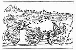
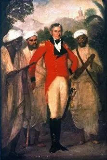
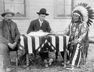
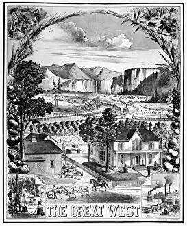
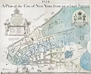
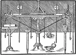
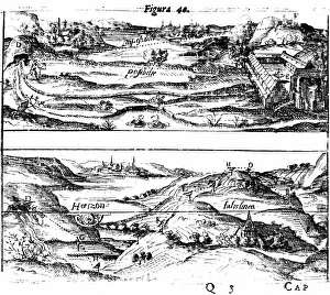
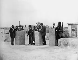
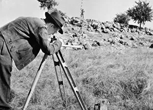
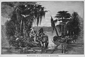
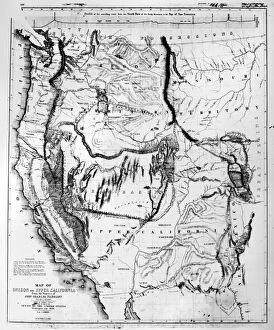
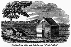
"Surveyors: Mapping the World, Land and Sea Through Time" Step back in time to 1594 with a colored German engraving showcasing surveyors diligently working on land and sea. Their meticulous efforts capture the essence of early surveying techniques. In another line engraving from the same year, German they are seen taking sightings on both land and sea. This glimpse into their world offers a fascinating insight into the tools and methods used during this era. Traveling forward to 1872, Gustave Doré's masterpiece "The New Zealander" depicts a scene where surveyors play an integral role in shaping new territories. Their expertise is crucial in charting unexplored lands. Thomas Holme's engraved plan of Philadelphia from 1683 showcases how early surveyors laid the foundation for one of America's most iconic cities. Their precision and attention to detail can be seen etched onto this historical map. Even beyond Earth's boundaries, surveying remains essential. The lunar map featuring spacecraft on the Moon exemplifies how even celestial bodies require careful examination by skilled professionals. George Washington, renowned as America's first President, was also an accomplished surveyor. A wood engraving from 1881 captures him meticulously measuring Lord Fairfax's vast land holdings—an important chapter in his life before politics beckoned. From ancient kingdoms to modern workhouses like Wellington's Union Workhouse in Somerset, maps have always played a vital role in understanding our surroundings. Surveyors' contributions ensure accurate depictions that aid navigation and planning alike. Young George Washington himself began his journey as a surveyor—a profession that would shape his destiny as he embarked upon greatness later in life. Color engravings from the 19th century immortalize this formative period for one of history's greatest leaders. Beyond terrestrial landscapes, Admiral Teddy Evans stands tall among British naval officers and Antarctic explorers.