
Sykes Mark Sir Collection
"Sykes Mark Sir: A Glimpse into the Dynasties of Ancient Times" Step back in time and explore the fascinating dynasties that once ruled during the Buwayid era


All Professionally Made to Order for Quick Shipping
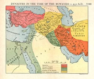
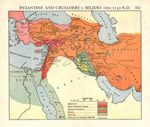
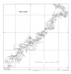
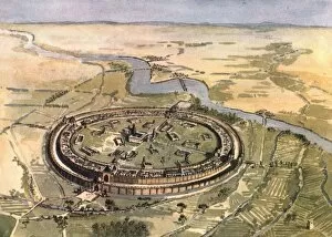
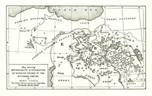
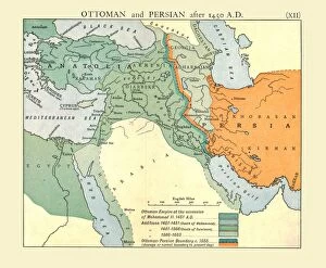
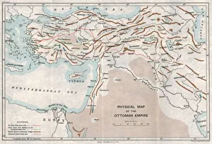
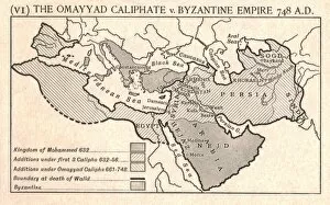
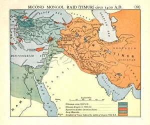
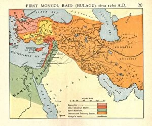
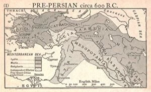
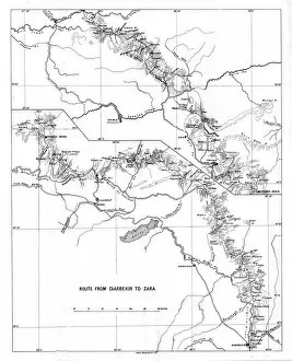
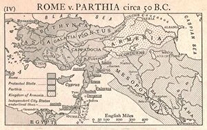
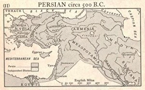
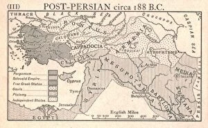
"Sykes Mark Sir: A Glimpse into the Dynasties of Ancient Times" Step back in time and explore the fascinating dynasties that once ruled during the Buwayid era, circa 932 A. D. C1915. Immerse yourself in the rich history depicted by Emery Walker Ltd's captivating artwork. Journey further into history as Byzantine and Crusaders clash with Seljuks around 1130 A. D. C1915, in a battle for power and dominance. Witness this epic conflict through Emery Walker Ltd's masterful illustrations. Discover the enchanting landscapes of Neri to Akra, beautifully captured by Stanfords Geographical Establishment in 1915. Let your imagination wander through these mesmerizing scenes. Transport yourself to Baghdad during Mansur's reign in 1915, courtesy of Edmund Sandars' exquisite creation. Marvel at the grandeur of this ancient city and its vibrant culture. Witness the transformation of Ottoman and Persian empires after 1450 A. D. , as portrayed by Emery Walker Ltd's remarkable artistry. Delve into their complex histories and unravel their intertwined destinies. Uncover the geographical intricacies of the Ottoman Empire with an extraordinary physical map from c1915, created by an unknown artist. Trace its borders and marvel at its vast expanse. Relive historic clashes between Abbasid Caliphate and Byzantine Empire circa 786 A. D. , brought to life by Emery Walker Ltd's talented creators. Experience these pivotal moments that shaped our world today. Travel even further back to witness The Omayyad Caliphate vying against Byzantine Empire circa 748 A. D. , immortalized through Emery Walker Ltd's stunning artwork. Feel the tension rise as two mighty powers collide.