Fraud Blocker Skip to main content

Theatrum Orbis Terrarum Collection

"Theatrum Orbis Terrarum

Background imageTheatrum Orbis Terrarum Collection: Orteliuss map of Ottoman Empire, 1570

Orteliuss map of Ottoman Empire, 1570
Orteliuss map of the Ottoman Empire. This map is from the 1570 first edition of Theatrum orbis terrarum ( Theatre of the World )

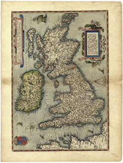
Background imageTheatrum Orbis Terrarum Collection: 16th century map of the British Isles

16th century map of the British Isles
Map of the British Isles, in the 1570 edition of Ortelius Atlas (Theatrum Orbis Terrarum). Abraham Ortelius (1527-1598) was a Flemish mapmaker who is considered to have produced the first true atlas

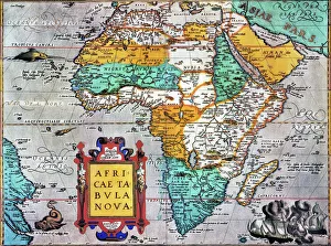
Background imageTheatrum Orbis Terrarum Collection: MAP OF AFRICA from the 1595 edition of Abraham Ortelius atlas Theatrum Orbis Terrarum

MAP OF AFRICA from the 1595 edition of Abraham Ortelius atlas Theatrum Orbis Terrarum
MAP OF AFRICA from the 1595 edition of Abraham Ortelius atlas " Theatrum Orbis Terrarum."

Background imageTheatrum Orbis Terrarum Collection: ICELAND: MAP, 1595. Map of Iceland from a 1595 edition of Abraham Ortelius atlas Theatrum

ICELAND: MAP, 1595. Map of Iceland from a 1595 edition of Abraham Ortelius atlas Theatrum Orbis Terrarum

Background imageTheatrum Orbis Terrarum Collection: MAP OF THE ROMAN EMPIRE. From the 1595 atlas, Theatrum Orbis Terrarum

MAP OF THE ROMAN EMPIRE. From the 1595 atlas, Theatrum Orbis Terrarum, by Abraham Oertel, also known as Ortelius, featuring portraits of Roma, deity of ancient Rome, and Romulus

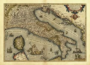
Background imageTheatrum Orbis Terrarum Collection: Orteliuss map of Italy, 1570

Orteliuss map of Italy, 1570
Orteliuss map of Italy. This map is from the 1570 first edition of Theatrum orbis terrarum ( Theatre of the World ). Drawn by the Flemish mapmaker Abraham Ortelius (1527-1598)

Background imageTheatrum Orbis Terrarum Collection: Orteliuss map of Poland, 1570

Orteliuss map of Poland, 1570
Orteliuss map of Poland. This map is from the 1570 first edition of Theatrum orbis terrarum ( Theatre of the World ). Drawn by the Flemish mapmaker Abraham Ortelius (1527-1598)

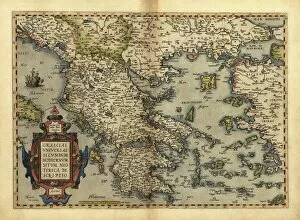
Background imageTheatrum Orbis Terrarum Collection: Orteliuss map of Greece, 1570

Orteliuss map of Greece, 1570
Orteliuss map of Greece. This map is from the 1570 first edition of Theatrum orbis terrarum ( Theatre of the World ). Drawn by the Flemish mapmaker Abraham Ortelius (1527-1598)

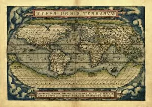
Background imageTheatrum Orbis Terrarum Collection: Orteliuss world map, 1570

Orteliuss world map, 1570
Orteliuss world map. This world map is from the 1570 first edition of Theatrum orbis terrarum ( Theatre of the World ). Drawn by the Flemish mapmaker Abraham Ortelius (1527-1598)

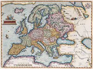
Background imageTheatrum Orbis Terrarum Collection: Europae (From: Theatrum Orbis Terrarum), 1579. Artist: Ortelius, Abraham (1527-1598)

Europae (From: Theatrum Orbis Terrarum), 1579. Artist: Ortelius, Abraham (1527-1598)
Europae (From: Theatrum Orbis Terrarum), 1579. From a private collection

Background imageTheatrum Orbis Terrarum Collection: Orteliuss map of Holland, 1570

Orteliuss map of Holland, 1570
Orteliuss map of Holland. This map is from the 1570 first edition of Theatrum orbis terrarum ( Theatre of the World ). Drawn by the Flemish mapmaker Abraham Ortelius (1527-1598)

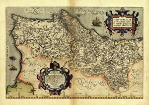
Background imageTheatrum Orbis Terrarum Collection: Orteliuss map of Portugal, 1570

Orteliuss map of Portugal, 1570
Orteliuss map of Portugal. This map is from the 1570 first edition of Theatrum orbis terrarum ( Theatre of the World ). Drawn by the Flemish mapmaker Abraham Ortelius (1527-1598)

Background imageTheatrum Orbis Terrarum Collection: Theatrum Orbis Terrarum, 1570 (etching)

Theatrum Orbis Terrarum, 1570 (etching)
CUL4853441 Theatrum Orbis Terrarum, 1570 (etching) by Ortelius, Abraham (1527-98) (after); (add.info.: ORTELIUS, Abraham (1527-1598). Theatrum Orbis Terrarum. 1570

Background imageTheatrum Orbis Terrarum Collection: Theatrum Orbis Terrarum, 1570 (etching)

Theatrum Orbis Terrarum, 1570 (etching)
CUL4860343 Theatrum Orbis Terrarum, 1570 (etching) by Ortelius, Abraham (1527-98) (after); (add.info.: ORTELIUS, Abraham (1527-1598). Theatrum Orbis Terrarum. 1570

Background imageTheatrum Orbis Terrarum Collection: Theatrum Orbis Terrarum, 1570 (etching)

Theatrum Orbis Terrarum, 1570 (etching)
CUL4853049 Theatrum Orbis Terrarum, 1570 (etching) by Ortelius, Abraham (1527-98) (after); (add.info.: ORTELIUS, Abraham (1527-1598). Theatrum Orbis Terrarum. 1570

Background imageTheatrum Orbis Terrarum Collection: ORTELIUS, Abraham (1527-1598). Theatrum Orbis Terrarum. 1570

ORTELIUS, Abraham (1527-1598). Theatrum Orbis Terrarum. 1570. It is considered to be the first modern atlas
CUL4695089 ORTELIUS, Abraham (1527-1598). Theatrum Orbis Terrarum. 1570. It is considered to be the first modern atlas. CHAVES, Jeronimo de (1523-1574). Mathematic, astronomer and navigator

Background imageTheatrum Orbis Terrarum Collection: Theatrum Orbis Terrarum, 1570 (etching)

Theatrum Orbis Terrarum, 1570 (etching)
CUL4853029 Theatrum Orbis Terrarum, 1570 (etching) by Ortelius, Abraham (1527-98) (after); (add.info.: ORTELIUS, Abraham (1527-1598). Theatrum Orbis Terrarum. 1570

Background imageTheatrum Orbis Terrarum Collection: Europae. From Theatrum Orbis Terrarum, 1572. Creator: Ortelius, Abraham (1527-1598)

Europae. From Theatrum Orbis Terrarum, 1572. Creator: Ortelius, Abraham (1527-1598)
Europae. From Theatrum Orbis Terrarum, 1572. Private Collection

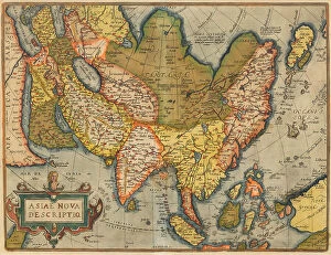
Background imageTheatrum Orbis Terrarum Collection: Asiae Nova Descriptio. From Theatrum Orbis Terrarum, 1572. Creator: Ortelius, Abraham (1527-1598)

Asiae Nova Descriptio. From Theatrum Orbis Terrarum, 1572. Creator: Ortelius, Abraham (1527-1598)
Asiae Nova Descriptio. From Theatrum Orbis Terrarum, 1572. Private Collection

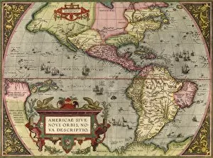
Background imageTheatrum Orbis Terrarum Collection: Americae Sive Novi Orbis Nova Descripto. From Theatrum Orbis Terrarum, 1572

Americae Sive Novi Orbis Nova Descripto. From Theatrum Orbis Terrarum, 1572. Creator: Ortelius, Abraham (1527-1598)
Americae Sive Novi Orbis Nova Descripto. From Theatrum Orbis Terrarum, 1572. Private Collection

Background imageTheatrum Orbis Terrarum Collection: Africae Tabula Nova. From Theatrum Orbis Terrarum, 1572. Creator: Ortelius, Abraham (1527-1598)

Africae Tabula Nova. From Theatrum Orbis Terrarum, 1572. Creator: Ortelius, Abraham (1527-1598)
Africae Tabula Nova. From Theatrum Orbis Terrarum, 1572. Private Collection

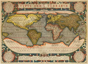
Background imageTheatrum Orbis Terrarum Collection: Typus Orbis Terrarum. From Theatrum Orbis Terrarum, 1572. Creator: Ortelius, Abraham (1527-1598)

Typus Orbis Terrarum. From Theatrum Orbis Terrarum, 1572. Creator: Ortelius, Abraham (1527-1598)
Typus Orbis Terrarum. From Theatrum Orbis Terrarum, 1572. Private Collection

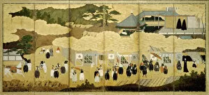
Background imageTheatrum Orbis Terrarum Collection: Arrival of a Portuguese ship. Nanban screen, ca. 1600. Artist: Anonymous

Arrival of a Portuguese ship. Nanban screen, ca. 1600. Artist: Anonymous
Arrival of a Portuguese ship. Nanban screen, ca. 1600. Found in the collection of Rijksmuseum, Amsterdam

Background imageTheatrum Orbis Terrarum Collection: America, or the New World: From the Theatrum Orbis Terrarum by Abraham Ortelius, 1570, 1570

America, or the New World: From the Theatrum Orbis Terrarum by Abraham Ortelius, 1570, 1570
America, or the New World: From the Theatrum Orbis Terrarum by Abraham Ortelius, 1570, (1936). From The Connoisseur, Vol. 98, edited by H. Granville Fell. [International Studio, London, 1936]

Background imageTheatrum Orbis Terrarum Collection: The Victoria, a Spanish carrack, ship of Ferdinand Magellan?s Armada de Molucca

The Victoria, a Spanish carrack, ship of Ferdinand Magellan?s Armada de Molucca. (Aus Maris Pacifici), 1595. From a private collection

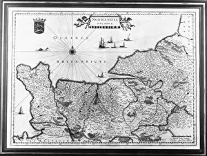
Background imageTheatrum Orbis Terrarum Collection: Map of Normandy after an illustration from Theatrum Orbis Terrarum sive Atlas Novus by

Map of Normandy after an illustration from Theatrum Orbis Terrarum sive Atlas Novus by
3518953 Map of Normandy after an illustration from Theatrum Orbis Terrarum sive Atlas Novus by Willem and Joan Blaeu, plate representing Normandia Ducatus (Normandy: Calvados, Manche, Orne, Eure)

Background imageTheatrum Orbis Terrarum Collection: The Americas, 1592 (hand-coloured engraving)

The Americas, 1592 (hand-coloured engraving)
986218 The Americas, 1592 (hand-coloured engraving) by Ortelius, Abraham (1527-98); Private Collection; (add.info.: The Americas. From Theatrum Orbis Terrarum, by Abraham Ortelius (1527-1598)

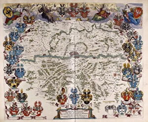
Background imageTheatrum Orbis Terrarum Collection: Map of Germany, c. 1644-1645 (hand-coloured engraving)

Map of Germany, c. 1644-1645 (hand-coloured engraving)
985772 Map of Germany, c.1644-1645 (hand-coloured engraving) by Blaeu, Willem (1571-1638) and Joan (1596-1673) (after); 50.6x33.4 (folio size) cm; Private Collection; (add.info.: Map of Germany)

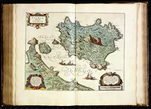
Background imageTheatrum Orbis Terrarum Collection: Ischia, 1642 (coloured engraving)

Ischia, 1642 (coloured engraving)
985753 Ischia, 1642 (coloured engraving) by Blaeu, Willem (1571-1638) and Joan (1596-1673); 49.2x65.4 cm; Private Collection; (add.info.: Ischia. From Theatrum orbis terrarum)

Background imageTheatrum Orbis Terrarum Collection: Asia, 1592 (hand-coloured engraving)

Asia, 1592 (hand-coloured engraving)
986219 Asia, 1592 (hand-coloured engraving) by Ortelius, Abraham (1527-98); Private Collection; (add.info.: Asia. From Theatrum Orbis Terrarum, by Abraham Ortelius (1527-1598)

Background imageTheatrum Orbis Terrarum Collection: The Pacific Ocean, 1592 (hand-coloured engraving)

The Pacific Ocean, 1592 (hand-coloured engraving)
986217 The Pacific Ocean, 1592 (hand-coloured engraving) by Ortelius, Abraham (1527-98); Private Collection; (add.info.: The Pacific Ocean)

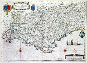
Background imageTheatrum Orbis Terrarum Collection: Map of Provincia or Provence, now part of Southern France

Map of Provincia or Provence, now part of Southern France
478396 Map of Provincia or Provence, now part of Southern France, 1638 (hand-coloured engraving) by Blaeu, Willem (1571-1638); Private Collection; (add.info.: From Theatrum Orbis Terrarum, sive)

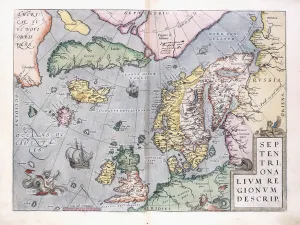
Background imageTheatrum Orbis Terrarum Collection: Double-page map of Northern Europe, 1575 (colour engraving)

Double-page map of Northern Europe, 1575 (colour engraving)
985737 Double-page map of Northern Europe, 1575 (colour engraving) by Ortelius, Abraham (1527-98) (after); 42.4x29.5 (folio size) cm; Private Collection; (add.info)

Background imageTheatrum Orbis Terrarum Collection: India, 1592 (hand-coloured engraving)

India, 1592 (hand-coloured engraving)
986220 India, 1592 (hand-coloured engraving) by Ortelius, Abraham (1527-98); Private Collection; (add.info.: India. From Theatrum Orbis Terrarum, by Abraham Ortelius (1527-1598)

Background imageTheatrum Orbis Terrarum Collection: Portrait of Abraham Ortelius (1527-1598) From: Theatrum Orbis Terrarum, 1579. Artist: Fenderich

Portrait of Abraham Ortelius (1527-1598) From: Theatrum Orbis Terrarum, 1579. Artist: Fenderich
Portrait of Abraham Ortelius (1527-1598) From: Theatrum Orbis Terrarum, 1579. From a private collection

Background imageTheatrum Orbis Terrarum Collection: Map of the current Central America, the Caribbean and northern South America, in

Map of the current Central America, the Caribbean and northern South America, in the Theatrum Orbis Terrarum of 1574 by Abraham Ortelius

Background imageTheatrum Orbis Terrarum Collection: Arrival of a Portuguese ship. Nanban screen. Detail: Japanese Christians, ca. 1600

Arrival of a Portuguese ship. Nanban screen. Detail: Japanese Christians, ca. 1600. Artist: Anonymous
Arrival of a Portuguese ship. Nanban screen. Detail: Japanese Christians, ca. 1600. Found in the collection of Rijksmuseum, Amsterdam

Background imageTheatrum Orbis Terrarum Collection: Map of Russia (From: Theatrum Orbis Terrarum), 1573. Artist: Ortelius, Abraham (1527-1598)

Map of Russia (From: Theatrum Orbis Terrarum), 1573. Artist: Ortelius, Abraham (1527-1598)
Map of Russia (From: Theatrum Orbis Terrarum), 1573. From a private collection

Background imageTheatrum Orbis Terrarum Collection: Maris Pacifici (From Theatrum orbis terrarum), 1595. Artist: Ortelius, Abraham (1527-1598)

Maris Pacifici (From Theatrum orbis terrarum), 1595. Artist: Ortelius, Abraham (1527-1598)
Maris Pacifici (From Theatrum orbis terrarum), 1595. From a private collection

Background imageTheatrum Orbis Terrarum Collection: The Baltic Sea (From: Theatrum Orbis Terrarum), c. 1608-1610. Artist: Ortelius, Abraham (1527-1598)

The Baltic Sea (From: Theatrum Orbis Terrarum), c. 1608-1610. Artist: Ortelius, Abraham (1527-1598)
The Baltic Sea (From: Theatrum Orbis Terrarum), c. 1608-1610. From a private collection

Background imageTheatrum Orbis Terrarum Collection: Map of Russia (From: Theatrum Orbis Terrarum), 1598. Artist: Ortelius, Abraham (1527-1598)

Map of Russia (From: Theatrum Orbis Terrarum), 1598. Artist: Ortelius, Abraham (1527-1598)
Map of Russia (From: Theatrum Orbis Terrarum), 1598. From a private collection

Background imageTheatrum Orbis Terrarum Collection: Orteliuss map of The New World, 1603

Orteliuss map of The New World, 1603
Orteliuss map of The New World. This map of the Americas is from the 1603 edition of Theatrum orbis terrarum (Theatre of the World)

Background imageTheatrum Orbis Terrarum Collection: Orteliuss map of Europe, 1603

Orteliuss map of Europe, 1603
Orteliuss map of Europe. This map of Europe is from the 1603 edition of Theatrum orbis terrarum (Theatre of the World). First published in 1570 by Flemish mapmaker Abraham Ortelius (1527-1598)

Background imageTheatrum Orbis Terrarum Collection: Map of Palestine, from Theatrvm Orbis Terrarvm, 1570 (hand coloured engraving)

Map of Palestine, from Theatrvm Orbis Terrarvm, 1570 (hand coloured engraving)
XCF324389 Map of Palestine, from Theatrvm Orbis Terrarvm, 1570 (hand coloured engraving) by Ortelius, Abraham (1527-98); Private Collection; (add.info)


All Professionally Made to Order for Quick Shipping

"Theatrum Orbis Terrarum: A Glimpse into the World of Cartography in the 16th Century" Step back in time and explore the fascinating world of cartography with "Theatrum Orbis Terrarum, " a renowned atlas compiled by Abraham Ortelius. This groundbreaking work, first published in 1570, revolutionized mapmaking and provided invaluable insights into various regions across the globe. One captivating feature within this collection is Orteliuss map of the Ottoman Empire from 1570. It offers a unique perspective on this powerful empire, showcasing its vast territories and intricate borders during that era. Similarly, an exquisite 16th-century map of the British Isles takes us on a journey through England, Scotland, Wales, and Ireland as they were perceived at that time. Delve further into this historical treasure trove to discover maps like "Iceland: Map" from a 1595 edition. This depiction provides an intriguing glimpse into Iceland's geography during that period while highlighting its significance within European exploration. Another remarkable inclusion is Ortelius's detailed "Map of Africa. " Published in 1595, it showcases Africa's diverse landscapes and kingdoms as known at that time—a testament to both geographical knowledge and cultural understanding during the Renaissance. Transport yourself back to ancient times with "Map of the Roman Empire. " This particular rendition unveils Rome's extensive dominion over Europe, North Africa, and parts of Asia Minor—an awe-inspiring representation capturing centuries-old power dynamics. Orteliuss prowess extends beyond empires; his maps also shed light on individual countries such as Italy (1570), Poland (1570), Greece (1570), Holland (1570), Portugal (1570). Each meticulously crafted piece provides valuable insights into these nations' topography while reflecting their political importance during this transformative era. Finally, marvel at Orteliuss grand vision with his world map from 1570.