Fraud Blocker Skip to main content

Greetings Card > Asia > Mongolia > Maps

Maps Greetings Card Collection

Discover the enchanting landscapes of Mongolia with our Maps of Mongolia, Asia collection of Greetings Cards from Media Storehouse. Each card features intricately detailed maps of this beautiful and historic country, showcasing its unique geography and cultural richness. Perfect for sending a thoughtful message to friends and family, these high-quality cards are printed on premium paper and come with matching envelopes. Explore the vast expanses of Mongolia's wilderness, from the rolling steppe to the towering mountains, and add a touch of adventure to your correspondence. Order now and let the wonders of Mongolia inspire your next correspondence.

Maps of Mongolia Asia are detailed representations of the country's geography

Choose a picture from our Maps Greetings Card Collection for your Wall Art and Photo Gifts

40 Greetings Cards

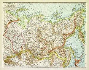
Background imageMaps Greetings Card Collection: Map of Siberia 1895

Map of Siberia 1895
Map of Siberia

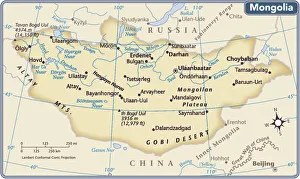
Background imageMaps Greetings Card Collection: Mongolia country map

Mongolia country map
2011 edition

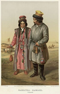
Background imageMaps Greetings Card Collection: Kalmychka. Kalmyk, 1862. Creator: Karlis Huns

Kalmychka. Kalmyk, 1862. Creator: Karlis Huns
Kalmychka. Kalmyk, 1862. Sheet 52 from the album "Description ethnographique des peuples de la Russie", volume 1

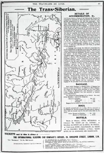
Background imageMaps Greetings Card Collection: Map of the Trans-Siberian Railway, produced by J. Bartholomew & Co. c. 1920 (engraving)

Map of the Trans-Siberian Railway, produced by J. Bartholomew & Co. c. 1920 (engraving)
XJF696541 Map of the Trans-Siberian Railway, produced by J. Bartholomew & Co. c.1920 (engraving) by English School, (20th century); Private Collection; (add.info)

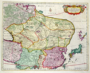
Background imageMaps Greetings Card Collection: Map of Mongolia showing part of Russia, Japan and China, c. 1680 (coloured engraving)

Map of Mongolia showing part of Russia, Japan and China, c. 1680 (coloured engraving)
BAL42852 Map of Mongolia showing part of Russia, Japan and China, c.1680 (coloured engraving) by Wit, Frederick de (1630-1706); O Shea Gallery, London, UK; Dutch, out of copyright

Background imageMaps Greetings Card Collection: Map of the Mongol States c. 1280 AD and Marco Polo's travels. (print)

Map of the Mongol States c. 1280 AD and Marco Polo's travels. (print)
7420050 Map of the Mongol States c. 1280 AD and Marco Polo's travels. (print); (add.info.: Map of the Mongol States c. 1280 AD and Marco Polo's travels. From the book Outline of History by H.G)

Background imageMaps Greetings Card Collection: Map of the world as it was known in 1300 Engraving from 'History of the world' by Ridpath 1885

Map of the world as it was known in 1300 Engraving from "History of the world" by Ridpath 1885 Private
ELD4932055 Map of the world as it was known in 1300 Engraving from "History of the world" by Ridpath 1885 Private collection; (add.info)

Background imageMaps Greetings Card Collection: Traveller Map - Mission in North West Mongolia - Album of the 1909 mission of Bouillane de Lacoste

Traveller Map - Mission in North West Mongolia - Album of the 1909 mission of Bouillane de Lacoste commander in
CSO4985187 Traveller Map - Mission in North West Mongolia - Album of the 1909 mission of Bouillane de Lacoste commander in Mongolia

Background imageMaps Greetings Card Collection: Map of Asia at the times of Mongolian emperor Genghis Khan, 1226 Engraving from Houze's 'Universal

Map of Asia at the times of Mongolian emperor Genghis Khan, 1226 Engraving from Houze's "Universal
ELD4924604 Map of Asia at the times of Mongolian emperor Genghis Khan, 1226 Engraving from Houze's "Universal Atlas"

Background imageMaps Greetings Card Collection: Map of Asia from death of emperor Genghis Khan (1227) to british colonization attempts in 1849

Map of Asia from death of emperor Genghis Khan (1227) to british colonization attempts in 1849
ELD4924616 Map of Asia from death of emperor Genghis Khan (1227) to british colonization attempts in 1849) Engraving from Houze's "Atlas Universel"

Background imageMaps Greetings Card Collection: Transbaikal Buryats, 1862. Creator: Karlis Huns

Transbaikal Buryats, 1862. Creator: Karlis Huns
Transbaikal Buryats, 1862. Sheet 51 from the album "Description ethnographique des peuples de la Russie", volume 1

Background imageMaps Greetings Card Collection: Map of the Far East of the USSR, Northern China (Manchuria) and Mongolia, 1930. Creator: Unknown

Map of the Far East of the USSR, Northern China (Manchuria) and Mongolia, 1930. Creator: Unknown
Map of the Far East of the USSR, Northern China (Manchuria) and Mongolia, 1930. This Soviet-era map is intended to serve a propaganda purpose

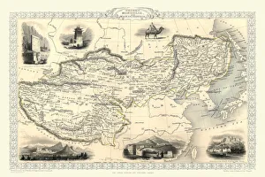
Background imageMaps Greetings Card Collection: Tibet, Mongolia and Manchuria 1851

Tibet, Mongolia and Manchuria 1851
A fine facimile artworked from an antique original map of Tibet, Mongolia and Manchuria, issued as part of the 1851 edition of John Tallis and Companys " The Illustrated Atlas

Background imageMaps Greetings Card Collection: Map of Siberia

Map of Siberia. Map showing eastern Russia, Mongolia, the Sea of Okhotsk and the Kamchatka Peninsula. Plate 67 from The Times Atlas

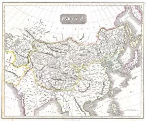
Background imageMaps Greetings Card Collection: 1814 Thomson Map Of Tartary Mongolia Tibet John Thomson

1814 Thomson Map Of Tartary Mongolia Tibet John Thomson
1814, Thomson Map of Tartary, Mongolia, Tibet, John Thomson, 1777 - 1840, was a Scottish cartographer from Edinburgh, UK

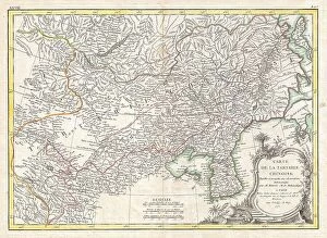
Background imageMaps Greetings Card Collection: 1770 Bonne Map Of Chinese Tartary Mongolia Manchuria And Korea

1770 Bonne Map Of Chinese Tartary Mongolia Manchuria And Korea
1770, Bonne Map of Chinese Tartary, Mongolia, Manchuria and Korea, Corea, Rigobert Bonne 1727 - 1794, one of the most important cartographers of the late 18th century

Background imageMaps Greetings Card Collection: Political map of China

Political map of China. Map showing China, Mongolia, East Turkestan, Tibet and the Korean peninsula. Plate 62 from The Times Atlas

Background imageMaps Greetings Card Collection: The Mongolian Empire from 12th-15th Century, c1903, (1904)

The Mongolian Empire from 12th-15th Century, c1903, (1904). From The Worlds History, Volume II, by Dr. H. F. Helmolt [William Heinemann, London, 1904]

Background imageMaps Greetings Card Collection: Stone map in Nart Khairkhan, Gobi-Altai Province, Mongolia, Mongolian, Asia, Asian

Stone map in Nart Khairkhan, Gobi-Altai Province, Mongolia, Mongolian, Asia, Asian

Background imageMaps Greetings Card Collection: Map of Mongolia showing Japan and China, c. 1680 (coloured engraving)

Map of Mongolia showing Japan and China, c. 1680 (coloured engraving)
BAL42851 Map of Mongolia showing Japan and China, c.1680 (coloured engraving) by Wit, Frederick de (1630-1706); O Shea Gallery, London, UK; Dutch, out of copyright

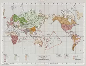
Background imageMaps Greetings Card Collection: Language (colour litho)

Language (colour litho)
3650025 Language (colour litho) by English School, (19th century); Private Collection; (add.info.: Language. Map showing the distribution of the principal languages of the world)

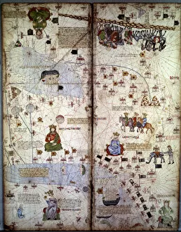
Background imageMaps Greetings Card Collection: Mapping: Map of Cathay (Catai) ancient name of Mongolian China in Central Asia and Europe

Mapping: Map of Cathay (Catai) ancient name of Mongolian China in Central Asia and Europe
JLJ4686533 Mapping: Map of Cathay (Catai) ancient name of Mongolian China in Central Asia and Europe. There are: Delhi (India), with the Aral Sea, the Volga River, the Caspian Sea, the Caucasus

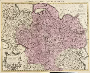
Background imageMaps Greetings Card Collection: Map of Tartaria (Central Asia, Siberia, Turkestan, Mongolia and Manchuria) (etching

Map of Tartaria (Central Asia, Siberia, Turkestan, Mongolia and Manchuria) (etching
LRI4706814 Map of Tartaria (Central Asia, Siberia, Turkestan, Mongolia and Manchuria) (etching, 1730) by Delisle, Guillaume (1675-1726); Private Collection; (add.info.: Map of Tartaria (Central Asia)

Background imageMaps Greetings Card Collection: Central Asia (engraving, 1596)

Central Asia (engraving, 1596)
LRI4718741 Central Asia (engraving, 1596) by Mercator, Gerardus (1512-94); Private Collection; (add.info.: Tartaria, 1633: Central Asia (Grande Tartaria)

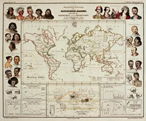
Background imageMaps Greetings Card Collection: Physik Atlas, 1848 (colour litho)

Physik Atlas, 1848 (colour litho)
1265898 Physik Atlas, 1848 (colour litho) by Berghaus, Heinrich (1797-1884); Newberry Library, Chicago, Illinois, USA; eNewberry Library; German, out of copyright

Background imageMaps Greetings Card Collection: Expedition Around the World (1785-1788) by Jean Francois Galaup de La Perouse (1741-1788)

Expedition Around the World (1785-1788) by Jean Francois Galaup de La Perouse (1741-1788)
XEE4162318 Expedition Around the World (1785-1788) by Jean Francois Galaup de La Perouse (1741-1788): the sailors debark on the Saghalian island (Sakhaline)

Background imageMaps Greetings Card Collection: Mongol (chromolitho)

Mongol (chromolitho)
1093725 Mongol (chromolitho) by French School, (19th century); Private Collection; (add.info.: Mongol. French educational card, late 19th or early 20th century.); © Look and Learn

Background imageMaps Greetings Card Collection: Antique map of Mongolia, China and Tibet

Antique map of Mongolia, China and Tibet

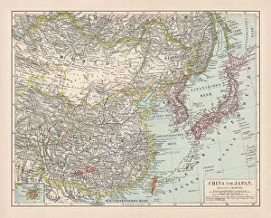
Background imageMaps Greetings Card Collection: Map of China and Japan, 1902. Creator: Unknown

Map of China and Japan, 1902. Creator: Unknown
Map of China and Japan, 1902. Showing Mongolia, Eastern Turkestan and Tibet, with insets of Hong Kong and Tokyo Bay. From The Century Atlas of the World. [John Walker & Co, Ltd. London, 1902]

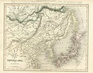
Background imageMaps Greetings Card Collection: Central Asia including Japan antique map 19th century 1843

Central Asia including Japan antique map 19th century 1843
This is an original steel engraving with original colour, an antique map of Central Asia (including Japan, northern China, Mongolia and Korea)

Background imageMaps Greetings Card Collection: Engraving: Map of Asia

Engraving: Map of Asia
Engraved illustrations of the Physical Map of Asia from Iconographic Encyclopedia of Science, Literature and Art, Published in 1851. Copyright has expired on this artwork. Digitally restored

Background imageMaps Greetings Card Collection: A rock inscription on the banks of the Yenisei river, 1895

A rock inscription on the banks of the Yenisei river, 1895. From The Universal Geography with Illustrations and Maps, division XII, written by Elisee Reclus and published by Virtue & Co

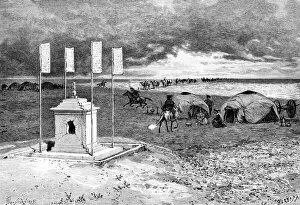
Background imageMaps Greetings Card Collection: The tomb of a lama and an encampment, Mongolian desert, c1890

The tomb of a lama and an encampment, Mongolian desert, c1890. Nomads yurts around the tomb of a Buddhist monk. Illustration from The Universal Geography with Illustrations and Maps, Division XIII

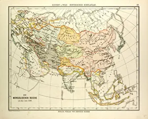
Background imageMaps Greetings Card Collection: MAP OF THE MONGOLIAN EMPIRE IN 1300

MAP OF THE MONGOLIAN EMPIRE IN 1300

Background imageMaps Greetings Card Collection: Lenguages of the world map 1895

Lenguages of the world map 1895
Meyers Konversations-Lexikon. Ein Nachschlagewerk des allgemeinen Wissens, 5th edition 17 volumes Bibliographisches Institut - Leipzig 1895-1897

Background imageMaps Greetings Card Collection: Mongolia locator map

Mongolia locator map
2012 edition

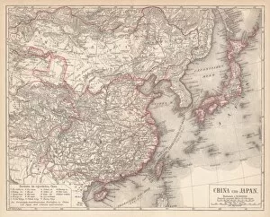
Background imageMaps Greetings Card Collection: China and Japan, lithograph, published in 1881

China and Japan, lithograph, published in 1881
Antique map of China and Japan. Lithograph, published in 1881

Background imageMaps Greetings Card Collection: Map of China and Japan, lithograph, published in 1875

Map of China and Japan, lithograph, published in 1875
Map of China and Japan. Lithograph, published in 1875

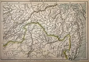
Background imageMaps Greetings Card Collection: Siberia map, the Amur region

Siberia map, the Amur region
Illustration of a Siberia map, the Amur region

Background imageMaps Greetings Card Collection: Map of China and northeastern Asia

Map of China and northeastern Asia


All Professionally Made to Order for Quick Shipping


-

Maps Greetings Card Collection

Maps of Mongolia Asia are detailed representations of the country's geography. They show the physical features of the land, including mountains, rivers, deserts and plains. They also show major cities and towns, roads and railroads, airports, national parks and other points of interest, and are be used to plan trips or explore different regions in Mongolia and can also be used to help understand the political boundaries between countries in Asia as well as those within Mongolia itself and can an invaluable tool for anyone interested in learning more about this fascinating part of the world.
+

Our beautiful Wall Art and Photo Gifts include Framed Prints, Photo Prints, Poster Prints, Canvas Prints, Jigsaw Puzzles, Metal Prints and so much more

The Maps of Mongolia Asia collection from Media Storehouse is a stunning compilation of vintage and contemporary maps that showcase the beauty and diversity of Mongolia. Our collection features an extensive range of maps, including topographical, political, historical, and cultural maps that provide a comprehensive view of this fascinating country. Each map in our collection is carefully selected for its unique style and visual appeal. From hand-drawn antique maps to modern satellite images, these prints are perfect for anyone who loves geography or wants to learn more about Mongolia's history and culture. The Maps of Mongolia Asia collection is available as wall art or framed prints in various sizes to suit any space. These high-quality prints are made using premium materials that ensure they will last for years without fading or deteriorating. Whether you're looking to decorate your home or office with beautiful artwork or want to give a thoughtful gift to someone special, the Maps of Mongolia Asia collection from Media Storehouse is sure to impress.
+

What are Maps of Mongolia Asia art prints?

Maps of Mongolia Asia art prints are high-quality reproductions of maps that depict the geography, topography, and other features of Mongolia. These prints are created using advanced printing techniques and materials to ensure that they accurately capture the details and colors of the original maps. These art prints are not only visually appealing but also serve as valuable educational resources for students, researchers, historians, travelers, and anyone interested in learning more about this fascinating country. They can be used to study Mongolian history or geography or simply as decorative pieces for homes or offices. Maps of Mongolia Asia art prints come in a variety of sizes and styles to suit different tastes and preferences. Whether you prefer vintage-style maps with an antique look or modern designs with bold colors and graphics, there is something for everyone. Maps of Mongolia Asia art prints offer a unique way to explore this beautiful country from afar while adding a touch of sophistication to any space.
+

What Maps of Mongolia Asia art prints can I buy from Media Storehouse?

We offer a wide range of Maps of Mongolia Asia art prints that are perfect for anyone who loves to explore the world through maps. These art prints showcase different aspects of Mongolia, including its geography, topography, and landmarks. You can choose from vintage or modern styles, depending on your preference. One popular option is the "Mongolia Map" print which features an antique-style map with intricate details such as mountain ranges and rivers. Another great choice is the "Gobi Desert Map" print which highlights one of Mongolia's most famous natural wonders. If you're looking for something more artistic, Media Storehouse also has several abstract Mongolian maps available in various colors and designs. These unique pieces would make a great addition to any home or office decor. There are plenty of options when it comes to Maps of Mongolia Asia art prints at Media Storehouse. Whether you're interested in history or aesthetics, there's sure to be something that catches your eye.
+

How do I buy Maps of Mongolia Asia art prints?

To buy Maps of Mongolia Asia art prints from Media Storehouse, you can browse through our extensive collection of maps and select the one that catches your eye. Once you have found the print you want to purchase, simply add it to your cart and proceed to checkout. You will be prompted to enter your shipping information and payment details. We offer a variety of payment options including credit card, PayPal, and Apple Pay. We also offer worldwide shipping so no matter where you are located, you can receive your Maps of Mongolia Asia art print. Their prints are produced using high-quality materials such as fine art paper or canvas which ensures that they last for many years without fading or deteriorating. Whether you're looking for a unique piece of wall decor or a thoughtful gift for someone special, we have something for everyone with their vast selection of Maps of Mongolia Asia art prints.
+

How much do Maps of Mongolia Asia art prints cost?

We offer a wide range of Maps of Mongolia Asia art prints that vary in price depending on the size and type of print. Our selection includes both framed and unframed options, as well as canvas prints and posters. We strive to provide affordable prices for our customers while maintaining high-quality products. The cost of each print is determined by several factors such as the printing process used, the materials used, and the size of the print. However, we can assure you that our prices are competitive within the market. If you're interested in purchasing one of our Maps of Mongolia Asia art prints, please visit our website or contact us for more information about pricing and availability.
+

How will my Maps of Mongolia Asia art prints be delivered to me?

We take great care in delivering your Maps of Mongolia Asia art prints to you. We use high-quality packaging materials to ensure that your prints arrive in perfect condition. Depending on the size and quantity of your order, we may use either a sturdy cardboard tube or a flat package with protective padding to ship your prints. We work with trusted shipping partners who are experienced in handling delicate items like art prints. Once your order is processed and shipped, you will receive an email notification with tracking information so that you can monitor the progress of your delivery. We understand how important it is for our customers to receive their orders promptly and safely. That's why we strive to provide reliable shipping services that meet our customers' needs and expectations. Whether you're ordering from within the UK or internationally, rest assured that we'll do everything possible to get your Maps of Mongolia Asia art prints delivered to you quickly and securely.