
Flat Earth Collection
"Exploring the Flat Earth: Tracing Ancient Beliefs and Artistic Representations" Intriguingly, ancient civilizations held diverse beliefs about the shape of our planet


All Professionally Made to Order for Quick Shipping
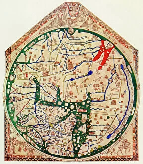
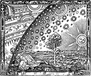
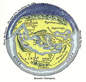
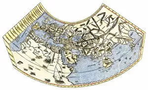
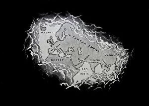
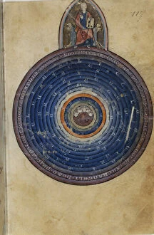
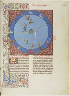
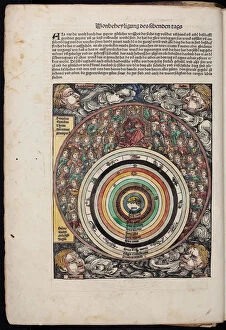
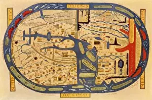
"Exploring the Flat Earth: Tracing Ancient Beliefs and Artistic Representations" Intriguingly, ancient civilizations held diverse beliefs about the shape of our planet. From Homeric cosmogony to Babylonian maps, these captivating hints from history shed light on their understanding of the world. One remarkable depiction is the Flammarion engraving, which portrays a person peering beyond the edge of the firmament into an unknown realm. This image, found in "L'atmosphère: Météorologie populaire, " invites us to ponder what lies beyond our familiar skies. The Assyrian Art's Babylonian Map of the World further captivates with its intricate details dating back to 510-500 BC. It showcases how early cultures envisioned landmasses and celestial bodies within a flat framework. Moving forward in time, we encounter Chonhado's World Map revealing a unique perspective on global geography. Its portrayal highlights how different regions were interconnected according to this particular worldview. A fascinating glimpse into Puerto Rico's past can be found in Jack Delano's photograph capturing life in its flat cattle country during 1942. This snapshot transports us back to an era where vast landscapes seemed endless and unexplored. Woodcuts like Fantastic Depiction of the Solar System provide colorful interpretations that blend science and artistry. These imaginative renderings invite contemplation about our place within a seemingly infinite universe. Delving deeper into medieval times, Gossuin de Metz's Miniature from L Image du Monde offers insight into 13th-century perceptions of Earth as a flat entity surrounded by celestial spheres and zodiacs. Such depictions reveal how knowledge was passed down through generations. Albrecht Dürer’s The Northern Celestial Hemisphere adds another layer to this narrative with its meticulous representation of constellations and stars above Earth’s plane—an exquisite fusion of scientific accuracy and artistic finesse.