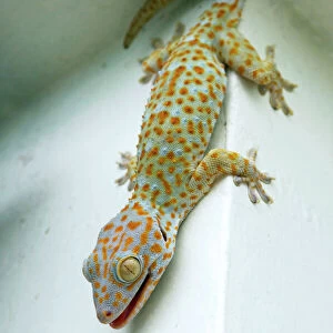
Greetings Card > Animals > Birds > Passerines > Finches > Atlantic Canary
Greetings Card : Map of Gran Canaria, Canary Islands


![]()
Cards from Mary Evans Picture Library
Map of Gran Canaria, Canary Islands
Map of Gran Canaria, Canary Islands. Date: circa 1908
Mary Evans Picture Library makes available wonderful images created for people to enjoy over the centuries
Media ID 14262710
© Mary Evans / Pharcide
Atlantic Canaria Canaries Canary Cruz Gran Maps Quisisana Tenerife
Greetings Card (7"x5")
Brighten someone's day with a beautifully detailed and vintage-inspired greeting card from our Media Storehouse collection. Featuring an enchanting map of Gran Canaria, Canary Islands, dating back to circa 1908, this card is sourced from Mary Evans Prints Online. The intricate lines and rich colors of this rights-managed image transport you to the heart of this stunning island, making it an ideal choice for those with wanderlust or for those with connections to the Canaries. Share the adventure, express your thoughts, or simply add a touch of charm to your correspondence with this unique and captivating greeting card.
Folded Greeting Cards (12.5x17.5 cm) have a laminate finish and are supplied with an envelope. The front and inside can be personalised with text in a selection of fonts, layouts and colours.
Greetings Cards suitable for Birthdays, Weddings, Anniversaries, Graduations, Thank You and much more
Estimated Product Size is 12.5cm x 17.5cm (4.9" x 6.9")
These are individually made so all sizes are approximate
Artwork printed orientated as per the preview above, with landscape (horizontal) or portrait (vertical) orientation to match the source image.
FEATURES IN THESE COLLECTIONS
> Animals
> Birds
> Passerines
> Finches
> Atlantic Canary
> Animals
> Mammals
> Cricetidae
> Santa Cruz Mouse
> Animals
> Mammals
> Muridae
> Water Mouse
> Arts
> Artists
> O
> Oceanic Oceanic
> Europe
> France
> Canton
> Landes
> Maps and Charts
> Related Images
EDITORS COMMENTS
Step back in time with this map of Gran Canaria, one of the beautiful Canary Islands located in the Atlantic Ocean. Dated circa 1908, this map offers a glimpse into the topography and geography of the island as it appeared over a century ago. The intricate details of the map reveal the coastline's undulating contours, the vast expanse of the Atlantic Ocean, and the various bays and inlets that dot the island's shores. Gran Canaria, the third largest of the Canary Islands, is known for its diverse landscapes, from the arid desert-like areas in the south to the lush, green northern regions. The map accurately depicts these contrasting terrains, inviting the viewer to imagine the rich tapestry of natural beauty that awaits exploration. Notable landmarks on the map include the bustling port city of Las Palmas de Gran Canaria, with its vibrant streets and historic quarters, as well as the picturesque resort town of Quisisana and the sacred pilgrimage site of Santa Cruz de Canaria. The map also highlights the various towns and villages scattered across the island, each with its unique character and charm. As you delve into the intricacies of this map, you can almost hear the gentle lapping of the waves against the shore and feel the warm sun on your face. A true treasure for history buffs, armchair travelers, and anyone with a passion for the natural world, this map of Gran Canaria is a captivating window into the past.
MADE IN AUSTRALIA
Safe Shipping with 30 Day Money Back Guarantee
FREE PERSONALISATION*
We are proud to offer a range of customisation features including Personalised Captions, Color Filters and Picture Zoom Tools
SECURE PAYMENTS
We happily accept a wide range of payment options so you can pay for the things you need in the way that is most convenient for you
* Options may vary by product and licensing agreement. Zoomed Pictures can be adjusted in the Cart.