Greetings Card > North America > Canada > Maps
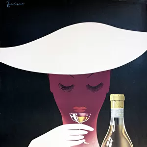
Greetings Card : Alaska and British Columbia map, 1872


![]()
Cards from North Wind
Alaska and British Columbia map, 1872
Map of Alaska, the Aleutian Islands, and British Columbia, 1872.
Hand-colored woodcut of a 19th-century illustration
North Wind Picture Archives brings history to life with stock images and hand-colored illustrations
Media ID 5882699
© North Wind Picture Archives
1870s Alaska British Columbia Canada Canadian Old Fashioned Pacific Pacific Coast Pacific Northwest 1872 Aleutian Islands Aleutians
Greetings Card (7"x5")
Step back in time with our exquisite selection of Media Storehouse Greeting Cards. This captivating design features an antique map of Alaska and British Columbia from 1872, sourced from the North Wind Picture Archives. The intricate hand-colored woodcut illustration showcases the unexplored territories of the Aleutian Islands and British Columbia in the 19th century. Perfect for history enthusiasts or those with a fondness for vintage aesthetics, these cards are sure to transport your recipient on a journey through time. Send a piece of the past with our classic and elegant greeting cards.
Folded Greeting Cards (12.5x17.5 cm) have a laminate finish and are supplied with an envelope. The front and inside can be personalised with text in a selection of fonts, layouts and colours.
Greetings Cards suitable for Birthdays, Weddings, Anniversaries, Graduations, Thank You and much more
Estimated Product Size is 17.5cm x 12.5cm (6.9" x 4.9")
These are individually made so all sizes are approximate
Artwork printed orientated as per the preview above, with landscape (horizontal) or portrait (vertical) orientation to match the source image.
FEATURES IN THESE COLLECTIONS
> North America
> Canada
> Maps
> North America
> Canada
> Related Images
> North America
> Related Images
> North America
> United States of America
> Alaska
> Related Images
> North America
> United States of America
> Maps
> Popular Themes
> North Island
> North Wind Picture Archives
> Maps
EDITORS COMMENTS
This hand-colored woodcut print from 1872 showcases a historical map of Alaska, the Aleutian Islands, and British Columbia. The intricate details and vibrant colors bring to life the rich heritage and traditional essence of this vintage piece. As we gaze upon this 19th-century illustration, we are transported back in time to an era when exploration and discovery shaped the course of history. The map highlights the vastness of North America's Pacific coast, depicting both Canadian and American territories with precision. The artistry behind this print is truly remarkable; every line meticulously etched onto the woodblock tells a story of adventure and conquest. It serves as a visual testament to the explorers who braved treacherous waters in search of new lands. Through its portrayal of Alaska's rugged terrain, British Columbia's majestic beauty, and the enchanting Aleutian Islands scattered along the coastline, this artwork encapsulates not only geographical accuracy but also captures our imagination. With its old-fashioned charm and nostalgic appeal, it evokes a sense of curiosity about how these regions have evolved over time. This map stands as a reminder that beneath modern cities lie layers upon layers of history waiting to be discovered. Whether you are an avid collector or simply appreciate art that embodies cultural significance, this unique print offers an opportunity to own a piece of North American history - one that connects us to our past while igniting dreams for future adventures along these breathtaking shores.
MADE IN AUSTRALIA
Safe Shipping with 30 Day Money Back Guarantee
FREE PERSONALISATION*
We are proud to offer a range of customisation features including Personalised Captions, Color Filters and Picture Zoom Tools
SECURE PAYMENTS
We happily accept a wide range of payment options so you can pay for the things you need in the way that is most convenient for you
* Options may vary by product and licensing agreement. Zoomed Pictures can be adjusted in the Cart.