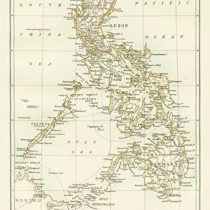
Home > Asia > Philippines > Maps
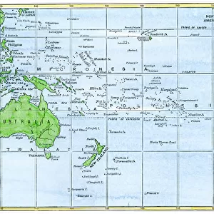
'Detroit de San Bernardino; Les Terres Du Pacifique, 1914. Creator: Unknown

![]()
Wall Art and Photo Gifts from Heritage Images
'Detroit de San Bernardino; Les Terres Du Pacifique, 1914. Creator: Unknown
'Detroit de San Bernardino; Les Terres Du Pacifique, 1914. From "Grande Geographie Bong Illustree", 1914
Heritage Images features heritage image collections
Media ID 36287664
© The Print Collector/Heritage Images
Archipelago Cartography Island Islands Map Making Mapmaking Philippines
FEATURES IN THESE COLLECTIONS
> Asia
> Philippines
> Maps
> Asia
> Philippines
> Related Images
Detroit de San Bernardino; Les Terres Du Pacifique,
EDITORS COMMENTS
a captivating and enigmatic map print from the early 20th century, offers a vivid glimpse into the cartographic exploration of the Pacific archipelago during an era of heightened imperial ambitions and geographic discovery. The map, created in 1914, is of unknown origin, having been discovered in the extensive archives of "Grande Geographie Bong Illustree," a renowned French geography magazine. This evocative map depicts a stunning array of islands and waters, with the Philippines prominently featured at its heart. The islands are rendered in a rich, vibrant palette, their names inscribed in elegant, flowing script. The map's title, "Detroit de San Bernardino; Les Terres Du Pacifique," translates to "Strait of San Bernardino; The Lands of the Pacific," referencing the strategic waterway that separates the islands of Luzon and Mindanao in the Philippines. The map's creation coincides with a period of intense interest in the Pacific region, as European powers vied for territorial control and influence. The map's intricate detail and colorful representation of the islands underscore the allure and mystery of this far-off land, as well as the advances in cartographic technology and techniques that enabled such detailed and accurate representations. As a relic of a bygone era, "Detroit de San Bernardino; Les Terres Du Pacifique" serves as a testament to the enduring fascination with geography and exploration, as well as the role that maps have played in shaping our understanding of the world. Despite its unknown provenance, this map remains a captivating and intriguing piece of cartographic history, inviting us to explore the vast and diverse Pacific archipelago and the stories it holds.
MADE IN AUSTRALIA
Safe Shipping with 30 Day Money Back Guarantee
FREE PERSONALISATION*
We are proud to offer a range of customisation features including Personalised Captions, Color Filters and Picture Zoom Tools
SECURE PAYMENTS
We happily accept a wide range of payment options so you can pay for the things you need in the way that is most convenient for you
* Options may vary by product and licensing agreement. Zoomed Pictures can be adjusted in the Cart.