Home > Arts > Artists > A > John White Alexander
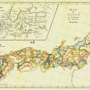
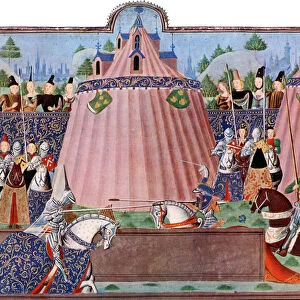
The Great Arras Battle Area, 1917. Creator: Unknown

![]()
Wall Art and Photo Gifts from Heritage Images
The Great Arras Battle Area, 1917. Creator: Unknown
The Great Arras Battle Area, 1917. From " The War Illustrated Album De Luxe - Volume VIII. Ending The First Three Years", edited by J. A. Hammerton. [The Amalgamated Press, Limited, London, 1917]
Heritage Images features heritage image collections
Media ID 19661363
© The Print Collector/Heritage Images
Amalgamated Press Amalgamated Press Limited Amalgamated Press Ltd Arras Arras Nord Pas De Calais France Battle Of Arras Campaign Cartography Hammerton Hammerton J A Hammerton Ja Hammerton Sir John Alexander J A Hammerton Ja Hammerton John Hammerton Map Making Military Campaign Military Strategy Nord Pas De Calais Sir John Alexander Sir John Alexander Hammerton Sir John Hammerton Strategic Strategy The Amalgamated Press War Illustrated 1st World War
FEATURES IN THESE COLLECTIONS
> Arts
> Artists
> A
> John White Alexander
> Arts
> Artists
> W
> John White
> Europe
> France
> Canton
> Nord
> Europe
> France
> Canton
> Pas de Calais
> Historic
> World War I and II
> World War I
> Historic
> World War I and II
> Maps and Charts
> World
EDITORS COMMENTS
This print takes us back to the historic Great Arras Battle Area in 1917 during World War I. The image, captured by an unknown photographer, showcases the aftermath of a fierce battle that unfolded in this strategic location. The photograph is part of "The War Illustrated Album De Luxe - Volume VIII. Ending The First Three Years", edited by J. A. Hammerton and published by The Amalgamated Press Limited in London, 1917. It offers a glimpse into the military campaign and cartography employed during this tumultuous period. The Great Arras Battle Area, located in Nord Pas de Calais region of France, was a significant battleground where British forces fought valiantly against their adversaries. This powerful visual representation allows us to reflect on the bravery and sacrifice exhibited by soldiers from Britain and other countries involved. As we study this image, we can't help but marvel at its historical significance as it transports us to a time when nations were embroiled in one of the deadliest conflicts ever witnessed – World War I. Though created over a century ago, this photograph continues to serve as a reminder of the human cost associated with war. Through its depiction of destruction and desolation juxtaposed against strategic military planning, this print captures both the devastating reality faced by those on the front lines and highlights their unwavering determination to secure victory amidst unimaginable circumstances.
MADE IN AUSTRALIA
Safe Shipping with 30 Day Money Back Guarantee
FREE PERSONALISATION*
We are proud to offer a range of customisation features including Personalised Captions, Color Filters and Picture Zoom Tools
SECURE PAYMENTS
We happily accept a wide range of payment options so you can pay for the things you need in the way that is most convenient for you
* Options may vary by product and licensing agreement. Zoomed Pictures can be adjusted in the Cart.