Home > Oceania > New Zealand > Maps
'Ports d'Auckland; Les Terres Du Pacifique, 1914. Creator: Unknown
![]()

Wall Art and Photo Gifts from Heritage Images
'Ports d'Auckland; Les Terres Du Pacifique, 1914. Creator: Unknown
'Ports d'Auckland; Les Terres Du Pacifique, 1914. From "Grande Geographie Bong Illustree", 1914
Heritage Images features heritage image collections
Media ID 36287498
© The Print Collector/Heritage Images
Aotearoa Australasia Cartography Geological Map Map Making Mapmaking New Zealand Auckland Harbour
FEATURES IN THESE COLLECTIONS
> Maps and Charts
> Geological Map
> Oceania
> New Zealand
> Auckland
> Oceania
> New Zealand
> Maps
> Oceania
> New Zealand
> Related Images
Ports d'Auckland; Les Terres Du Pacifique, 1914
EDITORS COMMENTS
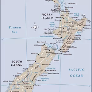
is a captivating and intriguing geographical map print from the early 20th century, created by an unknown cartographer. This vintage map offers a fascinating glimpse into the geographical knowledge and perception of the Pacific region during this time. The map focuses on the Auckland Harbour area in New Zealand, a significant location in the Pacific, and is part of a larger series published in the renowned French geographical publication "Grande Geographie Illustreé" in 1914. The map's title, "Ports d'Auckland; Les Terres Du Pacifique," translates to "Auckland Harbours; The Lands of the Pacific," indicating the map's primary focus on this region. The map is a testament to the advancements in cartography during the 1900s. It is a colorful and detailed representation of the geographical features of the area, including the coastline, islands, and harbors. The map also includes a geological map insert, which provides information on the geological formations and structures beneath the surface. The map's vibrant colors and intricate detailing transport us back in time, offering a unique perspective on how the Pacific region was perceived and represented during the early 20th century. The map's unknown origin adds to its allure and mystery, making it a valuable addition to any collection of historical maps or geographical curiosities. This map is not only a testament to the advancements in cartography during the 20th century but also a reminder of the rich history and cultural significance of the Pacific region. It serves as a reminder of the importance of exploration, discovery, and the pursuit of knowledge, making it a must-have for anyone with an interest in geography, history, or the Pacific region.
MADE IN AUSTRALIA
Safe Shipping with 30 Day Money Back Guarantee
FREE PERSONALISATION*
We are proud to offer a range of customisation features including Personalised Captions, Color Filters and Picture Zoom Tools
SECURE PAYMENTS
We happily accept a wide range of payment options so you can pay for the things you need in the way that is most convenient for you
* Options may vary by product and licensing agreement. Zoomed Pictures can be adjusted in the Cart.


