Jigsaw Puzzle > Europe > Poland > Maps
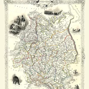
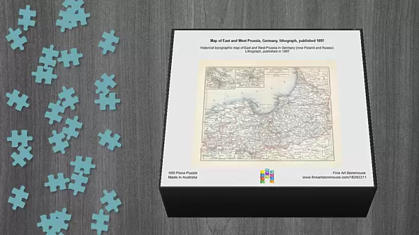
Jigsaw Puzzle : Map of East and West Prussia, Germany, lithograph, published 1897


![]()
Jigsaw Puzzles from Fine Art Storehouse
Map of East and West Prussia, Germany, lithograph, published 1897
Historical topographic map of East and West Prussia in Germany (now Poland and Russia). Lithograph, published in 1897
Unleash your creativity and transform your space into a visual masterpiece!
ZU_09
Media ID 18292211
Jigsaw Puzzle (500 Pieces)
Discover the rich history of East and West Prussia with our captivating jigsaw puzzle from Media Storehouse. This intricately detailed puzzle features a historical topographic map of the region, published in 1897. The lithograph depicts the borders of Germany's East and West Prussia, now a significant part of Poland and Russia. Immerse yourself in the intricacies of this puzzle and bring the past to life, making it a perfect addition to your collection or a thoughtful gift for history and puzzle enthusiasts.
500 piece puzzles are custom made in Australia and hand-finished on 100% recycled 1.6mm thick laminated puzzle boards. There is a level of repetition in jigsaw shapes with each matching piece away from its pair. The completed puzzle measures 40x51cm and is delivered packaged in an attractive presentation box specially designed to fit most mail slots with a unique magnetic lid
Jigsaw Puzzles are an ideal gift for any occasion
Estimated Product Size is 50.7cm x 40.3cm (20" x 15.9")
These are individually made so all sizes are approximate
Artwork printed orientated as per the preview above, with landscape (horizontal) or portrait (vertical) orientation to match the source image.
FEATURES IN THESE COLLECTIONS
> Fine Art Storehouse
> Map
> Historical Maps
> Europe
> Germany
> Related Images
> Europe
> Poland
> Related Images
> Europe
> Russia
> Related Images
> Maps and Charts
> Early Maps
EDITORS COMMENTS
This lithograph, titled "Map of East and West Prussia, Germany" takes us on a journey back in time to the year 1897. A historical topographic map meticulously crafted with intricate details, it offers a glimpse into the past when these lands were known as East and West Prussia in Germany. The print showcases the remarkable craftsmanship of its creator, ZU_09, who expertly captures the essence of this region's geography. Every contour line and river is delicately etched onto the lithograph, allowing us to explore this land that has undergone significant changes over the years. Once an integral part of Germany but now divided between Poland and Russia, East and West Prussia hold great historical significance. This artwork serves as a visual testament to their rich heritage and complex history. As we gaze upon this print, we are transported back in time to an era where borders shifted and cultures intertwined. It reminds us of how our world is constantly evolving while preserving fragments of its past within maps like these. Whether you are a history enthusiast or simply appreciate fine artistry, this lithograph offers both aesthetic pleasure and educational value. It invites us to reflect upon the ever-changing nature of our world while appreciating the beauty found within even seemingly mundane objects such as maps.
MADE IN AUSTRALIA
Safe Shipping with 30 Day Money Back Guarantee
FREE PERSONALISATION*
We are proud to offer a range of customisation features including Personalised Captions, Color Filters and Picture Zoom Tools
SECURE PAYMENTS
We happily accept a wide range of payment options so you can pay for the things you need in the way that is most convenient for you
* Options may vary by product and licensing agreement. Zoomed Pictures can be adjusted in the Cart.