Jigsaw Puzzle > Africa > Madagascar > Maps
Jigsaw Puzzle : Madagascar country map


Please select a smaller print size for this image
![]()
from Fine Art Storehouse
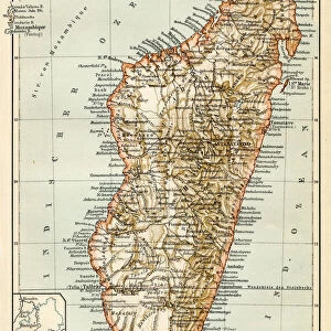
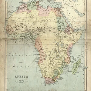
Madagascar country map
2011 edition
Unleash your creativity and transform your space into a visual masterpiece!
Media ID 14432249
Jigsaw Puzzle (1000 Pieces)
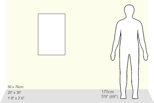
1000 piece puzzles are custom made in Australia and hand-finished on 100% recycled 1.6mm thick laminated puzzle boards. There is a level of repetition in jigsaw shapes with each matching piece away from its pair. The completed puzzle measures 76x50cm and is delivered packaged in an attractive presentation box specially designed to fit most mail slots with a unique magnetic lid
Jigsaw Puzzles are an ideal gift for any occasion
Estimated Product Size is 50.2cm x 76cm (19.8" x 29.9")
These are individually made so all sizes are approximate
Artwork printed orientated as per the preview above, with landscape (horizontal) or portrait (vertical) orientation to match the source image.
FEATURES IN THESE COLLECTIONS
> Fine Art Storehouse
> Map
> Reference Maps
> Africa
> Madagascar
> Maps
> Africa
> Madagascar
> Related Images
> Maps and Charts
> Related Images
EDITORS COMMENTS
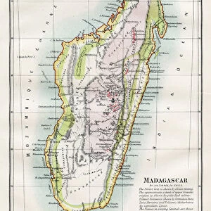
This print showcases the intricate details of the Madagascar country map, specifically the 2011 edition. With its vibrant colors and precise cartographic markings, this artwork from Fine Art Storehouse is a testament to the beauty and diversity of this enchanting island nation. The map depicts Madagascar's vast landscapes, stretching from its pristine coastlines to its lush rainforests and towering mountain ranges. Every contour line and river is meticulously illustrated, providing an immersive visual experience that transports viewers into the heart of this extraordinary country. As one gazes upon this print, they are instantly captivated by the sheer magnitude of Madagascar's natural wonders. From iconic landmarks like Tsingy de Bemaraha National Park to remote regions such as Masoala National Park, each area is clearly delineated on this detailed map. Beyond its geographical features, the print also highlights key cities, towns, and road networks that connect communities across Madagascar. This serves as a reminder of how human presence intertwines with nature in creating a harmonious balance within this unique ecosystem. Whether you are an avid traveler or simply fascinated by geography, this print offers both aesthetic appeal and educational value. It invites exploration into every corner of Madagascar's diverse terrain while igniting curiosity about its rich cultural heritage. Displaying Fine Art Storehouse's commitment to preserving exceptional works of art for public enjoyment, this photograph encapsulates the essence of Madagascar through a stunning portrayal of its geography – an exquisite addition to any art collection or decor space.
MADE IN AUSTRALIA
Safe Shipping with 30 Day Money Back Guarantee
FREE PERSONALISATION*
We are proud to offer a range of customisation features including Personalised Captions, Color Filters and Picture Zoom Tools
SECURE PAYMENTS
We happily accept a wide range of payment options so you can pay for the things you need in the way that is most convenient for you
* Options may vary by product and licensing agreement. Zoomed Pictures can be adjusted in the Cart.