Home > Europe > United Kingdom > England > Birmingham > Area > Fox Hollies
Birmingham B27 7 Map

![]()
Wall Art and Photo Gifts from Map Marketing
Birmingham B27 7 Map
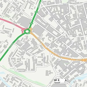
Postcode Sector Map of Birmingham B27 7
Media ID 19965371
Aspen Close Birmingham Broad Road Brook Lane Chaucer Grove Circular Road Coppice Drive Dolphin Lane Eastcote Road Fox Grove Foxglove Close Green Acres Greenwood Avenue Grove Avenue Harrier Road Hazelwood Road Holly Drive Keats Grove Ladbroke Grove Mayfield Road Oakhurst Road Osprey Road Overton Road Pollard Road Ruskin Grove Shirley Road Sorrel Drive Summer Road Tavistock Road The Link The Willows Thornfield Road Vicarage Grove Victoria Road Westfield Road Wetherby Road
FEATURES IN THESE COLLECTIONS
> Map Marketing
> Postcode Sector Maps
> B - Birmingham
> Europe
> United Kingdom
> England
> Birmingham
> Area
> Acocks Green
> Europe
> United Kingdom
> England
> Birmingham
> Area
> Fox Hollies
> Europe
> United Kingdom
> England
> Birmingham
> Area
> Hall Green
> Maps and Charts
> Related Images
MADE IN AUSTRALIA
Safe Shipping with 30 Day Money Back Guarantee
FREE PERSONALISATION*
We are proud to offer a range of customisation features including Personalised Captions, Color Filters and Picture Zoom Tools
SECURE PAYMENTS
We happily accept a wide range of payment options so you can pay for the things you need in the way that is most convenient for you
* Options may vary by product and licensing agreement. Zoomed Pictures can be adjusted in the Cart.