Home > Animals > Birds > Passerines > Chats And Flycatchers > Nightingale
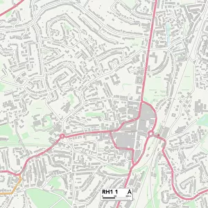
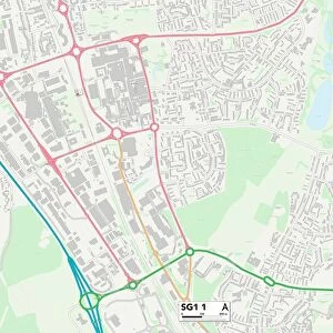
Horsham RH20 4 Map

![]()
Wall Art and Photo Gifts from Map Marketing
Horsham RH20 4 Map
Postcode Sector Map of Horsham RH20 4
Media ID 19979113
Amberley Close Amberley Road Browns Lane Chantry Close Chantry Lane Chapel Lane Church Street Clay Lane Downlands Fern Road Fox Court Garden Close Greenacre Close Greenfield Way Hawthorn Way Heather Way High Street Holly Close Horsham Kingsland Close London Road Love Lane Manor Close Meadowside Melton Avenue Melton Close Melton Drive Mill Lane Nightingale Lane North Street Orchard Gardens Plantation Way Priory Close Ravenscroft Rectory Close Rectory Road Reed Close Riverside Rosemary Close Ryecroft Lane Sandhill Lane School Hill School Lane Swan Close The Brackens The Crescent The Glade The Holt The Laurels The Pines The Plantation The Street Washington Road West Street Holm Oak
FEATURES IN THESE COLLECTIONS
> Map Marketing
> Postcode Sector Maps
> RH - Redhill
> Animals
> Birds
> Passerines
> Chats And Flycatchers
> Nightingale
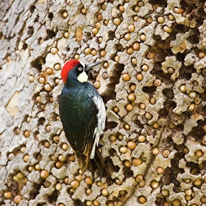
> Animals
> Birds
> Piciformes
> Woodpeckers
> Related Images
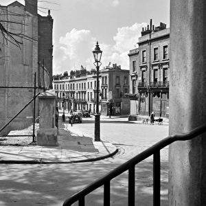
> Arts
> Portraits
> Pop art gallery
> Street art portraits
> Europe
> United Kingdom
> England
> London
> Sights
> Green Park
> Europe
> United Kingdom
> England
> London
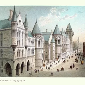
> Sights
> High Court
> Europe
> United Kingdom
> England
> London
> Towns
> Clay Hill
> Europe
> United Kingdom
> England
> London
> Towns
> Copse Hill
> Europe
> United Kingdom
> England
> London
> Towns
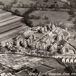
> Grove Park
> Europe
> United Kingdom
> England
> London
> Towns
> Mill Hill
MADE IN AUSTRALIA
Safe Shipping with 30 Day Money Back Guarantee
FREE PERSONALISATION*
We are proud to offer a range of customisation features including Personalised Captions, Color Filters and Picture Zoom Tools
SECURE PAYMENTS
We happily accept a wide range of payment options so you can pay for the things you need in the way that is most convenient for you
* Options may vary by product and licensing agreement. Zoomed Pictures can be adjusted in the Cart.