Fraud Blocker Skip to main content

Home > Maps and Charts > Australia

Australia Collection (page 9)

Australia is a vast continent located in the southern hemisphere, surrounded by the Indian and Pacific oceans

579 items

Background imageAustralia Collection: Telegraph Map of the Eastern World (engraving)

Telegraph Map of the Eastern World (engraving)
1610430 Telegraph Map of the Eastern World (engraving) by Dower, John (fl.c.1845-55); Private Collection; (add.info.: Telegraph Map of the Eastern World)

Background imageAustralia Collection: Map, The Commonwealth of Australia

Map, The Commonwealth of Australia. Date: circa 1900s

Background imageAustralia Collection: Louis XVI of France giving his instructions to the Comte de Laperouse, 1785 (engraving)

Louis XVI of France giving his instructions to the Comte de Laperouse, 1785 (engraving)
972700 Louis XVI of France giving his instructions to the Comte de Laperouse, 1785 (engraving) by Monsiau, Nicolas Andre (1754-1837) (after); Private Collection; (add.info)

Background imageAustralia Collection: Advert for Queensland, Australia

Advert for Queensland, Australia, a call for more people to live and work there. circa 1890

Background imageAustralia Collection: The Direct Route to Australia (engraving)

The Direct Route to Australia (engraving)
1097207 The Direct Route to Australia (engraving) by English School, (19th century); Private Collection; (add.info.: The Direct Route to Australia)

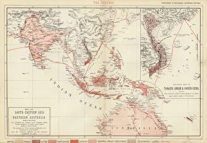
Background imageAustralia Collection: Map of South-Eastern Asia and Northern Australia (colour litho)

Map of South-Eastern Asia and Northern Australia (colour litho)
726783 Map of South-Eastern Asia and Northern Australia (colour litho) by English School, (19th century); Private Collection; (add.info.: Map of South-Eastern Asia and Northern Australia)

Background imageAustralia Collection: Composite Great Circle Sailing, New and Shorter Route to Australia (engraving)

Composite Great Circle Sailing, New and Shorter Route to Australia (engraving)
1612017 Composite Great Circle Sailing, New and Shorter Route to Australia (engraving) by English School, (19th century); Private Collection; (add.info.: Composite Great Circle Sailing)

Background imageAustralia Collection: Map of the coast of New Zealand, illustration from

Map of the coast of New Zealand, illustration from
3610747 Map of the coast of New Zealand, illustration from A journal of a voyage to the South Seas : in His Majestys ship, the Endeavour, 1794 (hand-coloured engraving) by Parkinson

Background imageAustralia Collection: Wool (colour litho)

Wool (colour litho)
3648633 Wool (colour litho) by English School, (20th century); Private Collection; (add.info.: Wool. Illustration for Atlas of the Worlds Commerce compiled from the latest official returns at)

Background imageAustralia Collection: Part of South Australia, from a Series of World Maps published by John Tallis & Co

Part of South Australia, from a Series of World Maps published by John Tallis & Co
STC190604 Part of South Australia, from a Series of World Maps published by John Tallis & Co, New York & London, 1850s (engraving) by Rapkin

Background imageAustralia Collection: Australia, from a Series of World Maps published by John Tallis & Co

Australia, from a Series of World Maps published by John Tallis & Co
STC190600 Australia, from a Series of World Maps published by John Tallis & Co. London & New York, 1850s (engraving) by Rapkin

Background imageAustralia Collection: Isobars and Isohyets, Australia and South East Australia (colour litho)

Isobars and Isohyets, Australia and South East Australia (colour litho)
6015866 Isobars and Isohyets, Australia and South East Australia (colour litho) by English School, (19th century); Private Collection; (add.info.: Isobars and Isohyets)

Background imageAustralia Collection: Map of the Eastern Hemisphere (coloured engraving)

Map of the Eastern Hemisphere (coloured engraving)
6014056 Map of the Eastern Hemisphere (coloured engraving) by American School, (19th century); Private Collection; (add.info.: Map of the Eastern Hemisphere)

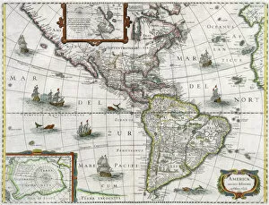
Background imageAustralia Collection: Map of the Americas, 1631 (coloured engraving)

Map of the Americas, 1631 (coloured engraving)
STC93603 Map of the Americas, 1631 (coloured engraving) by Hondius, Henricus (1597-1651); Private Collection; The Stapleton Collection; Dutch, out of copyright

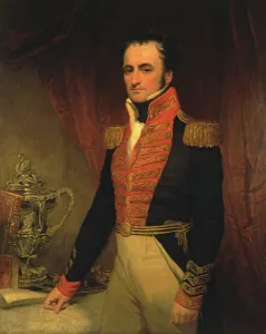
Background imageAustralia Collection: Portrait of Admiral Sir James Stirling (1791-1865), first Governor of Western Australia

Portrait of Admiral Sir James Stirling (1791-1865), first Governor of Western Australia
NSW71485 Portrait of Admiral Sir James Stirling (1791-1865), first Governor of Western Australia 1829-39, c.1833 by Anonymous; Mitchell Library, State Library of New South Wales; Mitchell Library

Background imageAustralia Collection: General map extending from India and Ceylon to northwestern Australia by way of southern

General map extending from India and Ceylon to northwestern Australia by way of southern
BON111064 General map extending from India and Ceylon to northwestern Australia by way of southern Japan, the Philippines

Background imageAustralia Collection: Map of the eastern hemisphere, illustration from A journal of a voyage to the South

Map of the eastern hemisphere, illustration from A journal of a voyage to the South
3610754 Map of the eastern hemisphere, illustration from A journal of a voyage to the South Seas : in His Majestys ship, the Endeavour, 1794 (hand-coloured engraving) by Parkinson

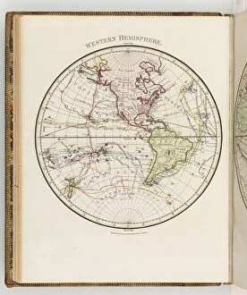
Background imageAustralia Collection: Map of the western hemisphere, illustration from A journal of a voyage to the South

Map of the western hemisphere, illustration from A journal of a voyage to the South
3610752 Map of the western hemisphere, illustration from A journal of a voyage to the South Seas : in His Majestys ship, the Endeavour, 1794 (hand-coloured engraving) by Parkinson

Background imageAustralia Collection: Early English terrestrial globe, c. 1673 (engraving, brass, walnut & oak)

Early English terrestrial globe, c. 1673 (engraving, brass, walnut & oak)
3482897 Early English terrestrial globe, c.1673 (engraving, brass, walnut & oak) by Berry, William (1639-1718) & Morden, Robert (c.1650-1703); height: 53 cm; Private Collection; (add.info)

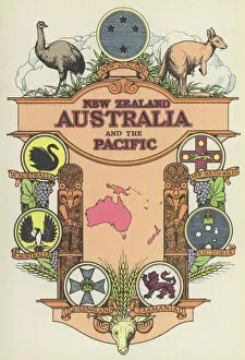
Background imageAustralia Collection: New Zealand, Australia and the Pacific (colour litho)

New Zealand, Australia and the Pacific (colour litho)
5996923 New Zealand, Australia and the Pacific (colour litho) by English School, (20th century); Private Collection; (add.info.: New Zealand, Australia and the Pacific)

Background imageAustralia Collection: Site of Melbourne, 1837 (engraving)

Site of Melbourne, 1837 (engraving)
1608354 Site of Melbourne, 1837 (engraving) by English School, (19th century); Private Collection; (add.info.: Site of Melbourne, 1837. Illustration for The Illustrated London News, 24 November 1855)

Background imageAustralia Collection: The Route of Burke and Wills across the Continent of Australia from Coopers Creek to the Gulf of

The Route of Burke and Wills across the Continent of Australia from Coopers Creek to the Gulf of Carpentaria (engraving)
1620141 The Route of Burke and Wills across the Continent of Australia from Coopers Creek to the Gulf of Carpentaria (engraving) by Dower

Background imageAustralia Collection: Gold in Australia, Port Phillip District (engraving)

Gold in Australia, Port Phillip District (engraving)
1607487 Gold in Australia, Port Phillip District (engraving) by English School, (19th century); Private Collection; (add.info.: Gold in Australia, Port Phillip District)

Background imageAustralia Collection: A game of maps around a campfire in Queenslaw, Australia

A game of maps around a campfire in Queenslaw, Australia
LSE4085455 A game of maps around a campfire in Queenslaw, Australia. by Unknown Artist, (19th century); Bibliotheque des Arts Decoratifs, Paris

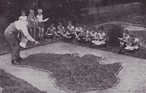
Background imageAustralia Collection: A practical demonstration (b / w photo)

A practical demonstration (b / w photo)
3651749 A practical demonstration (b/w photo) by English Photographer, (20th century); Private Collection; (add.info.: A practical demonstration)

Background imageAustralia Collection: Map of the southern hemisphere of the world, 1708 (etching, 1717)

Map of the southern hemisphere of the world, 1708 (etching, 1717)
LRI4711137 Map of the southern hemisphere of the world, 1708 (etching, 1717) by Nolin, Jean-Baptiste (c.1657-1708); Private Collection; (add.info.: Map of the southern hemisphere of the world)

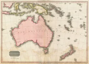
Background imageAustralia Collection: John Pinkertons map of Australia and the South West Pacific, 1818 (colour engraving)

John Pinkertons map of Australia and the South West Pacific, 1818 (colour engraving)
696806 John Pinkertons map of Australia and the South West Pacific, 1818 (colour engraving) by Pinkerton, E. J. (fl.1844); Private Collection; (add.info)

Background imageAustralia Collection: India Quae Orientalis Dicitur, Et Insulae Adiacentes, map showing South-East Asia

India Quae Orientalis Dicitur, Et Insulae Adiacentes, map showing South-East Asia
BON93408 India Quae Orientalis Dicitur, Et Insulae Adiacentes, map showing South-East Asia and The East Indies, published, Amsterdam, c.1635 (hand-coloured engraving) by Blaeu

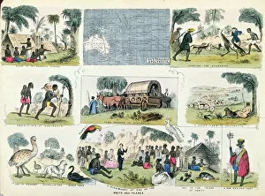
Background imageAustralia Collection: Illustrations of Australia and Polynesia, from a geography book (colour litho)

Illustrations of Australia and Polynesia, from a geography book (colour litho)
CHT197186 Illustrations of Australia and Polynesia, from a geography book (colour litho) by English School, (19th century); Private Collection; (add.info)

Background imageAustralia Collection: Plan of Sydney with Pyrmont, New South Wales, the latter the Property of Edward

Plan of Sydney with Pyrmont, New South Wales, the latter the Property of Edward
STC195053 Plan of Sydney with Pyrmont, New South Wales, the latter the Property of Edward Macarthure Esquire Divided into Allotments for Building, 1836, published by James & Luke G

Background imageAustralia Collection: Gold, mining countries (colour litho)

Gold, mining countries (colour litho)
3648659 Gold, mining countries (colour litho) by English School, (20th century); Private Collection; (add.info.: Gold, mining countries)

Background imageAustralia Collection: Australia (chromolitho)

Australia (chromolitho)
3656913 Australia (chromolitho) by American School, (19th century); Private Collection; (add.info.: Australia. Illustration for trade card)

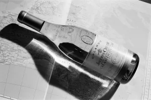
Background imageAustralia Collection: Bottle of White Wine, Orlando, Jacobs Creek, South Eastern Australia Chardonnay 1992

Bottle of White Wine, Orlando, Jacobs Creek, South Eastern Australia Chardonnay 1992

Background imageAustralia Collection: Scouts tune in for the jamboree. Huddersfield scouts took part in a worldwide

Scouts tune in for the jamboree. Huddersfield scouts took part in a worldwide jamboree ? on the radio. Mr Tony Barr, of Denby Dale Amateur Radio Club

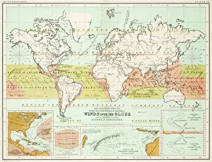
Background imageAustralia Collection: Winds - Map of the world 1861

Winds - Map of the world 1861
Map of the world - Winds over the globe - storms and hurricanes

Background imageAustralia Collection: the world 1877

the world 1877
antique map of the world - 1877

Background imageAustralia Collection: map of the world 1814

map of the world 1814
antique map showing the world with all the latest discovery of 1814

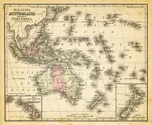
Background imageAustralia Collection: old map of australia - australasia

old map of australia - australasia
an old australasia map with the principal islands of malaysa map (1865) - sepia vintage colors

Background imageAustralia Collection: Map of Oceania 1884

Map of Oceania 1884

Background imageAustralia Collection: map of australia, malaysia and polynesia

map of australia, malaysia and polynesia
old map of australia, malaysia and polynesia - 1883

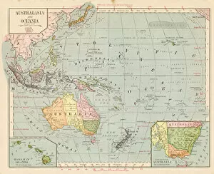
Background imageAustralia Collection: Map of Oceania Australia 1899

Map of Oceania Australia 1899
Maurys Geographical Series Manual of Geography - New York 1899

Background imageAustralia Collection: map of the world 1867

map of the world 1867
meteorological map of the world 1867 - showing isothermal lines

Background imageAustralia Collection: Map of the world 1861

Map of the world 1861
Map of the world - The distribution of Earthquakes and Volcanoes over the globe

Background imageAustralia Collection: Animals - Map of the world 1861

Animals - Map of the world 1861
Map of the world - The distributions of animals

Background imageAustralia Collection: map of the world 1873

map of the world 1873
antique map of the world - from a french atlas - 1872

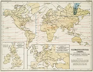
Background imageAustralia Collection: Climate map of the world 1861

Climate map of the world 1861
Map of the world - Climatological Chart

Background imageAustralia Collection: map of the world 1855

map of the world 1855
map of the world illustrating the principal features of the land and the co-tidal lines - 1855

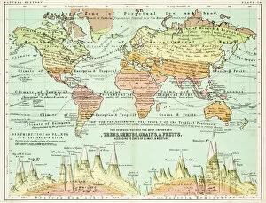
Background imageAustralia Collection: Agricultural Map of the world 1861

Agricultural Map of the world 1861
map of the world showing the distribution of the most important Tress, Shrubs, Grains and Fruits according to zones of climate and moisture plants


All Professionally Made to Order for Quick Shipping


-

Australia Collection

Australia is a vast continent located in the southern hemisphere, surrounded by the Indian and Pacific oceans. The country has a diverse landscape that includes deserts, forests, mountains, and beaches. Australia is home to unique wildlife such as kangaroos, koalas, and wallabies. The population is approximately 25 million people with most living in cities along the eastern coast. The capital city is Canberra while Sydney and Melbourne are the largest cities in terms of population. Maps and charts can be used to explore different regions including its states and territories which include New South Wales, Victoria, Queensland, Western Australia among others.
+

Our beautiful pictures are available as Framed Prints, Photos, Wall Art and Photo Gifts

The Australia collection from Media Storehouse is a stunning compilation of wall art and framed prints that showcase the beauty, diversity, and rich history of Australia. Our collection features an extensive range of maps and charts that depict various regions, cities, landmarks, flora, fauna, and geological formations in intricate detail. The artwork captures the essence of Australia's unique landscapes and cultural heritage through vintage illustrations, antique engravings, colorful posters, and contemporary designs. Whether you are a geography enthusiast or simply looking to add some Australian flair to your home or office decor, our collection offers something for everyone. From iconic landmarks like Uluru (Ayers Rock) to lesser-known gems like the Great Barrier Reef Marine Park Authority Map - Coral Sea Commonwealth Marine Reserve 2014 Edition - Large Format Print Poster Wall Art Decor - 36x24 inches; each piece in our collection is meticulously crafted with high-quality materials to ensure long-lasting durability. The Australia collection from Media Storehouse is a must-have for anyone who loves beautiful artwork that celebrates the natural wonders of our world.
+

What are Australia (Maps and Charts) art prints?

Australia art prints are a collection of high-quality reproductions of antique maps and charts depicting the geography, topography, and history of Australia. These prints showcase the evolution of cartography over time, from early hand-drawn maps to more modern printed versions. The collection includes a wide range of styles and designs, including detailed coastal charts, colorful political maps, and intricate topographical surveys. Each print is carefully reproduced using state-of-the-art printing techniques to ensure that every detail is captured with precision. These art prints are perfect for anyone interested in Australian history or geography or those who simply appreciate beautiful artwork. They make great additions to home decor or office spaces and can be framed to create stunning wall displays. Australia art prints provide an excellent way to explore the rich history and natural beauty of this fascinating country through the lens of cartography.
+

What Australia (Maps and Charts) art prints can I buy from Media Storehouse?

We offer a wide range of Australia maps and charts art prints that you can purchase. You can choose from vintage maps, topographic maps, city street maps, nautical charts, and more. These art prints are available in various sizes to suit your needs and preferences. One popular option is the vintage map of Australia which showcases the country's geography with intricate details such as mountains, rivers, lakes, and cities. Another great choice is the city street map of Sydney or Melbourne that highlights key landmarks and attractions within these bustling metropolitan areas. For those interested in marine navigation or boating enthusiasts, Media Storehouse also offers nautical charts featuring Australian coastlines with detailed information on water depths and hazards. Whether you're looking for decorative pieces for your home or office space or educational resources for schools or libraries, we have a diverse selection of Australia maps and charts art prints to choose from.
+

How do I buy Australia (Maps and Charts) art prints?

To purchase Australia art prints from Media Storehouse, you can browse our online collection of artwork. Once you have found the print that you would like to purchase, simply add it to your cart and proceed to checkout. During the checkout process, you will be prompted to enter your shipping information and payment details. We offer a variety of sizes for their art prints, so be sure to select the size that best fits your needs. We also offer different framing options if you prefer your print framed before delivery. If you have any questions or concerns about purchasing an Australia art print from Media Storehouse, they have a customer service team available to assist with any inquiries. Buying an art print from Media Storehouse is a straightforward process that allows customers access to high-quality prints in various sizes and framing options.
+

How much do Australia (Maps and Charts) art prints cost?

We offer a wide range of Australia maps and charts art prints that are available for purchase. The cost of these prints varies depending on the size and type of print you choose. We have a variety of sizes ranging from small to large, as well as different types such as canvas or framed prints. Our Australia maps and charts art prints are perfect for those who love geography or want to add some unique decor to their home or office space. These high-quality prints showcase the beauty and detail of Australia's landscapes, coastlines, cities, and more. We take pride in offering affordable prices for our customers without compromising on quality. Our team is dedicated to providing excellent customer service and ensuring that your order arrives safely and securely. If you're looking for beautiful Australia maps and charts art prints at reasonable prices, look no further than Media Storehouse.
+

How will my Australia (Maps and Charts) art prints be delivered to me?

We take pride in delivering your Australia art prints with utmost care. We understand that these prints are valuable to you, which is why we ensure that they reach you in perfect condition. Your Australia art prints will be delivered to you through our trusted delivery partners. Depending on your location, the delivery partner may vary. However, rest assured that all our delivery partners are reliable and efficient. We use high-quality packaging materials to protect your art print during transit. Your print will be carefully rolled up and placed inside a sturdy cardboard tube for added protection. Once your order has been dispatched from our warehouse, we will send you an email confirmation along with a tracking number so that you can track the progress of your shipment. Westrive to provide excellent customer service at every step of the way. If you have any questions or concerns about the delivery of your Australia art prints, please do not hesitate to contact us.