Home > Europe > United Kingdom > Wales > Maps
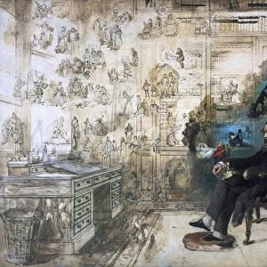
Map of the western hemisphere, illustration from A journal of a voyage to the South

![]()
Wall Art and Photo Gifts from Fine Art Finder
Map of the western hemisphere, illustration from A journal of a voyage to the South
3610752 Map of the western hemisphere, illustration from A journal of a voyage to the South Seas : in His Majestys ship, the Endeavour, 1794 (hand-coloured engraving) by Parkinson, Sydney (c.1745-71) (after); height: 34 cm; Dixson Galleries, State Library of New South Wales; (add.info.: A journal of a voyage to the South Seas : in His Majestys ship, the Endeavour : faithfully transcribed from the papers of the last Sydney Parkinson, draughtsman to Joseph Banks, esq. on his late expedition with Dr. Solander around the world / embellished with views and designs delineated by the author.
London : printed for Charles Dilly, in the Poultry, and James Phillips, in the George-Yard, 1784.
HMS Endeavour commanded by Lieutenant James Cook on his first voyage of discovery, to Australia and New Zealand, from 1769 to 1771.); Mitchell Library, State Library of New South Wales; English, out of copyright
Media ID 22735436
© Mitchell Library, State Library of New South Wales / Bridgeman Images
Americas Australasia Captain Cook Cartography Colonisation Endeavour Enlightenment Expedition Globe Hemisphere Hms Endeavour James Cook Joseph Banks Journal Mapping New Zealand Solander South Seas Voyage Western
FEATURES IN THESE COLLECTIONS
> Arts
> Artists
> Related Images
> Europe
> United Kingdom
> England
> London
> Related Images
> Europe
> United Kingdom
> Wales
> Maps
> Fine Art Finder
> Artists
> Sydney (after) Parkinson
> Maps and Charts
> Wales
> Maps and Charts
> World
> North America
> Related Images
EDITORS COMMENTS
This print showcases a hand-coloured engraving of a map titled "Map of the western hemisphere, illustration from A journal of a voyage to the South Seas". Created by Sydney Parkinson in 1794, this artwork is an integral part of historical exploration and cartography. The map was featured in Parkinson's journal chronicling his expedition aboard His Majesty's ship, the Endeavour, commanded by Lieutenant James Cook. The intricate details on this map offer a glimpse into the world as it was perceived during the Enlightenment era. It highlights various regions including Australasia, North America, South America, and Oceania. This significant piece not only serves as a navigational tool but also reflects the British Empire's efforts in colonisation and naval dominance. With its rich history and connection to renowned naturalist Joseph Banks, who accompanied Cook on his voyage around the world, this print holds immense value for those interested in exploration and adventure. It transports viewers back to an era when brave explorers set sail into uncharted territories with hopes of discovering new lands and expanding knowledge. Displayed at Dixson Galleries within the State Library of New South Wales' Mitchell Library collection, this print is a testament to human curiosity and our relentless pursuit of understanding our planet. Its presence reminds us that there are still vast realms waiting to be explored beyond what we already know.
MADE IN AUSTRALIA
Safe Shipping with 30 Day Money Back Guarantee
FREE PERSONALISATION*
We are proud to offer a range of customisation features including Personalised Captions, Color Filters and Picture Zoom Tools
SECURE PAYMENTS
We happily accept a wide range of payment options so you can pay for the things you need in the way that is most convenient for you
* Options may vary by product and licensing agreement. Zoomed Pictures can be adjusted in the Cart.