Fraud Blocker Skip to main content

Home > Maps and Charts > Greece

Greece Collection (page 3)

Greece is a country located in southeastern Europe, with a population of approximately 10.7 million people

1,416 items

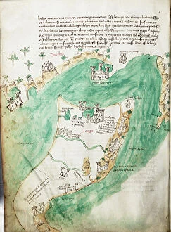
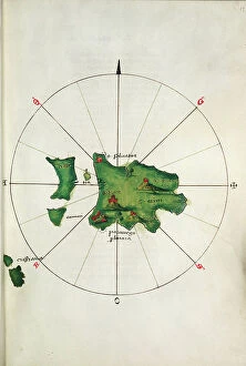
Background imageGreece Collection: Chart of Ithaki, c.1420 (vellum)

Chart of Ithaki, c.1420 (vellum)
7339622 Chart of Ithaki, c.1420 (vellum) by Buondelmonti, Cristoforo (1385-1430); 25x18 cm; National Maritime Museum, London

Background imageGreece Collection: Chart of Paxos, c.1420 (vellum)

Chart of Paxos, c.1420 (vellum)
7339621 Chart of Paxos, c.1420 (vellum) by Buondelmonti, Cristoforo (1385-1430); 25x18 cm; National Maritime Museum, London

Background imageGreece Collection: Chart of Paxos, c.1420 (vellum)

Chart of Paxos, c.1420 (vellum)
7339620 Chart of Paxos, c.1420 (vellum) by Buondelmonti, Cristoforo (1385-1430); 25x18 cm; National Maritime Museum, London

Background imageGreece Collection: Muhammad al-Idrisi. Paris transcript of V-4. The map displays: the northern shoreline of Marmara Sea

Muhammad al-Idrisi. Paris transcript of V-4. The map displays: the northern shoreline of Marmara Sea
529624 Muhammad al-Idrisi. Paris transcript of V-4. The map displays: the northern shoreline of Marmara Sea, Gallipoli Peninsula

Background imageGreece Collection: Map of Crete, c.1900 (engraving)

Map of Crete, c.1900 (engraving)
533320 Map of Crete, c.1900 (engraving); (add.info.: Map of Crete, Greece, circa 1902, From the 10th edition of Encyclopaedia Britannica.); Encyclopaedia Britannica/UIG

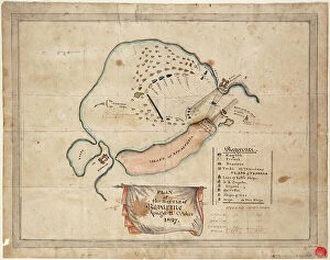
Background imageGreece Collection: Battle of Plataea, Greece, 479 BC (engraving)

Battle of Plataea, Greece, 479 BC (engraving)
8635041 Battle of Plataea, Greece, 479 BC (engraving) by German School, (19th century) (after); Private Collection; (add.info.: Plan of the Battle of Plataea, Greece, 479 BC)

Background imageGreece Collection: The Balkan States, 1914 (litho)

The Balkan States, 1914 (litho)
8660706 The Balkan States, 1914 (litho) by English School, (20th century); Private Collection; (add.info.: The Balkan States, 1914)

Background imageGreece Collection: Pegasus and Equuleus, c.1825 (card, paper, tissue)

Pegasus and Equuleus, c.1825 (card, paper, tissue)
7340882 Pegasus and Equuleus, c.1825 (card, paper, tissue) by Hall, Sydney (fl.1826); 20.3x14 cm; National Maritime Museum, London, UK; (add.info.: Creator: Sidney Hall Plate 15)

Background imageGreece Collection: Justus Danckers's atlas: Hungary and Greece, c.1688 (coloured engraving)

Justus Danckers's atlas: Hungary and Greece, c.1688 (coloured engraving)
7340066 Justus Danckers's atlas: Hungary and Greece, c.1688 (coloured engraving) by Danckertsz, Justus (1635-1701); 50x59 cm; National Maritime Museum, London

Background imageGreece Collection: Rhodes and Symi (Greek islands) facing the Turkish coast

Rhodes and Symi (Greek islands) facing the Turkish coast
MMM5474179 Rhodes and Symi (Greek islands) facing the Turkish coast; National Maritime Museum, London, UK; (add.info.: Rhodes and Symi (Greek islands) facing the Turkish coast

Background imageGreece Collection: Symi, cartographic survey of the Greek island, with handwritten notes on vellum

Symi, cartographic survey of the Greek island, with handwritten notes on vellum
MMM5474161 Symi, cartographic survey of the Greek island, with handwritten notes on vellum by Buondelmonti, Cristoforo (1385-1430); National Maritime Museum, London, UK; (add.info.: Symi)

Background imageGreece Collection: Plan of the volcano Mt. Vesuvius after an eruption, and path of lava flow through Torre del Greco

Plan of the volcano Mt. Vesuvius after an eruption, and path of lava flow through Torre del Greco, Naples
FLO4574376 Plan of the volcano Mt. Vesuvius after an eruption, and path of lava flow through Torre del Greco, Naples. Handcoloured copperplate engraving from Bertuch's " Bilderbuch fur

Background imageGreece Collection: La ville de Troie, avec les celebres personnages de la Grece et en bas a droite Homere en

La ville de Troie, avec les celebres personnages de la Grece et en bas a droite Homere en "Cosmographia" de
GIA5033876 La ville de Troie, avec les celebres personnages de la Grece et en bas a droite Homere en "Cosmographia" de Julius Solinus 14eme siecle.; (add.info.: La ville de Troie)

Background imageGreece Collection: World map depicting the flat earth by Greek historian Herodote (484 or 482-425 BC)

World map depicting the flat earth by Greek historian Herodote (484 or 482-425 BC)
NWI4848152 World map depicting the flat earth by Greek historian Herodote (484 or 482-425 BC). Colourful engraving of the 19th century.; (add.info)

Background imageGreece Collection: Greece, Chania, Crete: French Military Circle of Officers. On the wall the Map of Turkey

Greece, Chania, Crete: French Military Circle of Officers. On the wall the Map of Turkey, the Black Sea
LUX4765228 Greece, Chania, Crete: French Military Circle of Officers. On the wall the Map of Turkey, the Black Sea. Letter and Newspaper Sorting Lockers, 1908 - Officers of 122; (add.info.: Greece)

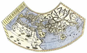
Background imageGreece Collection: Cosmographia (Geography) by Ptolemy, 1477 (book)

Cosmographia (Geography) by Ptolemy, 1477 (book)
7415661 Cosmographia (Geography) by Ptolemy, 1477 (book); Bibliotheque Nationale, Paris, France; (add.info.: Claude Ptolemy (c.90-168) Cosmographia (Geography) Printed by Dominicus de Lapis Bologna

Background imageGreece Collection: Chart of Kos and Bodrum, c.1420 (vellum)

Chart of Kos and Bodrum, c.1420 (vellum)
7339627 Chart of Kos and Bodrum, c.1420 (vellum) by Buondelmonti, Cristoforo (1385-1430); 25x18 cm; National Maritime Museum, London

Background imageGreece Collection: Chart of Corfu and adjacent mainland, c.1420 (Vellum)

Chart of Corfu and adjacent mainland, c.1420 (Vellum)
7339619 Chart of Corfu and adjacent mainland, c.1420 (Vellum) by Buondelmonti, Cristoforo (1385-1430); 25x18 cm; National Maritime Museum, London

Background imageGreece Collection: Chart of Negroponte, 1554 (vellum)

Chart of Negroponte, 1554 (vellum)
7339644 Chart of Negroponte, 1554 (vellum) by Agnese, Battista (c.1500-64); 26x40 cm; National Maritime Museum, London, UK; (add.info.: Creator: Battista Agnese Scale: 1)

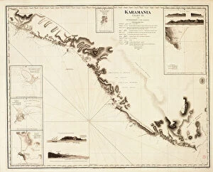
Background imageGreece Collection: Karamania Chart III from Cape Karaboornoo to Cape Anamour, 1819 (engraving)

Karamania Chart III from Cape Karaboornoo to Cape Anamour, 1819 (engraving)
7339424 Karamania Chart III from Cape Karaboornoo to Cape Anamour, 1819 (engraving) by Beaufort, Francis (fl.1819); 60x75 cm; National Maritime Museum, London

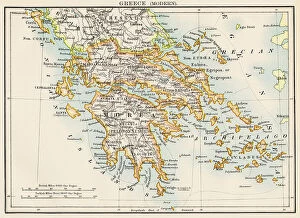
Background imageGreece Collection: Map of Greece (Thessaly, Peloponnese and Cycladic Islands), circa 1870. 19th century lithography

Map of Greece (Thessaly, Peloponnese and Cycladic Islands), circa 1870. 19th century lithography
NWI4871595 Map of Greece (Thessaly, Peloponnese and Cycladic Islands), circa 1870. 19th century lithography.; (add.info.: Map of Greece (Thessaly, Peloponnese and Cycladic Islands), circa 1870

Background imageGreece Collection: Map of Epirus and western Greece, 295 BC. From Cassell's Universal History

Map of Epirus and western Greece, 295 BC. From Cassell's Universal History, published 1888 (b/w engraving)
6867255 Map of Epirus and western Greece, 295 BC. From Cassell's Universal History, published 1888 (b/w engraving); (add.info.: Map of Epirus and western Greece, 295 BC)

Background imageGreece Collection: Geographic map of the Greek Empire at the time of the Crusades

Geographic map of the Greek Empire at the time of the Crusades and of Italy under the reign of Emperor Frederic I
ELD4924811 Geographic map of the Greek Empire at the time of the Crusades and of Italy under the reign of Emperor Frederic I Barberossa, 1125-1200 (Map of Greek empire and Italy)

Background imageGreece Collection: United States, Bomber Pilot's Printed Silk Cloth Map

United States, Bomber Pilot's Printed Silk Cloth Map
3032599 United States, Bomber Pilot's Printed Silk Cloth Map ; Private Collection; (add.info.: World War II, United States, Bomber Pilot's Printed Silk United States Army Air Force)

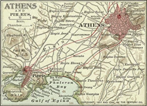
Background imageGreece Collection: Map of Athens, c.1900 (engraving)

Map of Athens, c.1900 (engraving)
532702 Map of Athens, c.1900 (engraving); (add.info.: Map showing the historical churches of Athens and Piraeus, circa 1900)

Background imageGreece Collection: Map of the Earth according to Herodotus (engraving)

Map of the Earth according to Herodotus (engraving)
8635073 Map of the Earth according to Herodotus (engraving) by German School, (19th century) (after); Private Collection; (add.info)

Background imageGreece Collection: Euboea and Athens, c.1420 (Vellum)

Euboea and Athens, c.1420 (Vellum)
7339630 Euboea and Athens, c.1420 (Vellum) by Buondelmonti, Cristoforo (1385-1430); 25x18 cm; National Maritime Museum, London

Background imageGreece Collection: Chart of Cephalonia, c.1420 (vellum)

Chart of Cephalonia, c.1420 (vellum)
7339623 Chart of Cephalonia, c.1420 (vellum) by Buondelmonti, Cristoforo (1385-1430); 25x18 cm; National Maritime Museum, London

Background imageGreece Collection: Plan of the Battle of Navarino, 21 October 1827, 1827 (coloured manuscript)

Plan of the Battle of Navarino, 21 October 1827, 1827 (coloured manuscript)
7339519 Plan of the Battle of Navarino, 21 October 1827, 1827 (coloured manuscript) by Unknown Artist, (19th century); 32x42 cm; National Maritime Museum, London

Background imageGreece Collection: Archipeligo, Rhodes I. Port Lindo surveyed by Captain Thomas Graves, HMS Beacon 1842, 1848 (print)

Archipeligo, Rhodes I. Port Lindo surveyed by Captain Thomas Graves, HMS Beacon 1842, 1848 (print)
7342501 Archipeligo, Rhodes I. Port Lindo surveyed by Captain Thomas Graves, HMS Beacon 1842, 1848 (print) by Walker, J. & C

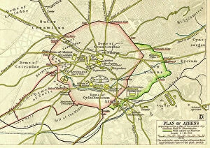
Background imageGreece Collection: Plan of Athens, Greece c.200 AD. From Historical Atlas, published 1923

Plan of Athens, Greece c.200 AD. From Historical Atlas, published 1923
2603507 Plan of Athens, Greece c.200 AD. From Historical Atlas, published 1923

Background imageGreece Collection: Map of the Athenian Empire at its height, c.450 B.C. From Historical Atlas

Map of the Athenian Empire at its height, c.450 B.C. From Historical Atlas, published 1923 (colour litho)
2603503 Map of the Athenian Empire at its height, c.450 B.C. From Historical Atlas, published 1923 (colour litho) by American School, (20th century)

Background imageGreece Collection: World map of Claude Ptolemee (Claudius Ptolemaeus, 90-168) illustrating the flat earth

World map of Claude Ptolemee (Claudius Ptolemaeus, 90-168) illustrating the flat earth
NWI4846095 World map of Claude Ptolemee (Claudius Ptolemaeus, 90-168) illustrating the flat earth. Colourful engraving of the 19th century.; (add.info)

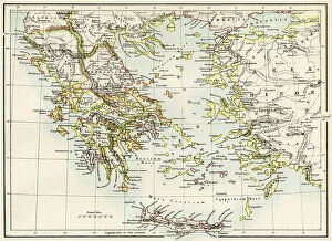
Background imageGreece Collection: Geographic map of territories around the Aegean Sea: Greek islands, Turkey, Minor Asia; Rhodes

Geographic map of territories around the Aegean Sea: Greek islands, Turkey, Minor Asia; Rhodes, Thrace
NWI4863295 Geographic map of territories around the Aegean Sea: Greek islands, Turkey, Minor Asia; Rhodes, Thrace, Poloponese and Macedoine (Macedonia) of Antiquity

Background imageGreece Collection: Plan of the underground caves near Agioi-Deka, Gortyn, Crete, and entrance to the caves

Plan of the underground caves near Agioi-Deka, Gortyn, Crete, and entrance to the caves
FLO4569004 Plan of the underground caves near Agioi-Deka, Gortyn, Crete, and entrance to the caves. Believed to be the site of the mythical Labyrinth by Charles Robert Cockerell

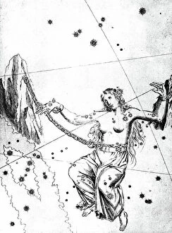
Background imageGreece Collection: Constellation of Andromeda from Johannes Bayer Uranometria Ulm 1723 (engraving)

Constellation of Andromeda from Johannes Bayer Uranometria Ulm 1723 (engraving)
531609 Constellation of Andromeda from Johannes Bayer Uranometria Ulm 1723 (engraving); (add.info.: Andromeda chained to rocks waiting for rescue by Perseus)

Background imageGreece Collection: Muhammad al-Idrisi. Paris transcript of V-4. The map displays: the northern shoreline of Marmara Sea

Muhammad al-Idrisi. Paris transcript of V-4. The map displays: the northern shoreline of Marmara Sea
529625 Muhammad al-Idrisi. Paris transcript of V-4. The map displays: the northern shoreline of Marmara Sea, Gallipoli Peninsula

Background imageGreece Collection: 8623059

8623059

Background imageGreece Collection: Map of Early Greece (litho)

Map of Early Greece (litho)
8660840 Map of Early Greece (litho) by English School, (20th century); Private Collection; (add.info.: Map of Early Greece)

Background imageGreece Collection: Ancient Greece, 500-300 BC (litho)

Ancient Greece, 500-300 BC (litho)
8660785 Ancient Greece, 500-300 BC (litho) by English School, (20th century); Private Collection; (add.info.: Ancient Greece, 500-300 BC)

Background imageGreece Collection: Syracuse at the Time of the Siege, 415-413 BC (litho)

Syracuse at the Time of the Siege, 415-413 BC (litho)
8652547 Syracuse at the Time of the Siege, 415-413 BC (litho) by Bartholomew, John George (1860-1920) ; Private Collection; (add.info.: Syracuse at the Time of the Siege, 415-413 BC)

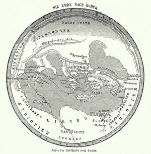
Background imageGreece Collection: Map of the Earth according to Homer (engraving)

Map of the Earth according to Homer (engraving)
8635074 Map of the Earth according to Homer (engraving) by German School, (19th century) (after); Private Collection; (add.info.: Map of the Earth according to the ancient Greek poet Homer)

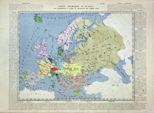
Background imageGreece Collection: Primary cities of Europe, their population and degree of trade of individual states (print)

Primary cities of Europe, their population and degree of trade of individual states (print)
6202957 Primary cities of Europe, their population and degree of trade of individual states (print; (add.info.: CARTOGRAPHY "Primary cities of Europe)

Background imageGreece Collection: Chart of Zakinthos, c.1420 (vellum)

Chart of Zakinthos, c.1420 (vellum)
7339625 Chart of Zakinthos, c.1420 (vellum) by Buondelmonti, Cristoforo (1385-1430); 25x18 cm; National Maritime Museum, London

Background imageGreece Collection: Chart of Negroponte, 1590 (drawing)

Chart of Negroponte, 1590 (drawing)
7339639 Chart of Negroponte, 1590 (drawing) by Millo, Antonio (fl.c.1590); 31x20.5 cm; National Maritime Museum, London, UK; (add.info.: Creator)

Background imageGreece Collection: Santorini, Sonetti, c.1485 (vellum)

Santorini, Sonetti, c.1485 (vellum)
7339632 Santorini, Sonetti, c.1485 (vellum) by Sonetti, Bartolomeo da li (fl.1485); 27x19 cm; National Maritime Museum, London

Background imageGreece Collection: Representation du monde selon Claude Ptoleme (Claudius Ptolemaeus (vers 100-170)

Representation du monde selon Claude Ptoleme (Claudius Ptolemaeus (vers 100-170)
AIS5331520 Representation du monde selon Claude Ptoleme (Claudius Ptolemaeus (vers 100-170). Gravure extraite de "Atlas Coelestis seu Harmonia Macrocosmica" (1661)

Background imageGreece Collection: Map of Greece and Italy from Constantine I the Great to the sack of Rome during the migration period

Map of Greece and Italy from Constantine I the Great to the sack of Rome during the migration period
ELD4928075 Map of Greece and Italy from Constantine I the Great to the sack of Rome during the migration period, 410) Engraving from Houze's "Atlas Universale"


All Professionally Made to Order for Quick Shipping


-

Greece Collection

Greece is a country located in southeastern Europe, with a population of approximately 10.7 million people. The country has an area of 131,957 square kilometers and is divided into thirteen administrative regions. Greece's capital city is Athens, which is also the largest city in the country. The geography includes numerous islands scattered throughout the Aegean and Ionian Seas, as well as mountainous terrain on the mainland. The highest point is Mount Olympus at 2,917 meters. A rich history dating back to ancient times when it was home to some of the world's most famous philosophers and mathematicians such as Socrates, Plato, and Aristotle. Today, Greece remains an important cultural center with many historical landmarks including the Acropolis in Athens and Delphi archaeological site. Overall, maps and charts can provide valuable insights into various aspects of Greek society such as demographics or economic activity while also showcasing its unique geography and cultural heritage.
+

Our beautiful Wall Art and Photo Gifts include Framed Prints, Photo Prints, Poster Prints, Canvas Prints, Jigsaw Puzzles, Metal Prints and so much more

The Greece collection from Media Storehouse is a stunning assortment of wall art and framed prints that showcases the beauty, history, and culture of Greece. Our collection features an array of maps and charts that depict various regions, cities, islands, landmarks, and historical events in Greece. The maps are intricately detailed with accurate geographical information such as topography, rivers, mountains, coastlines etc., while the charts provide valuable insights into ancient Greek mythology, philosophy or architecture. These artworks are printed on high-quality paper using advanced printing technology to ensure vibrant colors and sharp details. They come in different sizes to suit any space or decor style. Whether you're a history buff or simply love the Mediterranean charm of Greece's landscapes and seascapes - our collection has something for everyone. Overall our collection offers a unique opportunity to bring some Greek heritage into your home or office space through beautiful artwork that captures its rich cultural legacy.
+

What are Greece (Maps and Charts) art prints?

Greece art prints are a collection of high-quality, visually stunning reproductions of maps and charts depicting the geography, history, culture, and landmarks of Greece. These art prints showcase the intricate details of ancient Greek architecture, mythology, and landscapes in vivid colors that capture the essence of this beautiful country. These prints are perfect for anyone who loves Greece or wants to learn more about its rich heritage. They make great gifts for travelers or those interested in history or geography. The collection includes a variety of styles from vintage to modern designs that will suit any decor style. Whether you're looking for a map to hang on your wall or an artistic representation of Greece's famous landmarks like the Acropolis or Santorini's blue-domed churches overlooking the Aegean Sea - these art prints are sure to impress with their attention to detail and quality craftsmanship.
+

What Greece (Maps and Charts) art prints can I buy from Media Storehouse?

We offer a wide variety of Greece art prints in the form of maps and charts. These prints showcase the beauty and history of Greece, including its stunning landscapes, ancient ruins, and iconic landmarks. Some popular options include detailed maps of Athens or Crete, vintage travel posters featuring Greek islands like Santorini or Mykonos, and historical charts depicting the mythology and gods of Ancient Greece. In addition to these traditional map and chart styles, Media Storehouse also offers modern interpretations that incorporate bold colors and abstract designs. Whether you're looking for a classic depiction of Greece's rich cultural heritage or a contemporary take on its natural wonders, there is sure to be an art print that suits your taste. All prints are available in various sizes to fit any space in your home or office. They are printed using high-quality materials to ensure vibrant colors and crisp details that will last for years to come.
+

How do I buy Greece (Maps and Charts) art prints?

To buy Greece art prints from Media Storehouse, you can browse our extensive collection of high-quality prints online. Simply search for the specific artwork or artist you are interested in, or explore their curated collections to discover new pieces. Once you have found a print that catches your eye, select the size and framing options that best suit your needs. You can choose from a range of materials and finishes to create a custom look that complements your decor. When you are ready to purchase, simply add the item to your cart and proceed through the checkout process. We accept various payment methods for easy and secure transactions. Whether you are looking for a unique piece of wall art for your home or office, or searching for a special gift for someone who loves Greece , we have something to suit every taste and budget.
+

How much do Greece (Maps and Charts) art prints cost?

We offer a wide range of Greece art prints at varying prices. Our collection includes high-quality prints featuring maps and charts of Greece that are perfect for adding a touch of sophistication to any room in your home or office. The cost of our Greece art prints depends on the size, framing options, and other customizations you choose. We take pride in offering affordable yet premium quality artwork that is sure to impress anyone who sees it. Whether you're looking for a small print to hang on your wall or a large canvas to make a statement piece, we have something for everyone's budget. Our team works hard to ensure that each order is processed quickly and efficiently so you can enjoy your new artwork as soon as possible. So if you're looking for beautiful Greece art prints at reasonable prices, look no further than Media Storehouse.
+

How will my Greece (Maps and Charts) art prints be delivered to me?

We take great care in ensuring that your Greece art prints are delivered to you safely and securely. We use high-quality packaging materials to protect your artwork during transit, so it arrives in pristine condition. Your prints will be carefully rolled and placed into a sturdy cardboard tube for delivery. This ensures that they remain flat and free from creases or damage during transportation. The tube is then sealed with tape to prevent any moisture or dust from entering. Once your order has been dispatched, you will receive an email confirmation with tracking information so you can monitor the progress of your delivery. Our shipping partners are reliable and efficient, ensuring that your package arrives on time. We pride ourselves on providing excellent customer service, so if there are any issues with the delivery of your Greece art prints, please do not hesitate to contact us.