Fraud Blocker Skip to main content

Home > Maps and Charts > India

India Collection (page 2)

India is a country located in South Asia, bordered by Pakistan to the west, China and Nepal to the north, Bhutan to the northeast

690 items

Background imageIndia Collection: Plan of the Battle of Assaye, illustration from Cassell

Plan of the Battle of Assaye, illustration from Cassell
876370 Plan of the Battle of Assaye, illustration from Cassells Illustrated History of India by James Grant, pub. 1879 (litho) by English School

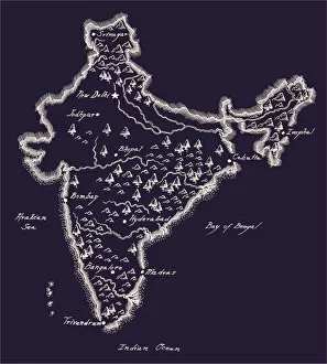
Background imageIndia Collection: Antique India Map

Antique India Map
India Map, - Antique style. Includes mountains and water bodies. High detail - vector illustration
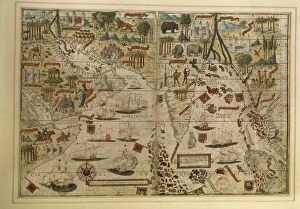
Background imageIndia Collection: Map of India and Indian Ocean, from Miller Atlas by Pedro and Jorge Reinel, Lopo Homen

Map of India and Indian Ocean, from Miller Atlas by Pedro and Jorge Reinel, Lopo Homen
Cartography, 16th century. Map of India and Indian Ocean, from Miller Atlas, by Pedro and Jorge Reinel, Lopo Homen (cartographers) and Antonio de Holanda (miniaturist), 1519

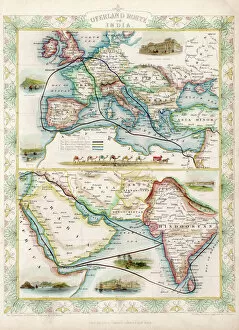
Background imageIndia Collection: World Map / Overland India

World Map / Overland India
The overland routes from England to India, compared with sea routes

Background imageIndia Collection: Map / Asia / East Indies

Map / Asia / East Indies
India and its neighbours : note that Burma is named India beyond the Ganges

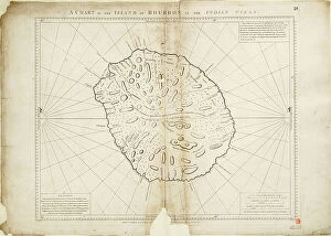
Background imageIndia Collection: A chart of the Island of Bourbon in the Indian Ocean, 1780 (paper)

A chart of the Island of Bourbon in the Indian Ocean, 1780 (paper)
7339415 A chart of the Island of Bourbon in the Indian Ocean, 1780 (paper) by Gilbert, William (18th century); 61x93 cm; National Maritime Museum, London

Background imageIndia Collection: Bay of Bengal, c.1660 (engraving)

Bay of Bengal, c.1660 (engraving)
7339392 Bay of Bengal, c.1660 (engraving) by Unknown Artist, (17th century); 31x40 cm; National Maritime Museum, London, UK; (add.info.: Creator: Anonymous Single sheet. Engr)

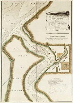
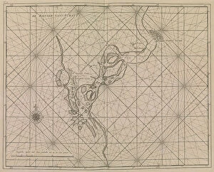
Background imageIndia Collection: Map of Hoogly River, c.1777 (engraving)

Map of Hoogly River, c.1777 (engraving)
7339428 Map of Hoogly River, c.1777 (engraving) by British School, (18th Century); 20.5x32.5 cm; National Maritime Museum, London, UK; (add.info.: Creator: Lacam, Benjamin Single sheet. Hand col)

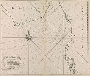
Background imageIndia Collection: A Large Chart of Part of the Coast of GUZARATT & INDIA from Diu Head to Bombay. (print)

A Large Chart of Part of the Coast of GUZARATT & INDIA from Diu Head to Bombay. (print)
7340646 A Large Chart of Part of the Coast of GUZARATT & INDIA from Diu Head to Bombay. (print) by Thornton, John (1641-1708); National Maritime Museum, London, UK; (add.info.: Creator: Thornton)

Background imageIndia Collection: The Peninsula of India from the Kistnah River to Cape Comorin, 1792 (print)

The Peninsula of India from the Kistnah River to Cape Comorin, 1792 (print)
7340497 The Peninsula of India from the Kistnah River to Cape Comorin, 1792 (print) by Rennell, James (1742-1830); 44x49 cm; National Maritime Museum, London

Background imageIndia Collection: A new and correct sea chart of the whole world showing the variations of the compass as they were

A new and correct sea chart of the whole world showing the variations of the compass as they were found in the year
7340787 A new and correct sea chart of the whole world showing the variations of the compass as they were found in the year 1700, 1702 (engraving) by British School

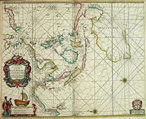
Background imageIndia Collection: A chart of the easternmost part of the East Indies with all the adjacent islands from Cape Comorin

A chart of the easternmost part of the East Indies with all the adjacent islands from Cape Comorin to Japan
7340780 A chart of the easternmost part of the East Indies with all the adjacent islands from Cape Comorin to Japan, 1675 (Hand coloured engraving) by Seller

Background imageIndia Collection: Chart of Sindh and Kutch coasts, 1848-50 (print)

Chart of Sindh and Kutch coasts, 1848-50 (print)
7340643 Chart of Sindh and Kutch coasts, 1848-50 (print) by British School, (19th century); 76.5x61.5 cm; National Maritime Museum, London

Background imageIndia Collection: A chart of Broach Bar and river surveyed by Lieut WIlliam Augustus Skynner 1773, 1775 (print)

A chart of Broach Bar and river surveyed by Lieut WIlliam Augustus Skynner 1773, 1775 (print)
7340638 A chart of Broach Bar and river surveyed by Lieut WIlliam Augustus Skynner 1773, 1775 (print) by British School, (18th Century); 18.8x35.6 cm; National Maritime Museum, London

Background imageIndia Collection: 'Chart of part of the coasts of Cutch and Guzarat by J G Richardson

'Chart of part of the coasts of Cutch and Guzarat by J G Richardson
7340637 'Chart of part of the coasts of Cutch and Guzarat by J G Richardson... communicated by Capt Archibald Blair to whom this plate is inscribed by his most obliged A Dalrymple

Background imageIndia Collection: Map of the chief foreign settlements in India at the end of the 17th century (print)

Map of the chief foreign settlements in India at the end of the 17th century (print)
7420058 Map of the chief foreign settlements in India at the end of the 17th century (print); (add.info.: Map of the chief foreign settlements in India at the end of the 17th century)

Background imageIndia Collection: Vellum chart of Africa, India and the Mediterranean, 1554 (vellum)

Vellum chart of Africa, India and the Mediterranean, 1554 (vellum)
7339652 Vellum chart of Africa, India and the Mediterranean, 1554 (vellum) by Agnese, Battista (c.1500-64); 26x40 cm; National Maritime Museum, London

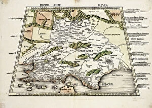
Background imageIndia Collection: Conical projection of India, 1513 (coloured woodcut)

Conical projection of India, 1513 (coloured woodcut)
7339481 Conical projection of India, 1513 (coloured woodcut) by Unknown Artist, (16th century); 37x57 cm; National Maritime Museum, London

Background imageIndia Collection: Plan of Lucknow, plotted from a survey made in 1856, by Lieut. Moorsom, 52nd. Lt. Infantry

Plan of Lucknow, plotted from a survey made in 1856, by Lieut. Moorsom, 52nd. Lt. Infantry
7339413 Plan of Lucknow, plotted from a survey made in 1856, by Lieut. Moorsom, 52nd. Lt. Infantry. (Presented by Captain Moorsom, C.E.), c.1856 (silk, paper) by British School

Background imageIndia Collection: Empire Air Routes: England-India-Malaya-Australia Route, Map A (colour litho)

Empire Air Routes: England-India-Malaya-Australia Route, Map A (colour litho)
8659286 Empire Air Routes: England-India-Malaya-Australia Route, Map A (colour litho) by English School, (20th century); Private Collection; (add.info.: England-India-Malaya-Australia Route, Map A)

Background imageIndia Collection: Kingdom of Holland (litho)

Kingdom of Holland (litho)
8661363 Kingdom of Holland (litho) by English School, (20th century); Private Collection; (add.info.: Kingdom of Holland. Though the kingdom of Holland is small in extent)

Background imageIndia Collection: Map of the Himalayan region (Bhutan, China, India, Nepal, Turkestan, Afghanistan, Pakistan)

Map of the Himalayan region (Bhutan, China, India, Nepal, Turkestan, Afghanistan, Pakistan, Burma or Myanmar), ca
NWI4865646 Map of the Himalayan region (Bhutan, China, India, Nepal, Turkestan, Afghanistan, Pakistan, Burma or Myanmar), ca. 1870

Background imageIndia Collection: Map of East India Islands with New Guinea, c.1900 (engraving)

Map of East India Islands with New Guinea, c.1900 (engraving)
533036 Map of East India Islands with New Guinea, c.1900 (engraving); (add.info.: Map of East India Islands, with an inset of New Guinea, circa 1902)

Background imageIndia Collection: Chart of the West Indies, 1796

Chart of the West Indies, 1796
2902871 Chart of the West Indies, 1796; (add.info.: Chart of the West Indies, 1796.); Buyenlarge Archive/UIG

Background imageIndia Collection: India, Hindustan, 1782

India, Hindustan, 1782
2902855 India, Hindustan, 1782; (add.info.: India, Hindustan, 1782.); Buyenlarge Archive/UIG

Background imageIndia Collection: The french leaves River May, 1591 (engraving)

The french leaves River May, 1591 (engraving)
2435392 The french leaves River May, 1591 (engraving) by Bry, Theodor de (1528-98); (add.info.: History. USA. The french leaves River May (today Saint Johns River) and inspect two rivers (Axona)

Background imageIndia Collection: Description of the Indian coast of Malabar, on the Indian Ocean (Mare Indicum), in 1459

Description of the Indian coast of Malabar, on the Indian Ocean (Mare Indicum), in 1459
NWI4853329 Description of the Indian coast of Malabar, on the Indian Ocean (Mare Indicum), in 1459, taken from the cosmography of Fra Mauro (1385-1460)

Background imageIndia Collection: The Evening Post map of the West Indies, 1898

The Evening Post map of the West Indies, 1898
2902870 The Evening Post map of the West Indies, 1898; (add.info.: The Evening Post map of the West Indies, 1898.); Buyenlarge Archive/UIG

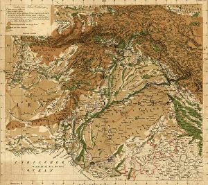
Background imageIndia Collection: Afghanistan - Bordering Indian Lands, 1842

Afghanistan - Bordering Indian Lands, 1842
2902273 Afghanistan - Bordering Indian Lands, 1842; (add.info.: Afghanistan - Bordering Indian Lands, 1842.); Buyenlarge Archive/UIG

Background imageIndia Collection: Map of India in 1750. (print)

Map of India in 1750. (print)
7420059 Map of India in 1750. (print); (add.info.: Map of India in 1750. From the book Outline of History by H.G. Wells, published 1920.); Photo © Ken Welsh. All rights reserved 2024

Background imageIndia Collection: Map of the Gujarat coast, 1798 (print)

Map of the Gujarat coast, 1798 (print)
7340642 Map of the Gujarat coast, 1798 (print) by French School, (18th century); 66x45 cm; National Maritime Museum, London

Background imageIndia Collection: Chart of Jamaica, Barbados, St Christopher, Martinique, Antigua and Bermuda

Chart of Jamaica, Barbados, St Christopher, Martinique, Antigua and Bermuda, 1713 (coloured engraving)
7340629 Chart of Jamaica, Barbados, St Christopher, Martinique, Antigua and Bermuda, 1713 (coloured engraving) by Seller, John (1632-97); National Maritime Museum, London

Background imageIndia Collection: A military chart of the marches and encampments of the grand army commanded by Major General

A military chart of the marches and encampments of the grand army commanded by Major General Medows from the 26th May
7340494 A military chart of the marches and encampments of the grand army commanded by Major General Medows from the 26th May to the 14th December 1790, 1791 (manuscript) by Mackenzie, C

Background imageIndia Collection: A chart of the easternmost part of the East Indies with all the adjacent islands from Cape Comorin

A chart of the easternmost part of the East Indies with all the adjacent islands from Cape Comorin to Japan
7340050 A chart of the easternmost part of the East Indies with all the adjacent islands from Cape Comorin to Japan, 1675 (coloured engraving) by Seller

Background imageIndia Collection: Plan of Choul and Surat River, 1775, 18th century (print)

Plan of Choul and Surat River, 1775, 18th century (print)
7340011 Plan of Choul and Surat River, 1775, 18th century (print) by Unknown artist, (18th century); National Maritime Museum, London

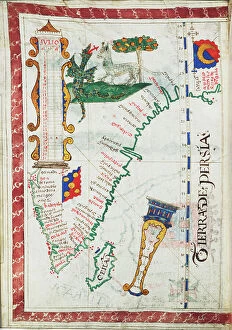
Background imageIndia Collection: Tierra de Persia', scale: circa 1:13 500 000, showing additional places South India and Sri Lanka

Tierra de Persia', scale: circa 1:13 500 000, showing additional places South India and Sri Lanka
7339615 Tierra de Persia', scale: circa 1:13 500 000, showing additional places South India and Sri Lanka., c.1550-60 (vellum) by Unknown Artist, (16th century); 24x17 cm; National Maritime Museum

Background imageIndia Collection: Jaygad (Jyghur) and entrance to Shatri River..., 1880 (coloured photozincograph)

Jaygad (Jyghur) and entrance to Shatri River..., 1880 (coloured photozincograph)
7339408 Jaygad (Jyghur) and entrance to Shatri River..., 1880 (coloured photozincograph) by Jarrad, Frederick W. (19th century); 68x100 cm; National Maritime Museum, London

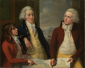
Background imageIndia Collection: The Money brothers: William (1769-1834), James (1772-1833) and Robert Taylor (1775-1803)

The Money brothers: William (1769-1834), James (1772-1833) and Robert Taylor (1775-1803), 1788-92 (oil on canvas)
7337973 The Money brothers: William (1769-1834), James (1772-1833) and Robert Taylor (1775-1803), 1788-92 (oil on canvas) by Rigaud, John Francis (1742-1810); 101.6x127 cm; National Maritime Museum

Background imageIndia Collection: Map of southern India with Bombay, c.1900 (engraving)

Map of southern India with Bombay, c.1900 (engraving)
533019 Map of southern India with Bombay, c.1900 (engraving); (add.info.: Map showing historical boundaries of Southern India with inset map of Bombay (now Mumbai) and the Malay Peninsula

Background imageIndia Collection: Map of India (engraving)

Map of India (engraving)
8636195 Map of India (engraving) by English School, (19th century); Private Collection; (add.info.: Map of India. Illustration for Philips' Picturesque History of England edited by J Francon Williams)

Background imageIndia Collection: Kingdom of Holland (litho)

Kingdom of Holland (litho)
8661140 Kingdom of Holland (litho) by English School, (20th century); Private Collection; (add.info.: Kingdom of Holland. Though the kingdom of Holland is small in extent)

Background imageIndia Collection: Delhi (litho)

Delhi (litho)
8652489 Delhi (litho) by English School, (20th century); Private Collection; (add.info.: Delhi. Illustration for A Literary and Historical Atlas of Asia by J G Bartholomew [1860-1920] (J M Dent)

Background imageIndia Collection: Coast of Western India from Bombay to Karachi compiled chiefly from the surveys made by order of

Coast of Western India from Bombay to Karachi compiled chiefly from the surveys made by order of the honorable East
7340648 Coast of Western India from Bombay to Karachi compiled chiefly from the surveys made by order of the honorable East India Company, 1867 (print) by Imray

Background imageIndia Collection: River approach to Surat, c.1726 (print)

River approach to Surat, c.1726 (print)
7340644 River approach to Surat, c.1726 (print) by Dutch School, (18th century); 47.2x56.7 cm; National Maritime Museum, London

Background imageIndia Collection: Map showing the British Control over India

Map showing the British Control over India
3523302 Map showing the British Control over India; (add.info.: Map showing the British Control over India. Dated 19th Century); Universal History Archive/UIG

Background imageIndia Collection: Sphere and stand, c.1890 (plaster, printed lithography, varnish, papier mache, brass, wood, paper)

Sphere and stand, c.1890 (plaster, printed lithography, varnish, papier mache, brass, wood, paper, ink)
7339588 Sphere and stand, c.1890 (plaster, printed lithography, varnish, papier mache, brass, wood, paper, ink) by Johnston, Alexander Keith (1804-71); 24.4x23.5 cm; National Maritime Museum, London

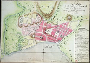
Background imageIndia Collection: Plan of Jacmel town with fortifications, 1799 (drawing)

Plan of Jacmel town with fortifications, 1799 (drawing)
7339492 Plan of Jacmel town with fortifications, 1799 (drawing) by Rivieres, Antoine Francois Sorrel des (1737-1830); 38x53 cm; National Maritime Museum, London

Background imageIndia Collection: Plan and view of Gingerah, 1774 (engraving)

Plan and view of Gingerah, 1774 (engraving)
7339390 Plan and view of Gingerah, 1774 (engraving) by Werner, A.& Dalrymple, Alexander & Begbie, P. (fl.1774); 28x19 cm; National Maritime Museum, London, UK; (add.info.: Creator: A)


All Professionally Made to Order for Quick Shipping


-

India Collection

India is a country located in South Asia, bordered by Pakistan to the west, China and Nepal to the north, Bhutan to the northeast, Bangladesh and Myanmar to the east and has a population of over 1.3 billion people with Hindi being its official language. India's economy is one of the fastest-growing economies in the world with agriculture as its main source of income for many rural areas. The country has a diverse culture that includes various religions such as Hinduism, Islam, Christianity and Sikhism among others. It also boasts several famous landmarks including Taj Mahal and Red Fort which attract millions of tourists every year.
+

Our beautiful pictures are available as Framed Prints, Photos, Wall Art and Photo Gifts

The India collection from Media Storehouse offers a diverse range of wall art and framed prints that showcase the rich cultural heritage of India. Our collection features an extensive selection of vintage maps, charts, and illustrations that depict various regions, cities, landmarks, and historical events in India. From ancient temples to bustling marketplaces, our collection captures the vibrant colors and intricate details of Indian culture. Whether you're looking for a stunning piece to adorn your home or office space or searching for a unique gift for someone special, our collection has something to offer. Each print is carefully crafted using high-quality materials to ensure longevity and durability. With its wide range of styles and sizes available at affordable prices, the India collection from Media Storehouse is an excellent choice for anyone who wants to add some Indian flair to their decor.
+

What are India (Maps and Charts) art prints?

India art prints are a collection of high-quality, visually stunning prints that showcase the diverse geography and rich history of India. These prints feature detailed maps, charts, and illustrations that depict various regions, cities, landmarks, and historical events in India. These art prints are perfect for anyone who is interested in Indian culture or history. They can be used to decorate homes or offices with an exotic touch or as educational tools for schools or libraries. The vibrant colors and intricate details make them ideal conversation starters. We offer a wide range of India art prints that cater to different tastes and preferences. From vintage-style maps to modern-day illustrations, there is something for everyone. All our art prints are printed on high-quality paper using state-of-the-art printing technology to ensure maximum clarity and durability. India art prints are beautiful works of art that capture the essence of India's geography and history in a visually appealing way.
+

What India (Maps and Charts) art prints can I buy from Media Storehouse?

We offer a wide range of India maps and charts art prints that are perfect for decorating your home or office. You can choose from vintage maps, antique charts, and modern designs that showcase the beauty and diversity of India's geography. Some popular options include detailed topographical maps of regions like the Himalayas, Rajasthan, and Kerala. These prints feature intricate contour lines that highlight the country's mountain ranges, rivers, lakes, and forests. You can also find colorful political maps that show India's states and territories along with major cities and landmarks. These prints are great for educational purposes or as a unique gift for someone who loves geography. In addition to traditional map designs, Media Storehouse also offers artistic interpretations of India's landscapes such as abstract paintings inspired by the Taj Mahal or vibrant illustrations depicting wildlife in national parks. There is something for everyone when it comes to India maps and charts art prints at Media Storehouse.
+

How do I buy India (Maps and Charts) art prints?

To buy India art prints from Media Storehouse, you can browse our extensive collection of artwork online. Once you have found the print that you like, simply add it to your cart and proceed to checkout. You will be prompted to enter your shipping information and payment details. We offer a variety of sizes for each print, so make sure to select the size that best suits your needs. We also offer framing options if you prefer a ready-to-hang piece of art. Their India art prints are high-quality reproductions of vintage maps and charts, perfect for adding a touch of history and culture to any room in your home or office. Buying India art prints from Media Storehouse is easy and convenient. With their vast selection of artwork available at your fingertips, you're sure to find the perfect piece for your space.
+

How much do India (Maps and Charts) art prints cost?

India art prints are a popular choice for those who want to add an exotic touch to their home or office décor. The cost of these prints can vary depending on the size, quality, and type of paper used. Generally speaking, larger prints will be more expensive than smaller ones, while high-quality papers such as archival or museum-grade may also increase the price. It's important to note that India art prints come in a variety of styles and designs, so prices can differ based on the specific artwork being purchased. Some prints may feature intricate details or vibrant colors that make them stand out from others. Ultimately, the cost of India art prints is determined by several factors including size, quality, design complexity among other things. However it is possible to find affordable options without compromising on quality if you shop around carefully.
+

How will my India (Maps and Charts) art prints be delivered to me?

Your India art prints will be delivered to you in a safe and secure manner by our trusted delivery partners. We take great care in packaging your artwork to ensure that it arrives at your doorstep in pristine condition. Your print will be carefully rolled up and placed inside a sturdy cardboard tube, which is then sealed with tape to prevent any damage during transit. Once your order has been dispatched, we will provide you with a tracking number so that you can monitor the progress of your delivery online. You can expect your artwork to arrive within the estimated timeframe provided at checkout. We pride ourselves on providing excellent customer service, so if for any reason you are not satisfied with the condition of your print upon arrival, please do not hesitate to contact us and we will work with you to resolve the issue as quickly as possible.