Fraud Blocker Skip to main content

Home > Maps and Charts > Ireland

Ireland Collection (page 2)

Ireland is an island nation located in the northwestern part of Europe

1,486 items

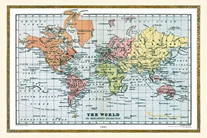
Background imageIreland Collection: Old Map of The World 1881

Old Map of The World 1881
Irish Land War (1879-1882); home rule movement led by Parnell. End of First Boer War (1880-1881). French establish a protectorate in Tunisia

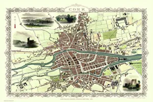
Background imageIreland Collection: Old Map of Cork Ireland 1851 by John Tallis

Old Map of Cork Ireland 1851 by John Tallis
In this Victorian map of Cork in southern Ireland by John Tallis the North and South channels of the River Lee flow through the centre of the plan with the extensive Barracks dominating

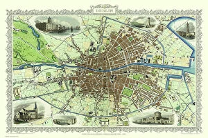
Background imageIreland Collection: Old Map of Dublin Ireland 1851 by John Tallis

Old Map of Dublin Ireland 1851 by John Tallis
This most attractive 19th Century map of Dublin in Southern Ireland by John Tallis 1851 shows all of Dublins districts, the Grand Canal networks and the arrival of the railways

Background imageIreland Collection: Old Map of The Province of Connacht, Ireland 1611 by John Speed

Old Map of The Province of Connacht, Ireland 1611 by John Speed
A facimile of John Speeds historical map of the Province of Connacht originally published for the " Theatre of the Empire of Great Britain"

Background imageIreland Collection: Poster, Map of Royal Britain

Poster, Map of Royal Britain. 1957

Background imageIreland Collection: Comic map of Europe by Frederick Rose, c. 1870 (litho)

Comic map of Europe by Frederick Rose, c. 1870 (litho)
XND76008 Comic map of Europe by Frederick Rose, c.1870 (litho) by English School, (19th century); Private Collection; (add.info)

Background imageIreland Collection: Antique map of Cambridgeshire

Antique map of Cambridgeshire
An antique map of Cambridgeshire 1840.ašJames Pigot (1794-1842)aš showing the whole county and all its major towns and cities.Pigot started as an engraver for Deans Manchester Directory

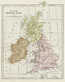
Background imageIreland Collection: Map of the British Isles 1895

Map of the British Isles 1895
The Rand-McNally Grammar School Geography 1895 - Chicago & New York

Background imageIreland Collection: Map of Cork, County Cork, Ireland Victorian Engraving, 1840

Map of Cork, County Cork, Ireland Victorian Engraving, 1840
Very Rare, Beautifully Illustrated Antique Engraving of Map of Exmoor, England Victorian Engraving, 1840. Source: Original edition from my own archives. Copyright has expired on this artwork

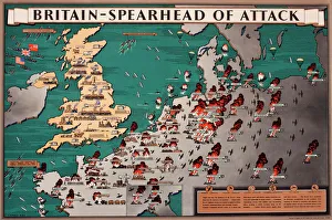
Background imageIreland Collection: Map, Britain -- Spearhead of Attack, WW2

Map, Britain -- Spearhead of Attack, WW2. Date: 1940s

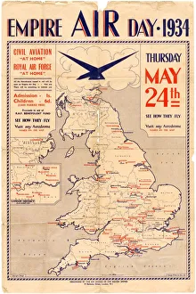
Background imageIreland Collection: Poster for Empire Air Day, 1934

Poster for Empire Air Day, 1934
Shows aerodromes in England, Wales, southern Scotland and Northern Ireland, all of which were open for Empire Air Day. Admission one shilling for adults, sixpence for children

Background imageIreland Collection: Antique Map of Northern Ireland, detail of Londonderry, 19th Century

Antique Map of Northern Ireland, detail of Londonderry, 19th Century
Antique Map of Northern Ireland, detail of Londonderry area, 19th Century

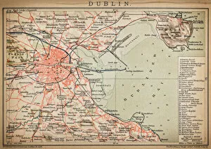
Background imageIreland Collection: Dublin

Dublin
Antique map of Dublin

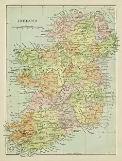
Background imageIreland Collection: Map of Ireland

Map of Ireland
Marcus Ward's Home Atlas - London, 1894

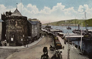
Background imageIreland Collection: Southern Ireland: Reginalds Tower, Waterford (coloured photo)

Southern Ireland: Reginalds Tower, Waterford (coloured photo)
7180527 Southern Ireland: Reginalds Tower, Waterford (coloured photo) by Irish Photographer (20th century); Private Collection; (add.info.: Reginalds Tower, Waterford)

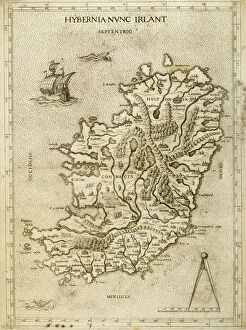
Background imageIreland Collection: Hybernia Nunc Irlant. Ireland. Map

Hybernia Nunc Irlant. Ireland. Map was clearly made by a member of the Lafreri School of cartographers, Antonio Lafreri (1512-77). Rome, 1570. Renaissance. Engraving by Paolo Forlani, 16th C

Background imageIreland Collection: Map of British Isles, lithograph, lithograph, published in 1876

Map of British Isles, lithograph, lithograph, published in 1876
Map of British Isles. Lithograph, published in 1876
Background imageIreland Collection: MAP: IRELAND, 1893. Home Rule Map of Ireland, illustrated with Irish politicians

MAP: IRELAND, 1893. Home Rule Map of Ireland, illustrated with Irish politicians. Engraving, 1893

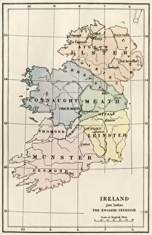
Background imageIreland Collection: Ireland in the 16th century

Ireland in the 16th century
Map of Ireland before the English invasion, circa 1580. Color lithograph reproduction of a 19th-century illustration

Background imageIreland Collection: Map of Ireland, 1798

Map of Ireland, 1798
7261222 Map of Ireland, 1798 by Faden, William (1750-1836); Private Collection; (add.info.: Ireland Divided into Provinces and Counties)

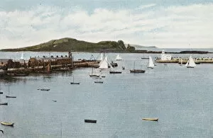
Background imageIreland Collection: Ireland: Howth Harbour and Irelands Eye, County Dublin (coloured photo)

Ireland: Howth Harbour and Irelands Eye, County Dublin (coloured photo)
7182363 Ireland: Howth Harbour and Irelands Eye, County Dublin (coloured photo) by Irish Photographer (20th century); Private Collection; (add.info.: Howth Harbour and Irelands Eye, County Dublin)

Background imageIreland Collection: Map of the British isles 1889

Map of the British isles 1889
Indiana Educational Series The Complete Geography - Indianapolis 1889

Background imageIreland Collection: Historical Map of Dublin, Ireland Victorian Engraving, Circa 1610

Historical Map of Dublin, Ireland Victorian Engraving, Circa 1610
Very Rare, Beautifully Illustrated Antique Engraving of Historical Map of Dublin, Ireland Victorian Engraving, Circa 1610 from Our Own Country, Great Britain, Descriptive, Historical, Pictorial

Background imageIreland Collection: The Invasions of England and Ireland With al [sic] their Civ

The Invasions of England and Ireland With al [sic] their Civ
Map: The Invasions of England and Ireland With al [sic] their Civill [sic] Wars since the Conquest Corn Danckertsz sculpsit [London] George Humble, 1627 (c)

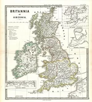
Background imageIreland Collection: 1865, Spruner Map of the British Isles, England, Scotland, Ireland, topography, cartography

1865, Spruner Map of the British Isles, England, Scotland, Ireland, topography, cartography
1865, Spruner Map of the British Isles, England, Scotland, Ireland

Background imageIreland Collection: The French Coast, England, Scotland and Ireland, from a nautical atlas, 1520 (ink on vellum)

The French Coast, England, Scotland and Ireland, from a nautical atlas, 1520 (ink on vellum)
XOT330911 The French Coast, England, Scotland and Ireland, from a nautical atlas, 1520 (ink on vellum) (detail from 330910) by Giovanni Xenodocus da Corfu (fl)

Background imageIreland Collection: Map of England and Wales, 1644 (engraving) (b / w photo)

Map of England and Wales, 1644 (engraving) (b / w photo)
XJF273140 Map of England and Wales, 1644 (engraving) (b/w photo) by Hollar, Wenceslaus (1607-77); Private Collection; Czech, out of copyright

Background imageIreland Collection: Illustration of a relief map of the British Isles

Illustration of a relief map of the British Isles

Background imageIreland Collection: 'Scale' in Maps (colour litho)

"Scale" in Maps (colour litho)
8658789 "Scale" in Maps (colour litho) by English School, (20th century); Private Collection; (add.info.: "Scale" in Maps)

Background imageIreland Collection: A correct chart of the city and harbour of Dublin, Irleand, 1730 (coloured engraving)

A correct chart of the city and harbour of Dublin, Irleand, 1730 (coloured engraving)
7339461 A correct chart of the city and harbour of Dublin, Irleand, 1730 (coloured engraving) by Price, Charles (1679?-1733); 47x58 cm; National Maritime Museum, London

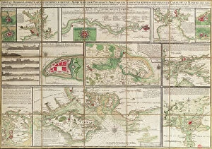
Background imageIreland Collection: A table containing details of the main maritime ports that are represented in the map of

A table containing details of the main maritime ports that are represented in the map of the English Channel
7339430 A table containing details of the main maritime ports that are represented in the map of the English Channel, c.1780 (paper, linen) by Unknown artist

Background imageIreland Collection: A general chart on Mercators projection to show the track of the 'Lion'

A general chart on Mercators projection to show the track of the 'Lion'
7339422 A general chart on Mercators projection to show the track of the 'Lion' and 'Hindostan' from England to the Gulph of Pekin in China and their return back to England, 1796 (print) by Barrow

Background imageIreland Collection: Sheet 16 from: An exact survey of the cities of London and Westminster, the Borough of Southwark

Sheet 16 from: An exact survey of the cities of London and Westminster, the Borough of Southwark
7340520 Sheet 16 from: An exact survey of the cities of London and Westminster, the Borough of Southwark, with the country near ten miles round..., 1746 (coloured engraving) by Rocque

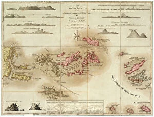
Background imageIreland Collection: The Virgin Islands from English and Danish surveys, 1775 (engraving)

The Virgin Islands from English and Danish surveys, 1775 (engraving)
7340498 The Virgin Islands from English and Danish surveys, 1775 (engraving) by Jefferys, Thomas (c.1719-71); 46.5x62 cm; National Maritime Museum, London

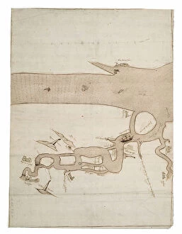
Background imageIreland Collection: Chart of River Medway and part of the Thames: no.24 Sheerness, c.1590 (ink and wash)

Chart of River Medway and part of the Thames: no.24 Sheerness, c.1590 (ink and wash)
7340493 Chart of River Medway and part of the Thames: no.24 Sheerness, c.1590 (ink and wash) by Unknown Artist, (16th century); 40x30 cm; National Maritime Museum, London

Background imageIreland Collection: Chart of Dover Strait, c.1587-88 (watercolour on vellum)

Chart of Dover Strait, c.1587-88 (watercolour on vellum)
7340491 Chart of Dover Strait, c.1587-88 (watercolour on vellum) by Teixeira, Luis (fl.1564-1612); 40x52 cm; National Maritime Museum, London, UK; (add.info.: Creator: Luis Teixeira Single sheet)

Background imageIreland Collection: Plate from Edward Barlow's journal of his life at sea in king's ships

Plate from Edward Barlow's journal of his life at sea in king's ships
7340651 Plate from Edward Barlow's journal of his life at sea in king's ships, East & West Indiamen & other merchantmen from 1659 to 1703., 1814 (print) by Heather, W

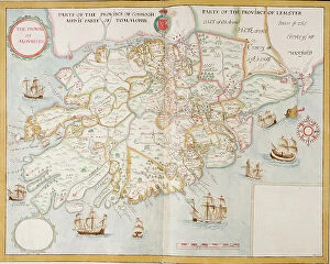
Background imageIreland Collection: The province of Munster, Ireland, c.1595 (manuscript)

The province of Munster, Ireland, c.1595 (manuscript)
7339307 The province of Munster, Ireland, c.1595 (manuscript) by Unknown Artist, (16th century); 45x59 cm; National Maritime Museum, London, UK; (add.info.: Creator: unknown Scale: [ca)

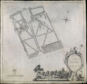
Background imageIreland Collection: Plan of Greenwich Park, showing the Royal Observatory, One Tree Hill and the Ranger's House

Plan of Greenwich Park, showing the Royal Observatory, One Tree Hill and the Ranger's House, 1790 (pen, wash)
7340660 Plan of Greenwich Park, showing the Royal Observatory, One Tree Hill and the Ranger's House, 1790 (pen, wash, vellum) by Morton, John (18th century); 55.5x53.5 cm; National Maritime Museum

Background imageIreland Collection: Map of Greenford, Osterley, Ealing and Kew, 1746 (coloured engraving)

Map of Greenford, Osterley, Ealing and Kew, 1746 (coloured engraving)
7340517 Map of Greenford, Osterley, Ealing and Kew, 1746 (coloured engraving) by Rocque, John (c.1704-d.1762); 51x67 cm; National Maritime Museum, London

Background imageIreland Collection: Map of Wimbledon and Tooting, 1746 (coloured engraving)

Map of Wimbledon and Tooting, 1746 (coloured engraving)
7340512 Map of Wimbledon and Tooting, 1746 (coloured engraving) by Rocque, John (c.1704-d.1762); 51x67 cm; National Maritime Museum, London

Background imageIreland Collection: England East Coast. Sheet 1, late 19th century (print)

England East Coast. Sheet 1, late 19th century (print)
7340593 England East Coast. Sheet 1, late 19th century (print) by Imray, James & Son (19th century); National Maritime Museum, London

Background imageIreland Collection: Map of Highgate, Kentish Town, Holloway, Tottenham and Newington, 1746 (coloured engraving)

Map of Highgate, Kentish Town, Holloway, Tottenham and Newington, 1746 (coloured engraving)
7340507 Map of Highgate, Kentish Town, Holloway, Tottenham and Newington, 1746 (coloured engraving) by Rocque, John (c.1704-d.1762); 51x67 cm; National Maritime Museum, London

Background imageIreland Collection: Plymouth, 1672 (Ink, watercolour, paper, linen )

Plymouth, 1672 (Ink, watercolour, paper, linen )
7340487 Plymouth, 1672 (Ink, watercolour, paper, linen ) by Gomme, Bernard de (1620-85); 92x1015 cm; National Maritime Museum, London

Background imageIreland Collection: Royal Victoria and Albert and King George V Docks 1934, c.1934 (print)

Royal Victoria and Albert and King George V Docks 1934, c.1934 (print)
7340370 Royal Victoria and Albert and King George V Docks 1934, c.1934 (print) by Vincent Brooks, Day & Son (1867-1940); National Maritime Museum, London

Background imageIreland Collection: A chart of the entrance into the Channel containing the west coast of Cornwall

A chart of the entrance into the Channel containing the west coast of Cornwall
7340130 A chart of the entrance into the Channel containing the west coast of Cornwall and Scilly Islands with all the soundings, 1779 (copperplate engraving) by British School

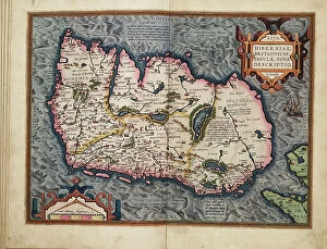
Background imageIreland Collection: New description of Ireland, the British Isles, 1573 (copperplate engraving on paper)

New description of Ireland, the British Isles, 1573 (copperplate engraving on paper)
7340125 New description of Ireland, the British Isles, 1573 (copperplate engraving on paper) by Ortelius, Abraham (1527-98); 42x53 cm; National Maritime Museum, London

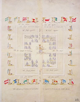
Background imageIreland Collection: The discription of the forme and mannre of our in campment in the lord Generalls Northern Journey

The discription of the forme and mannre of our in campment in the lord Generalls Northern Journey, c.1600 (paper)
7339833 The discription of the forme and mannre of our in campment in the lord Generalls Northern Journey, c.1600 (paper, linen) by Unknown Artist, (17th century); 47x37 cm; National Maritime Museum


All Professionally Made to Order for Quick Shipping


-

Ireland Collection

Ireland is an island nation located in the northwestern part of Europe. It covers an area of 70,273 square kilometers and has a population of approximately 4.9 million people. The country is divided into four provinces: Leinster, Munster, Connacht, and Ulster. Ireland's capital city is Dublin which is also its largest city. The official languages are Irish and English with Catholicism being the predominant religion. Ireland's economy relies heavily on exports particularly in pharmaceuticals, software development, and financial services sectors. Its natural beauty attracts millions of tourists annually to explore its rugged coastline, rolling hillsides dotted with sheep farms as well as ancient castles and ruins dating back centuries ago.
+

Our beautiful pictures are available as Framed Prints, Photos, Wall Art and Photo Gifts

The Ireland collection from Media Storehouse is a stunning compilation of vintage maps and charts that depict the beautiful landscapes, cities, towns, and coastlines of Ireland. Our collection features an extensive range of prints that showcase different regions in Ireland, including Dublin City Centre, Cork Harbour, Galway Bay, Connemara National Park, Ring of Kerry and many more. These maps are carefully curated to provide a unique perspective on the history and geography of Ireland. They offer a glimpse into the past with their intricate details such as old road networks or historical landmarks. Our collection includes both black-and-white and color prints which can be customized to suit any decor style. Whether you're looking for wall art for your home or office space or searching for unique gifts for loved ones who have an affinity towards Irish culture or heritage - our collection has something special to offer everyone. These high-quality framed prints make perfect additions to any room's decor while also being educational pieces that spark conversations about Irish history and geography.
+

What are Ireland (Maps and Charts) art prints?

Ireland art prints are high-quality reproductions of antique maps and charts depicting the geography, topography, and history of Ireland. These prints showcase the intricate details of Ireland's landscape, including its mountains, rivers, lakes, cities, towns, and historical landmarks. We offer a fascinating glimpse into Ireland's past as well as its present-day layout. These art prints are perfect for anyone with an interest in Irish history or geography. They make great gifts for those who have a connection to Ireland or simply appreciate beautiful artwork. The prints come in a variety of sizes to suit any space or decor style. We offer a wide selection of these stunning art prints that can be easily ordered online from their website. Each print is made using high-quality materials to ensure longevity and durability over time. Whether you're looking for something to hang on your wall at home or in your office space, these Ireland art prints will add character and charm to any room they're displayed in.
+

What Ireland (Maps and Charts) art prints can I buy from Media Storehouse?

We offer a wide range of Ireland art prints that are perfect for adding a touch of Irish charm to your home or office. These prints feature detailed maps and charts of various regions in Ireland, showcasing the country's rich history and culture. Some popular options include vintage maps of Dublin, Cork, Galway, and Belfast, as well as antique charts depicting the coastlines and waterways around Ireland. You can also find contemporary designs featuring colorful illustrations of iconic landmarks like the Cliffs of Moher or the Giant's Causeway. Whether you're looking for a unique gift for an Irish friend or simply want to decorate your own space with some beautiful artwork inspired by this stunning country, we have plenty of options to choose from. With high-quality printing on premium paper stock, these art prints are sure to impress anyone who sees them.
+

How do I buy Ireland (Maps and Charts) art prints?

To purchase Ireland art prints from Media Storehouse, you can browse our extensive collection of prints online. Simply search for the specific print you are interested in or browse through their categories to find a print that catches your eye. Once you have found the perfect print, select the size and format that suits your needs. We offer a range of formats including framed prints, canvas prints, and photographic prints. You can also choose to customize your order by selecting different framing options or adding a mount. Once you have made your selection, simply add it to your cart and proceed to checkout. At this point, you will be prompted to enter your shipping information and payment details. Buying Ireland art prints from Media Storehouse is an easy process that allows you to bring beautiful artwork into your home or office with just a few clicks of a button.
+

How much do Ireland (Maps and Charts) art prints cost?

We offer a wide range of Ireland art prints that are available at varying prices. Our collection includes high-quality prints featuring detailed maps and charts of different regions in Ireland, showcasing the country's rich history and culture. Our pricing is competitive and affordable, ensuring that everyone can find something they love within their budget. We have options for every taste and preference, from vintage-style prints to modern designs. Each print is produced using premium materials to ensure longevity and durability. They are printed on high-quality paper with vibrant colors that will not fade over time. Whether you're looking for a unique piece of art to decorate your home or office or searching for the perfect gift for an Irish enthusiast, our Ireland art prints are an excellent choice. With our extensive selection of designs at various price points, you're sure to find the perfect print to suit your needs.
+

How will my Ireland (Maps and Charts) art prints be delivered to me?

We take great care in delivering your Ireland art prints to you. We use high-quality packaging materials to ensure that your print arrives in perfect condition. Depending on the size of the print, it will either be delivered flat or rolled up in a sturdy tube. We work with trusted courier partners who provide reliable and secure delivery services. Once your order has been dispatched, you will receive an email notification with tracking information so that you can keep track of its progress. We understand how important it is for our customers to receive their orders promptly and safely. That's why we strive to deliver all orders as quickly as possible while ensuring they are well-protected during transit. Whether you're ordering for yourself or as a gift for someone else, rest assured that your Ireland art prints will be delivered to you with the utmost care and attention from Media Storehouse.