Fraud Blocker Skip to main content

Home > Maps and Charts > Italy

Italy Collection (page 5)

Italy is a country located in southern Europe, bordered by the Mediterranean Sea to the south and surrounded by several other countries including France

3,131 items

Background imageItaly Collection: World map on vellum, c.1540 (vellum)

World map on vellum, c.1540 (vellum)
7295751 World map on vellum, c.1540 (vellum) by Italian School, (16th century); 35.4x50.8 cm; National Maritime Museum, London, UK; (add.info.: Creator: Brother of Giovanni Verrazano Single sheet)

Background imageItaly Collection: Map of Italy, with Sicily and Sardinia, circa 1870. 19th century lithography

Map of Italy, with Sicily and Sardinia, circa 1870. 19th century lithography
NWI4871628 Map of Italy, with Sicily and Sardinia, circa 1870. 19th century lithography.; (add.info.: Map of Italy, with Sicily and Sardinia, circa 1870)

Background imageItaly Collection: Geographic atlas: portulan or nautical map of the Mediterranean Sea and its coasts (Africa)

Geographic atlas: portulan or nautical map of the Mediterranean Sea and its coasts (Africa, Barbaria, Europe)
JEB4874690 Geographic atlas: portulan or nautical map of the Mediterranean Sea and its coasts (Africa, Barbaria, Europe, Middle East)

Background imageItaly Collection: Theory of Round Earth: Map of the world drawn up from the discoveries of Christopher Columbus

Theory of Round Earth: Map of the world drawn up from the discoveries of Christopher Columbus (1451-1506)
NWI4848339 Theory of Round Earth: Map of the world drawn up from the discoveries of Christopher Columbus (1451-1506) and Vasco Nunez de Balboa

Background imageItaly Collection: Geography map: representation of the island of Cuba, Jamaica, Bahamas, South Florida

Geography map: representation of the island of Cuba, Jamaica, Bahamas, South Florida
VEN5030476 Geography map: representation of the island of Cuba, Jamaica, Bahamas, South Florida and Yucatan in the Gulf of Mexico from an Atlas made by the Italian cartographer Antonio Francesco

Background imageItaly Collection: Geography map: representation of southern Guatemala, Hondura

Geography map: representation of southern Guatemala, Hondura and northern Nicaragua in Central America from an Atlas
VEN5030457 Geography map: representation of southern Guatemala, Hondura and northern Nicaragua in Central America from an Atlas made by the Italian cartographer Antonio Francesco Lucini (born in 1605)

Background imageItaly Collection: Geography map: representation of the south of the eastern coast of South America

Geography map: representation of the south of the eastern coast of South America (Brazil and Argentina)
VEN5030453 Geography map: representation of the south of the eastern coast of South America (Brazil and Argentina) from an Atlas made by the Italian cartographer Antonio Francesco Lucini

Background imageItaly Collection: Geography map: representation of the south of the coast of Peru

Geography map: representation of the south of the coast of Peru and part of the coast of Chile in South America from an
VEN5030446 Geography map: representation of the south of the coast of Peru and part of the coast of Chile in South America from an Atlas made by the Italian cartographer Antonio Francesco Lucini

Background imageItaly Collection: Geography map: representation of southern Brazil from an Atlas made by the Italian cartographer

Geography map: representation of southern Brazil from an Atlas made by the Italian cartographer Antonio Francesco
VEN5030352 Geography map: representation of southern Brazil from an Atlas made by the Italian cartographer Antonio Francesco Lucini (born 1605), about 1661 Biblioteca Angelica

Background imageItaly Collection: Commission on the waters of the lower Po (lower part of the river)

Commission on the waters of the lower Po (lower part of the river): allegories of the river of freedom and equality
VEN5028139 Commission on the waters of the lower Po (lower part of the river): allegories of the river of freedom and equality. Official document of 1802

Background imageItaly Collection: Vegetable garden of the University of Bologna. Details of a plan. Archiginnasio Library, Bologna

Vegetable garden of the University of Bologna. Details of a plan. Archiginnasio Library, Bologna
VEN5027206 Vegetable garden of the University of Bologna. Details of a plan. Archiginnasio Library, Bologna.; (add.info.: Vegetable garden of the University of Bologna. Details of a plan)

Background imageItaly Collection: The map of Antonio Pigafetta (16th century Italian sailor) of Magellan Detroit to navigate around

The map of Antonio Pigafetta (16th century Italian sailor) of Magellan Detroit to navigate around the land, 1519-1520
NWI4902432 The map of Antonio Pigafetta (16th century Italian sailor) of Magellan Detroit to navigate around the land, 1519-1520. The north is represented downstairs. Engraving

Background imageItaly Collection: Christopher Columbus (1451-1506) shows a map of his journey to King Ferdinand II of Aragon

Christopher Columbus (1451-1506) shows a map of his journey to King Ferdinand II of Aragon
NWI4900890 Christopher Columbus (1451-1506) shows a map of his journey to King Ferdinand II of Aragon and Queen Isabella 1st of Castile (known as the Catholic). Engraving

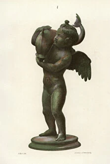
Background imageItaly Collection: Bronze statue of an Amorino (infant cupid) with a dolphin from the Thermae (baths) at Regio IX

Bronze statue of an Amorino (infant cupid) with a dolphin from the Thermae (baths) at Regio IX, Insula IV, 5
FLO4687176 Bronze statue of an Amorino (infant cupid) with a dolphin from the Thermae (baths) at Regio IX, Insula IV, 5. Chromolithograph by J.G

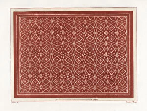
Background imageItaly Collection: Floor mosaic from a room in the viridarium (garden) in the House of Vesonius Primus, a fuller

Floor mosaic from a room in the viridarium (garden) in the House of Vesonius Primus, a fuller
FLO4687124 Floor mosaic from a room in the viridarium (garden) in the House of Vesonius Primus, a fuller. Chromolithograph by Victor Steeger after an illustration by Geremia Discanno from Emile

Background imageItaly Collection: Mosaic of a guard dog on a chain from the Casa del Poeta Tragico, House of the Tragic Poet

Mosaic of a guard dog on a chain from the Casa del Poeta Tragico, House of the Tragic Poet, Regio VI, Insulae 8,3,5
FLO4687105 Mosaic of a guard dog on a chain from the Casa del Poeta Tragico, House of the Tragic Poet, Regio VI, Insulae 8,3,5

Background imageItaly Collection: Painting of an aquarium with fish and lobster from the House of the Patrician or Centenary

Painting of an aquarium with fish and lobster from the House of the Patrician or Centenary (Casa del Centenario)
FLO4687102 Painting of an aquarium with fish and lobster from the House of the Patrician or Centenary (Casa del Centenario), Regio IX, Insula VIII. Chromolithograph by J.G

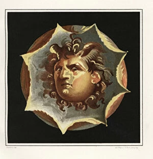
Background imageItaly Collection: Wind god from the House of the Patrician or Centenary (Casa di Centanario), Regio IX, Insula VIII

Wind god from the House of the Patrician or Centenary (Casa di Centanario), Regio IX, Insula VIII
FLO4687020 Wind god from the House of the Patrician or Centenary (Casa di Centanario), Regio IX, Insula VIII. Chromolithograph by J.G

Background imageItaly Collection: Map of the excavations of Pompeii, showing the Insulae excavated between 1874-1881 in red

Map of the excavations of Pompeii, showing the Insulae excavated between 1874-1881 in red. Chromolithograph by J.G
FLO4686852 Map of the excavations of Pompeii, showing the Insulae excavated between 1874-1881 in red. Chromolithograph by J.G

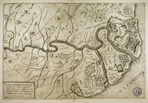
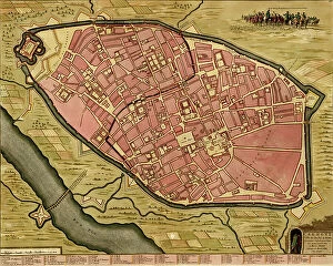
Background imageItaly Collection: Map of the city of Ostia, Italy (engraving)

Map of the city of Ostia, Italy (engraving)
3600000 Map of the city of Ostia, Italy (engraving); (add.info.: Map of the city of Ostia (Italy), 1562. Italian engraving of the 16th century.); PHAS/UIG

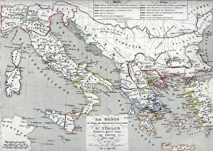
Background imageItaly Collection: Map of Greece from the invasion of the Dorians to the Medic War

Map of Greece from the invasion of the Dorians to the Medic War and of Italy after the founding of Rome
ELD4924944 Map of Greece from the invasion of the Dorians to the Medic War and of Italy after the founding of Rome, 1190-504 BC (Map of Greece and Italy)

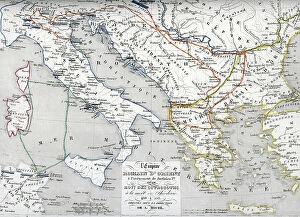
Background imageItaly Collection: Map of Greece (at the time of Philip and Alexander the Great)

Map of Greece (at the time of Philip and Alexander the Great) and Italy during the wars against the Samnites
ELD4924869 Map of Greece (at the time of Philip and Alexander the Great) and Italy during the wars against the Samnites, 400-300 BC (Map of Greece and Italy)

Background imageItaly Collection: Map of the Greek Empire after the submission of Bulgaria and Italy under the reign of

Map of the Greek Empire after the submission of Bulgaria and Italy under the reign of the Franconian (Salian)
ELD4924843 Map of the Greek Empire after the submission of Bulgaria and Italy under the reign of the Franconian (Salian) emperors at the time of the Conquete of the Normans

Background imageItaly Collection: Map of the Byzantine Empire at the times of Justinian I and Ostrogothic Kingdom founded by

Map of the Byzantine Empire at the times of Justinian I and Ostrogothic Kingdom founded by Theoderic the Great
ELD4928064 Map of the Byzantine Empire at the times of Justinian I and Ostrogothic Kingdom founded by Theoderic the Great) Engraving from Houze's "Atlas Universale"

Background imageItaly Collection: Geographic map of the territories of Italy (upper), the Roman hills (lower left)

Geographic map of the territories of Italy (upper), the Roman hills (lower left)
NWI4863026 Geographic map of the territories of Italy (upper), the Roman hills (lower left) and the surroundings of the city of Rome during the Roman Empire

Background imageItaly Collection: Italy, Sicily: the tourists leave Marseille for Sicily, on the bridge of a liner

Italy, Sicily: the tourists leave Marseille for Sicily, on the bridge of a liner
LUX4779728 Italy, Sicily: the tourists leave Marseille for Sicily, on the bridge of a liner, lying on the sun loungers shelted from the wind by hats and blankets

Background imageItaly Collection: Cuneum or Cuneo in Italy, 1700

Cuneum or Cuneo in Italy, 1700
2900903 Cuneum or Cuneo in Italy, 1700; (add.info.: Cuneum or Cuneo in Italy, 1700.); Buyenlarge Archive/UIG

Background imageItaly Collection: Map of Southern Europe

Map of Southern Europe
3499619 Map of Southern Europe; (add.info.: Map of Southern Europe, coast of the North of Africa and Canary Islands. Nautical letter by Joan Martines. Messina, Sicily, 1587.); PHAS/UIG

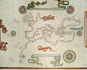
Background imageItaly Collection: Portolan Map of the Mediterranean and connecting seas

Portolan Map of the Mediterranean and connecting seas
3507730 Portolan Map of the Mediterranean and connecting seas; (add.info.: Portolan Map of the Mediterranean and connecting seas)

Background imageItaly Collection: Map of Veragua showing coastline explored by Christopher Columbus on his fourth voyage, in 1502

Map of Veragua showing coastline explored by Christopher Columbus on his fourth voyage, in 1502
2915330 Map of Veragua showing coastline explored by Christopher Columbus on his fourth voyage, in 1502. From the book Life of Christopher Columbus by Clements R

Background imageItaly Collection: Paolo dal Pozzo Toscanelli, 19th century (engraving)

Paolo dal Pozzo Toscanelli, 19th century (engraving)
2450184 Paolo dal Pozzo Toscanelli, 19th century (engraving); (add.info.: Science. Geography. Paolo dal Pozzo Toscanelli's map, Italy, XVth cent. Facsimile, Germany, XIXth cent.); Photo © CCI

Background imageItaly Collection: Map containing the island and kingdom of Sicily, with a part of Naples

Map containing the island and kingdom of Sicily, with a part of Naples, and other adjacent coasts including
7339456 Map containing the island and kingdom of Sicily, with a part of Naples, and other adjacent coasts including the Tyrrhenean Sea, 1676 (coloured engraving) by Seller

Background imageItaly Collection: Osaro, 1590 (Manuscript)

Osaro, 1590 (Manuscript)
7339638 Osaro, 1590 (Manuscript) by Millo, Antonio (fl.c.1590); 31x205 cm; National Maritime Museum, London, UK; (add.info.: Creator: Millo, Antonio Bound sheet. Ms. Additional Places: Osor)

Background imageItaly Collection: The unrolling of the Clouds:The world as known at the end of the 13th century , 1754 (illustration)

The unrolling of the Clouds:The world as known at the end of the 13th century , 1754 (illustration)
1578424 The unrolling of the Clouds:The world as known at the end of the 13th century , 1754 (illustration); (add.info.: The unrolling of the Clouds)

Background imageItaly Collection: Map of Italy, c.1900 (engraving)

Map of Italy, c.1900 (engraving)
532983 Map of Italy, c.1900 (engraving); (add.info.: Map of Italy, with insets of Rome and Venice, circa 1902, from the 10th edition of Encyclopaedia Britannica.); Encyclopaedia Britannica/UIG

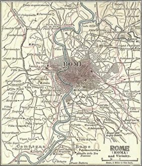
Background imageItaly Collection: Map of Rome, c.1900 (engraving)

Map of Rome, c.1900 (engraving)
532848 Map of Rome, c.1900 (engraving); (add.info.: Map of Rome, circa 1900, from the 10th edition of Encyclopaedia Britannica.); Encyclopaedia Britannica/UIG

Background imageItaly Collection: map of the old and the new naval shipyard ( Arsenale Nuovo ) in Venice

map of the old and the new naval shipyard ( Arsenale Nuovo ) in Venice, drawing by Antonio di Nadale between 1325
1747829 map of the old and the new naval shipyard ( Arsenale Nuovo ) in Venice, drawing by Antonio di Nadale between 1325 and 1473; (add.info)

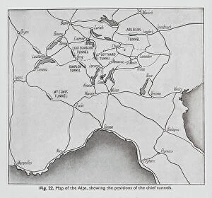
Background imageItaly Collection: Positions of the chief tunnels in the Alps (litho)

Positions of the chief tunnels in the Alps (litho)
8675799 Positions of the chief tunnels in the Alps (litho) by English School, (20th century); Private Collection; (add.info.: Positions of the chief tunnels in the Alps)

Background imageItaly Collection: Caesar, Gallic War: Helvetiorum Clades (litho)

Caesar, Gallic War: Helvetiorum Clades (litho)
8636509 Caesar, Gallic War: Helvetiorum Clades (litho) by English School, (20th century); Private Collection; (add.info.: Helvetiorum Clades)

Background imageItaly Collection: Famous rivers: The Tiber (litho)

Famous rivers: The Tiber (litho)
8634756 Famous rivers: The Tiber (litho) by English School, (20th century); Private Collection; (add.info.: The Tiber. Illustration for Chatterbox, 1913.); © Look and Learn

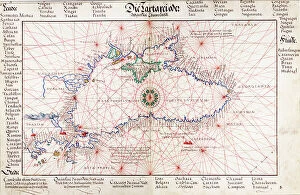
Background imageItaly Collection: Chart of Black Sea, 1554 (vellum)

Chart of Black Sea, 1554 (vellum)
7339645 Chart of Black Sea, 1554 (vellum) by Agnese, Battista (c.1500-64); 26x40 cm; National Maritime Museum, London, UK; (add.info.: Creator: Johan B. Agnese 'Die Tartareioda'. Scale: 1:15 000 000)

Background imageItaly Collection: Persia, 1554 (vellum)

Persia, 1554 (vellum)
7339640 Persia, 1554 (vellum) by Agnese, Battista (c.1500-64); 26x40 cm; National Maritime Museum, London, UK; (add.info.: Creator: Battista Agnese Bound sheet. Col. ms. Medium: Vellum. Scale: [ca)

Background imageItaly Collection: Justus Danckers's atlas: Hungary and Greece, c.1688 (coloured engraving)

Justus Danckers's atlas: Hungary and Greece, c.1688 (coloured engraving)
7340066 Justus Danckers's atlas: Hungary and Greece, c.1688 (coloured engraving) by Danckertsz, Justus (1635-1701); 50x59 cm; National Maritime Museum, London

Background imageItaly Collection: Map of northern and central Italy in ancient times

Map of northern and central Italy in ancient times
7177119 Map of northern and central Italy in ancient times.; Private Collection; (add.info.: Map of northern and central Italy in ancient times)

Background imageItaly Collection: 'Rhodes and Symi (Greek islands) facing the Turkish coast

'Rhodes and Symi (Greek islands) facing the Turkish coast
MMM5474179 'Rhodes and Symi (Greek islands) facing the Turkish coast; National Maritime Museum, London, UK; (add.info.: Rhodes and Symi (Greek islands) facing the Turkish coast

Background imageItaly Collection: Symi, cartographic survey of the Greek island, with handwritten notes on vellum

Symi, cartographic survey of the Greek island, with handwritten notes on vellum
MMM5474161 Symi, cartographic survey of the Greek island, with handwritten notes on vellum by Buondelmonti, Cristoforo (1385-1430); National Maritime Museum, London, UK; (add.info.: Symi)

Background imageItaly Collection: Pagoda of Chidambaram, Hindu temple, with illustration of the gopuram tower

Pagoda of Chidambaram, Hindu temple, with illustration of the gopuram tower and plan of the central structure
FLO4623824 Pagoda of Chidambaram, Hindu temple, with illustration of the gopuram tower and plan of the central structure. Handcoloured copperplate drawn

Background imageItaly Collection: Plan of the volcano Mt. Vesuvius after an eruption, and path of lava flow through Torre del Greco

Plan of the volcano Mt. Vesuvius after an eruption, and path of lava flow through Torre del Greco, Naples
FLO4574376 Plan of the volcano Mt. Vesuvius after an eruption, and path of lava flow through Torre del Greco, Naples. Handcoloured copperplate engraving from Bertuch's " Bilderbuch fur


All Professionally Made to Order for Quick Shipping


-

Italy Collection

Italy is a country located in southern Europe, bordered by the Mediterranean Sea to the south and surrounded by several other countries including France, Switzerland, Austria, and Slovenia. The country has a population of approximately 60 million people and its capital city is Rome. Italy is known for its rich history, culture, art, architecture, fashion industry and cuisine and has a diverse landscape with mountains in the north and beaches along the coastlines. Italy's economy relies heavily on tourism as well as industries such as agriculture, manufacturing and services. The country also plays an important role in international politics as a member of the European Union (EU) and United Nations (UN).
+

Our beautiful Wall Art and Photo Gifts include Framed Prints, Photo Prints, Poster Prints, Canvas Prints, Jigsaw Puzzles, Metal Prints and so much more

The Italy collection from Media Storehouse is a stunning assortment of wall art and framed prints that showcase the beauty, history, and culture of Italy. Our collection features an extensive range of maps and charts that depict various regions, cities, landmarks, and historical events in Italy. These artworks are available in different sizes to suit any space or decor style. Whether you're a lover of Italian cuisine or architecture, our collection has something for everyone. You can choose from vintage-style maps that capture the essence of old-world charm or modern designs that reflect contemporary trends. Each print is made using high-quality materials to ensure longevity and durability. The Italy collection is perfect for anyone who wants to add a touch of Italian elegance to their home or office decor. With its rich history, breathtaking landscapes, and vibrant culture - there's no better way to celebrate all things Italian than with these beautiful artworks.
+

What are Italy (Maps and Charts) art prints?

Italy art prints are a collection of high-quality, visually stunning prints that showcase the beauty and history of Italy. These prints feature detailed maps and charts of various regions in Italy, including cities such as Rome, Florence, Venice, and Naples. The artwork is created using advanced printing techniques to ensure that each print captures the intricate details of the original map or chart. The result is a beautiful piece of art that not only looks great on your wall but also provides an educational insight into Italian geography. These art prints are perfect for anyone who loves travel or has an interest in Italian culture. They make excellent gifts for friends or family members who have visited Italy or plan to do so in the future. These Italy art prints offer a unique way to appreciate the beauty and complexity of one of Europe's most fascinating countries.
+

What Italy (Maps and Charts) art prints can I buy from Media Storehouse?

We offer a wide range of Italy art prints that are perfect for adding a touch of Italian charm to your home or office. You can choose from vintage maps, antique charts, and contemporary designs that showcase the beauty and diversity of Italy's landscapes, cities, and regions. Some popular options include detailed maps of Rome, Florence, Venice, Naples, Sicily, Tuscany, and the Amalfi Coast. These prints feature intricate illustrations of famous landmarks such as the Colosseum, St. Peter's Basilica, Ponte Vecchio Bridge or Mount Etna. In addition to city maps you can also find regional maps highlighting areas like Lake Como or Cinque Terre. For those interested in history there are historic charts depicting ancient Roman Empire territories. Whether you're looking for a unique gift or simply want to decorate your own space with beautiful artwork inspired by Italy's rich culture and heritage Media Storehouse has something for everyone.
+

How do I buy Italy (Maps and Charts) art prints?

To purchase Italy art prints from Media Storehouse, you can browse our extensive collection of high-quality prints online. Simply search for the specific print you are looking for or browse through the Italy category to find a selection of maps and charts that capture the beauty and history of this iconic country. Once you have found your desired print, select the size and format that best suits your needs. You can choose from a range of options including framed or unframed prints, canvas wraps, or mounted prints. To complete your purchase, simply add the item to your cart and follow the checkout process. Payment options may vary depending on your location but typically include credit card or PayPal. With our secure online ordering system, you can be confident in purchasing authentic Italy art prints that will make a stunning addition to any home or office decor.
+

How much do Italy (Maps and Charts) art prints cost?

We offer a wide range of Italy art prints at varying prices. Our collection includes vintage maps, contemporary charts, and artistic interpretations of Italy's geography. The cost of each print depends on several factors such as the size, material, and framing options chosen by the customer. We strive to provide affordable yet high-quality art prints that cater to different tastes and preferences. Our selection features various styles ranging from classic black-and-white designs to colorful illustrations that capture the beauty of Italy's landscapes. Whether you're looking for a unique piece to decorate your home or office or searching for a thoughtful gift for someone who loves Italy, our collection has something for everyone. With our easy-to-use website and secure payment system, ordering your favorite Italy art print is just a few clicks away.
+

How will my Italy (Maps and Charts) art prints be delivered to me?

We take pride in delivering your Italy art prints with utmost care. We use high-quality packaging materials to ensure that your print arrives in perfect condition. Your art print will be rolled up carefully and placed inside a sturdy cardboard tube for protection during transit. We work with trusted courier partners who are experienced in handling delicate items like art prints. Once your order is dispatched, you will receive a tracking number so you can monitor the progress of your delivery. Our team also ensures that all necessary customs paperwork is completed accurately and efficiently to avoid any delays or additional charges at the destination country. We understand how important it is for our customers to receive their orders promptly and securely. That's why we strive to provide reliable delivery services that meet our customers' expectations every time.