Metal Print > Fine Art Finder > Maps (celestial & Terrestrial)
Metal Print : Map of Eastern North America: Florida to Chesapeake Bay (lithograph)
")


![]()
Metal Prints from Fine Art Finder
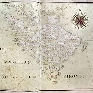
Map of Eastern North America: Florida to Chesapeake Bay (lithograph)
XCF259782 Map of Eastern North America: Florida to Chesapeake Bay (lithograph) by White, John (fl.1570-93) (after); 37x47.2 cm; Private Collection; English, out of copyright
Media ID 12775614
© www.bridgemanart.com
Bermuda Crest Dolphin Flying Fish Navigation New England Sir Walter Raleigh Virginia Bahama Islands Squirrel Fish
10"x8" (25x20cm) Table Top Metal Print
Discover the historical charm of the past with our Media Storehouse Metal Print of the Map of Eastern North America: Florida to Chesapeake Bay. This stunning lithograph, inspired by the work of John White (active circa 1570-93), showcases the intricate details of the Eastern North American coastline from Florida to the Chesapeake Bay. With its rich, vibrant colors and exceptional clarity, this metal print brings the past to life, making it a captivating addition to any home or office decor. Produced using high-quality materials and state-of-the-art printing techniques, this metal print is not only visually impressive but also durable and long-lasting. Bring a piece of history into your space with the Media Storehouse Map of Eastern North America: Florida to Chesapeake Bay Metal Print, available exclusively through Fine Art Finder.
Table Top Metal Prints feature rounded corners and an easel back for easy display. Available in two sizes, 18x13cm (7x5) or 25x20cm (10x8). Lightweight and vibrant, they are perfect for displaying artwork and are guaranteed to add style to any desk or table top. The unique material is fade, moisture, chemical and scratch resistant to help ensure this art lasts a lifetime.
Made with durable metal and luxurious printing techniques, metal prints bring images to life and add a modern touch to any space
Estimated Product Size is 25.4cm x 20.3cm (10" x 8")
These are individually made so all sizes are approximate
Artwork printed orientated as per the preview above, with landscape (horizontal) or portrait (vertical) orientation to match the source image.
FEATURES IN THESE COLLECTIONS
> Fine Art Finder
> Artists
> John (after) White
> Fine Art Finder
> Maps (celestial & Terrestrial)
EDITORS COMMENTS
This lithograph, titled "Map of Eastern North America: Florida to Chesapeake Bay" takes us on a visual journey through the diverse landscapes and seascapes of this region. Created by John White in the late 16th century, this print showcases his remarkable talent for cartography. The map encompasses an extensive area, stretching from Florida to Chesapeake Bay, offering a comprehensive view of the eastern coast. It highlights various significant locations such as Norumbega, New England, Bermuda, and the Bahama Islands. The intricate details include crests representing Sir Walter Raleigh and navigational elements that hint at the exploration spirit of that era. As we explore further into this artwork's intricacies, our eyes are drawn to the beautifully depicted marine fauna. From dolphins gracefully swimming through waves to flying fish soaring above ships navigating these waters - every element comes alive with vividness and precision. The inclusion of squirrel fish adds an intriguing touch to this composition. These small but vibrant creatures symbolize nature's diversity along these coastal regions. This lithograph not only serves as a historical document but also captivates viewers with its artistic brilliance. Its sizeable dimensions allow for a closer examination of each detail meticulously etched onto paper. Displayed in private collections today, this work stands as a testament to John White's skillful craftsmanship and dedication to capturing both geographical accuracy and aesthetic beauty within one piece.
MADE IN AUSTRALIA
Safe Shipping with 30 Day Money Back Guarantee
FREE PERSONALISATION*
We are proud to offer a range of customisation features including Personalised Captions, Color Filters and Picture Zoom Tools
SECURE PAYMENTS
We happily accept a wide range of payment options so you can pay for the things you need in the way that is most convenient for you
* Options may vary by product and licensing agreement. Zoomed Pictures can be adjusted in the Cart.