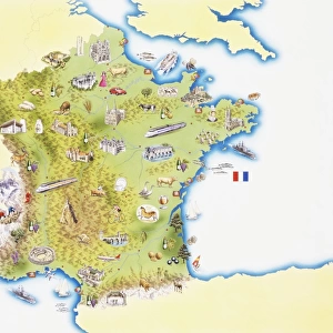
Metal Print > Europe > France > Maps
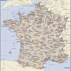
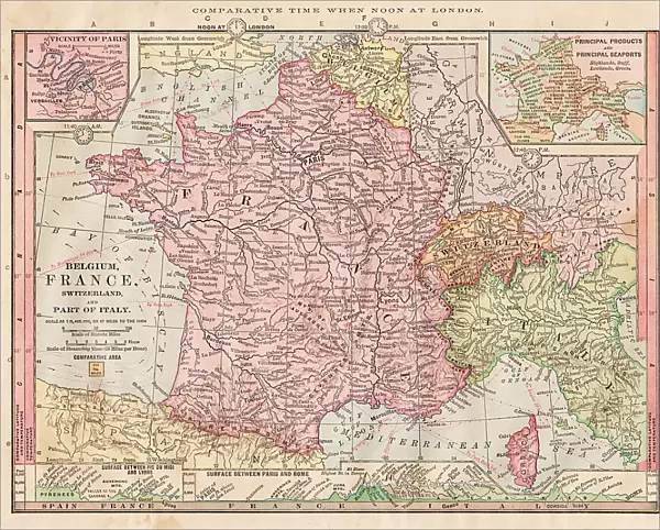
Metal Print : Map of France 1886


![]()
Metal Prints from Fine Art Storehouse
Map of France 1886
Map of France Maps Monteith Physical Geography 1886
Unleash your creativity and transform your space into a visual masterpiece!
THEPALMER
Media ID 14756944
© This content is subject to copyright
10"x8" (25x20cm) Table Top Metal Print
Discover history with our stunning Metal Prints from Media Storehouse. This particular piece showcases an intriguing Map of France from 1886, created by THEPALMER, available through Fine Art Storehouse under the Monteith Physical Geography collection. Each Metal Print is meticulously crafted, bringing the rich details of this vintage map to life. The high-quality metal material not only enhances the visual appeal but also provides a durable and long-lasting finish. Add this unique and educational piece to your decor, and let the story of France's past unfold before your eyes.
Table Top Metal Prints feature rounded corners and an easel back for easy display. Available in two sizes, 18x13cm (7x5) or 25x20cm (10x8). Lightweight and vibrant, they are perfect for displaying artwork and are guaranteed to add style to any desk or table top. The unique material is fade, moisture, chemical and scratch resistant to help ensure this art lasts a lifetime.
Made with durable metal and luxurious printing techniques, metal prints bring images to life and add a modern touch to any space
Estimated Product Size is 25.4cm x 20.3cm (10" x 8")
These are individually made so all sizes are approximate
Artwork printed orientated as per the preview above, with landscape (horizontal) or portrait (vertical) orientation to match the source image.
FEATURES IN THESE COLLECTIONS
> Fine Art Storehouse
> Map
> Historical Maps
> Maps and Charts
> Related Images
EDITORS COMMENTS
In this print titled "Map of France 1886" we are transported back in time to the late 19th century. The map, originally published as part of the Monteith Physical Geography collection, offers a fascinating glimpse into the intricate details and artistic craftsmanship of cartography during that era. The carefully drawn lines and delicate shading bring forth a sense of nostalgia, reminding us of an age when maps were meticulously handcrafted works of art. As our eyes wander across the image, we can trace the borders and contours that define France's diverse landscapes – from its majestic mountain ranges to its meandering rivers and picturesque coastlines. This particular rendition captures France at a significant moment in history. It allows us to explore not only its geographical features but also provides insights into political boundaries and regional divisions prevalent during that period. Each city, town, and village is marked with precision, inviting us to embark on a journey through time as we imagine life in these different regions over a century ago. "The Map of France 1886" by THEPALMER serves as both an educational tool for geography enthusiasts and an exquisite piece of artwork for collectors. Its historical significance combined with its aesthetic appeal makes it a timeless addition to any space – be it your study or living room – where it can spark conversations about history, culture, or simply ignite one's imagination about exploring the beautiful country depicted within its borders.
MADE IN AUSTRALIA
Safe Shipping with 30 Day Money Back Guarantee
FREE PERSONALISATION*
We are proud to offer a range of customisation features including Personalised Captions, Color Filters and Picture Zoom Tools
SECURE PAYMENTS
We happily accept a wide range of payment options so you can pay for the things you need in the way that is most convenient for you
* Options may vary by product and licensing agreement. Zoomed Pictures can be adjusted in the Cart.