Metal Print > Maps and Charts > Early Maps
Metal Print : 1815 Europe Map


![]()
Metal Prints from Mary Evans Picture Library
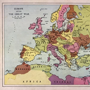
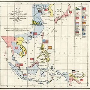
1815 Europe Map
A map of Europe at the time of the Congress of Vienna
Mary Evans Picture Library makes available wonderful images created for people to enjoy over the centuries
Media ID 4369271
© Mary Evans Picture Library 2015 - https://copyrighthub.org/s0/hub1/creation/maryevans/MaryEvansPictureID/10124947
1815 Congress Maps Treaty Vienna
14"x11" (28x35cm) Metal Print
Step back in time with our stunning Media Storehouse Metal Print of the 1815 Europe Map. This exquisite piece, sourced from Mary Evans Prints Online, showcases the political landscape of Europe during the Congress of Vienna. The intricate details of the map are brought to life through our premium metal printing process, ensuring vibrant colors and exceptional clarity. Add a touch of history to your home or office with this beautiful and conversation-starting piece. Order now and relive the intrigues and alliances that shaped Europe for generations to come.
Our Metal Prints feature rounded corners and rear fixings for easy wall mounting. Images are directly printed onto a lightweight, high quality 5mm thick, durable metallic surface for a vivid and vibrant finish. Available in 2 sizes, 28x35cm (14x11) and 50x40cm (20x16). The unique material is fade, moisture, chemical and scratch resistant to help ensure this art lasts a lifetime.
Made with durable metal and luxurious printing techniques, metal prints bring images to life and add a modern touch to any space
Estimated Product Size is 35.5cm x 27.9cm (14" x 11")
These are individually made so all sizes are approximate
Artwork printed orientated as per the preview above, with landscape (horizontal) or portrait (vertical) orientation to match the source image.
FEATURES IN THESE COLLECTIONS
> Europe
> Related Images
> Maps and Charts
> Early Maps
> Maps and Charts
> Related Images
EDITORS COMMENTS
This stunning print captures a detailed map of Europe as it appeared in the year 1815, during the time of the Congress of Vienna. The Congress of Vienna was a significant event in European history, where major powers came together to redraw the political boundaries following the defeat of Napoleon Bonaparte. This map provides a fascinating glimpse into the geopolitical landscape of Europe at that pivotal moment.
The intricate details on this map showcase not only the various countries and regions within Europe, but also highlight important cities, rivers, and mountain ranges. It serves as a valuable historical document that sheds light on how borders were defined and territories were divided during this crucial period.
As we study this map, we can imagine diplomats and statesmen poring over similar documents during negotiations at the Congress of Vienna. The treaties signed during this time would have far-reaching consequences for generations to come, shaping alliances and conflicts throughout Europe.
Whether you are a history buff or simply appreciate beautiful cartography, this print is sure to captivate your imagination and transport you back to 1815 Europe. Display it proudly in your home or office as a reminder of an era when nations came together to shape the future of our continent.
MADE IN AUSTRALIA
Safe Shipping with 30 Day Money Back Guarantee
FREE PERSONALISATION*
We are proud to offer a range of customisation features including Personalised Captions, Color Filters and Picture Zoom Tools
SECURE PAYMENTS
We happily accept a wide range of payment options so you can pay for the things you need in the way that is most convenient for you
* Options may vary by product and licensing agreement. Zoomed Pictures can be adjusted in the Cart.