Metal Print : World Map / St Sever 11C


![]()
Metal Prints from Mary Evans Picture Library
World Map / St Sever 11C
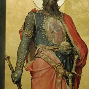
A world map according to Saint Sever, showing various countries, seas and rivers Date: 11th century
Mary Evans Picture Library makes available wonderful images created for people to enjoy over the centuries
Media ID 7140329
© Mary Evans Picture Library 2015 - https://copyrighthub.org/s0/hub1/creation/maryevans/MaryEvansPictureID/10113654
11th Countries Maps Rivers Seas Sever
10"x8" (25x20cm) Table Top Metal Print
Discover the captivating history of the 11th century with our Media Storehouse Metal Print featuring the World Map according to Saint Sever, sourced from Mary Evans Prints Online. This mesmerizing rights managed image showcases intricate detailing of continents, seas, and rivers as they were perceived during this era. Bring the rich history of the past into your modern space with this stunning, high-quality metal print. Each print is meticulously crafted to provide a vibrant, long-lasting display, making it an excellent addition to any home or office decor. Immerse yourself in the intrigue of historical cartography and elevate your interior design with this unique and captivating piece.
Table Top Metal Prints feature rounded corners and an easel back for easy display. Available in two sizes, 18x13cm (7x5) or 25x20cm (10x8). Lightweight and vibrant, they are perfect for displaying artwork and are guaranteed to add style to any desk or table top. The unique material is fade, moisture, chemical and scratch resistant to help ensure this art lasts a lifetime.
Made with durable metal and luxurious printing techniques, metal prints bring images to life and add a modern touch to any space
Estimated Product Size is 25.4cm x 20.3cm (10" x 8")
These are individually made so all sizes are approximate
Artwork printed orientated as per the preview above, with landscape (horizontal) or portrait (vertical) orientation to match the source image.
EDITORS COMMENTS
1. Title: "A Glimpse into the Past: Saint Sever's 11th Century World Map" This image showcases a rare and intriguing artifact from the annals of history - a world map dating back to the 11th century, as depicted in the works of Saint Sever. The map, a testament to the curiosity and exploration of the medieval world, is a fascinating representation of the geographical knowledge available during that time. The map, adorned with meticulously drawn borders and labels, reveals a world vastly different from our own. Countries, seas, and rivers are depicted with varying degrees of accuracy, reflecting the limited yet growing understanding of the world during the Middle Ages. The map includes the known continents of Europe, Asia, Africa, and the Americas, as well as the Mediterranean Sea and various rivers, such as the Nile, Danube, and Rhine. Saint Sever, a monk and scholar from the monastery of Bec in Normandy, France, is believed to have created or commissioned this map. His works, which included geographical descriptions and maps, were influential in the development of European cartography. This map, in particular, demonstrates the progress made in geographical knowledge during the 11th century, as well as the curiosity and intellectual pursuits of the monks and scholars of the time. The intricate details and vibrant colors of this map transport us back to an era of exploration and discovery, offering a unique perspective on the world as it was known over 900 years ago. This artifact serves as a reminder of the rich history and cultural heritage that has shaped our understanding of the world and our place within it.
MADE IN AUSTRALIA
Safe Shipping with 30 Day Money Back Guarantee
FREE PERSONALISATION*
We are proud to offer a range of customisation features including Personalised Captions, Color Filters and Picture Zoom Tools
SECURE PAYMENTS
We happily accept a wide range of payment options so you can pay for the things you need in the way that is most convenient for you
* Options may vary by product and licensing agreement. Zoomed Pictures can be adjusted in the Cart.