Fraud Blocker Skip to main content

Europe Map Collection

Discover the rich history and diverse landscapes of Europe with these captivating maps

Background imageEurope Map Collection: Map of Europe showing how it appeared at the time of the Third Crusade AD 1190

Map of Europe showing how it appeared at the time of the Third Crusade AD 1190
EHIST006

Background imageEurope Map Collection: Map of Europe showing how it appeared in the year AD 1740

Map of Europe showing how it appeared in the year AD 1740
EHIST010

Background imageEurope Map Collection: Map of Europe showing how it appeared in the time of Charles the Great AD 768 - AD 814

Map of Europe showing how it appeared in the time of Charles the Great AD 768 - AD 814
EHIST004

Background imageEurope Map Collection: Map of Central Europe and Eastern Europe as it appeared between AD 1863 and AD 1897

Map of Central Europe and Eastern Europe as it appeared between AD 1863 and AD 1897
EHIST013

Background imageEurope Map Collection: High detail map of Europe in neutrals

High detail map of Europe in neutrals
Rosana Laiz Blursbyai

Background imageEurope Map Collection: Map of Europe showing the Barbarian Migrations and how Europe appeared between Ad 451

Map of Europe showing the Barbarian Migrations and how Europe appeared between Ad 451 and AD 500 on 4 map panels
EHISM002

Background imageEurope Map Collection: Map of Europe showing how it appeared after the Peace of Westphalia 1648AD

Map of Europe showing how it appeared after the Peace of Westphalia 1648AD
EHIST009

Background imageEurope Map Collection: Map of Europe showing how it appeared in the year AD 1360

Map of Europe showing how it appeared in the year AD 1360
EHIST007

Background imageEurope Map Collection: Map of Europe showing how it appeared at the time of the Accession of The Emperor Charles V in AD

Map of Europe showing how it appeared at the time of the Accession of The Emperor Charles V in AD 1519
EHIST008

Background imageEurope Map Collection: Map of Europe showing how it appeared between AD 565 and AD 720 on 4 map panels for each period

Map of Europe showing how it appeared between AD 565 and AD 720 on 4 map panels for each period
EHIST003

Background imageEurope Map Collection: Map of Europe as it appeared in Roman Times circa AD 350

Map of Europe as it appeared in Roman Times circa AD 350
EHISM001

Background imageEurope Map Collection: Europe 1851

Europe 1851
A fine facimile artworked from an antique original map of Europe, issued as part of the 1851 edition of John Tallis and Companys " The Illustrated Atlas and Modern History of the World"

Background imageEurope Map Collection: Old Map of Europe 1852 by Henry George Collins

Old Map of Europe 1852 by Henry George Collins
This is a finely detailed map of Europe remastered from a rare Atlas of the World published in 1852 by Henry George Collins

Background imageEurope Map Collection: Black and grey detailed map of Europe

Black and grey detailed map of Europe
Rosana Laiz Blursbyai

Background imageEurope Map Collection: Gray watercolor Europe map

Gray watercolor Europe map
Rosana Laiz Blursbyai

Background imageEurope Map Collection: Neutral detailed map of Europe

Neutral detailed map of Europe
Rosana Laiz Blursbyai

Background imageEurope Map Collection: Two Maps of Central Europe that illustrate how the region looked during the years of conflict

Two Maps of Central Europe that illustrate how the region looked during the years of conflict between AD 1795
EHIST011

Background imageEurope Map Collection: Map of Europe showing how it appeared at the time of the Restoration of the Empire in the Wwest by

Map of Europe showing how it appeared at the time of the Restoration of the Empire in the Wwest by Otto The Great AD
EHIST005

Background imageEurope Map Collection: Labeled European Map

Labeled European Map
Labeled European map concept showing countries with labels. EPS 10 file. Transparency effects used on highlight elements

Background imageEurope Map Collection: Physical outline map of Europe

Physical outline map of Europe
Antique illustration of Physical outline map of Europe

Background imageEurope Map Collection: Rain map of Europe

Rain map of Europe
Antique illustration of a rain map of Europe

Background imageEurope Map Collection: Population tightness map of Europe

Population tightness map of Europe


All Professionally Made to Order for Quick Shipping

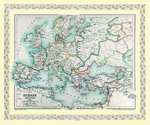
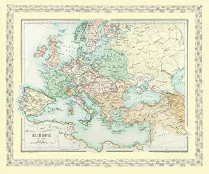
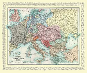
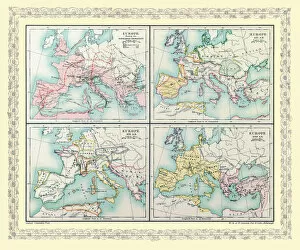
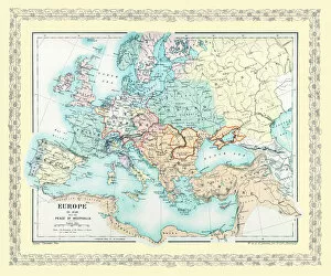
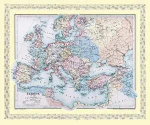
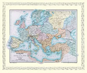
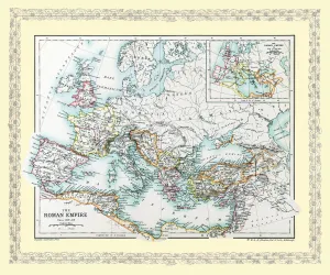
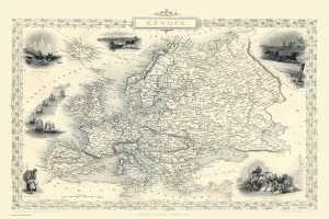
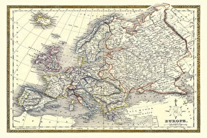
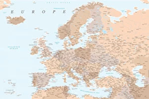
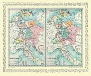
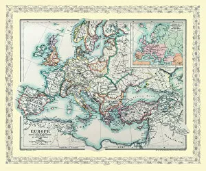
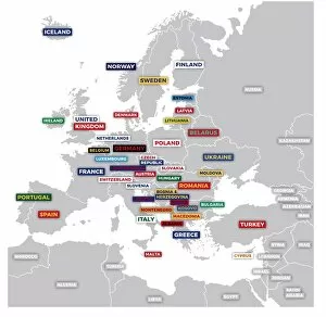
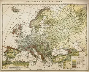
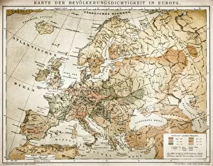
Discover the rich history and diverse landscapes of Europe with these captivating maps. Immerse yourself in the intricate details of a black and grey map, showcasing every nook and cranny of this enchanting continent. Let your imagination wander as you trace the contours of each country, from the rugged mountains to the vast plains. Indulge in the artistic beauty of a gray watercolor Europe map, where shades blend seamlessly to create a mesmerizing visual experience. Allow yourself to be swept away by its ethereal charm, as if stepping into a dreamy European landscape. Uncover the secrets hidden within a neutral detailed map, meticulously crafted to highlight every city and river that has shaped Europe's vibrant tapestry. Follow ancient trade routes or plan your next adventure through this comprehensive guide. Delve into history with a high detail map presented in soothing neutrals. Transport yourself back to AD 1740 and witness how borders have shifted over time, marveling at how empires rose and fell on this ever-evolving canvas. Journey through time with maps depicting Central Europe and Eastern Europe between AD 1863 and AD 1897. Witness political transformations unfold before your eyes as nations redefine themselves amidst an era of change. Navigate effortlessly through labeled European maps that provide insight into our continent's geographical wonders. From majestic mountain ranges to picturesque coastlines, let these labels serve as gateways for exploration. Travel back further still with maps illustrating pivotal moments such as the Third Crusade in AD 1190 or Charles the Great's reign from AD 768 - AD 814. Immerse yourself in these historical snapshots that bring legends alive once more. Witness Europe's evolution throughout centuries by exploring maps from various periods like AD 1360 or during The Emperor Charles V's accession in AD 1519. Marvel at how boundaries shift while cultures intertwine across generations. Experience an immersive journey spanning five centuries on four panels displaying Europe between AD 565 and AD 720.