Photo Mug > Maps and Charts > Americas
Photo Mug : Map of South America 1867


![]()
Home Decor from Fine Art Storehouse
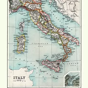
Map of South America 1867
Map of South America - Warren geography 1867
Unleash your creativity and transform your space into a visual masterpiece!
THEPALMER
Media ID 20773085
Photo Mug
Add a touch of history to your morning routine with our Media Storehouse Photo Mug featuring the iconic Map of South America by THEPALMER from Fine Art Storehouse. Dating back to 1867, this intricately detailed map by Warren Geography transports you back in time with every sip. Perfect for history enthusiasts, world travelers, or anyone who appreciates the beauty of vintage cartography, this mug is not only functional but also a work of art. Embrace the past and start your day with a dose of history and caffeine.
A personalised photo mug blends sentimentality with functionality, making an ideal gift for cherished loved ones, close friends, or valued colleagues. Preview may show both sides of the same mug.
Elevate your coffee or tea experience with our premium white ceramic mug. Its wide, comfortable handle makes drinking easy, and you can rely on it to be both microwave and dishwasher safe. Sold in single units, preview may show both sides of the same mug so you can see how the picture wraps around.
Mug Size is 9.6cm high x 8.1cm diameter (3.8" x 3.2")
These are individually made so all sizes are approximate
FEATURES IN THESE COLLECTIONS
> Maps and Charts
> Related Images
> South America
> Related Images
EDITORS COMMENTS
This print showcases the "Map of South America 1867" by Warren geography, a true gem from the past. The intricate details and vibrant colors transport us back to a time when cartography was both an art form and a scientific endeavor. Created in 1867, this map offers a fascinating glimpse into the continent's geographical features, political boundaries, and cultural diversity during that era. The composition is masterfully executed, with delicate lines tracing rivers, mountain ranges towering majestically across the landscape, and cities marked as tiny dots representing bustling hubs of civilization. Each stroke on this vintage piece tells a story of exploration and discovery. As we gaze upon this historical artifact expertly captured by THEPALMER for Fine Art Storehouse, our imagination takes flight. We can almost envision intrepid explorers setting sail along uncharted coastlines or indigenous tribes thriving amidst lush rainforests. This map becomes more than just an illustration; it becomes a portal to another time. Whether you are an avid history enthusiast or simply appreciate fine artistry, this print is sure to captivate your senses. It serves as a reminder of how far we have come in understanding our world while honoring the meticulous craftsmanship that went into creating such remarkable maps centuries ago. Let yourself be transported to South America in 1867 through this extraordinary piece brought to life by THEPALMER's lens.
MADE IN AUSTRALIA
Safe Shipping with 30 Day Money Back Guarantee
FREE PERSONALISATION*
We are proud to offer a range of customisation features including Personalised Captions, Color Filters and Picture Zoom Tools
SECURE PAYMENTS
We happily accept a wide range of payment options so you can pay for the things you need in the way that is most convenient for you
* Options may vary by product and licensing agreement. Zoomed Pictures can be adjusted in the Cart.