Photographic Print > Asia > Japan > Maps
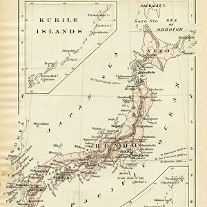
Photographic Print : Map of China and Japan 1889


![]()
Photo Prints from Fine Art Storehouse
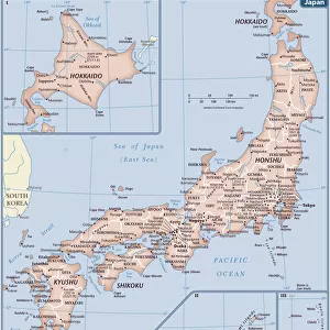
Map of China and Japan 1889
Comprehensive Geography by James Monteith - American Book Company 1882, 1889
Unleash your creativity and transform your space into a visual masterpiece!
THEPALMER
Media ID 18357303
10"x8" (25x20cm) Photo Print
Step back in time with our exquisite 'Map of China and Japan' print from THEPALMER's Comprehensive Geography series, published by the American Book Company in 1889. This captivating vintage map showcases the intricate details of China and Japan during an era of significant historical change. Add a touch of history and global charm to your space with this beautiful fine art print from Media Storehouse's extensive collection.
Ideal for framing, Australian made Photo Prints are produced on high-quality 270 gsm lustre photo paper which has a subtle shimmer adding a touch of elegance, designed to enhance their visual appeal.
Our Photo Prints are in a large range of sizes and are printed on Archival Quality Paper for excellent colour reproduction and longevity. They are ideal for framing (our Framed Prints use these) at a reasonable cost. Alternatives include cheaper Poster Prints and higher quality Fine Art Paper, the choice of which is largely dependant on your budget.
Estimated Image Size (if not cropped) is 25.4cm x 18.3cm (10" x 7.2")
Estimated Product Size is 25.4cm x 20.3cm (10" x 8")
These are individually made so all sizes are approximate
Artwork printed orientated as per the preview above, with landscape (horizontal) orientation to match the source image.
FEATURES IN THESE COLLECTIONS
> Fine Art Storehouse
> Map
> Historical Maps
> Asia
> Japan
> Related Images
> Maps and Charts
> Related Images
EDITORS COMMENTS
In this print titled "Map of China and Japan 1889" we are transported back in time to an era when cartography was a blend of artistry and scientific precision. The image, sourced from the Comprehensive Geography by James Monteith, published by the American Book Company in 1882 and updated in 1889, offers us a glimpse into the intricate world of early mapmaking. The map itself is a testament to human curiosity and exploration. With delicate strokes and meticulous detail, it showcases the vast expanse of China and Japan during that period. From the majestic peaks of the Himalayas to the meandering rivers that carve their way through these ancient lands, every feature has been carefully etched onto paper. As we study this historical artifact, we can't help but marvel at how much our understanding of geography has evolved over time. This particular rendition serves as a reminder of both our past achievements and our ongoing quest for knowledge about distant lands. "The Map of China and Japan 1889" invites us to embark on a visual journey through history—a tangible piece that encapsulates not only geographical boundaries but also cultural connections between two nations with rich traditions spanning centuries. It reminds us that maps are more than just tools; they hold stories waiting to be discovered by those who dare to explore them.
MADE IN AUSTRALIA
Safe Shipping with 30 Day Money Back Guarantee
FREE PERSONALISATION*
We are proud to offer a range of customisation features including Personalised Captions, Color Filters and Picture Zoom Tools
SECURE PAYMENTS
We happily accept a wide range of payment options so you can pay for the things you need in the way that is most convenient for you
* Options may vary by product and licensing agreement. Zoomed Pictures can be adjusted in the Cart.