Photographic Print > Animals > Mammals > Muridae > Western Mouse
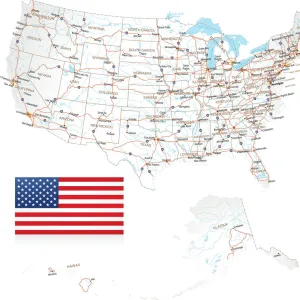
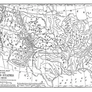
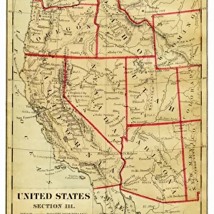
Photographic Print : Map of the Western United States of America, 19th Century


![]()
Photo Prints from Fine Art Storehouse
Map of the Western United States of America, 19th Century
Vintage engraving of a Map of the Western United States of America, 19th Century
Unleash your creativity and transform your space into a visual masterpiece!
duncan1890
Media ID 19684329
© of Duncan P Walker
10"x8" (25x20cm) Photo Print
Step back in time with our exquisite vintage engraving of a Map of the Western United States of America from the 19th Century, available through Media Storehouse's Fine Art Storehouse. This captivating piece by duncan1890 transports you to an era of exploration and discovery. The intricate details of the map, with its bold lines and distinctive borders, make for a stunning addition to any home or office. Perfect for history enthusiasts, cartography lovers, or those who appreciate the beauty of vintage art. Bring a piece of the past into your present with this beautiful, collectible print.
Ideal for framing, Australian made Photo Prints are produced on high-quality 270 gsm lustre photo paper which has a subtle shimmer adding a touch of elegance, designed to enhance their visual appeal.
Our Photo Prints are in a large range of sizes and are printed on Archival Quality Paper for excellent colour reproduction and longevity. They are ideal for framing (our Framed Prints use these) at a reasonable cost. Alternatives include cheaper Poster Prints and higher quality Fine Art Paper, the choice of which is largely dependant on your budget.
Estimated Product Size is 20.3cm x 25.4cm (8" x 10")
These are individually made so all sizes are approximate
Artwork printed orientated as per the preview above, with landscape (horizontal) or portrait (vertical) orientation to match the source image.
FEATURES IN THESE COLLECTIONS
> Fine Art Storehouse
> Map
> Historical Maps
> Animals
> Mammals
> Muridae
> Western Mouse
> Maps and Charts
> Related Images
> North America
> United States of America
> Related Images
EDITORS COMMENTS
This vintage engraving of a Map of the Western United States of America, dating back to the 19th century, takes us on a journey through time. As we gaze upon this intricate print by duncan1890 from Fine Art Storehouse, we are transported to an era when exploration and discovery shaped the American West. The map itself is a testament to both artistry and cartography. Every detail has been meticulously etched onto paper, showcasing the vastness and diversity of this untamed frontier. From towering mountain ranges to winding rivers, each element comes alive under the skilled hand of the artist. With its faded hues and delicate lines, this print exudes nostalgia and invites us to explore history's footsteps. It serves as a reminder that long before modern technology connected every corner of our world, brave pioneers embarked on perilous journeys across these uncharted territories. As we study this map closely, it becomes apparent that it not only depicts geographical features but also tells stories of human resilience and ambition. It sparks our curiosity about those who ventured into unknown lands in search of fortune or simply seeking new beginnings. Whether displayed in a classroom or adorning the walls of an avid history enthusiast's home, this vintage engraving holds immense educational value while evoking a sense of wonderment for all who encounter it. Let it transport you back in time as you trace your fingers along its contours and embark on your own imaginary expedition through the Western United States' rich past.
MADE IN AUSTRALIA
Safe Shipping with 30 Day Money Back Guarantee
FREE PERSONALISATION*
We are proud to offer a range of customisation features including Personalised Captions, Color Filters and Picture Zoom Tools
SECURE PAYMENTS
We happily accept a wide range of payment options so you can pay for the things you need in the way that is most convenient for you
* Options may vary by product and licensing agreement. Zoomed Pictures can be adjusted in the Cart.