Photographic Print > South America > Venezuela > Maps
Photographic Print : Venezuela country map


![]()
Photo Prints from Fine Art Storehouse
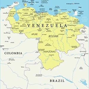
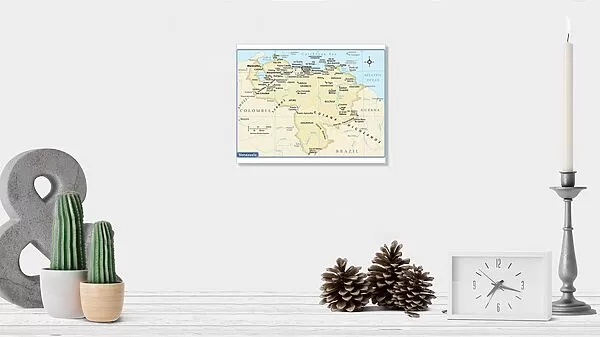
Venezuela country map
2011 edition
Unleash your creativity and transform your space into a visual masterpiece!
Media ID 14432311
10"x8" (25x20cm) Photo Print
Ideal for framing, Australian made Photo Prints are produced on high-quality 270 gsm lustre photo paper which has a subtle shimmer adding a touch of elegance, designed to enhance their visual appeal.
Our Photo Prints are in a large range of sizes and are printed on Archival Quality Paper for excellent colour reproduction and longevity. They are ideal for framing (our Framed Prints use these) at a reasonable cost. Alternatives include cheaper Poster Prints and higher quality Fine Art Paper, the choice of which is largely dependant on your budget.
Estimated Image Size (if not cropped) is 25.4cm x 18.8cm (10" x 7.4")
Estimated Product Size is 25.4cm x 20.3cm (10" x 8")
These are individually made so all sizes are approximate
Artwork printed orientated as per the preview above, with landscape (horizontal) orientation to match the source image.
FEATURES IN THESE COLLECTIONS
> Fine Art Storehouse
> Map
> Reference Maps
> Maps and Charts
> Related Images
> South America
> Venezuela
> Maps
> South America
> Venezuela
> Related Images
EDITORS COMMENTS
This print showcases the Venezuela country map from the 2011 edition, offering a stunning visual representation of this South American nation's diverse landscapes and rich cultural heritage. The intricate details and vibrant colors of the map are beautifully captured in this high-quality print, making it an ideal addition to any art collection or home decor. The Venezuela country map serves as more than just a geographical reference; it tells a story of a nation brimming with natural wonders, from its breathtaking Andean peaks to its vast Amazon rainforest. Each region is intricately depicted on this print, allowing viewers to explore the country's various states and their unique characteristics. Beyond its aesthetic appeal, this print also holds historical significance. As an artifact from 2011, it provides a snapshot of Venezuela during that time period – capturing cities bustling with life, roads connecting communities, and landmarks that have shaped the nation's identity. Whether you have personal ties to Venezuela or simply appreciate the beauty of cartography as an art form, this print offers both visual delight and educational value. It invites viewers to embark on a virtual journey through one of South America's most enchanting countries while serving as a reminder of our interconnected world.
MADE IN AUSTRALIA
Safe Shipping with 30 Day Money Back Guarantee
FREE PERSONALISATION*
We are proud to offer a range of customisation features including Personalised Captions, Color Filters and Picture Zoom Tools
SECURE PAYMENTS
We happily accept a wide range of payment options so you can pay for the things you need in the way that is most convenient for you
* Options may vary by product and licensing agreement. Zoomed Pictures can be adjusted in the Cart.