Photographic Print > Maps and Charts > Americas
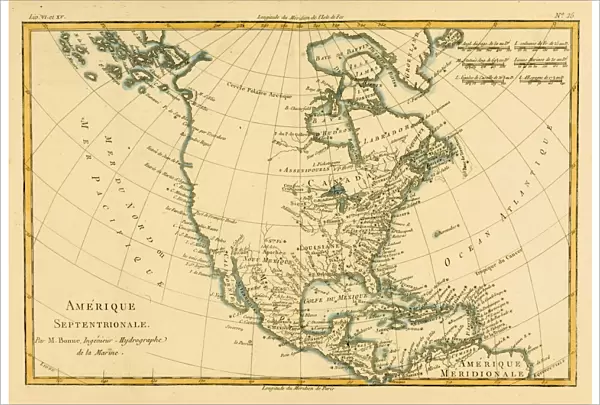
Photographic Print : Map of North America, circa. 1760. From Atlas de Toutes Les Parties Connues du Globe
![]()

Photo Prints from Universal Images Group (UIG)
Map of North America, circa. 1760. From Atlas de Toutes Les Parties Connues du Globe
Map of North America, circa.1760. From Atlas de Toutes Les Parties Connues du Globe Terrestre by Cartographer Rigobert Bonne. Published Geneva circa. 1760
Universal Images Group (UIG) manages distribution for many leading specialist agencies worldwide
Media ID 20165297
© Universal Images Group
America Color Colour Mapmaking North Plate Welsh
12"x8" (30x20cm) Photo Print
Step back in time with our exclusive Media Storehouse collection of antique maps. This stunning print showcases a captivating map of North America from the year 1760, taken from the renowned "Atlas de Toutes Les Parties Connues du Globe" by Cartographer Rigobert Bonne. Published in Geneva around 1760, this map offers a fascinating glimpse into the geographical knowledge of the time. The intricate details and vibrant colors bring history to life, making it a beautiful addition to any home or office decor. Order now and transport yourself back to an era of exploration and discovery!
Ideal for framing, Australian made Photo Prints are produced on high-quality 270 gsm lustre photo paper which has a subtle shimmer adding a touch of elegance, designed to enhance their visual appeal.
Our Photo Prints are in a large range of sizes and are printed on Archival Quality Paper for excellent colour reproduction and longevity. They are ideal for framing (our Framed Prints use these) at a reasonable cost. Alternatives include cheaper Poster Prints and higher quality Fine Art Paper, the choice of which is largely dependant on your budget.
Estimated Product Size is 31.4cm x 21.2cm (12.4" x 8.3")
These are individually made so all sizes are approximate
Artwork printed orientated as per the preview above, with landscape (horizontal) orientation to match the source image.
FEATURES IN THESE COLLECTIONS
> Maps and Charts
> Related Images
> Universal Images Group (UIG)
> History
> Historical Maps
EDITORS COMMENTS
This print showcases a remarkable piece of history - the Map of North America, circa 1760. Taken from the renowned Atlas de Toutes Les Parties Connues du Globe Terrestre by Cartographer Rigobert Bonne, this horizontal and colorful illustration offers a fascinating glimpse into the geography and cartography of that era. The map depicts North America in stunning detail, highlighting its vast landscapes and diverse territories. From the rugged mountains to the sprawling plains, every contour is meticulously engraved on this plate. The vibrant colors bring life to each region, allowing viewers to immerse themselves in an age when exploration was at its peak. As we gaze upon this historical artifact, we are transported back in time to Geneva circa 1760 when it was first published. It serves as a testament to human curiosity and our relentless pursuit of knowledge about our world. Credit goes to Welsh Ken for his expertise in mapmaking which has contributed significantly to preserving such invaluable pieces of our collective heritage. Through his skillful craftsmanship, he has ensured that generations can appreciate and study these maps even centuries later. Thanks to Universal History Archive/Universal Images Group for capturing this image with utmost precision and presenting it for us all to admire. This print not only celebrates the artistry behind cartography but also invites us on a journey through time as we explore North America's past through its intricate details.
MADE IN AUSTRALIA
Safe Shipping with 30 Day Money Back Guarantee
FREE PERSONALISATION*
We are proud to offer a range of customisation features including Personalised Captions, Color Filters and Picture Zoom Tools
SECURE PAYMENTS
We happily accept a wide range of payment options so you can pay for the things you need in the way that is most convenient for you
* Options may vary by product and licensing agreement. Zoomed Pictures can be adjusted in the Cart.


