Photographic Print > Maps and Charts > Related Images
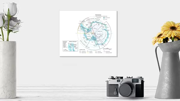
Photographic Print : Map of Antarctica


![]()
Photo Prints from Universal Images Group (UIG)
Map of Antarctica
Universal Images Group (UIG) manages distribution for many leading specialist agencies worldwide
Media ID 9539765
© Dorling Kindersley/UIG
10"x8" (25x20cm) Photo Print
Ideal for framing, Australian made Photo Prints are produced on high-quality 270 gsm lustre photo paper which has a subtle shimmer adding a touch of elegance, designed to enhance their visual appeal.
Our Photo Prints are in a large range of sizes and are printed on Archival Quality Paper for excellent colour reproduction and longevity. They are ideal for framing (our Framed Prints use these) at a reasonable cost. Alternatives include cheaper Poster Prints and higher quality Fine Art Paper, the choice of which is largely dependant on your budget.
Estimated Image Size (if not cropped) is 25.4cm x 18.2cm (10" x 7.2")
Estimated Product Size is 25.4cm x 20.3cm (10" x 8")
These are individually made so all sizes are approximate
Artwork printed orientated as per the preview above, with landscape (horizontal) orientation to match the source image.
FEATURES IN THESE COLLECTIONS
> Maps and Charts
> Related Images
> Universal Images Group (UIG)
> Illustrations
> Illustrations 1
EDITORS COMMENTS
This print showcases a stunning "Map of Antarctica" created by the renowned Dorling Kindersley. The intricate illustration beautifully captures the vastness and mystique of this icy continent, offering an immersive experience for any geography enthusiast or avid traveler. With its vibrant colors and meticulous cartography, this map becomes more than just a geographical representation; it transforms into a work of art. As we gaze upon this masterpiece, our eyes are drawn to the mesmerizing details that bring Antarctica to life. From the jagged coastlines to the sprawling ice shelves, every feature is meticulously depicted with utmost precision. This visual delight not only educates but also ignites our wanderlust, inviting us to explore one of Earth's most remote and untouched regions. The map serves as a gateway to understanding Antarctica's unique geography and its significance in scientific research. It highlights various countries' territorial claims while emphasizing international cooperation in preserving this fragile ecosystem. By studying this map closely, one can unravel the mysteries hidden within Antarctica's frozen expanse. Universal Images Group (UIG) has flawlessly captured every nuance of Dorling Kindersley's extraordinary creation through their exceptional printing techniques. This high-quality print ensures that every line and color pops off the page, allowing viewers to immerse themselves fully in Antarctic exploration without leaving their homes. Whether you are an adventurer at heart or simply appreciate exquisite illustrations, this print is sure to captivate your imagination and transport you on an unforgettable journey across Antarctica's breathtaking landscapes
MADE IN AUSTRALIA
Safe Shipping with 30 Day Money Back Guarantee
FREE PERSONALISATION*
We are proud to offer a range of customisation features including Personalised Captions, Color Filters and Picture Zoom Tools
SECURE PAYMENTS
We happily accept a wide range of payment options so you can pay for the things you need in the way that is most convenient for you
* Options may vary by product and licensing agreement. Zoomed Pictures can be adjusted in the Cart.