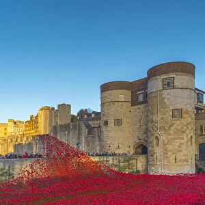
Poster Print > Europe > United Kingdom > England > London > Sights > Tower of London
Poster Print : Tower of London and surrounding area 1597


![]()
Poster Prints from Mary Evans Picture Library
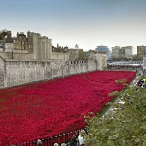
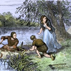
Tower of London and surrounding area 1597
From a print published by the Royal Antiquarian Society and engraved from the survey made in 1597. Date: 1597
Mary Evans Picture Library makes available wonderful images created for people to enjoy over the centuries
Media ID 20158653
© Bubblepunk
1597 Antiquarian Area Draught Gascoyne Liberties Maps Plan Surrounding Boundries Gulielmus Smith
A3 (42 x 29.7cm) Poster Print
Step back in time with our exquisite Tower of London and Surrounding Area poster print from Media Storehouse. This captivating reproduction, sourced from Mary Evans Prints Online, showcases a detailed engraving of the iconic fortress as it appeared in 1597. Originally published by the Royal Antiquarian Society, this historical treasure provides a fascinating glimpse into the past, transporting you back to the bustling streets and fortified walls of Tudor London. Add an air of antiquity and scholarly charm to your space with this beautifully preserved piece of history.
Premium quality poster prints are printed on luxurious semi-gloss satin 270 gsm paper. Our meticulously crafted poster prints offer an affordable option for decorating any space, making them ideal for living rooms, bedrooms, offices and beyond. To ensure your poster arrives in good condition, we roll and send them in strong mailing tubes.
Poster prints are budget friendly enlarged prints in standard poster paper sizes (A0, A1, A2, A3 etc). Whilst poster paper is sometimes thinner and less durable than our other paper types, they are still ok for framing and should last many years. Our Archival Quality Photo Prints and Fine Art Paper Prints are printed on higher quality paper and the choice of which largely depends on your budget.
Estimated Product Size is 42.6cm x 30.6cm (16.8" x 12")
These are individually made so all sizes are approximate
Artwork printed orientated as per the preview above, with landscape (horizontal) orientation to match the source image.
FEATURES IN THESE COLLECTIONS
> Mary Evans Prints Online
> London
> Mary Evans Prints Online
> New Images July 2020
> Architecture
> Towers
> Churches
> Architecture
> Towers
> Tower of London
> Arts
> Artists
> S
> Mary Smith
> Arts
> Landscape paintings
> Waterfall and river artworks
> River artworks
> Europe
> United Kingdom
> England
> London
> Related Images
> Europe
> United Kingdom
> England
> London
> River Thames
> Europe
> United Kingdom
> England
> London
> Royalty
> Europe
> United Kingdom
> England
> London
> Sights
> Tower of London
> Europe
> United Kingdom
> Heritage Sites
> Tower of London
> Maps and Charts
> Related Images
EDITORS COMMENTS
This fascinating print, published by the Royal Antiquarian Society in 1597, offers a unique glimpse into the topography of London as it appeared over 400 years ago. The meticulously detailed map, engraved from a survey made in that year, centers around the iconic Tower of London, a historic fortress and palace located on the north bank of the River Thames. The Tower, which dates back to the late 11th century, is depicted in all its medieval grandeur, surrounded by its moat and connected to the mainland by a bridge. To the north, the print reveals the sprawling complex of the Royal Palace, which was the primary residence of the monarchy until the 17th century. The palace, which included the Chapel Royal, the White Tower, and the Bloody Tower, is shown with its various courtyards and gardens. To the east, the print reveals the bustling area of Barking Church and Hill, which was a popular residential and commercial district. The print also highlights the liberties of the Tower, including the precincts of the Tower Hill, the Tower Liberty, and the Water Lane Liberty. The surrounding area, which was dotted with churches, fields, and gardens, is also depicted in the print. Notable structures include St. Katharine's by the Tower, St. Mary Magdalen Bermondsey, and St. Mary Whitechapel. The River Thames, which played a crucial role in London's economic and social life, is shown winding its way through the city, with various wharves and docks indicated along its banks. This intricately detailed map, produced by the skilled hands of engravers Gulielmus Haiward, Gascoyne, East, Smith, and Field, provides a valuable record of London's topography during the 16th century. It offers a fascinating glimpse into the past, allowing us to visualize the city as it was over 400 years ago.
MADE IN AUSTRALIA
Safe Shipping with 30 Day Money Back Guarantee
FREE PERSONALISATION*
We are proud to offer a range of customisation features including Personalised Captions, Color Filters and Picture Zoom Tools
SECURE PAYMENTS
We happily accept a wide range of payment options so you can pay for the things you need in the way that is most convenient for you
* Options may vary by product and licensing agreement. Zoomed Pictures can be adjusted in the Cart.