Fraud Blocker Skip to main content

Home > Universal Images Group (UIG) > Art > Painting, Sculpture & Prints > Cartography

Cartography Collection (page 8)

953 items

We are proud to offer this selection in partnership with Universal Images Group (UIG)

Background imageCartography Collection: Damascus from Civitates Orbis Terrarum by Georg Braun, 1541-1622 and Franz Hogenberg, 1540-1590

Damascus from Civitates Orbis Terrarum by Georg Braun, 1541-1622 and Franz Hogenberg, 1540-1590, engraving
Cartography, Syria, 16th century. Damascus. From Civitates Orbis Terrarum by Georg Braun (1541-1622) and Franz Hogenberg (1540-1590), Cologne. Engraving

Background imageCartography Collection: Serravalle Scrivia from Civitates Orbis Terrarum by Georg Braun, 1541-1622 and Franz Hogenberg

Serravalle Scrivia from Civitates Orbis Terrarum by Georg Braun, 1541-1622 and Franz Hogenberg, 1540-1590, engraving
Cartography, Italy, 16th century. Serravalle Scrivia. From Civitates Orbis Terrarum by Georg Braun (1541-1622) and Franz Hogenberg (1540-1590), Cologne. Engraving

Background imageCartography Collection: Map of Galway, Dublin, Limerick and Cork from Civitates Orbis Terrarum by Georg Braun

Map of Galway, Dublin, Limerick and Cork from Civitates Orbis Terrarum by Georg Braun, 1541-1622 and Franz Hogenberg
Cartography, Ireland, 16th century. Map of Galway, Dublin, Limerick and Cork. From Civitates Orbis Terrarum by Georg Braun (1541-1622) and Franz Hogenberg (1540-1590), Cologne. Engraving

Background imageCartography Collection: The Orinoco River course up to Maracaibo, Venezuela, 1675

The Orinoco River course up to Maracaibo, Venezuela, 1675
Cartography, Venezuela, XII century. The Orinoco River course up to Maracaibo, 1675

Background imageCartography Collection: Map of Domremy-la-Pucelle area in France, birthplace of Joan of Arc

Map of Domremy-la-Pucelle area in France, birthplace of Joan of Arc, indicating feudal and administrative boundaries
Cartography, France, 16th century. Map of Domremy-la-Pucelle area, birthplace of Joan of Arc, indicating the feudal and administrative boundaries

Background imageCartography Collection: Luxembourg city, Grand Ducal Palace and stone monument from Civitates Orbis Terrarum by Georg Braun

Luxembourg city, Grand Ducal Palace and stone monument from Civitates Orbis Terrarum by Georg Braun
Cartography, Luxembourg, 16th century. Luxembourg city. Grand Ducal Palace and stone monument. From Civitates Orbis Terrarum by Georg Braun (1541-1622) and Franz Hogenberg (1540-1590), Cologne

Background imageCartography Collection: Map of coast of Virginia, from Theatrum Orbis Terrarum by Joan Blaeu, 1596-1673

Map of coast of Virginia, from Theatrum Orbis Terrarum by Joan Blaeu, 1596-1673
Cartography, America, 17th century. Map of coast of Virginia, from Theatrum Orbis Terrarum by Joan Blaeu (1596-1673)

Background imageCartography Collection: Italy, Giovinazzo (Bari) by Giovan Battista Pacichelli from Il Regno di Napoli in prospettiva

Italy, Giovinazzo (Bari) by Giovan Battista Pacichelli from Il Regno di Napoli in prospettiva
Cartography, Italy, 18th century. The City of Giovinazzo (Bari). From The Kingdom of Naples in perspective by Giovan Battista Pacichelli, 1702. Engraving

Background imageCartography Collection: Italy, Rome, Map of Rome in 1600 from Theatrum Civitatum et Admirandorum Italiae by Jean Blaeu

Italy, Rome, Map of Rome in 1600 from Theatrum Civitatum et Admirandorum Italiae by Jean Blaeu, Amsterdam, 1663
Italy - 18th century - Civitatis admirandorum by Jean Blaeu. Map of Rome in 1600

Background imageCartography Collection: Map of Southern America from Cosmographie by Andre Thevet, 1502-1590

Map of Southern America from Cosmographie by Andre Thevet, 1502-1590
Cartography, 16th century. Map of Southern America by Andre Thevet (1502-1590), Cosmographie

Background imageCartography Collection: Netherlands, Amsterdam map from Civitates Orbis Terrarum by Georg Braun (1541-1622)

Netherlands, Amsterdam map from Civitates Orbis Terrarum by Georg Braun (1541-1622) and Franz Hogenberg (1540-1590)
Cartography, Netherlands, 16th century. The city of Amsterdam. From Civitates Orbis Terrarum by Georg Braun (1541-1622) and Franz Hogenberg (1540-1590), Cologne. Engraving

Background imageCartography Collection: Military map of the siege of Genoa by the Austrian troops during the War of the Austrian

Military map of the siege of Genoa by the Austrian troops during the War of the Austrian Succession, 1746
Cartography, Italy, 18th century. Military map of the siege of Genoa by the Austrian troops during the War of the Austrian Succession, 1746. By Elias Back, Augsburg 1747. Copper engraving

Background imageCartography Collection: Ottoman empire, from portolan atlas consisting of six charts

Ottoman empire, from portolan atlas consisting of six charts, by Placido Caloiro and Francesco Oliva, Parchment. 1646
Cartography, 17th century. The Ottoman empire, from a portolan atlas consisting of six charts, by Placido Caloiro and Francesco Oliva, 1646. Parchment

Background imageCartography Collection: Map of Plon from Civitates Orbis Terrarum by Georg Braun, 1541-1622 and Franz Hogenberg

Map of Plon from Civitates Orbis Terrarum by Georg Braun, 1541-1622 and Franz Hogenberg, 1540-1590, engraving
Cartography, Germany, 16th century. Map of Plon. From Civitates Orbis Terrarum by Georg Braun (1541-1622) and Franz Hogenberg (1540-1590), Cologne. Engraving

Background imageCartography Collection: Republic of Genoa, Map by Matthaeus Seutter, Augsburg, Copper engraving, 1735

Republic of Genoa, Map by Matthaeus Seutter, Augsburg, Copper engraving, 1735
Cartography, Italy, 18th century. Republic of Genoa. Map by Matthaeus Seutter, Augsburg, 1735. Copper engraving

Background imageCartography Collection: Africa, Europe and part of Americas: Central America and Brazil

Africa, Europe and part of Americas: Central America and Brazil, from Atlas of the World in thirty-three Maps
Cartography, 16th century. Africa, Europe and part of Americas: Central America and Brazil, from Atlas of the World in thirty-three Maps, by Battista Agnese, 1553

Background imageCartography Collection: Map of Great Britain and Ireland, by Stefano Buonsignori, oil painting, 1575-1584

Map of Great Britain and Ireland, by Stefano Buonsignori, oil painting, 1575-1584
Italy - Tuscany region - Florence. Palazzo Vecchio, Hall of the Geographical Maps. Map of Great Britain and Ireland, oil painting by Stefano Buonsignori 1575-1584

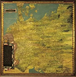
Background imageCartography Collection: Map of Germany, by Stefano Buonsignori, oil painting, 1575-1584

Map of Germany, by Stefano Buonsignori, oil painting, 1575-1584
Italy - Tuscany region - Florence. Palazzo Vecchio, Hall of the Geographical Maps. Map of Germany, oil painting by Stefano Buonsignori 1575-1584

Background imageCartography Collection: Map of Piedmont Region, Venice, Copper engraving, 1567

Map of Piedmont Region, Venice, Copper engraving, 1567
Cartography, Italy, 16th century. Map of Piedmont Region, Venice, 1567. Copper engraving

Background imageCartography Collection: Florida people, maps by Gian Battista Ramusio, 1540 and Francesco Grisellini, 1761, detail

Florida people, maps by Gian Battista Ramusio, 1540 and Francesco Grisellini, 1761, detail
Italy - Veneto Region - Venice - Palazzo Ducale (Doges Palace) - Hall of the Maps (Sala delle Mappe) - Florida people - Maps by Gian Battista Ramusio (1540) and Francesco Grisellini (1761). Detail

Background imageCartography Collection: Nautical chart of Aegean Sea, third chart, from a nautical atlas of the Mediterranean Sea in three

Nautical chart of Aegean Sea, third chart, from a nautical atlas of the Mediterranean Sea in three charts
Cartography, 17th century. Nautical chart of Aegean Sea. Third chart, from a nautical atlas of the Mediterranean Sea in three charts, by Pietro Giovanni Prunus, 1651. Cm 41.6x28

Background imageCartography Collection: Map of Tartary, by Gian Battista Ramusio, 1540 and Francesco Grisellini, 1761

Map of Tartary, by Gian Battista Ramusio, 1540 and Francesco Grisellini, 1761
Italy - Veneto Region - Venice - Palazzo Ducale (Doges Palace). Hall of the Maps (Sala delle Mappe). Map of Tartary, by Gian Battista Ramusio (1540) and Francesco Grisellini (1761)

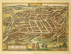
Background imageCartography Collection: Vilnius from Civitates Orbis Terrarum by Georg Braun, 1541-1622 and Franz Hogenberg, 1540-1590

Vilnius from Civitates Orbis Terrarum by Georg Braun, 1541-1622 and Franz Hogenberg, 1540-1590, engraving
Cartography, Lithuania, 16th century. Vilnius. From Civitates Orbis Terrarum by Georg Braun (1541-1622) and Franz Hogenberg (1540-1590), Cologne. Engraving

Background imageCartography Collection: Map of the Indian Peninsula, oil painting by Stefano Buonsignori 1575-1584

Map of the Indian Peninsula, oil painting by Stefano Buonsignori 1575-1584
Italy - Tuscany region - Florence. Palazzo Vecchio, Hall of the Geographical Maps. Map of the Indian Peninsula, oil painting by Stefano Buonsignori 1575-1584

Background imageCartography Collection: USA, New York, New York City, Staten Island, American War of Independence military map, 1776

USA, New York, New York City, Staten Island, American War of Independence military map, 1776
Cartography, United States of America, 18th century. New York, Staten Island. American War of Independence. Military map, 1776

Background imageCartography Collection: Zaros, Crete from Civitates Orbis Terrarum by Georg Braun, 1541-1622 and Franz Hogenberg

Zaros, Crete from Civitates Orbis Terrarum by Georg Braun, 1541-1622 and Franz Hogenberg, 1540-1590, engraving
Cartography, Greece, 16th century. Zaros, Crete. From Civitates Orbis Terrarum by Georg Braun (1541-1622) and Franz Hogenberg (1540-1590), Cologne. Engraving

Background imageCartography Collection: Map of the Region of Piedmont, Italy, from Theatrum Orbis Terrarum by Abraham Ortelius, 1528-1598

Map of the Region of Piedmont, Italy, from Theatrum Orbis Terrarum by Abraham Ortelius, 1528-1598, 1570
Cartography, Italy, 16th century. Map of the Region of Piedmont, from Theatrum Orbis Terrarum by Abraham Ortelius (1528-1598), Antwerp, 1570

Background imageCartography Collection: Nautical chart of the Central-Eastern Mediterranean Sea, detail with Egypt and Red Sea

Nautical chart of the Central-Eastern Mediterranean Sea, detail with Egypt and Red Sea
Cartography, 16th century. Nautical chart of the Central-Eastern Mediterranean Sea, detail with Egypt and Red Sea, by Giorgio Sideri called Callapoda or Calopodio da Candia (Crete)

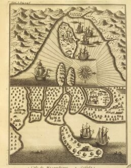
Background imageCartography Collection: Island of Mozambique, from Portuguese discoveries by Francois Lafitau, 1733

Island of Mozambique, from Portuguese discoveries by Francois Lafitau, 1733
Cartography, 18th century. The island of Mozambique, from Portuguese discoveries by Francois Lafitau, 1733

Background imageCartography Collection: Map of New Zealand by Antonio Zatta according to discoveries of James Cook, Venice 1778

Map of New Zealand by Antonio Zatta according to discoveries of James Cook, Venice 1778
Cartography, 18th century. Map of New Zealand by Antonio Zatta according to the discoveries of James Cook, Venice 1778

Background imageCartography Collection: Map of the Horn of Africa, oil painting by Stefano Buonsignori 1575-1584, detail

Map of the Horn of Africa, oil painting by Stefano Buonsignori 1575-1584, detail
Italy - Tuscany region - Florence. Palazzo Vecchio, Hall of the Geographical Maps. Map of the Horn of Africa, oil painting by Stefano Buonsignori 1575-1584. Detail

Background imageCartography Collection: Italy, Naples, map and front view with Castel Nuovo, engraving

Italy, Naples, map and front view with Castel Nuovo, engraving 18th century, Biblioteca Nazionale Vittorio Emanuele III

Background imageCartography Collection: Map of Siena and its defensive structures, detail of the fortress planned by Giovanni Battista

Map of Siena and its defensive structures, detail of the fortress planned by Giovanni Battista Pelori before its
Cartography, Italy, 16th century. Map of Siena and its defensive structures, detail of the fortress planned by Giovanni Battista Pelori before its reconstruction

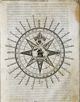
Background imageCartography Collection: The Rose of Agulha, representing the Cardinal points, from The Art of Navigation by Luis Pimentel

The Rose of Agulha, representing the Cardinal points, from The Art of Navigation by Luis Pimentel
Cartography, 16th century. The Rose of Agulha, representing the Cardinal points. From The Art of Navigation by Luis Pimentel, 1681

Background imageCartography Collection: Map tracing David Livingstones travels in southern Africa between 1848 and 1856 by John Arrowsmith

Map tracing David Livingstones travels in southern Africa between 1848 and 1856 by John Arrowsmith
History of Exploration, 19th century. Map tracing Livingstons travels in southern Africa between 1848 and 1856 by John Arrowsmith

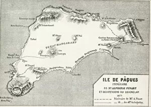
Background imageCartography Collection: Easter Island by Erhard, 1878

Easter Island by Erhard, 1878
History of Exploration, 19th century. Easter Island, from Alphonse Pinards expedition in 1877. Engraving by Erhard depicting The World Tour, 1878

Background imageCartography Collection: Map by Vincenzo Valgrisi, according to Ptolemys Geography, Venice, Copper engraving, 1561

Map by Vincenzo Valgrisi, according to Ptolemys Geography, Venice, Copper engraving, 1561
Cartography, 16th century. Central Europe. Map by Vincenzo Valgrisi, according to Ptolemys Geography, Venice, 1561. Copper engraving

Background imageCartography Collection: Map of Bristol from Civitates Orbis Terrarum by Georg Braun, 1541-1622 and Franz Hogenberg

Map of Bristol from Civitates Orbis Terrarum by Georg Braun, 1541-1622 and Franz Hogenberg, 1540-1590, engraving
Cartography, Great Britain, 16th century. Map of Bristol. From Civitates Orbis Terrarum by Georg Braun (1541-1622) and Franz Hogenberg (1540-1590), Cologne. Engraving

Background imageCartography Collection: Italy, Conversano (Bari) by Giovan Battista Pacichelli from Il Regno di Napoli in prospettiva

Italy, Conversano (Bari) by Giovan Battista Pacichelli from Il Regno di Napoli in prospettiva
Cartography, Italy, 18th century. The City of Conversano (Bari). Engraving from Il Regno di Napoli in prospettiva (The Kingdom of Naples in Perspective), by Giovan Battista Pacichelli, 1702

Background imageCartography Collection: Sardinian States on the mainland. Map from the Army Corps of Topographical Engineers

Sardinian States on the mainland. Map from the Army Corps of Topographical Engineers, engraving in copper. 1846
Cartography, Italy, 19th century. Sardinian States on the mainland. Map from the Army Corps of Topographical Engineers, 1846. Engraving in copper

Background imageCartography Collection: Map of Northern coast of Tabacco Island in Galapagos Islands, watercolour painting

Map of Northern coast of Tabacco Island in Galapagos Islands, watercolour painting
History of Exploration, 17th century. Galapagos Islands. Map of the northern coast of Tabacco Island. From the logbook of De Beauchesne, a ships captain in the South Seas from 1698 to 1701. Watercolor

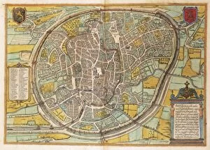
Background imageCartography Collection: Map of Bruxelles from Civitates Orbis Terrarum by Georg Braun, 1541-1622 and Franz Hogenberg

Map of Bruxelles from Civitates Orbis Terrarum by Georg Braun, 1541-1622 and Franz Hogenberg, 1540-1590, engraving
Cartography, Belgium, 16th century. Map of Bruxelles. From Civitates Orbis Terrarum by Georg Braun (1541-1622) and Franz Hogenberg (1540-1590), Cologne. Engraving

Background imageCartography Collection: Map of Central-Northern Italy by Robert Dudley from the maritime encyclopedia Dell Arcano del

Map of Central-Northern Italy by Robert Dudley from the maritime encyclopedia Dell Arcano del Mare, Copper engraving
Cartography, Italy, 17th century. Map of Central-Northern Italy by Robert Dudley from the maritime encyclopedia Dell Arcano del Mare, 1647. Copper engraving

Background imageCartography Collection: Chart for navigating the newly discovered islands in parts of India also known as the Carta del

Chart for navigating the newly discovered islands in parts of India also known as the Carta del Cantino, 1502
Cartography, 16th century. Chart for navigating the newly discovered islands in parts of India also known as the Carta del Cantino, 1502. Detail: Western Africa

Background imageCartography Collection: Map of Marchena and Osuna from Civitates Orbis Terrarum by Georg Braun

Map of Marchena and Osuna from Civitates Orbis Terrarum by Georg Braun, 1541-1622 and Franz Hogenberg, 1540-1590
Cartography, Spain, 16th century. Map of Marchena and Osuna. From Civitates Orbis Terrarum by Georg Braun (1541-1622) and Franz Hogenberg (1540-1590), Cologne. Engraving

Background imageCartography Collection: Map of Cambridge from Civitates Orbis Terrarum by Georg Braun, 1541-1622 and Franz Hogenberg

Map of Cambridge from Civitates Orbis Terrarum by Georg Braun, 1541-1622 and Franz Hogenberg, 1540-1590, engraving
Cartography, Great Britain, 16th century. Map of Cambridge. From Civitates Orbis Terrarum by Georg Braun (1541-1622) and Franz Hogenberg (1540-1590), Cologne. Engraving

Background imageCartography Collection: Plate depicting Southern America, from the Atlas by Willem Janszoon Blaeu, 1658

Plate depicting Southern America, from the Atlas by Willem Janszoon Blaeu, 1658
Cartography, America, 17th century. Plate depicting Southern America. From the Atlas by Willem Janszoon Blaeu, Amsterdam, 1658

Background imageCartography Collection: Duchy of Milan and neighboring regions, Map by Giovanni Giorgio Settala, 1570

Duchy of Milan and neighboring regions, Map by Giovanni Giorgio Settala, 1570
Cartography, Italy 16th century. Duchy of Milan and neighboring regions. Map by Giovanni Giorgio Settala, 1570, from a republication of Theatrum Orbis Terrarum by Abraham Ortelius (1528-1598)


All Professionally Made to Order for Quick Shipping


-

Why Choose Us?

We are a leading provider of Art Prints and Photo Gifts since 2003, working in partnership with a range of Sporting Clubs, Charities, Museums and Picture Libraries. A large share of profits from any of their images will go directly towards supporting that charity or club. Our archive of images is carefully curated to bring you a wide range of subjects, including landscapes, wildlife, architecture, and more. We ship from our partner labs in the UK, USA, EU (Netherlands) and Australia.
+

How do I place an order?

Ordering is quick & easy - Just follow 5 Simple Steps:
  1. Find your image: Use our search box or browse our online photo Collections to find the image you want.

  2. Choose your print format: Select your desired product and add it to your cart.

  3. Enter your details: If you're a returning customer, simply enter your email address and password, and we'll fill in your billing and shipping address details. All personal details are held securely and are fully GDPR compliant. As standard, we remove all Personally Identifiable Information after 12 months.

  4. Pay for your purchase: We use state-of-the-art security for online shopping and do not have access to your card details.

  5. Sit back and relax: We'll email you confirmation of your order and when it's dispatched. Registered customers can also track orders in the 'My Account' area.

+

How do I pay for an order?

You can pay for your order with most of the major credit and debit cards, or PayPal. For added security, major financial institutions process payment details separately and securely on our behalf. We do not have access to your online payment card details. Online payments are preferred however we do take phone orders. For UK customers only we accept cheques issued against a UK bank.
+

Is my data safe?

We take data security very seriously. We do not have access to your full card details and all payments are requested over a fully secure connection. Additionally, we fully comply with current European and GDPR legislation, and automatically remove all personal data after at most 12 months (unless you have an account with us and have signed in recently). We also have a strict opt-in policy and would never sell your personal details. Your data is only used to fulfill your order promptly and efficiently.
+

Is wall art ready to hang?

For quick and easy installation all wall art, including framed prints, canvas prints and metal prints are supplied with a ready to hang solution on the back. Generally, saw tooth hangers are applied as they allow wall art to hang flush against the wall. The serrated edge of the hanger prevents the frame from shifting or tilting when hung.
+

Are the photo prints fade resistant?

Yes, we use archival quality photo paper photographic paper for vivid reproduction Prints are an accurate representations of the original artwork, which is preserved for artistic character and authenticity. We guarantee they match previews shown on our web site