Framed Print
Canvas Print
Metal Print
Photographic Print
Poster Print
Fine Art Print
Jigsaw Puzzle
Photo Mug
Greetings Card
Cushion
Mouse Mat
Choose a picture from our collection for your Wall Art and Photo Gifts
8 Sep 2012 Collection2 Items
2 Sep 2012Switzerland, Canton Fribourg, Kerzers, Papiliorama, Butterfly
14 Sep 2012Jazz Music Entertainment
17 Sep 2012Forepaugh And Sells Brothers Circus
26 Sep 2012 Collection7 Items
6 Sep 2012 Collection2 Items
12 Sep 2012William Mckinley, President of US
11 Sep 2012 Collection237 Items
13 Sep 2012 Collection13 Items
24 Sep 2012 Collection7 Items
Turkey, Satellite ImageSatellite view of Turkey. This image was compiled from data acquired by LANDSAT satellite
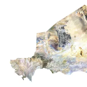
Niger, Satellite ImageSatellite view of Niger. This image was compiled from data acquired by LANDSAT satellite
Advertisement Stove Cat ApplianceSeated Cat, Garland Stoves and Ranges, Trade Card, circa 1880. (Photo by: Universal History Archive/UIG)
Lion and FamilyA lion guards its family. The caption for this painting by William A. Drake reads Don't you dare hurt our babies or their mama. King Lion seems to say. He is a good papa
Uss Constitution Ship BoatU.S.S. Constitution, Old Ironsides, Undated Lithograph. (Photo by: Universal History Archive/UIG)
Girl Parasol AdvertisingGirl Holding Parasol, Boston One Price Clothing House, Trade Card, circa 1890. (Photo by: Universal History Archive/UIG)
Textile Advertisement Sewing MachineWoman Seated on Park Bench, Davis Sewing Machines, Trade Card, circa 1895. (Photo by: Universal History Archive/UIG)
Medical AdvertisingWoman Holding Seashell to Ear, Dr. Evory's Diamond Catarrh Remedy, Trade Card, circa 1900. (Photo by: Universal History Archive/UIG)
Shoes Advertisement ClothesChildren Standing with Large Shoe, John Kelly's Fine Shoes, Trade Card, circa 1885. (Photo by: Universal History Archive/UIG)
Food & Drink Advertisement Woman HammockWoman in Hammock, Prana Sparklets, Trade Card, circa 1900. (Photo by: Universal History Archive/UIG)
Jazz Music EntertainmentJazz Musicians and Singer, Cover of McClure's Magazine, 1925. (Photo by: Universal History Archive/UIG)
Forepaugh And Sells Brothers CircusForepaugh and Sells Brothers Poster, The 7 Wild Wheel Whirl Wonders. (Photo by: Universal History Archive/UIG)
Advertisement Furnace Heating WomanWomen Looking into Radiator, American Radiator Company, Advertisement, circa 1921. (Photo by: Universal History Archive/UIG)
Advertisement Light Bulb ElectricityWoman Holding Illuminated Light Bulb, Dutch Ad for Philips Electric Lights, Trade Card, circa 1925. (Photo by: Universal History Archive/UIG)
Advertisement Soap HygieneWoman Washing Dishes, Scourene, The Simonds Soap Co. Trade Card, circa 1880. (Photo by: Universal History Archive/UIG)
Switzerland, Canton Fribourg, Kerzers, Papiliorama, Butterfly
Map World GeographyMap of the World by Battista Agnese, 1543-45. (Photo by: Universal History Archive/UIG)
William Mckinley, President of USWilliam McKinley, 25th President of the United States, Painting. (Photo by: Universal History Archive/UIG)
Earth Globe Showing North and South American Continents With Country BordersThis satellite view shows the earth globe on white background with focus on North and South America, with country borders and ocean relief
Switzerland, Canton Fribourg, Kerzers, Papiliorama, leaf
Kazakhstan, Satellite ImageSatellite view of Kazakhstan in Central Asia with country borders. This image was compiled from data acquired by LANDSAT satellite
Montenegro, Relief MapRelief map of Montenegro. This map was processed from elevation data
Bangladesh, Satellite ImageSatellite view of Bangladesh. This image was compiled from data acquired by LANDSAT satellite
Guinea-Bissau, Satellite ImageSatellite view of Guinea-Bissau. This image was compiled from data acquired by LANDSAT satellite
Earth Globe Showing North Pole With Country BordersThis image shows the earth globe on white background with focus on North Pole, with country borders and ocean relief
Mali, Satellite ImageSatellite view of Mali. This image was compiled from data acquired by LANDSAT satellite
Nigeria, Relief MapRelief map of Nigeria. This map was processed from elevation data
Malawi, Relief MapRelief map of Malawi. This map was processed from elevation data
Mozambique, Satellite ImageSatellite view of Mozambique. This image was compiled from data acquired by LANDSAT satellite
Libya, Satellite ImageSatellite view of Libya. This image was compiled from data acquired by LANDSAT satellite
Ivory Coast, Relief MapRelief map of Ivory Coast. This map was processed from elevation data
Asia, Relief Map With Country BordersRelief map of Asia with country borders. This map was processed from elevation data
Liberia, Relief MapRelief map of Liberia. This map was processed from elevation data
Tunisia, Relief MapRelief map of Tunisia. This map was processed from elevation data
Tunisia, Satellite ImageSatellite view of Tunisia. This image was compiled from data acquired by LANDSAT satellite
Bhutan, Relief MapRelief map of Bhutan. This map was processed from elevation data
Asia, Relief MapRelief map of Asia. This map was processed from elevation data
Asia, Relief Map With Country BordersRelief map of South Korea in Asia with country borders. This map was processed from elevation data
Cambodia, Relief MapRelief map of Cambodia. This map was processed from elevation data
Russia, Relief MapRelief map of Russia in Asia with country borders. This map was processed from elevation data
Malawi, Satellite ImageSatellite view of Malawi. This image was compiled from data acquired by LANDSAT satellite
Eritrea, Satellite ImageSatellite view of Eritrea. This image was compiled from data acquired by LANDSAT satellite
Western Sahara, Relief MapRelief map of Western Sahara. This map was processed from elevation data
Sierra Leone, Relief MapRelief map of Sierra Leone. This map was processed from elevation data
Burundi, Relief MapRelief map of Burundi. This map was processed from elevation data
United Arab Emirates, Satellite ImageSatellite view of United Arab Emirates. This image was compiled from data acquired by LANDSAT satellite
Poland, Relief MapRelief map of Poland. This map was processed from elevation data
South Africa, Relief MapRelief map of South Africa. This map was processed from elevation data
Zimbabwe, Satellite ImageSatellite view of Zimbabwe. This image was compiled from data acquired by LANDSAT satellite
Republic of Congo, Relief MapRelief map of Republic of Congo. This map was processed from elevation data
China, Satellite ImageSatellite view of China. This image was compiled from data acquired by LANDSAT satellite
Lithuania, Satellite ImageSatellite view of Lithuania. This image was compiled from data acquired by LANDSAT satellite
Algeria, Relief MapRelief map of Algeria. This map was processed from elevation data
Azerbaijan, Relief MapRelief map of Azerbaijan. This map was processed from elevation data
Zambia, Relief MapRelief map of Zambia. This map was processed from elevation data
Romania, Relief MapRelief map of Romania. This map was processed from elevation data
Slovenia, Relief MapRelief map of Slovenia. This map was processed from elevation data
Armenia, Relief MapRelief map of Armenia. This map was processed from elevation data
Cameroon, Relief MapRelief map of Cameroon. This map was processed from elevation data
Central Asia, Relief Map With Country BordersRelief map of Turkmenistan in Central Asia with country borders. This map was processed from elevation data
Tanzania, Relief MapRelief map of Tanzania. This map was processed from elevation data
Somalia, Relief MapRelief map of Somalia. This map was processed from elevation data
Serbia, Relief MapRelief map of Serbia. This map was processed from elevation data
United Kingdom, Satellite ImageSatellite view of United Kingdom. This image was compiled from data acquired by LANDSAT satellite
Uganda, Relief MapRelief map of Uganda. This map was processed from elevation data
Ethiopia, Relief MapRelief map of Ethiopia. This map was processed from elevation data
Ukraine, Relief MapRelief map of Ukraine. This map was processed from elevation data
Romania, Satellite ImageSatellite view of Romania. This image was compiled from data acquired by LANDSAT satellite
Niger, Relief MapRelief map of Niger. This map was processed from elevation data