Home > Aerial Photography > Related Images
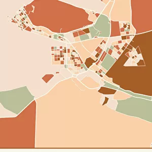
United Arab Emirates, Relief Map with Border and Mask

![]()
Wall Art and Photo Gifts from Universal Images Group (UIG)
United Arab Emirates, Relief Map with Border and Mask
Relief map of the United Arab Emirates (with border and mask). This image was compiled from data acquired by landsat 5 & 7 satellites combined with elevation data
Universal Images Group (UIG) manages distribution for many leading specialist agencies worldwide
Media ID 9613411
© Planet Observer/UIG
Coastline Desert Dubai Middle East Persian Gulf Relief Map Shore United Arab Emirates Gulf Of Oman Ras Al Khaimah Satellite View Sharjah
FEATURES IN THESE COLLECTIONS
> Aerial Photography
> Related Images
> Asia
> United Arab Emirates
> Dubai
> Asia
> United Arab Emirates
> Maps
> Asia
> United Arab Emirates
> Sharjah
> Universal Images Group (UIG)
> Universal Images Group
> Satellite and Aerial
> Planet Observer 4
EDITORS COMMENTS
This print showcases the intricate and diverse topography of the United Arab Emirates, a country known for its stunning landscapes. The relief map, created using data acquired by Landsat 5 & 7 satellites combined with elevation data, offers a detailed representation of this Middle Eastern nation. The image captures the vastness of the UAE's desert regions, stretching across the horizon in golden hues. Dubai's iconic skyline emerges from this sandy expanse, symbolizing modernity amidst nature's grandeur. Alongside lies the picturesque shoreline that borders the Persian Gulf, where azure waters meet pristine beaches. The horizontal composition allows viewers to appreciate every detail of this physical geography masterpiece. From Sharjah to Ras al Khaimah and beyond, each emirate is clearly outlined on this meticulously crafted map. The Gulf of Oman adds another dimension to this visual narrative as it gently caresses UAE's eastern coast. With no people in sight, one can truly immerse themselves in the natural beauty captured by satellite view photography. This color image serves as a testament to cartography expertise while highlighting how technology can provide us with awe-inspiring perspectives. Whether you are an enthusiast of geography or simply captivated by breathtaking landscapes, this print transports you into the heart of United Arab Emirates' remarkable terrain. It encapsulates both its rich cultural heritage and its harmonious coexistence with nature – an extraordinary fusion that defines UAE’s identity.
MADE IN AUSTRALIA
Safe Shipping with 30 Day Money Back Guarantee
FREE PERSONALISATION*
We are proud to offer a range of customisation features including Personalised Captions, Color Filters and Picture Zoom Tools
SECURE PAYMENTS
We happily accept a wide range of payment options so you can pay for the things you need in the way that is most convenient for you
* Options may vary by product and licensing agreement. Zoomed Pictures can be adjusted in the Cart.