Fraud Blocker Skip to main content

Home > Africa > Madagascar > Maps

Maps Collection

Madagascar is an island nation located off the coast of East Africa in the Indian Ocean

Choose a picture from our collection for your Wall Art and Photo Gifts

82 Items

Background imageMaps Collection: Map of Africa 1883

Map of Africa 1883
Warrens Common School Geography

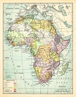
Background imageMaps Collection: Africa Political Map

Africa Political Map
Antique illustration of a Africa Political Map from 1893

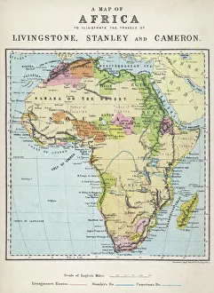
Background imageMaps Collection: Map of Africa illustrating travels of explorers

Map of Africa illustrating travels of explorers
A map of Africa which illustrates the travels of Livingstone, Stanley and Cameron. Date: 19th Century

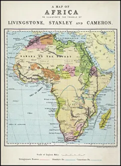
Background imageMaps Collection: Map of Africa illustrating travels of explorers

Map of Africa illustrating travels of explorers
A map of Africa which illustrates the travels of the explorers Livingstone, Stanley and Cameron

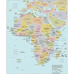
Background imageMaps Collection: Political Map of Africa

Political Map of Africa
Vector Illustration of the policital map of Africa Reference map as created by the US Central Intelligence Agency

Background imageMaps Collection: Madagascar country map

Madagascar country map
2011 edition

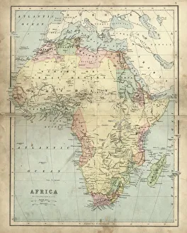
Background imageMaps Collection: Antique map of Africa in the 19th Century, 1873

Antique map of Africa in the 19th Century, 1873
Vintage engraving of a Victorian Antique map of Africa in the 19th Century, 1873

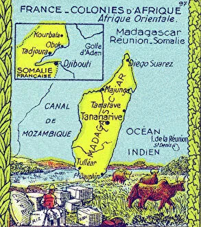
Background imageMaps Collection: Cartoon map of Madagascar

Cartoon map of Madagascar

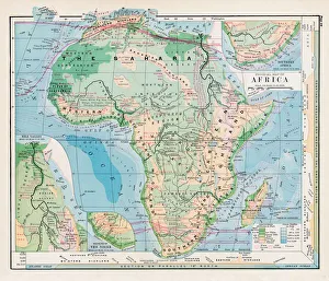
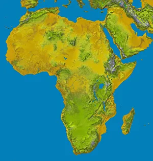
Background imageMaps Collection: Africa, topographic map

Africa, topographic map. Highlands and lowlands of the continents are shown as ridges and flat areas. Southern Europe and the Middle East are also seen at top and upper right respectively

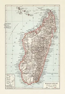
Background imageMaps Collection: Topografic map of Madagascar, lithograph, published in 1897

Topografic map of Madagascar, lithograph, published in 1897
Topografic map of Madagascar. Lithograph, published in 1897

Background imageMaps Collection: Madagascar Comores Islands map 1887

Madagascar Comores Islands map 1887
Map from La Premiere Annee de Geographie par P. Foncin - Paris 1887

Background imageMaps Collection: Vector illustration Africa map with countries names isolated on white background

Vector illustration Africa map with countries names isolated on white background. African continent icon

Background imageMaps Collection: Africa single states political map

Africa single states political map. Each country with its own color area. With national borders on white background Africa single states political map. Each country with its own color area

Background imageMaps Collection: Highly detailed physical map of Africa

Highly detailed physical map of Africa, in vector format, with all the relief forms, countries and big cities

Background imageMaps Collection: Map of part of the coast of Mozambique and the island of Madagascar

Map of part of the coast of Mozambique and the island of Madagascar
BL3289469 Map of part of the coast of Mozambique and the island of Madagascar

Background imageMaps Collection: Royal MS 20 E IX f.11v to f.12r Chart of the coasts of Asia and Africa from Cape Comorin to Cape Delgado

Royal MS 20 E IX f.11v to f.12r Chart of the coasts of Asia and Africa from Cape Comorin to Cape Delgado
BL3740764 Royal MS 20 E IX f.11v to f.12r Chart of the coasts of Asia and Africa from Cape Comorin to Cape Delgado, including the Persian Gulf and the Red Sea

Background imageMaps Collection: Carte des côtes méridionales d'Afrique et de l'entrée du Canal de Mozambique

Carte des côtes méridionales d'Afrique et de l'entrée du Canal de Mozambique
BL3700581 Carte des côtes méridionales d'Afrique et de l'entrée du Canal de Mozambique, dressée par M. Daussy

Background imageMaps Collection: Nossi Bé. Nosy Be. Madagascar, 1885 antique map

Nossi Bé. Nosy Be. Madagascar, 1885 antique map 'Nossi Bé'. Artist/engraver/cartographer: Engraved for Élisée Reclus. Provenance: "The Universal Geography"; by Élisée Reclus, Edited by A.H

Background imageMaps Collection: Madagascar Watercolor Map

Madagascar Watercolor Map
Michael Tompsett

Background imageMaps Collection: Madagascar Watercolor Map

Madagascar Watercolor Map
Michael Tompsett

Background imageMaps Collection: Map of Madagascar and Comoro Islands, c.1900 (engraving)

Map of Madagascar and Comoro Islands, c.1900 (engraving)
533398 Map of Madagascar and Comoro Islands, c.1900 (engraving); (add.info.: Map of Madagascar and Comoro Islands, circa 1902)

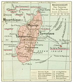
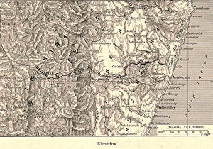
Background imageMaps Collection: L'Imerina; Iles Africaines de la mer des Indes, 1914. Creator: Unknown

L'Imerina; Iles Africaines de la mer des Indes, 1914. Creator: Unknown
L'Imerina; Iles Africaines de la mer des Indes, 1914. From "Grande Geographie Bong Illustree", 1914

Background imageMaps Collection: Afrique Sud- Orientale; Afrique Australe, 1914. Creator: Unknown

Afrique Sud- Orientale; Afrique Australe, 1914. Creator: Unknown
Afrique Sud- Orientale; Afrique Australe, 1914. From "Grande Geographie Bong Illustree", 1914

Background imageMaps Collection: Bathymetrie de l'Ouest de l'Ocean Indien; Iles Africaines de la mer des Indes

Bathymetrie de l'Ouest de l'Ocean Indien; Iles Africaines de la mer des Indes
Bathymetrie de l'Ouest de l'Ocean Indien; Iles Africaines de la mer des Indes, 1914. From "Grande Geographie Bong Illustree", 1914

Background imageMaps Collection: Diego- Suarez; Iles Africaines de la mer des Indes, 1914. Creator: Unknown

Diego- Suarez; Iles Africaines de la mer des Indes, 1914. Creator: Unknown
Diego- Suarez; Iles Africaines de la mer des Indes, 1914. From "Grande Geographie Bong Illustree", 1914

Background imageMaps Collection: Part of the eastern coast of Africa with the Island of Madagascar

Part of the eastern coast of Africa with the Island of Madagascar and the detailed maps of the islands belonging to France and Bourbon, engraving by G

Background imageMaps Collection: 13881304

13881304

Background imageMaps Collection: Old chromolithograph map of Madagascar, island country in the Indian Ocean

Old chromolithograph map of Madagascar, island country in the Indian Ocean
Antique Illustration, Copyright has expired on this artwork. From my own archives, digitally restored

Background imageMaps Collection: Antique map of island Madagascar 1896

Antique map of island Madagascar 1896 Original edition from my own archives Source : Brockhaus 1896

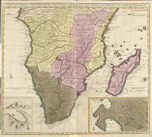
Background imageMaps Collection: Map of Meridional Africa (Angola, Namibia, Zambia, Zimbabwe, Mozambique

Map of Meridional Africa (Angola, Namibia, Zambia, Zimbabwe, Mozambique
LRI4706875 Map of Meridional Africa (Angola, Namibia, Zambia, Zimbabwe, Mozambique, South Africa) with the island of Madagascar (etching, 1730) by Delisle

Background imageMaps Collection: Map of Madagascar (litho)

Map of Madagascar (litho)
2818587 Map of Madagascar (litho) by French School, (19th century); Private Collection; (add.info.: Map of Madagascar. Carte de Madagascar. Baie de Diego-Suarez. Ile Mayotte. Nossy-Be)

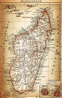
Background imageMaps Collection: Map of Madagascar

Map of Madagascar
Antique map of the African island of Madagascar

Background imageMaps Collection: MAP / AFRICA / MADAGASCAR

MAP / AFRICA / MADAGASCAR
Most of the interior of the island is described as unexplored Date: mid 19th century

Background imageMaps Collection: Map of Africa illustrating travels of explorers

Map of Africa illustrating travels of explorers
A map of Africa which illustrates the travels of the explorers Livingstone, Stanley and Cameron. Date: 19th Century

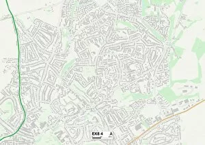
Background imageMaps Collection: Exeter EX8 4 Map

Exeter EX8 4 Map
Postcode Sector Map of Exeter EX8 4

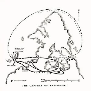
Background imageMaps Collection: The capture of Antsiranana, Madagascar, by the Royal Marines, World War II, 1942 (1944)

The capture of Antsiranana, Madagascar, by the Royal Marines, World War II, 1942 (1944). From " The Royal Marines - The Admiralty Account of Their Achievement 1939-43"

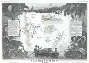
Background imageMaps Collection: 1852 Levassuer Map Of Senegal Senegambia And Madagascar

1852 Levassuer Map Of Senegal Senegambia And Madagascar
1852, Levassuer Map of Senegal, Senegambia, and Madagascar

Background imageMaps Collection: 1848 Levasseur Map Of Senegal Gambia And Madagascar

1848 Levasseur Map Of Senegal Gambia And Madagascar
1848, Levasseur Map of Senegal, Gambia and Madagascar

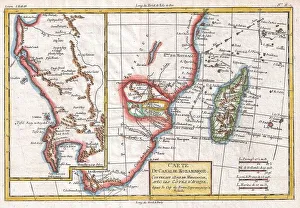
Background imageMaps Collection: 1780 Raynal And Bonne Map Of South Africa Zimbabwe

1780 Raynal And Bonne Map Of South Africa Zimbabwe
1780, Raynal and Bonne Map of South Africa, Zimbabwe, Madagascar, and Mozambique, Rigobert Bonne 1727 - 1794, one of the most important cartographers of the late 18th century

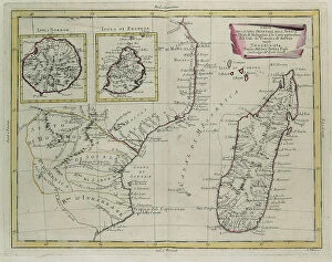
Background imageMaps Collection: 1770 Bonne Map Of East Africa Madagascar Isle Bourbon And Mauritius

1770 Bonne Map Of East Africa Madagascar Isle Bourbon And Mauritius
1770, Bonne Map of East Africa, Madagascar, Isle Bourbon and Mauritius, Mozambique, Rigobert Bonne 1727 - 1794, one of the most important cartographers of the late 18th century

Background imageMaps Collection: relief image of Africa by the Shuttle Radar Topography Mission (SRTM)

relief image of Africa by the Shuttle Radar Topography Mission (SRTM)
Relief image of Africa by the Shuttle Radar Topography Mission (SRTM). This release in 2000, includes data for all of the continent, plus the island of Madagascar and the Arabian Peninsula

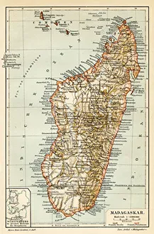
Background imageMaps Collection: Madagascar Ceylon map 1895

Madagascar Ceylon map 1895
Meyers Konversations-Lexikon. Ein Nachschlagewerk des allgemeinen Wissens, 5th edition 17 volumes Bibliographisches Institut - Leipzig 1895-1897

Background imageMaps Collection: Map of Africa 1895

Map of Africa 1895
The Rand-McNally Grammar School Geography 1895 - Chicago & New York

Background imageMaps Collection: Map of Africa 1877

Map of Africa 1877
Warrens Common School Geography 1877

Background imageMaps Collection: Map of Southern Africa, with illustrations showing distinguishing features

Map of Southern Africa, with illustrations showing distinguishing features
Former flag of South Africa

Background imageMaps Collection: Stereoscopic view of North America

Stereoscopic view of North America
February 2000 - This stereoscopic shaded relief image shows Africas topography as measured by the Shuttle Radar Topography Mission (SRTM) in February 2000

Background imageMaps Collection: Asia

Asia. Satellite image centred on Asia. The North Pole is at upper right. Water is blue, vegetation is green, arid areas are brown, and snow and ice are white

Background imageMaps Collection: Old chromolithograph map of Madagascar, island country in the Indian Ocean

Old chromolithograph map of Madagascar, island country in the Indian Ocean
Antique Illustration, Copyright has expired on this artwork. From my own archives, digitally restored

Background imageMaps Collection: Betsiboka River, Madagascar, True Colour Satellite Image

Betsiboka River, Madagascar, True Colour Satellite Image. Betsiboka river, the major river of Madagascar, goes into the Mozambique canal, close to the city of Mahajanga

Background imageMaps Collection: Globe Africa, True Colour Satellite Image

Globe Africa, True Colour Satellite Image. Earth. True colour satellite image of the Earth, centred on Africa. North is at top

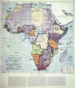
Background imageMaps Collection: Map of Africa in 1896

Map of Africa in 1896
Illustration of a Map of Africa in 1896

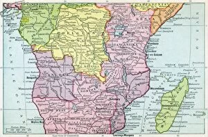
Background imageMaps Collection: Map Of Central Africa Circa 1930. From The Modern Atlas Of The World Published Circa 1930

Map Of Central Africa Circa 1930. From The Modern Atlas Of The World Published Circa 1930

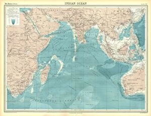
Background imageMaps Collection: Map of the Indian Ocean

Map of the Indian Ocean. Map showing the Indian subcontinent, East Africa, the Arabian peninsula, Indo-China and Western Australia. Plate 54 from The Times Atlas

Background imageMaps Collection: Map of Africa, with travellers routes

Map of Africa, with travellers routes
Map of Africa, with the routes of the modern travellers, Parke, Browne and Le Vaillant. 1799

Background imageMaps Collection: Gallieni, Colonial Administrator and Island of Madagascar

Gallieni, Colonial Administrator and Island of Madagascar
Map of the (then) French Overseas Territory, the island of Madagascar in the Indian Ocean - with inset portrait of Joseph Simon Gallieni (1849-1916)

Background imageMaps Collection: DR Congo, satellite image

DR Congo, satellite image
DR Congo. North is at top. Satellite image of the Democratic Republic of the Congo (DRC) in Central Africa, with the surrounding countries shaded out

Background imageMaps Collection: Madagascar And Comoros Islands Circa 1760

Madagascar And Comoros Islands Circa 1760. From Atlas De Toutes Les Parties Connues Du Globe Terrestre By Cartographer Rigobert Bonne Published Geneva Circa 1760

Background imageMaps Collection: Map Of Southern Africa And Madagascar

Map Of Southern Africa And Madagascar, Circa. 1760. From " Atlas De Toutes Les Parties Connues Du Globe Terrestre " By Cartographer Rigobert Bonne. Published Geneva Circa. 1760

Background imageMaps Collection: Map of Madagascar 1883

Map of Madagascar 1883
Encyclopedia Britannica 9th Edition New York Samuel L. Hall 1883 Vol XV

Background imageMaps Collection: Africa map 1893

Africa map 1893
Johnsonas Universal Cyclopedia - Charles Kendall - New York 1893

Background imageMaps Collection: Map of Africa 1889

Map of Africa 1889
Indiana Educational Series The Complete Geography - Indianapolis 1889

Background imageMaps Collection: Map of Africa 1889

Map of Africa 1889
Indiana Educational Series The Complete Geography - Indianapolis 1889

Background imageMaps Collection: Africa map 1881

Africa map 1881
Harpers School Geography, New York, Harpers and Brothers, 1881

Background imageMaps Collection: Madagascar strategic island by G. H. Davis

Madagascar strategic island by G. H. Davis
Madagascar, the strategic island to Allied communications in the East, occupied by British forces, forestalls a Japanese plot during the Second World War

Background imageMaps Collection: Victorian Map of Africa

Victorian Map of Africa
Engraved illustrations of a Map of Africa from Iconographic Encyclopedia of Science, Literature and Art, Published in 1851. Copyright has expired on this artwork. Digitally restored

Background imageMaps Collection: Africa map 1875

Africa map 1875
The Independent Course Comprehensive Geography by James Monteith, A.S. Barnes & Co, New York & Chicago 1875

Background imageMaps Collection: Africa political map 1895

Africa political map 1895
Meyers Konversations-Lexikon. Ein Nachschlagewerk des allgemeinen Wissens, 5th edition 17 volumes Bibliographisches Institut - Leipzig 1895-1897

Background imageMaps Collection: Africa political map 1895

Africa political map 1895
Meyers Konversations-Lexikon. Ein Nachschlagewerk des allgemeinen Wissens, 5th edition 17 volumes Bibliographisches Institut - Leipzig 1895-1897

Background imageMaps Collection: Main research trips in Africa 1895

Main research trips in Africa 1895
Meyers Konversations-Lexikon. Ein Nachschlagewerk des allgemeinen Wissens, 5th edition 17 volumes Bibliographisches Institut - Leipzig 1895-1897

Background imageMaps Collection: Antique map of Indian Ocean in southern hemisphere

Antique map of Indian Ocean in southern hemisphere

Background imageMaps Collection: Africa map 1878

Africa map 1878
Encyclopedia Britannica 9th Edition Vol I New York, Samuel Hall 1878

Background imageMaps Collection: Topographic view of Africa

Topographic view of Africa
This color shaded relief image shows the extent of digital elevation data for Africa recently released by the Shuttle Radar Topography Mission (SRTM)

Background imageMaps Collection: Map of the Cape of Good Hope (oil on panel)

Map of the Cape of Good Hope (oil on panel)
XOT351166 Map of the Cape of Good Hope (oil on panel) by Bonsignori, Stefano (fl.1575); Palazzo Vecchio (Cappella dei Priori) Florence, Italy; (add.info.: parte di buona speranza; capo; ); Italian

Background imageMaps Collection: WORLD MAP, c1492. World map showing only the Eastern Hemisphere

WORLD MAP, c1492. World map showing only the Eastern Hemisphere. One of the first maps to depict the Cape of Good Hope, Madagascar and Zanzibar

Background imageMaps Collection: Map of Madagascar by Jacques-Nicolas Bellin, 1766

Map of Madagascar by Jacques-Nicolas Bellin, 1766
Cartography, 18th century. Map of Madagascar by Jacques-Nicolas Bellin, 1766

Background imageMaps Collection: Map of Madagascar Island, from Isolario dell Atlante Veneto

Map of Madagascar Island, from Isolario dell Atlante Veneto
Cartography, 17th century. Madagascar Island, From the Isolario dell Atlante Veneto, Volume II, by Vincenzo Coronelli, Venice 1696-1697. Copper print on paper. 61 x 45.5 cm

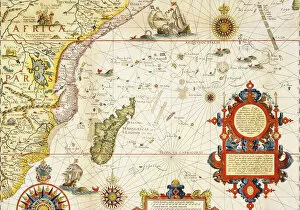
Background imageMaps Collection: The Indian Ocean and part of Asia and Africa: spring of the Nile river and Madagascar

The Indian Ocean and part of Asia and Africa: spring of the Nile river and Madagascar
Cartography, 16th century. The Indian Ocean and part of Asia and Africa: spring of the Nile river and Madagascar, from Atlas of the World in thirty-three Maps, by Battista Agnese, 1553

Background imageMaps Collection: Map of Madagascar

Map of Madagascar

Background imageMaps Collection: Global surface currents 2005-2007 C016 / 8119

Global surface currents 2005-2007 C016 / 8119
Global surface currents 2005-2007. Computer visualisation showing ocean surface currents around the tip of southern Africa, during the period from June 2005 to December 2007

Background imageMaps Collection: Europe and Africa, relief map

Europe and Africa, relief map. Globe centred on the continents of Europe and Africa, showing the ocean relief

Background imageMaps Collection: MADAGASCAR MAP, 1662. Map of Madagascar from Johannes Blaeus Atlas Major

MADAGASCAR MAP, 1662. Map of Madagascar from Johannes Blaeus Atlas Major
MADAGASCAR MAP, 1662. Map of Madagascar from Johannes Blaeus " Atlas Major, " Amsterdam, 1662

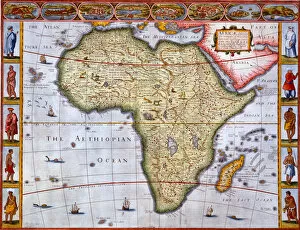
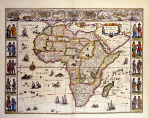
Background imageMaps Collection: Map of Africa

Map of Africa


All products are expertly crafted, using premium materials, tailored to your specifications and promptly shipped


-

Maps Collection

Madagascar is an island nation located off the coast of East Africa in the Indian Ocean, and is the fourth largest island in the world and home to some of the most unique wildlife on Earth. The geography of Madagascar is varied, with highlands, rainforests, deserts and beaches all present on this diverse landmass. Maps of Madagascar are essential for understanding its complex topography and for navigating its many regions. These maps show major cities, roads, rivers and other features that are important to know when travelling around this fascinating country. They also provide a visual representation of Madagascar’s unique flora and fauna, allowing visitors to appreciate its natural beauty from afar. With so much to explore in this remarkable place, they can invaluable tools for any traveler looking to make the most out of their visit to Madagascar Africa.
+

Our beautiful Wall Art and Photo Gifts include Framed Prints, Photo Prints, Poster Prints, Canvas Prints, Jigsaw Puzzles, Metal Prints and so much more

The Maps of Madagascar Africa collection from Media Storehouse is a stunning selection of wall art and framed prints that showcase the beauty and diversity of this unique African island nation. Featuring a range of vintage maps, illustrations, and satellite images, our collection offers a fascinating glimpse into the geography, history, and culture of Madagascar. From detailed topographical maps to colorful artistic renderings, each print in our collection captures the essence of Madagascar's landscapes and landmarks. Whether you're looking for an eye-catching centerpiece for your living room or a thoughtful gift for a travel enthusiast or geography buff, these high-quality prints are sure to impress. With options ranging from small unframed prints to large canvas artworks, there's something here for every taste and budget. So why not explore the Maps of Madagascar Africa collection today and discover the magic of this enchanting country?
+

What are Maps of Madagascar Africa art prints?

Maps of Madagascar Africa art prints are high-quality reproductions of maps that depict the island nation of Madagascar, located off the southeastern coast of Africa. These maps showcase the unique geography and topography of this diverse country, including its mountain ranges, rivers, and coastline. These art prints are perfect for anyone interested in African geography or history, as well as those who appreciate beautiful cartography. They can be used to decorate homes or offices with a touch of sophistication and elegance. We offer a wide variety of Maps of Madagascar Africa art prints in different sizes and styles to suit any taste or decor. Whether you prefer vintage-style maps or more modern designs, there is something for everyone in our collection. Our high-quality printing process ensures that these art prints will look stunning on any wall for years to come. So why not add some exotic flair to your home with one of our Maps of Madagascar Africa art prints today?
+

What Maps of Madagascar Africa art prints can I buy from Media Storehouse?

We offer a wide range of art prints featuring maps of Madagascar, Africa. These prints showcase the stunning landscapes and diverse cultures found on this beautiful island nation. Some of the available options include vintage maps that highlight the country's topography and natural features, as well as modern designs that incorporate vibrant colors and intricate details. In addition to traditional paper prints, Media Storehouse also offers canvas prints that are perfect for adding a touch of elegance to any room in your home or office. Whether you're looking for a unique gift for someone special or simply want to decorate your own space with beautiful artwork, there is sure to be a map print from Madagascar that will suit your needs. So why not explore our collection today and discover all the amazing options available? With so many different styles and sizes to choose from, you're sure to find something that captures the essence of this incredible country in just the right way.
+

How do I buy Maps of Madagascar Africa art prints?

To buy Maps of Madagascar Africa art prints from Media Storehouse, you can browse our extensive collection of artwork online. Once you have found the print that you would like to purchase, simply add it to your cart and proceed to checkout. At this point, you will be prompted to enter your payment and shipping information. We offer a variety of sizes and framing options for their art prints, so be sure to select the option that best suits your needs. Additionally, we offer a range of other products featuring Maps of Madagascar Africa artwork such as canvas prints or posters. If you have any questions about purchasing Maps of Madagascar Africa art prints from Media Storehouse, our customer service team is available via email or phone to assist with any inquiries or concerns that may arise during the ordering process.
+

How much do Maps of Madagascar Africa art prints cost?

We offer a wide range of Maps of Madagascar Africa art prints for purchase. The cost of these prints can vary depending on the size and type of print you choose. We have a variety of options available, including canvas prints, framed prints, and poster prints. Our Maps of Madagascar Africa art prints are created using high-quality materials to ensure that they are long-lasting and visually stunning. Each print is carefully crafted to capture the intricate details and beauty of this unique location. Whether you're looking for a small poster or a large canvas print, we have something to suit every budget. Our prices are competitive without compromising on quality, so you can be sure that you're getting great value for your money. Our Maps of Madagascar Africa art prints offer an affordable way to bring some culture and beauty into your home or office space.
+

How will my Maps of Madagascar Africa art prints be delivered to me?

Your Maps of Madagascar Africa art prints will be delivered to you in a safe and secure manner. We take great care in packaging our products so that they arrive at your doorstep undamaged. Our standard delivery method is via postal service, but we also offer express delivery options for those who need their prints sooner. Once your order has been processed, we will send you an email confirmation with tracking information so that you can keep track of your package's progress. If there are any issues with the delivery or if you have any questions about your order, please do not hesitate to contact our customer service team who will be happy to assist you. We want to ensure that you receive your Maps of Madagascar Africa art prints in perfect condition and enjoy them for years to come. Thank you for choosing Media Storehouse as your source for high-quality artwork.
© Copyright Media Storehouse, All Rights Reserved 2003 - 2025
Facebook     Pinterest     100% Payment Secure     Reviews IO