Canvas Print > Maps and Charts > Related Images
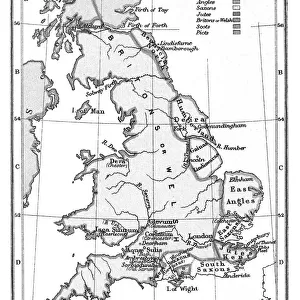
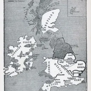
Canvas Print : Map of Anglo-Saxon Kingdoms and the Danelaw, 9th Century
![]()

Canvas Prints from Fine Art Storehouse
Map of Anglo-Saxon Kingdoms and the Danelaw, 9th Century
Vintage engraving of a Map of Anglo-Saxon Kingdoms and the Danelaw, 9th Century
Unleash your creativity and transform your space into a visual masterpiece!
duncan1890
Media ID 14549455
© This content is subject to copyright
20"x16" (51x41cm) Canvas Print
Discover the rich history of the Anglo-Saxon kingdoms and the Danelaw with our stunning Canvas Print of the "Map of Anglo-Saxon Kingdoms and the Danelaw, 9th Century" by duncan1890 from our Media Storehouse Fine Art collection. This captivating vintage engraving transports you back in time, offering a unique and intriguing glimpse into the political landscape of the early Middle Ages in Europe. The intricate details and bold lines are brought to life with our high-quality canvas printing process, ensuring a vibrant and long-lasting addition to any room in your home or office. Elevate your decor and ignite your imagination with this beautifully detailed and historically significant piece.
Delivered stretched and ready to hang our premium quality canvas prints are made from a polyester/cotton blend canvas and stretched over a 1.25" (32mm) kiln dried knot free wood stretcher bar. Packaged in a plastic bag and secured to a cardboard insert for safe transit.
Canvas Prints add colour, depth and texture to any space. Professionally Stretched Canvas over a hidden Wooden Box Frame and Ready to Hang
Estimated Image Size (if not cropped) is 35.9cm x 50.8cm (14.1" x 20")
Estimated Product Size is 40.6cm x 50.8cm (16" x 20")
These are individually made so all sizes are approximate
Artwork printed orientated as per the preview above, with portrait (vertical) orientation to match the source image.
FEATURES IN THESE COLLECTIONS
> Maps and Charts
> Related Images
> Fine Art Storehouse
> Map
> Historical Maps
EDITORS COMMENTS
This vintage engraving transports us back to the 9th century, offering a glimpse into the intricate tapestry of power and influence that defined Great Britain during the Anglo-Saxon era. The print showcases a meticulously detailed map, showcasing the various Anglo-Saxon kingdoms and their territories, as well as the enigmatic Danelaw. As our eyes wander across this historical masterpiece, we are drawn to the distinct boundaries that demarcate each kingdom - from Mercia in the heartland to Wessex in the south. Each region is intricately labeled, allowing us to immerse ourselves in an ancient world where rivalries and alliances shaped destinies. The inclusion of Danelaw adds another layer of intrigue to this artwork. This area represents lands under Viking control or influence during this period, highlighting both conflict and cultural exchange between these two formidable forces. Duncan1890's expert craftsmanship breathes life into this print, capturing every minute detail with precision and finesse. The delicate lines etched on paper evoke a sense of nostalgia for bygone times when maps were hand-drawn works of art rather than digital renderings. Whether you are an avid history enthusiast or simply appreciate fine artistry, this exquisite print serves as a window into a pivotal moment in British history. It invites contemplation about how these ancient kingdoms laid foundations for modern-day England while reminding us of our shared heritage rooted deep within these storied landscapes.
MADE IN AUSTRALIA
Safe Shipping with 30 Day Money Back Guarantee
FREE PERSONALISATION*
We are proud to offer a range of customisation features including Personalised Captions, Color Filters and Picture Zoom Tools
SECURE PAYMENTS
We happily accept a wide range of payment options so you can pay for the things you need in the way that is most convenient for you
* Options may vary by product and licensing agreement. Zoomed Pictures can be adjusted in the Cart.


