Canvas Print > Arts > Artists > O > Oceanic Oceanic
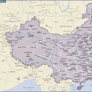
Canvas Print : Map of China and Japan, lithograph, published in 1875


![]()
Canvas Prints from Fine Art Storehouse
Map of China and Japan, lithograph, published in 1875
Map of China and Japan. Lithograph, published in 1875
Unleash your creativity and transform your space into a visual masterpiece!
Media ID 13666721
© ZU_09
Contour Drawing Country Geographic Area East Asian Culture Independent Mongolia Island Japan Japanese Culture Korea Land Pacific Ocean Sea Of Japan Or East Sea Taiwan Topographic Map Topography China East Asia Yellow Sea
20"x16" (51x41cm) Canvas Print
Step back in time with our exquisite Canvas Print of a historic Map of China and Japan, published in 1875. This stunning lithograph, part of our Media Storehouse collection from Fine Art Storehouse, transports you to a bygone era with intricate detail and vibrant colors. Perfect for adding a touch of history and culture to any room in your home or office. Experience the rich heritage of these two fascinating countries through this beautiful work of art.
Delivered stretched and ready to hang our premium quality canvas prints are made from a polyester/cotton blend canvas and stretched over a 1.25" (32mm) kiln dried knot free wood stretcher bar. Packaged in a plastic bag and secured to a cardboard insert for safe transit.
Canvas Prints add colour, depth and texture to any space. Professionally Stretched Canvas over a hidden Wooden Box Frame and Ready to Hang
Estimated Product Size is 50.8cm x 40.6cm (20" x 16")
These are individually made so all sizes are approximate
Artwork printed orientated as per the preview above, with landscape (horizontal) orientation to match the source image.
FEATURES IN THESE COLLECTIONS
> Arts
> Artists
> O
> Oceanic Oceanic
> Asia
> Japan
> Related Images
> Asia
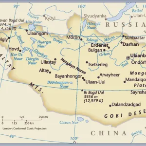
> Mongolia
> Related Images
> Asia
> Related Images
> Asia
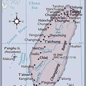
> Taiwan
> Related Images
> Fine Art Storehouse
> Map
> Historical Maps
EDITORS COMMENTS
This lithograph, published in 1875, showcases a detailed Map of China and Japan. A true antique engraved image, it offers a glimpse into the rich history and ancient cultures of East Asia. The topography is meticulously depicted, highlighting key features such as the Yellow Sea and the Sea of Japan (also known as the East Sea). The map also includes Taiwan, an island that holds great significance in this region. As we explore this vertical composition, our eyes are drawn to Independent Mongolia nestled between Japan and China. This representation reminds us of the intricate geopolitical dynamics at play during that era. The horizontal expanse reveals vast stretches of land bordered by seas - a testament to the significant role played by these countries in shaping regional politics and trade routes. The Pacific Ocean majestically sprawls beyond their shores, symbolizing their connection to larger global networks. This contour drawing serves not only as a geographical reference but also as a visual time capsule capturing East Asian culture from over 140 years ago. It allows us to appreciate how these nations have evolved while still cherishing their deep-rooted traditions. Whether you are an enthusiast of history or simply captivated by beautiful cartographic artistry, this photograph transports you back to an era when maps were cherished artifacts representing knowledge and exploration.
MADE IN AUSTRALIA
Safe Shipping with 30 Day Money Back Guarantee
FREE PERSONALISATION*
We are proud to offer a range of customisation features including Personalised Captions, Color Filters and Picture Zoom Tools
SECURE PAYMENTS
We happily accept a wide range of payment options so you can pay for the things you need in the way that is most convenient for you
* Options may vary by product and licensing agreement. Zoomed Pictures can be adjusted in the Cart.