Canvas Print > Animals > Birds > Passerines > Finches > Atlantic Canary
Canvas Print : Map of La Palma, Canary Islands


![]()
Canvas Prints from Mary Evans Picture Library
Map of La Palma, Canary Islands
Map of La Palma, Canary Islands. Date: circa 1908
Mary Evans Picture Library makes available wonderful images created for people to enjoy over the centuries
Media ID 14262716
© Mary Evans / Pharcide
Atlantic Canaries Canary Cruz Maps Palma Quisisana Tenerife
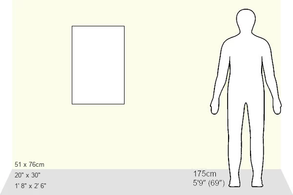
30"x20" (76x51cm) Canvas Print
"Bring the enchanting beauty of the Canary Islands into your home with our exquisite Canvas Prints from Media Storehouse. This particular piece features a captivating, vintage Map of La Palma, dating back to circa 1908. Sourced from Mary Evans Prints Online, this Rights Managed image showcases intricate details and rich colors, making it a stunning addition to any decor. Our high-quality canvas prints are meticulously crafted to bring out the vibrant hues and fine details of the map, ensuring a visually appealing and distinctive piece of art for your space. Elevate your interior design with a touch of history and the breathtaking allure of the Canary Islands. Order your Canvas Print of Map of La Palma today!"
Delivered stretched and ready to hang our premium quality canvas prints are made from a polyester/cotton blend canvas and stretched over a 1.25" (32mm) kiln dried knot free wood stretcher bar. Packaged in a plastic bag and secured to a cardboard insert for safe transit.
Canvas Prints add colour, depth and texture to any space. Professionally Stretched Canvas over a hidden Wooden Box Frame and Ready to Hang
Estimated Product Size is 50.8cm x 76.2cm (20" x 30")
These are individually made so all sizes are approximate
Artwork printed orientated as per the preview above, with portrait (vertical) orientation to match the source image.
FEATURES IN THESE COLLECTIONS
> Animals
> Birds
> Passerines
> Finches
> Atlantic Canary
> Animals
> Mammals
> Cricetidae
> Santa Cruz Mouse
> Animals
> Mammals
> Muridae
> Water Mouse
> Arts
> Artists
> O
> Oceanic Oceanic
> Europe
> France
> Canton
> Landes
> Maps and Charts
> Related Images
EDITORS COMMENTS
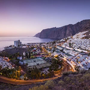
This map print, dated circa 1908, showcases the beautiful island of La Palma in the Canary Islands located in the Atlantic Ocean. The intricate details of the map reveal the various coastal towns and villages, including Santa Cruz de La Palma, the largest city and political capital, and the popular tourist destination of Quisisana, known for its Grand Hotel. The map provides a glimpse into the geography of the island, highlighting its rugged coastline, volcanic terrain, and the vast expanse of the Atlantic Ocean that surrounds it. The map also includes the neighboring islands of Tenerife, Gran Canaria, and El Hierro, adding to the grandeur of the view. The map serves as a testament to the rich history and natural beauty of the Canary Islands, which have been a popular destination for travelers since the late 1800s. The islands' unique location, situated near the intersection of the North and South Atlantic currents, offers a diverse climate and a wealth of natural resources, making it an ideal destination for exploration and relaxation. This map print is a beautiful addition to any home or office, transporting viewers to a time when travel was an adventure and the natural wonders of the world were a source of endless fascination. With its intricate details and stunning visual representation of the island, this map is a must-have for anyone with an appreciation for history, geography, or the natural world.
MADE IN AUSTRALIA
Safe Shipping with 30 Day Money Back Guarantee
FREE PERSONALISATION*
We are proud to offer a range of customisation features including Personalised Captions, Color Filters and Picture Zoom Tools
SECURE PAYMENTS
We happily accept a wide range of payment options so you can pay for the things you need in the way that is most convenient for you
* Options may vary by product and licensing agreement. Zoomed Pictures can be adjusted in the Cart.