
Canvas Print > Universal Images Group (UIG) > Universal Images Group > Satellite and Aerial > Planet Observer 6
Canvas Print : Libya, Relief Map


![]()
Canvas Prints from Universal Images Group (UIG)
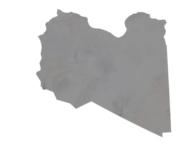
Libya, Relief Map
Relief map of Libya. This map was processed from elevation data
Universal Images Group (UIG) manages distribution for many leading specialist agencies worldwide
Media ID 9634177
© Planet Observer
Alsace Bas Rhin Geographical Border Relief Map Satellite View
20"x16" (51x41cm) Canvas Print
Bring the intricacies of geography into your home or office with our Canvas Prints from Media Storehouse. Featuring this stunning Relief Map of Libya from Universal Images Group (UIG), these prints are meticulously crafted from elevation data, offering a unique and visually engaging representation of the country's topography. Each print is beautifully printed on premium canvas material and coated with a protective, scratch-resistant finish, ensuring long-lasting vibrancy and clarity. Elevate your space with a touch of geographical artistry – order your Canvas Print of Libya Relief Map today.
Delivered stretched and ready to hang our premium quality canvas prints are made from a polyester/cotton blend canvas and stretched over a 1.25" (32mm) kiln dried knot free wood stretcher bar. Packaged in a plastic bag and secured to a cardboard insert for safe transit.
Canvas Prints add colour, depth and texture to any space. Professionally Stretched Canvas over a hidden Wooden Box Frame and Ready to Hang
Estimated Product Size is 50.8cm x 40.6cm (20" x 16")
These are individually made so all sizes are approximate
Artwork printed orientated as per the preview above, with landscape (horizontal) orientation to match the source image.
EDITORS COMMENTS
This print showcases a relief map of Libya, meticulously processed from elevation data. The intricate details and stunning topography depicted in this image offer a fascinating glimpse into the physical geography of this North African nation. With its vibrant colors and precise cartography, this photograph truly brings out the beauty and complexity of Libya's landscape. The absence of people in the frame allows us to focus solely on the geographical features that shape this land. From rugged mountain ranges to vast desert expanses, every contour is clearly visible, thanks to advanced satellite technology used for capturing this view. The geographical borders are also prominently displayed, providing valuable insights into Libya's territorial boundaries. Taken outdoors against a backdrop of Alsace in France, this vertical shot captures not only the essence of Libya but also highlights the versatility and global reach of Universal Images Group (UIG). Their dedication to delivering high-quality photography is evident through their ability to capture such detailed images from around the world. It is important to note that while UIG has provided us with this remarkable visual representation, it should be appreciated for its artistic value rather than any commercial use. This photograph serves as an educational tool for those interested in studying geography or simply admiring nature's wonders from afar.
MADE IN AUSTRALIA
Safe Shipping with 30 Day Money Back Guarantee
FREE PERSONALISATION*
We are proud to offer a range of customisation features including Personalised Captions, Color Filters and Picture Zoom Tools
SECURE PAYMENTS
We happily accept a wide range of payment options so you can pay for the things you need in the way that is most convenient for you
* Options may vary by product and licensing agreement. Zoomed Pictures can be adjusted in the Cart.