Home > Maps and Charts > Africa
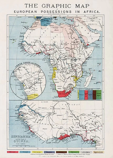
Map of European possessions in Africa in the 1880 s. After a map which appeared in the December 20th, 1884 edition of The Graphic
![]()

Wall Art and Photo Gifts from Design Pics
Map of European possessions in Africa in the 1880 s. After a map which appeared in the December 20th, 1884 edition of The Graphic
Design Pics offers Distinctively Different Imagery representing over 1,500 contributors
Media ID 24906212
© Ken Welsh
Africa Black Cartography Colonialism Colonies Colony Countries Geographical Geography Occupied Overseas Possession Territories Territory The Graphic Dependency Dominion Possessions Protectorate
FEATURES IN THESE COLLECTIONS
> Maps and Charts
> Early Maps
> Maps and Charts
> Related Images
EDITORS COMMENTS
This print showcases a historical map of European possessions in Africa during the 1880s. Reproduced from an original map featured in The Graphic's December 20th, 1884 edition, this piece offers a fascinating glimpse into the era of colonialism and territorial expansion. The map vividly illustrates the extensive reach of European powers across the African continent during this period. It depicts various colonies, protectorates, and dependencies established by nations such as Britain, France, Germany, Portugal, Belgium, and Italy. These territories are colorfully highlighted on the map to distinguish them from one another. The image serves as a powerful reminder of Europe's dominance over Africa at that time. It raises questions about power dynamics between white colonizers and indigenous black populations who were often subjected to exploitation under colonial rule. As an archival treasure preserved by Ken Welsh for Design Pics' collection, this print allows us to delve into history through cartography. It provides valuable insights into geographical boundaries and political landscapes prevalent in the late 19th century. Whether you're a history enthusiast or simply intrigued by old maps and their stories, this image is sure to transport you back in time while igniting curiosity about Africa's complex past.
MADE IN AUSTRALIA
Safe Shipping with 30 Day Money Back Guarantee
FREE PERSONALISATION*
We are proud to offer a range of customisation features including Personalised Captions, Color Filters and Picture Zoom Tools
SECURE PAYMENTS
We happily accept a wide range of payment options so you can pay for the things you need in the way that is most convenient for you
* Options may vary by product and licensing agreement. Zoomed Pictures can be adjusted in the Cart.


