Fraud Blocker Skip to main content

Home > Europe > France > Maps

Maps Collection (page 9)

Maps of France Europe are essential tools for travelers and tourists who want to explore the continent

11,167 items

Background imageMaps Collection: Labour unions in 1893 (engraving)

Labour unions in 1893 (engraving)
1802164 Labour unions in 1893 (engraving); (add.info.: map of France showing the dividing up of the workers trade unions in France in 1893 (1.300)

Background imageMaps Collection: Map of Saint Honore Street and Palais Royal, Paris, c.1750 (engraving)

Map of Saint Honore Street and Palais Royal, Paris, c.1750 (engraving)
1968556 Map of Saint Honore Street and Palais Royal, Paris, c.1750 (engraving); (add.info.: Map of Rue Saint Honore and the Palais Royal, France, mid-18th century. Paris)

Background imageMaps Collection: Science. Energy. The gas in Paris. Imagery, France, c.1930 (print)

Science. Energy. The gas in Paris. Imagery, France, c.1930 (print)
3433714 Science. Energy. The gas in Paris. Imagery, France, c.1930 (print); (add.info.: Sciences. Energies. Le gaz, combustible de Paris. Imagerie, France, vers 1930. Coll. Part. Science. Energy)

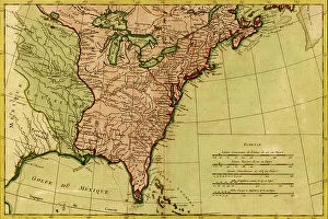
Background imageMaps Collection: French View of North America, 1762

French View of North America, 1762
2902787 French View of North America, 1762; (add.info.: North America from the Gulf of St. Lawrence to the Gulf of Mexico, west nearly to the Rocky Mountains.); Buyenlarge Archive/UIG

Background imageMaps Collection: A Map of British - French Settlements in America, 1755

A Map of British - French Settlements in America, 1755
2902786 A Map of British - French Settlements in America, 1755; (add.info.: A Map of British - French Settlements in America, 1755.); Buyenlarge Archive/UIG

Background imageMaps Collection: Nicea, 1700

Nicea, 1700
2900902 Nicea, 1700; (add.info.: Nicea Civitas. The city of Nice in France.); Buyenlarge Archive/UIG

Background imageMaps Collection: Villa Franca on the Mediterranean, 1700

Villa Franca on the Mediterranean, 1700
2900901 Villa Franca on the Mediterranean, 1700; (add.info.: Villefranche-sur-Mer is located about 4 miles east of the city of Nice, separated by Mont Boron, Mont Alban and Mont Vinaigrier)

Background imageMaps Collection: Cartoon against Thomas Jefferson's (Prairie Dog) secret negotiations for US purchase West Florida

Cartoon against Thomas Jefferson's (Prairie Dog) secret negotiations for US purchase West Florida from Spain
528387 Cartoon against Thomas Jefferson's (Prairie Dog) secret negotiations for US purchase West Florida from Spain. Napoleon as a hornet stings Jefferson to reveal the purchase price

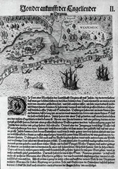
Background imageMaps Collection: The Englishmen's Arrival in Virginia: Map of Virginia coast showing Native territories Secotan

The Englishmen's Arrival in Virginia: Map of Virginia coast showing Native territories Secotan and Weapemoc
528106 The Englishmen's Arrival in Virginia: Map of Virginia coast showing Native territories Secotan and Weapemoc, and the Native community on Roanoak island at river mouth, 1590

Background imageMaps Collection: 19th Century Map of Paris with the River Seine depicted

19th Century Map of Paris with the River Seine depicted
1578946 19th Century Map of Paris with the River Seine depicted; (add.info.: 19th Century Map of Paris with the River Seine depicted. Dated 1880); Universal History Archive/UIG

Background imageMaps Collection: France (1887). The earthquare on the Riviera (South coast of Francia). Map (engraving)

France (1887). The earthquare on the Riviera (South coast of Francia). Map (engraving)
AIS5394021 France (1887). The earthquare on the Riviera (South coast of Francia). Map (engraving); © Lorio / Iberfoto

Background imageMaps Collection: View of Mecca, Persian miniature, 17th century (illuminated manscript)

View of Mecca, Persian miniature, 17th century (illuminated manscript)
AIS5355993 View of Mecca, Persian miniature, 17th century (illuminated manscript); Bibliotheque Nationale, Paris, France; © Iberfoto

Background imageMaps Collection: Plate extracted from a historical Atlas by Vidal Lablache, beg of 20th century (print)

Plate extracted from a historical Atlas by Vidal Lablache, beg of 20th century (print)
PCT4284029 Plate extracted from a historical Atlas by Vidal Lablache, beg of 20th century (print); (add.info.: Plate extracted from a historical Atlas by Vidal Lablache (Vidal-Lablache)

Background imageMaps Collection: Plate extracted from a historical Atlas by Vidal Lablache beg of 20th century (print)

Plate extracted from a historical Atlas by Vidal Lablache beg of 20th century (print)
PCT4284022 Plate extracted from a historical Atlas by Vidal Lablache beg of 20th century (print); (add.info.: Plate extracted from a historical Atlas by Vidal Lablache (Vidal-Lablache)

Background imageMaps Collection: Plate extracted from a historical Atlas by Vidal Lablache (Vidal-Lablache)

Plate extracted from a historical Atlas by Vidal Lablache (Vidal-Lablache)
PCT4284013 Plate extracted from a historical Atlas by Vidal Lablache (Vidal-Lablache: Paul Vidal de la Blache 1845-1918) debut twentyth (20th) century

Background imageMaps Collection: First tubular tramway project in Paris (underground electric railway between Vincennes)

First tubular tramway project in Paris (underground electric railway between Vincennes and Bois de Boulogne)
PCT4293742 First tubular tramway project in Paris (underground electric railway between Vincennes and Bois de Boulogne) - map of the route - cut under the rue de Rivoli showing the tunnel

Background imageMaps Collection: First World War 1914-1918 (War 14-18). Map of the western front between December 1914

First World War 1914-1918 (War 14-18). Map of the western front between December 1914 and October 1916
PCT4297712 First World War 1914-1918 (War 14-18). Map of the western front between December 1914 and October 1916, German advance - Italian front between June 1915

Background imageMaps Collection: La Manche (50), Basse Normandy (Basse-Normandie), France. Cherbourg, Mont Saint Michel, Granville

La Manche (50), Basse Normandy (Basse-Normandie), France. Cherbourg, Mont Saint Michel, Granville, Coutances
XEE4135028 La Manche (50), Basse Normandy (Basse-Normandie), France. Cherbourg, Mont Saint Michel, Granville, Coutances, Avranches and Saint Lo (Saint-Lo). Good geographic points

Background imageMaps Collection: First World War: Patriotic map showing a soldier in uniform coming from an Alsatian woman while a

First World War: Patriotic map showing a soldier in uniform coming from an Alsatian woman while a Farman plane flies
LUX4744431 First World War: Patriotic map showing a soldier in uniform coming from an Alsatian woman while a Farman plane flies over the scene and titled Les oiseaux de France

Background imageMaps Collection: First World War: Patriotic map showing France coming to search for its two lost regions at

First World War: Patriotic map showing France coming to search for its two lost regions at the border a map entitled
LUX4744416 First World War: Patriotic map showing France coming to search for its two lost regions at the border a map entitled Peace and Happiness

Background imageMaps Collection: Patriotic map showing a French soldier settles in an oral sliced and eating bread ' We

Patriotic map showing a French soldier settles in an oral sliced and eating bread " We
LUX4743607 Patriotic map showing a French soldier settles in an oral sliced and eating bread " We! we do not eat bread KK"

Background imageMaps Collection: Patriotic map showing a couple of sailors praying to the Virgin of Brittany before the start of

Patriotic map showing a couple of sailors praying to the Virgin of Brittany before the start of battle, 1915
LUX4743558 Patriotic map showing a couple of sailors praying to the Virgin of Brittany before the start of battle, 1915; (add.info)

Background imageMaps Collection: First World War: Patriotic Map of Four Children Degued as Soldiers, 1915

First World War: Patriotic Map of Four Children Degued as Soldiers, 1915
LUX4744262 First World War: Patriotic Map of Four Children Degued as Soldiers, 1915; (add.info.: World War I - War 14-18 (1914-1918) - World War I (WWI or WW1)

Background imageMaps Collection: First World War: Patriotic map showing a Sarthoise in costume bringing food to the soldier of a

First World War: Patriotic map showing a Sarthoise in costume bringing food to the soldier of a trench saying "O
LUX4744218 First World War: Patriotic map showing a Sarthoise in costume bringing food to the soldier of a trench saying "O the brave guys

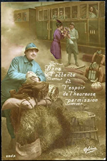
Background imageMaps Collection: Patriotic map showing a soldier in an oral trench thinks of the next permission that will bring

Patriotic map showing a soldier in an oral trench thinks of the next permission that will bring him back by train to
LUX4743408 Patriotic map showing a soldier in an oral trench thinks of the next permission that will bring him back by train to his home

Background imageMaps Collection: First World War: Patriotic map showing in Alsace a small Alsatian imitating a soldier who stands

First World War: Patriotic map showing in Alsace a small Alsatian imitating a soldier who stands guard in uniform
LUX4744090 First World War: Patriotic map showing in Alsace a small Alsatian imitating a soldier who stands guard in uniform and saying " Pridly like you, I want to bear arms"

Background imageMaps Collection: First World War: Patriotic map showing a soldier in uniform on guard surrounded by a strand of

First World War: Patriotic map showing a soldier in uniform on guard surrounded by a strand of lily of the valley
LUX4744033 First World War: Patriotic map showing a soldier in uniform on guard surrounded by a strand of lily of the valley and titled the Lucky Soldier of May

Background imageMaps Collection: First World War: Patriotic map showing a little boy holding April fish in his hand

First World War: Patriotic map showing a little boy holding April fish in his hand
LUX4743972 First World War: Patriotic map showing a little boy holding April fish in his hand and titled Glorious Avril a nos Vaillants

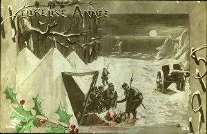
Background imageMaps Collection: First World War: Patriotic Greeting Map showing soldiers in a snow landscape around a wood fire

First World War: Patriotic Greeting Map showing soldiers in a snow landscape around a wood fire and titled Happy Year
LUX4743956 First World War: Patriotic Greeting Map showing soldiers in a snow landscape around a wood fire and titled Happy Year

Background imageMaps Collection: First World War: Patriotic map showing a little girl thinking of the absent who is an artillery

First World War: Patriotic map showing a little girl thinking of the absent who is an artillery waiter
LUX4743944 First World War: Patriotic map showing a little girl thinking of the absent who is an artillery waiter and laying near her cannon 75 and entitled A l'absent, 1915

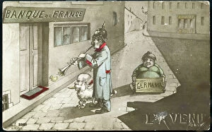
Background imageMaps Collection: First World War: France, Patriotic Map showing the defeated Germany coming to the bank of France

First World War: France, Patriotic Map showing the defeated Germany coming to the bank of France
LUX4739963 First World War: France, Patriotic Map showing the defeated Germany coming to the bank of France, titled: 'Bank of France the Future'

Background imageMaps Collection: First World War: France, Patriotic Map showing a drawing representing the superiority of French

First World War: France, Patriotic Map showing a drawing representing the superiority of French weapons, 1915
LUX4740584 First World War: France, Patriotic Map showing a drawing representing the superiority of French weapons, 1915, Map titled: Revenge of Our Weapons; (add.info)

Background imageMaps Collection: First World War: France, Patriotic Map showing the death of a young Frenchman defending his

First World War: France, Patriotic Map showing the death of a young Frenchman defending his village against
LUX4739803 First World War: France, Patriotic Map showing the death of a young Frenchman defending his village against the Germans, titled: 'how to die a young Frenchman', 1914, cartoonist: L. F

Background imageMaps Collection: First World War: France, Patriotic Map showing France and two soldiers in worship before the star

First World War: France, Patriotic Map showing France and two soldiers in worship before the star of France
LUX4739700 First World War: France, Patriotic Map showing France and two soldiers in worship before the star of France and our weapons: General Joffre

Background imageMaps Collection: First World War: France, Patriotic Map representing the Gallic rooster standing on a cannon 75

First World War: France, Patriotic Map representing the Gallic rooster standing on a cannon 75 celebrating victory for
LUX4739577 First World War: France, Patriotic Map representing the Gallic rooster standing on a cannon 75 celebrating victory for 1916, titled: '1916 Victor'

Background imageMaps Collection: First World War: France, Patriotic Map showing a young nurse treats a French soldier in uniform

First World War: France, Patriotic Map showing a young nurse treats a French soldier in uniform before treating a
LUX4739265 First World War: France, Patriotic Map showing a young nurse treats a French soldier in uniform before treating a German, entitled 'For Humanity'

Background imageMaps Collection: First World War: France, Patriotic Map showing Father Noel messenger to the Armies bringing toys

First World War: France, Patriotic Map showing Father Noel messenger to the Armies bringing toys for packages for
LUX4739211 First World War: France, Patriotic Map showing Father Noel messenger to the Armies bringing toys for packages for soldiers with children and their mother, 1917

Background imageMaps Collection: First World War: France, Patriotic Map showing a woman in love with her fiance

First World War: France, Patriotic Map showing a woman in love with her fiance, soldier on the forehead
LUX4742635 First World War: France, Patriotic Map showing a woman in love with her fiance, soldier on the forehead, seeking to be worthy of the cross of the heart, titled 'The Cross of the Heart'

Background imageMaps Collection: First World War: France, Patriotic Map showing a Russian soldier bringing a German flag to a young

First World War: France, Patriotic Map showing a Russian soldier bringing a German flag to a young girl in a Phrygian
LUX4742592 First World War: France, Patriotic Map showing a Russian soldier bringing a German flag to a young girl in a Phrygian hat representing the republic

Background imageMaps Collection: First World War: France, Patriotic Map showing a young Alsatian in traditional costume

First World War: France, Patriotic Map showing a young Alsatian in traditional costume, spinning tricolor wool, 1915
LUX4742498 First World War: France, Patriotic Map showing a young Alsatian in traditional costume, spinning tricolor wool, 1915

Background imageMaps Collection: First World War: France, Patriotic Map showing a little girl with a horseshoe

First World War: France, Patriotic Map showing a little girl with a horseshoe
LUX4742318 First World War: France, Patriotic Map showing a little girl with a horseshoe and a military kepi thinking of her father guarding in a snow landscape, titled: 'I think of you'

Background imageMaps Collection: First World War: France, Patriotic Map showing a little boy dresses in battleships hugging a

First World War: France, Patriotic Map showing a little boy dresses in battleships hugging a little girl in Alsatian
LUX4741156 First World War: France, Patriotic Map showing a little boy dresses in battleships hugging a little girl in Alsatian and thanking her for waiting for her

Background imageMaps Collection: First World War: France, Patriotic Map showing a mother and two daughters sending flowers to

First World War: France, Patriotic Map showing a mother and two daughters sending flowers to husband fighting at
LUX4740964 First World War: France, Patriotic Map showing a mother and two daughters sending flowers to husband fighting at the front

Background imageMaps Collection: First World War: France, Patriotic Map showing class 1919 leaving with joy

First World War: France, Patriotic Map showing class 1919 leaving with joy and courage to the front, 1918
LUX4740955 First World War: France, Patriotic Map showing class 1919 leaving with joy and courage to the front, 1918; (add.info.: World War I - War 14-18 (1914-1918) - World War I (WWI or WW1)

Background imageMaps Collection: First World War: France, Patriotic Map showing a sailor regaining his fiance during a leave, 1915

First World War: France, Patriotic Map showing a sailor regaining his fiance during a leave, 1915
LUX4741618 First World War: France, Patriotic Map showing a sailor regaining his fiance during a leave, 1915; (add.info.: World War I - War 14-18 (1914-1918) - World War I (WWI or WW1): France

Background imageMaps Collection: First World War: France, Patriotic Map showing France with its Phrygian cap

First World War: France, Patriotic Map showing France with its Phrygian cap and spee announcing peace for 1915, 1915
LUX4740949 First World War: France, Patriotic Map showing France with its Phrygian cap and spee announcing peace for 1915

Background imageMaps Collection: First World War: France, Patriotic Map showing King Albert and Queen Elizabeth posing on Deserte

First World War: France, Patriotic Map showing King Albert and Queen Elizabeth posing on Deserte Beach, 1914
LUX4741562 First World War: France, Patriotic Map showing King Albert and Queen Elizabeth posing on Deserte Beach, 1914, Map titled Last Flap of Heroic Belgium; (add.info)

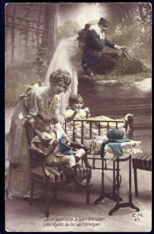
Background imageMaps Collection: First World War: France, Patriotic Map showing a woman knitting her little daughter a sweater for

First World War: France, Patriotic Map showing a woman knitting her little daughter a sweater for her father soldier at
LUX4740252 First World War: France, Patriotic Map showing a woman knitting her little daughter a sweater for her father soldier at the forehead during a vigorous winter and saying


All Professionally Made to Order for Quick Shipping


-

Maps Collection

Maps of France Europe are essential tools for travelers and tourists who want to explore the continent. They provide an overview of the country, its major cities, and its attractions and are show roads, rivers, mountains, lakes, and other natural features that make up the landscape. Additionally, they often include information about local customs and culture as well as points of interest such as museums or monuments, and are be found in bookstores or online in various formats including paper maps or digital versions that can be accessed on mobile devices. With a map of France Europe in hand travelers will have no trouble navigating their way around this beautiful country.
+

Our beautiful pictures are available as Framed Prints, Photos, Wall Art and Photo Gifts

The Maps of France Europe collection is a stunning assortment of wall art and framed prints that showcase the beauty and diversity of France. Our collection features an extensive range of maps, including antique maps dating back to the 16th century, as well as modern-day maps highlighting the country's cities, regions, and landmarks. Each print in our collection has been carefully curated by Media Storehouse to provide customers with a unique glimpse into French history and culture. From detailed depictions of Parisian streets to panoramic views of the Alps, these prints are sure to captivate anyone who loves France or European geography. Whether you're looking for a beautiful piece of artwork for your home or office or want to give someone special a thoughtful gift, Maps of France Europe offers something for everyone. With its high-quality printing techniques and durable framing options, our collection is sure to impress even the most discerning art enthusiasts.
+

What are Maps of France Europe art prints?

Maps of France Europe art prints are high-quality reproductions of vintage and contemporary maps showcasing the geography, topography, and landmarks of France and its neighboring European countries. These prints are perfect for those who love history, travel, or simply appreciate the beauty of cartography. The collection includes a wide range of styles, from antique maps dating back to the 16th century to modern designs featuring vibrant colors and intricate details. Some prints focus on specific regions or cities within France or Europe while others provide an overview of the entire continent. These art prints can be used to decorate any room in your home or office, adding a touch of sophistication and elegance to your space. They also make great gifts for anyone with an interest in geography or history. Whether you're looking for a unique piece to add to your personal collection or want to give someone special a thoughtful gift they'll treasure forever, Maps of France Europe art prints from Media Storehouse are sure to impress.
+

What Maps of France Europe art prints can I buy from Media Storehouse?

We offer a wide range of Maps of France Europe art prints that are perfect for those who love to travel or have an interest in geography. These maps come in various styles and designs, including vintage, antique, and modern versions. You can choose from different sizes and formats such as canvas prints, framed prints, posters or photographic prints. Some popular options include the Antique Map of France by John Speed which dates back to 1626; the Vintage Map of Paris which showcases the city's famous landmarks; and the Modern Map of Europe which highlights all major cities across the continent. Whether you're looking for a decorative piece for your home or office space or want to gift it to someone who loves history or geography- Media Storehouse has got you covered with their vast collection of Maps of France Europe art prints.
+

How do I buy Maps of France Europe art prints?

To buy Maps of France Europe art prints from Media Storehouse, you can browse through our extensive collection of maps and select the ones that interest you. Once you have made your selection, add them to your cart and proceed to checkout. You will be prompted to enter your shipping and payment information before completing the purchase. We offer a variety of sizes for their art prints, so make sure to choose the one that best fits your needs. The maps are printed on high-quality paper using state-of-the-art printing technology, ensuring that they look great in any setting. If you have any questions or concerns about purchasing Maps of France Europe art prints from Media Storehouse, our customer service team is available to assist you. They can provide additional information about the products or help with any issues that may arise during the ordering process.
+

How much do Maps of France Europe art prints cost?

We offer a wide range of Maps of France Europe art prints at varying prices. The cost of these prints depends on several factors such as the size, quality, and type of print you choose. Our standard paper prints are more affordable than our premium canvas or framed options. Additionally, some maps may be more intricate and detailed than others which can also impact the price. We strive to provide high-quality products at reasonable prices for all customers. Our Maps of France Europe art prints make great additions to any home or office decor and are perfect for history buffs or those who love travel. With a variety of sizes and styles available, there is something for everyone's taste and budget. We encourage customers to browse our selection online to find the perfect map print that fits their needs and preferences without breaking the bank.
+

How will my Maps of France Europe art prints be delivered to me?

We take great care in delivering your Maps of France Europe art prints to you. We use high-quality packaging materials to ensure that your artwork arrives in pristine condition. Your print will be carefully rolled and placed inside a sturdy tube for protection during transit. We work with trusted shipping partners who offer reliable delivery services. Once your order has been dispatched, you will receive an email notification with tracking information so that you can monitor the progress of your shipment. Our team is dedicated to providing excellent customer service, and we are always available to answer any questions or concerns you may have about the delivery process. If there are any issues with your order upon arrival, please contact us immediately so that we can resolve them as quickly as possible. You can trust Media Storehouse to deliver your Maps of France Europe art prints safely and efficiently straight to your doorstep.