Fraud Blocker Skip to main content

Home > Europe > France > Maps

Maps Collection (page 5)

Maps of France Europe are essential tools for travelers and tourists who want to explore the continent

11,167 items

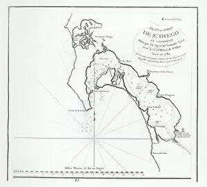
Background imageMaps Collection: San Diego Bay, California, from the itinerary of La Perouse, 1782 (engraving)

San Diego Bay, California, from the itinerary of La Perouse, 1782 (engraving)
XIR1272876 San Diego Bay, California, from the itinerary of La Perouse, 1782 (engraving) by French School, (18th century); Private Collection; (add.info)

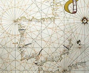
Background imageMaps Collection: Portolan Atlas, 1587. Map of the Iberian Peninsula
Portolan Atlas, 1587. Map of the Iberian Peninsula, the north coastline of Africa and the Vasque Countrys region in France. Made in Messina. Facsimile. Miniature Painting. SPAIN. Madrid

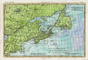
Background imageMaps Collection: Map / N America / Canada

Map / N America / Canada
The east coast of North America from New York to Newfoundland, showing habitats of Eskimaux, native American peoples, and the French colonies of Acadie, etc

Background imageMaps Collection: Map of French Railway Lines

Map of French Railway Lines

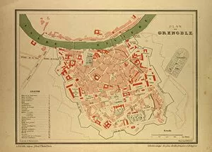
Background imageMaps Collection: Map of Grenoble, France

Map of Grenoble, France

Background imageMaps Collection: Map of Bouches Du Rhone, France

Map of Bouches Du Rhone, France

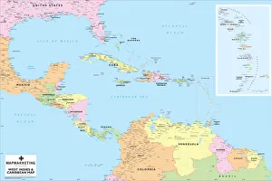
Background imageMaps Collection: West Indies and Caribbean Map

West Indies and Caribbean Map
This Caribbean map covers an area from Dallas in the north to Esmeraldes in the south and from Mexico City in the west to French Guiana in the east

Background imageMaps Collection: 1864, Garnier Map of Pairs, France w-Monuments, topography, cartography, geography

1864, Garnier Map of Pairs, France w-Monuments, topography, cartography, geography
1864, Garnier Map of Pairs, France w-Monuments

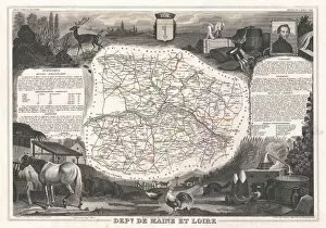
Background imageMaps Collection: 1852, Levasseur Map of the Department De Maine et Loire, France, topography, cartography

1852, Levasseur Map of the Department De Maine et Loire, France, topography, cartography
1852, Levasseur Map of the Department De Maine et Loire, France

Background imageMaps Collection: Map of Savoie, 1896, France

Map of Savoie, 1896, France

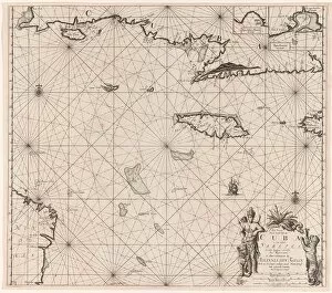
Background imageMaps Collection: Sea chart of the south coast of Cuba and Jamaica, Jan Luyken, Claes Jansz Voogt

Sea chart of the south coast of Cuba and Jamaica, Jan Luyken, Claes Jansz Voogt, Johannes van Keulen (I), 1684 - 1799

Background imageMaps Collection: Australia Map Gotha, Justus Perthes, 1872, Atlas

Australia Map Gotha, Justus Perthes, 1872, Atlas. Perthes, Johan Georg Justus 1749 aa 1816, German publisher, was born in Rudolstadt in 1749

Background imageMaps Collection: Sketch of part of the Island of Corsica, 1794 (pen, ink, wash)

Sketch of part of the Island of Corsica, 1794 (pen, ink, wash)
7339462 Sketch of part of the Island of Corsica, 1794 (pen, ink, wash) by Dundas, H. (18th century); 59x47 cm; National Maritime Museum, London, UK; (add.info.: Creator: H. Dundas Scale: 1:45 000)

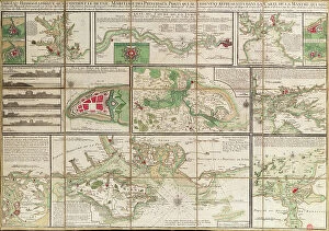
Background imageMaps Collection: A table containing details of the main maritime ports that are represented in the map of

A table containing details of the main maritime ports that are represented in the map of the English Channel
7339430 A table containing details of the main maritime ports that are represented in the map of the English Channel, c.1780 (paper, linen) by Unknown artist

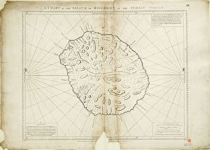
Background imageMaps Collection: A chart of the Island of Bourbon in the Indian Ocean, 1780 (paper)

A chart of the Island of Bourbon in the Indian Ocean, 1780 (paper)
7339415 A chart of the Island of Bourbon in the Indian Ocean, 1780 (paper) by Gilbert, William (18th century); 61x93 cm; National Maritime Museum, London

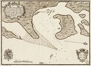
Background imageMaps Collection: South China Sea, 1757 (engraving)

South China Sea, 1757 (engraving)
7339393 South China Sea, 1757 (engraving) by Spanish School, (18th century); 30x40.5 cm; National Maritime Museum, London, UK; (add.info.: Creator: Pedro Manuel de Arandia; Laur)

Background imageMaps Collection: Bay of Bengal, c.1660 (engraving)

Bay of Bengal, c.1660 (engraving)
7339392 Bay of Bengal, c.1660 (engraving) by Unknown Artist, (17th century); 31x40 cm; National Maritime Museum, London, UK; (add.info.: Creator: Anonymous Single sheet. Engr)

Background imageMaps Collection: Sheet 16 from: An exact survey of the cities of London and Westminster, the Borough of Southwark

Sheet 16 from: An exact survey of the cities of London and Westminster, the Borough of Southwark
7340520 Sheet 16 from: An exact survey of the cities of London and Westminster, the Borough of Southwark, with the country near ten miles round..., 1746 (coloured engraving) by Rocque

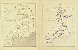
Background imageMaps Collection: Middle course: map of the Rhone basin to be reproduced, c.1880-90 (print)

Middle course: map of the Rhone basin to be reproduced, c.1880-90 (print)
8713431 Middle course: map of the Rhone basin to be reproduced, c.1880-90 (print); 22 x 17 cm; Private Collection; (add.info.: in "Practical method of writing-reading by A)

Background imageMaps Collection: Chart of the Archipelago to the Northward ot Mauritius laid down in 1776 by M le Victe Grenier

Chart of the Archipelago to the Northward ot Mauritius laid down in 1776 by M le Victe Grenier Lieut in the French Navy
7342593 Chart of the Archipelago to the Northward ot Mauritius laid down in 1776 by M le Victe Grenier Lieut in the French Navy [Includes Seychelles

Background imageMaps Collection: Map of Greenford, Osterley, Ealing and Kew, 1746 (coloured engraving)

Map of Greenford, Osterley, Ealing and Kew, 1746 (coloured engraving)
7340517 Map of Greenford, Osterley, Ealing and Kew, 1746 (coloured engraving) by Rocque, John (c.1704-d.1762); 51x67 cm; National Maritime Museum, London

Background imageMaps Collection: Map of Wimbledon and Tooting, 1746 (coloured engraving)

Map of Wimbledon and Tooting, 1746 (coloured engraving)
7340512 Map of Wimbledon and Tooting, 1746 (coloured engraving) by Rocque, John (c.1704-d.1762); 51x67 cm; National Maritime Museum, London

Background imageMaps Collection: Map of Highgate, Kentish Town, Holloway, Tottenham and Newington, 1746 (coloured engraving)

Map of Highgate, Kentish Town, Holloway, Tottenham and Newington, 1746 (coloured engraving)
7340507 Map of Highgate, Kentish Town, Holloway, Tottenham and Newington, 1746 (coloured engraving) by Rocque, John (c.1704-d.1762); 51x67 cm; National Maritime Museum, London

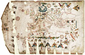
Background imageMaps Collection: Mediterranean, Black Sea and the North East Atlantic, 1548 (vellum)

Mediterranean, Black Sea and the North East Atlantic, 1548 (vellum)
7340478 Mediterranean, Black Sea and the North East Atlantic, 1548 (vellum) by Maggiolo, Jacopo Vesconte (1475-1549/61); 79x118 cm; National Maritime Museum, London

Background imageMaps Collection: Plan of the Island of Dominica laid down by actual survey under the direction of the Honorable

Plan of the Island of Dominica laid down by actual survey under the direction of the Honorable the Commissioners for
7340451 Plan of the Island of Dominica laid down by actual survey under the direction of the Honorable the Commissioners for the Sale of Lands in the Ceded Islands by John Byres Chief Surveyor 1776

Background imageMaps Collection: A chart of the entrance into the Channel containing the west coast of Cornwall

A chart of the entrance into the Channel containing the west coast of Cornwall
7340130 A chart of the entrance into the Channel containing the west coast of Cornwall and Scilly Islands with all the soundings, 1779 (copperplate engraving) by British School

Background imageMaps Collection: Plan of Rochefort, 1724 (watercolour)

Plan of Rochefort, 1724 (watercolour)
7339802 Plan of Rochefort, 1724 (watercolour) by Unknown artist, (18th century); 39x52 cm; National Maritime Museum, London

Background imageMaps Collection: Chart of the Black Sea, c.1600 (manuscript)

Chart of the Black Sea, c.1600 (manuscript)
7339792 Chart of the Black Sea, c.1600 (manuscript) by Unknown Artist, (17th century); 47x35 cm; National Maritime Museum, London, UK; (add.info.: Creator: unknown Bound in an atlas of six charts)

Background imageMaps Collection: This type of early vellum sea chart originated in the Mediterranean in the 13th century

This type of early vellum sea chart originated in the Mediterranean in the 13th century., c.1610 (manuscript)
7339782 This type of early vellum sea chart originated in the Mediterranean in the 13th century., c.1610 (manuscript) by Unknown Artist, (17th century); 40x56 cm; National Maritime Museum, London

Background imageMaps Collection: This type of early vellum sea chart originated in the Mediterranean in the 13th century

This type of early vellum sea chart originated in the Mediterranean in the 13th century., c.1610 (manuscript)
7339780 This type of early vellum sea chart originated in the Mediterranean in the 13th century., c.1610 (manuscript) by Unknown Artist, (17th century); 40x56 cm; National Maritime Museum, London

Background imageMaps Collection: Mediterranean archipelago Rhodes Island surveyed...under the direction of Com'r T Graves RN HMS

Mediterranean archipelago Rhodes Island surveyed...under the direction of Com'r T Graves RN HMS 'Beacon'
7342521 Mediterranean archipelago Rhodes Island surveyed...under the direction of Com'r T Graves RN HMS 'Beacon' (1841), 1862-1906 (engraving) by Walker, J. & C

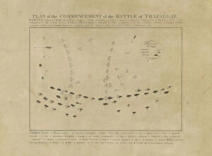
Background imageMaps Collection: Plan of the Commencement of the Battle of Trafalgar, 19th century (etching)

Plan of the Commencement of the Battle of Trafalgar, 19th century (etching)
7342311 Plan of the Commencement of the Battle of Trafalgar, 19th century (etching) by Unknown Artist, (19th century); 29.5x35.8 cm; National Maritime Museum, London

Background imageMaps Collection: A chart of the easternmost part of the East Indies with all the adjacent islands from Cape Comorin

A chart of the easternmost part of the East Indies with all the adjacent islands from Cape Comorin to Japan
7340780 A chart of the easternmost part of the East Indies with all the adjacent islands from Cape Comorin to Japan, 1675 (Hand coloured engraving) by Seller

Background imageMaps Collection: Pocket atlas and nautical almanac, c.1546 (vellum)

Pocket atlas and nautical almanac, c.1546 (vellum)
7340753 Pocket atlas and nautical almanac, c.1546 (vellum) by Brouscon, Guillaume (16th century); National Maritime Museum, London

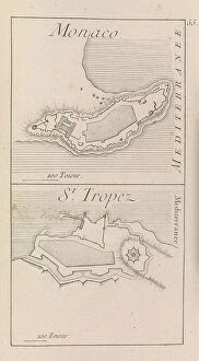
Background imageMaps Collection: The fortifications of Monaco and St. Tropez , c.1760? (print)

The fortifications of Monaco and St. Tropez , c.1760? (print)
7340632 The fortifications of Monaco and St. Tropez , c.1760? (print) by French School, (18th century); National Maritime Museum, London, UK; (add.info.: Georges-Louis Le Rouge (c)

Background imageMaps Collection: Map of Hounslow, Twickenham and Richmond, 1746 (coloured engraving)

Map of Hounslow, Twickenham and Richmond, 1746 (coloured engraving)
7340518 Map of Hounslow, Twickenham and Richmond, 1746 (coloured engraving) by Rocque, John (c.1704-d.1762); 51x67 cm; National Maritime Museum, London

Background imageMaps Collection: Map of Bow, Stratford, Blackwall and Plaistow, 1746 (coloured engraving)

Map of Bow, Stratford, Blackwall and Plaistow, 1746 (coloured engraving)
7340506 Map of Bow, Stratford, Blackwall and Plaistow, 1746 (coloured engraving) by Rocque, John (c.1704-d.1762); 51x67 cm; National Maritime Museum, London

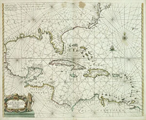
Background imageMaps Collection: Pascaerte vande Caribische eylanden, vande Barbados tot aende Bocht van Mexico

Pascaerte vande Caribische eylanden, vande Barbados tot aende Bocht van Mexico, 1661 (technical drawing)
7340062 Pascaerte vande Caribische eylanden, vande Barbados tot aende Bocht van Mexico, 1661 (technical drawing) by Doncker, Hendrick (c.1626-99); 43.5x53 cm; National Maritime Museum, London

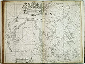
Background imageMaps Collection: A chart of the trading part of the East Indies and China, with the adjacent islands

A chart of the trading part of the East Indies and China, with the adjacent islands, from Surrat to Japan, 1677 (print)
7340055 A chart of the trading part of the East Indies and China, with the adjacent islands, from Surrat to Japan, 1677 (print) by Seller, John (1632-97); 44.5x56 cm; National Maritime Museum

Background imageMaps Collection: 'A new mappe of the sea coasts of England, France and Holland, wherein the English names, situation

'A new mappe of the sea coasts of England, France and Holland, wherein the English names, situation
7340046 'A new mappe of the sea coasts of England, France and Holland, wherein the English names, situation, point of the compass, and distance of the several ports, harbours, havens, creeks

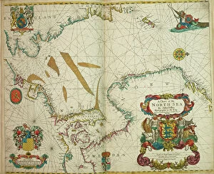
Background imageMaps Collection: A chart of the North Sea, 1675 (coloured engraving)

A chart of the North Sea, 1675 (coloured engraving)
7340044 A chart of the North Sea, 1675 (coloured engraving) by Seller, John (1632-97); 43.5x54 cm; National Maritime Museum, London

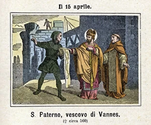
Background imageMaps Collection: Saint Patern (ou Paterne) de Vannes, 1886 (engraving)

Saint Patern (ou Paterne) de Vannes, 1886 (engraving)
FGL5500164 Saint Patern (ou Paterne) de Vannes, 1886 (engraving); (add.info.: San Paterno Bishop of Vannes, born nell'Armorica (490-560 or so, according to other sources)

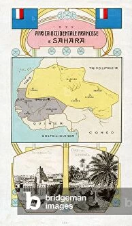
Background imageMaps Collection: CARTOGRAPHY 'French West Africa and Sahara'

CARTOGRAPHY "French West Africa and Sahara"
6202965 CARTOGRAPHY "French West Africa and Sahara"; (add.info.: CARTOGRAPHY "French West Africa and Sahara". Flag, cartography and view of Tombuctu and an Oasis in the desert)

Background imageMaps Collection: Colonialism: mapping of the Algiers region (chromolithograph)

Colonialism: mapping of the Algiers region (chromolithograph)
FGL5471170 Colonialism: mapping of the Algiers region (chromolithograph); (add.info.: French vignette from the collection, Edition de la Chocolaterie d'Aiguebelle ", chromolithography)

Background imageMaps Collection: Allegory of German Unity 1871 (Germany and Prussia reunited): The Reich 1871

Allegory of German Unity 1871 (Germany and Prussia reunited): The Reich 1871
FGL5479410 Allegory of German Unity 1871 (Germany and Prussia reunited): The Reich 1871. Sadowa's victory on 03/07/1866, won by the Prussians over the Austrians

Background imageMaps Collection: Vellum chart of Africa, India and the Mediterranean, 1554 (vellum)

Vellum chart of Africa, India and the Mediterranean, 1554 (vellum)
7339652 Vellum chart of Africa, India and the Mediterranean, 1554 (vellum) by Agnese, Battista (c.1500-64); 26x40 cm; National Maritime Museum, London

Background imageMaps Collection: A map of the British and French dominions in North America with the roads, distances

A map of the British and French dominions in North America with the roads, distances
7339367 A map of the British and French dominions in North America with the roads, distances, limits and extent of the settlements

Background imageMaps Collection: 'A chart of the islands in the China Sea near the Straits of Malacca with the positions of

'A chart of the islands in the China Sea near the Straits of Malacca with the positions of the English fleet
7339495 'A chart of the islands in the China Sea near the Straits of Malacca with the positions of the English fleet and the squadron of Admiral Linois on the 14 & 15th February 1804'


All Professionally Made to Order for Quick Shipping


-

Maps Collection

Maps of France Europe are essential tools for travelers and tourists who want to explore the continent. They provide an overview of the country, its major cities, and its attractions and are show roads, rivers, mountains, lakes, and other natural features that make up the landscape. Additionally, they often include information about local customs and culture as well as points of interest such as museums or monuments, and are be found in bookstores or online in various formats including paper maps or digital versions that can be accessed on mobile devices. With a map of France Europe in hand travelers will have no trouble navigating their way around this beautiful country.
+

Our beautiful pictures are available as Framed Prints, Photos, Wall Art and Photo Gifts

The Maps of France Europe collection is a stunning assortment of wall art and framed prints that showcase the beauty and diversity of France. Our collection features an extensive range of maps, including antique maps dating back to the 16th century, as well as modern-day maps highlighting the country's cities, regions, and landmarks. Each print in our collection has been carefully curated by Media Storehouse to provide customers with a unique glimpse into French history and culture. From detailed depictions of Parisian streets to panoramic views of the Alps, these prints are sure to captivate anyone who loves France or European geography. Whether you're looking for a beautiful piece of artwork for your home or office or want to give someone special a thoughtful gift, Maps of France Europe offers something for everyone. With its high-quality printing techniques and durable framing options, our collection is sure to impress even the most discerning art enthusiasts.
+

What are Maps of France Europe art prints?

Maps of France Europe art prints are high-quality reproductions of vintage and contemporary maps showcasing the geography, topography, and landmarks of France and its neighboring European countries. These prints are perfect for those who love history, travel, or simply appreciate the beauty of cartography. The collection includes a wide range of styles, from antique maps dating back to the 16th century to modern designs featuring vibrant colors and intricate details. Some prints focus on specific regions or cities within France or Europe while others provide an overview of the entire continent. These art prints can be used to decorate any room in your home or office, adding a touch of sophistication and elegance to your space. They also make great gifts for anyone with an interest in geography or history. Whether you're looking for a unique piece to add to your personal collection or want to give someone special a thoughtful gift they'll treasure forever, Maps of France Europe art prints from Media Storehouse are sure to impress.
+

What Maps of France Europe art prints can I buy from Media Storehouse?

We offer a wide range of Maps of France Europe art prints that are perfect for those who love to travel or have an interest in geography. These maps come in various styles and designs, including vintage, antique, and modern versions. You can choose from different sizes and formats such as canvas prints, framed prints, posters or photographic prints. Some popular options include the Antique Map of France by John Speed which dates back to 1626; the Vintage Map of Paris which showcases the city's famous landmarks; and the Modern Map of Europe which highlights all major cities across the continent. Whether you're looking for a decorative piece for your home or office space or want to gift it to someone who loves history or geography- Media Storehouse has got you covered with their vast collection of Maps of France Europe art prints.
+

How do I buy Maps of France Europe art prints?

To buy Maps of France Europe art prints from Media Storehouse, you can browse through our extensive collection of maps and select the ones that interest you. Once you have made your selection, add them to your cart and proceed to checkout. You will be prompted to enter your shipping and payment information before completing the purchase. We offer a variety of sizes for their art prints, so make sure to choose the one that best fits your needs. The maps are printed on high-quality paper using state-of-the-art printing technology, ensuring that they look great in any setting. If you have any questions or concerns about purchasing Maps of France Europe art prints from Media Storehouse, our customer service team is available to assist you. They can provide additional information about the products or help with any issues that may arise during the ordering process.
+

How much do Maps of France Europe art prints cost?

We offer a wide range of Maps of France Europe art prints at varying prices. The cost of these prints depends on several factors such as the size, quality, and type of print you choose. Our standard paper prints are more affordable than our premium canvas or framed options. Additionally, some maps may be more intricate and detailed than others which can also impact the price. We strive to provide high-quality products at reasonable prices for all customers. Our Maps of France Europe art prints make great additions to any home or office decor and are perfect for history buffs or those who love travel. With a variety of sizes and styles available, there is something for everyone's taste and budget. We encourage customers to browse our selection online to find the perfect map print that fits their needs and preferences without breaking the bank.
+

How will my Maps of France Europe art prints be delivered to me?

We take great care in delivering your Maps of France Europe art prints to you. We use high-quality packaging materials to ensure that your artwork arrives in pristine condition. Your print will be carefully rolled and placed inside a sturdy tube for protection during transit. We work with trusted shipping partners who offer reliable delivery services. Once your order has been dispatched, you will receive an email notification with tracking information so that you can monitor the progress of your shipment. Our team is dedicated to providing excellent customer service, and we are always available to answer any questions or concerns you may have about the delivery process. If there are any issues with your order upon arrival, please contact us immediately so that we can resolve them as quickly as possible. You can trust Media Storehouse to deliver your Maps of France Europe art prints safely and efficiently straight to your doorstep.