Fraud Blocker Skip to main content

Greetings Card > Europe > France > Paris > Maps

Maps Greetings Card Collection (#45)

Discover the enchanting beauty of Paris, France, with our Maps of Paris collection from Media Storehouse. These exquisite greeting cards showcase intricate and detailed maps of the City of Light, highlighting iconic landmarks such as the Eiffel Tower, Notre-Dame Cathedral, and the Louvre Museum. Each card is printed on high-quality paper, ensuring vibrant colors and crisp lines that will make your message stand out. Whether for a birthday, anniversary, or just to say hello, these cards are the perfect way to transport your loved ones to the romantic streets of Paris. Add a touch of European charm to your correspondence with our Maps of Paris collection.

Maps of Paris, France, Europe are invaluable resources for anyone visiting or living in the city

2,145 Greetings Cards

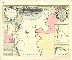
Background imageMaps Greetings Card Collection: Map Carte marine de la Mer Caspiene levA e suivant les ordres de S. M

Map Carte marine de la Mer Caspiene levA e suivant les ordres de S. M
Map, Carte marine de la Mer Caspiene levee suivant les ordres de S.M. czariene, par Mr. Carl Vanverden en 1719, 1720, et 1721

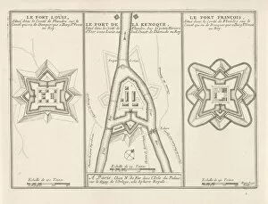
Background imageMaps Greetings Card Collection: Three forts Flanders c 1693-1696 Fort Louis Fort de la Kenoque

Three forts Flanders c 1693-1696 Fort Louis Fort de la Kenoque
Three forts in Flanders, c. 1693-1696 The Fort Louis / The Fort de la Kenoque / The Fort Francois (title on object) The forces of Europe, description of principals villes

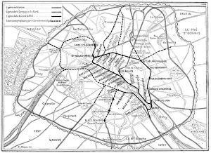
Background imageMaps Greetings Card Collection: Antique scientific engraving illustration: Paris Metro Subway map

Antique scientific engraving illustration: Paris Metro Subway map

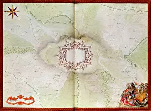
Background imageMaps Greetings Card Collection: Map of Phalsbourg, from the Atlas de Louis XIV (w / c on paper)

Map of Phalsbourg, from the Atlas de Louis XIV (w / c on paper)
2562877 Map of Phalsbourg, from the Atlas de Louis XIV (w/c on paper) by French School, (17th century); Bibliotheque du Genie, Paris, France; (add.info.: Plan of Phalsburg); French, out of copyright

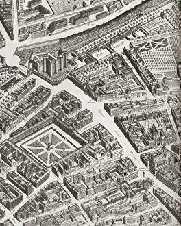
Background imageMaps Greetings Card Collection: Fragment Of The Turgot Map Of Paris, France, Showing La Porte Saint-Antoine

Fragment Of The Turgot Map Of Paris, France, Showing La Porte Saint-Antoine, The Great Entrance To The East Of Paris That Defended The Bastille. From A Contemporary Print

Background imageMaps Greetings Card Collection: View Of 16Th Century Alexandria Egypt. 19Th Century Reproduction Of Woodcut In The Travels Of P

View Of 16Th Century Alexandria Egypt. 19Th Century Reproduction Of Woodcut In The Travels Of P. Belon. Observations De Plusieurs Singularitez Published Paris 1588

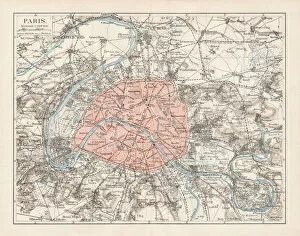
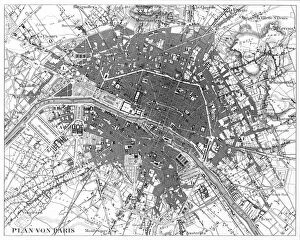
Background imageMaps Greetings Card Collection: Map of Paris 1900

Map of Paris 1900
Meyers hand-Atlas Leipzig und Wien Verlag des Bibliographischen Instituts 1900

Background imageMaps Greetings Card Collection: Plan of a Portion of Westminster Between 1734 and 1748 - Before the Erection of

Plan of a Portion of Westminster Between 1734 and 1748 - Before the Erection of Great George Street, (1881). Map of the area near the Houses of Parliament in London, showing Broad Sanctuary

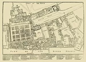
Background imageMaps Greetings Card Collection: A reduced copy of Fishers Ground Plan of the Royal Palace of Whitehall, 1680, (1881)

A reduced copy of Fishers Ground Plan of the Royal Palace of Whitehall, 1680, (1881)
A reduced copy of Fishers Ground Plan of the Royal Palace of Whitehall, taken in the Reign of Charles 2d. 1680, (1881). John Fishers map of the Palace of Whitehall in the village of Westminster

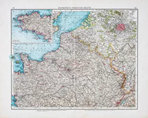
Background imageMaps Greetings Card Collection: Map of France 1896

Map of France 1896
Andres Allgemeiner Handatlas - Bielefeld und Leipzig 1896

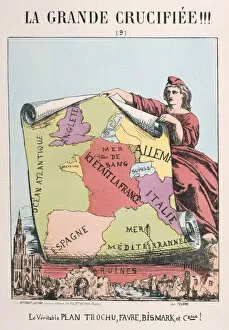
Background imageMaps Greetings Card Collection: Allegory of Republican France, 1871. Artist: E Courtaux

Allegory of Republican France, 1871. Artist: E Courtaux
Allegory of Republican France, 1871. Cartoon from a series titled La Grande Crucifiee!!! depicting Marianne as Republican France

Background imageMaps Greetings Card Collection: 13885621

13885621

Background imageMaps Greetings Card Collection: 13820006

13820006

Background imageMaps Greetings Card Collection: Kensington in 1764, (c1876). Creator: Unknown

Kensington in 1764, (c1876). Creator: Unknown
Kensington in 1764, (c1876). Kensington, was a suburb of London and birth-place of Queen Victoria with conveyancing of property passing between Earls

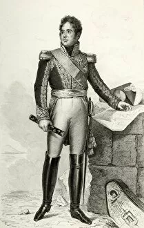
Background imageMaps Greetings Card Collection: Jacques Lauriston, 1804, (1839). Creator: Julien Leopold Boilly

Jacques Lauriston, 1804, (1839). Creator: Julien Leopold Boilly
Jacques Lauriston, 1804, (1839). Lauriston (Jacques-Alexandre Bernard Law, marquis de), Marechal de France. Portrait of Jacques Alexandre Bernard Law, marquis de Lauriston (1768-1828)

Background imageMaps Greetings Card Collection: Map of Epirus and Western Greece, 1890. Creator: Unknown

Map of Epirus and Western Greece, 1890. Creator: Unknown
Map of Epirus and Western Greece, 1890. For a brief period (280-275 BC), the Epirote king Pyrrhus made Epirus the most powerful state in the Greek world

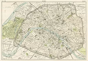
Background imageMaps Greetings Card Collection: Paris city map 1885

Paris city map 1885
Encyclopedia Britannica 9th Edition New York Charles Scribners and Sons 1885 Vol XVIII

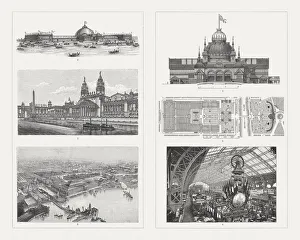
Background imageMaps Greetings Card Collection: Buildings of the world Exhibitions, 19th century

Buildings of the world Exhibitions, 19th century
Exhibition buildings of world exhibitions in the 19th century: 1-3) Buildings for the World Exhibition 1893 in Chicago, USA: 1) Machine exhibition building, 2) Building for horticulture

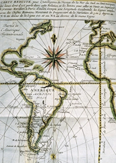
Background imageMaps Greetings Card Collection: Map of the Atlantic Ocean. 18th century

Map of the Atlantic Ocean. 18th century
Map of the Atlantic Ocean from Newfoundland to Cape Horn. At A Voyage to the South-sea and along the coasts of Chili and Peru, in the years 1712, 1713 and 1714 by Amedee-Franc

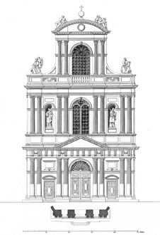
Background imageMaps Greetings Card Collection: Paris, France - Eglise de Saint Gervais et Saint Protais

Paris, France - Eglise de Saint Gervais et Saint Protais Date: 1855

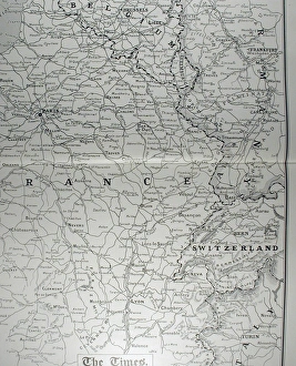
Background imageMaps Greetings Card Collection: Times War Atlas - WWI maps

Times War Atlas - WWI maps
The Times War Atlas. The atlas contains the following loose maps - 1) Map of the North Sea. 2) Map of the frontiers of France. 3) Map of the North Eastern Theatre of War. 4) Map of the Balkans

Background imageMaps Greetings Card Collection: Paris, France Circa 1850 Engraving

Paris, France Circa 1850 Engraving
Engraved illustrations of the City of Paris from Iconographic Encyclopedia of Science, Literature and Art, Published in 1851. Copyright has expired on this artwork. Digitally restored

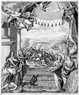
Background imageMaps Greetings Card Collection: The Battle of Malplaquet, 11th September 1709, engraved by Jeremias Wolff and Johann

The Battle of Malplaquet, 11th September 1709, engraved by Jeremias Wolff and Johann
XIR168360 The Battle of Malplaquet, 11th September 1709, engraved by Jeremias Wolff and Johann August Corninus (1683-1738) (engraving) (b/w photo) by Decker

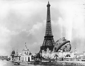
Background imageMaps Greetings Card Collection: Paris Exhibition

Paris Exhibition
View at the Exposition Universelle across the River Seine towards the Eiffel Tower, and the Globe Celeste. The Eiffel Tower, built to commemorate the 100th anniversary of the French Revolution

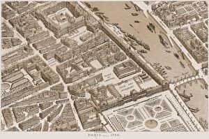
Background imageMaps Greetings Card Collection: FRANCE: MAP OF PARIS, 1730. A partial view of Paris as it appeared in 1730

FRANCE: MAP OF PARIS, 1730. A partial view of Paris as it appeared in 1730. Lithograph, French, 19th century

Background imageMaps Greetings Card Collection: North American territories in 1783

North American territories in 1783
North America at the close of the Revolution - Treaty of Paris, 1783. Printed color lithograph

Background imageMaps Greetings Card Collection: Constellation of Hercules (Heracles / Herakles): part of the Milky Way is shown on right of image

Constellation of Hercules (Heracles / Herakles): part of the Milky Way is shown on right of image
Constellation of Hercules (Heracles/Herakles): part of the Milky Way is shown on right of image. From JJ Fortin Atlas Coelestis de Flamsteed Paris 1775. Copperplate engraving

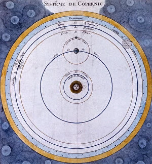
Background imageMaps Greetings Card Collection: Copernican (heliocentric / Sun-centred) system of the Universe, 1761

Copernican (heliocentric / Sun-centred) system of the Universe, 1761
Copernican (heliocentric/Sun-centred) system of the Universe, 1761. Illustration showing the orbits of the planets around the Sun. The orbits of the moons of Earth, Jupiter and Saturn are also shown

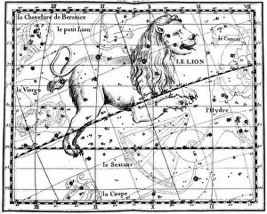
Background imageMaps Greetings Card Collection: Constellation of Leo, 1775. Artist: Jean Fortin

Constellation of Leo, 1775. Artist: Jean Fortin
Constellation of Leo, 1775. A number of distant galaxies can be observed in Leo by astronomers, and the constellation is associated with several meteor showers, most notably the Leonids

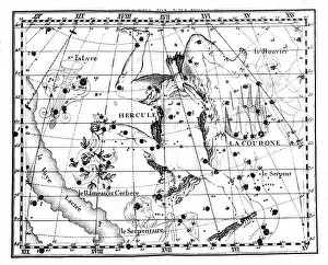
Background imageMaps Greetings Card Collection: Astronomical map, centred on the constellation of Hercules, 1775. Artist: Jean Fortin

Astronomical map, centred on the constellation of Hercules, 1775. Artist: Jean Fortin
Astronomical map, centred on the constellation of Hercules, 1775. Part of the Milky Way is shown on the right of the image. From Atlas Coelestis de Flamsteed by JJ Fortin. (Paris, 1775)

Background imageMaps Greetings Card Collection: Illustration from De la Terre a la Lune by Jules Verne, 1865

Illustration from De la Terre a la Lune by Jules Verne, 1865. Map of Florida showing the positioin of the launch site of the spacecraft Columbiad

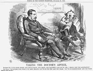
Background imageMaps Greetings Card Collection: Taking The Doctors Advice, 1863. Artist: John Tenniel

Taking The Doctors Advice, 1863. Artist: John Tenniel
Taking The Doctors Advice, 1863. Napoleon III had long had his French fingers in a variety of different European pies. At the beginning of November 1863

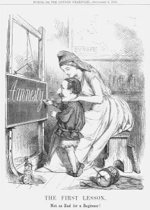
Background imageMaps Greetings Card Collection: The First Lesson!, 1859

The First Lesson!, 1859. Not so Bad for a Beginner! In this cartoon, Liberty in the role of a schoolmistress helps a childish Napoleon III to write the word Amnesty on the blackboard


All Professionally Made to Order for Quick Shipping


-

Maps Greetings Card Collection

Maps of Paris, France, Europe are invaluable resources for anyone visiting or living in the city. They provide an overview of the city's layout, including its streets and landmarks. They also show public transportation routes and stations, as well as points of interest such as parks and museums. Many it also include information about nearby cities and towns, allowing visitors to plan day trips outside the city limits. Additionally they can help visitors find their way around Paris more easily by providing detailed directions from one point to another. With a map in hand, travelers can explore all that Paris has to offer with confidence.
+

Our beautiful Wall Art and Photo Gifts include Framed Prints, Photo Prints, Poster Prints, Canvas Prints, Jigsaw Puzzles, Metal Prints and so much more

The Maps of Paris France Europe collection from Media Storehouse is a stunning assortment of wall art, framed prints, photo prints, canvas prints, jigsaw puzzles and greeting cards that capture the beauty and history of Paris. Our collection features a wide range of maps depicting different eras in the city's rich cultural heritage. From antique maps dating back to the 18th century to modern-day street maps highlighting popular landmarks such as the Eiffel Tower and Notre-Dame Cathedral, our collection offers something for everyone. Each piece in our collection is carefully crafted using high-quality materials to ensure long-lasting durability and vibrant colors that will stand out on any wall. Whether you're looking for a unique gift or want to add some French charm to your home or office decor, these beautiful pieces are sure to impress. With so many options available at affordable prices, it's easy to find exactly what you need from this impressive selection of artwork.
+

What are Maps of Paris France Europe art prints?

Maps of Paris France Europe art prints are beautiful and detailed depictions of the city of Paris, France, and its surrounding regions. These maps showcase the intricate layout of streets, landmarks, and buildings throughout the area. They are often created using a combination of traditional cartography techniques and modern design elements to produce an aesthetically pleasing representation. These art prints serve as both decorative pieces for your home or office space as well as educational tools for those interested in geography or history. They can be used to plan trips to Paris or simply admired for their artistic value. Maps of Paris France Europe art prints come in various sizes and styles, ranging from vintage designs that capture the essence of old-world charm to contemporary interpretations that reflect modern-day trends. Regardless of your personal style preferences, there is sure to be a map print that will suit your tastes perfectly.
+

What Maps of Paris France Europe art prints can I buy from Media Storehouse?

We offer a wide range of Maps of Paris, France and Europe art prints that are perfect for home decor or as gifts. These maps come in various sizes and styles to suit your preferences. You can choose from vintage-style maps that showcase the intricate details of the city's streets, landmarks, and neighborhoods, or modern designs that highlight its vibrant culture and history. Some popular options include detailed street maps of Paris with iconic landmarks such as the Eiffel Tower, Notre Dame Cathedral, and Arc de Triomphe highlighted. There are also antique-style world maps featuring Europe prominently along with other continents. Media Storehouse also offers panoramic views of Paris' skyline at different times of day including sunrise or sunset which make great wall art pieces for any room in your home. Whether you're looking for something classic or contemporary, we have a vast collection of Maps of Paris France Europe art prints to choose from.
+

How do I buy Maps of Paris France Europe art prints?

To buy Maps of Paris France Europe art prints from Media Storehouse, you can browse our extensive collection of maps and select the one that best suits your preferences. Once you have found the map you want to purchase, simply add it to your cart and proceed to checkout. You will be prompted to enter your shipping information and payment details before finalizing your order. We offer a variety of sizes for their art prints, so make sure to choose the size that fits your needs. We also offer different framing options if you prefer a framed print. If you have any questions or concerns about purchasing Maps of Paris France Europe art prints from Media Storehouse, they have a customer service team available to assist you. Simply reach out via email or phone and they will be happy to help guide you through the process.
+

How much do Maps of Paris France Europe art prints cost?

We offer a wide range of Maps of Paris France Europe art prints, which vary in price depending on the size and type of print. The cost for these prints can be affected by factors such as the quality of paper or canvas used, the printing method employed, and any additional features that may be included with the print. However, it is important to note that Media Storehouse strives to offer affordable prices for all their products while maintaining high-quality standards. You can expect reasonable pricing options for Maps of Paris France Europe art prints without compromising on quality. Whether you are looking for vintage maps or contemporary designs, we have something to suit every taste and budget. With a vast collection available online, you can easily browse through different options before making their purchase decision.
+

How will my Maps of Paris France Europe art prints be delivered to me?

We take great care in ensuring that your Maps of Paris France Europe art prints are delivered to you safely and securely. We use high-quality packaging materials to protect your print during transit, so it arrives at your doorstep in pristine condition. Your print will be carefully rolled and placed inside a protective tube before being shipped out to you. This ensures that the print is not damaged or creased during shipping. Additionally, we work with trusted courier services to ensure timely delivery of your order. Once your package has been dispatched, you will receive a tracking number via email which allows you to track the progress of your shipment online. If for any reason there are issues with the delivery of your order, our customer service team is always available to assist you. We hope that receiving your Maps of Paris France Europe art prints brings joy and inspiration into your home or office space.