Fraud Blocker Skip to main content

Home > Europe > Netherlands > Maps

Maps Collection (page 5)

The Netherlands is a country located in northwestern Europe, bordered by Germany to the east, Belgium to the south, and the North Sea to the northwest

549 items

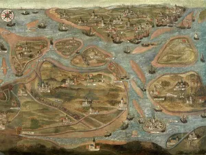
Background imageMaps Collection: Map of the Zwin Area (oil on canvas)

Map of the Zwin Area (oil on canvas)
490039 Map of the Zwin Area (oil on canvas) by Hervy, Jehan de (fl.1472-1507); Groeningemuseum, Bruges, Belgium; (add.info.: See also 490038 & 490040.); © Art in Flanders

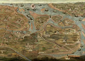
Background imageMaps Collection: Map of the Zwin Area (oil on canvas)

Map of the Zwin Area (oil on canvas)
490040 Map of the Zwin Area (oil on canvas) by Hervy, Jehan de (fl.1472-1507); Groeningemuseum, Bruges, Belgium; (add.info.: See also 490038 & 490039.); © Art in Flanders

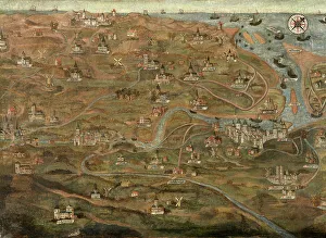
Background imageMaps Collection: Map of the Zwin Area (oil on canvas)

Map of the Zwin Area (oil on canvas)
490038 Map of the Zwin Area (oil on canvas) by Hervy, Jehan de (fl.1472-1507); Groeningemuseum, Bruges, Belgium; (add.info.: See also 490039 & 490040.); © Art in Flanders

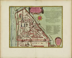
Background imageMaps Collection: The Moscow Kremlin Map of the 16th century (Castellum Urbis Moskvae), 1662 (copper engraving & w/c)

The Moscow Kremlin Map of the 16th century (Castellum Urbis Moskvae), 1662 (copper engraving & w/c)
7305379 The Moscow Kremlin Map of the 16th century (Castellum Urbis Moskvae), 1662 (copper engraving & w/c) by Blaeu, Joan (1596-1673); Private Collection; Photo © Fine Art Images

Background imageMaps Collection: The Moscow Kremlin Map of the 16th century (Castellum Urbis Moskvae), c. 1600 (engraving & w/c)

The Moscow Kremlin Map of the 16th century (Castellum Urbis Moskvae), c. 1600 (engraving & w/c)
7305377 The Moscow Kremlin Map of the 16th century (Castellum Urbis Moskvae), c.1600 (engraving & w/c) by Blaeu, Joan (1596-1673); Private Collection; Photo © Fine Art Images

Background imageMaps Collection: A self-portrait of the artist in his studio, 1670 (oil on canvas)

A self-portrait of the artist in his studio, 1670 (oil on canvas)
7304042 A self-portrait of the artist in his studio, 1670 (oil on canvas) by Musscher, Michiel van (1645-1705); 74.3 x 63.3 cm; Private Collection; Photo © Christie's Images

Background imageMaps Collection: A Young Man Choosing Love of Beauty Rather Than Riches (engraving)

A Young Man Choosing Love of Beauty Rather Than Riches (engraving)
7186138 A Young Man Choosing Love of Beauty Rather Than Riches (engraving) by Goltzius, Hendrik (1558-1617) (after); Private Collection; (add.info)

Background imageMaps Collection: Gold Prospector (colour litho)

Gold Prospector (colour litho)
7148388 Gold Prospector (colour litho) by Scheltema, Jan Hendrik (1861-1941); Private Collection; (add.info.: Gold Prospector)

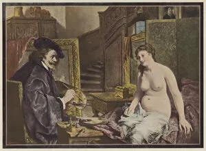
Background imageMaps Collection: Rembrandt, Dutch artist at work in his studio (colour litho)

Rembrandt, Dutch artist at work in his studio (colour litho)
7150440 Rembrandt, Dutch artist at work in his studio (colour litho) by Brunin, Leon (1861-1949); Private Collection; (add.info.: Rembrandt (1606-1669), Dutch artist at work in his studio

Background imageMaps Collection: Two Young Women at a Table, 1870 (w / c and pencil)

Two Young Women at a Table, 1870 (w / c and pencil)
6620747 Two Young Women at a Table, 1870 (w/c and pencil) by Bles, David (1821-99); 22.1-- 29.2 cm; Rijksmuseum, Amsterdam, The Netherlands

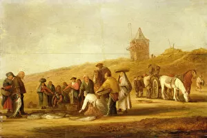
Background imageMaps Collection: Fishermen Selling their Catch on the Beach (oil on canvas)

Fishermen Selling their Catch on the Beach (oil on canvas)
147384 Fishermen Selling their Catch on the Beach (oil on canvas) by Neyn, Pieter de (1597-1639); 35.2x52.6 cm; Private Collection

Background imageMaps Collection: Map of Europe. 1588 (coloured etching)
Map of Europe. 1588 (coloured etching)
AIS5366571 Map of Europe. 1588 (coloured etching) by Plantin, Christophe (1414 or 1420-1589); Biblioteca Universidad, Salamanca, Spain; (add.info.: Map of Europe)

Background imageMaps Collection: Vanity (engraving)

Vanity (engraving)
7201595 Vanity (engraving) by Gheyn, Jacob II de (1565-1625) (after); Private Collection; (add.info.: Vanity. Illustration from Illustrierte Sittengeschichte von Mittelalter bis zur Gegenwart)

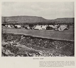
Background imageMaps Collection: Neutral Camp (b / w photo)

Neutral Camp (b / w photo)
7160176 Neutral Camp (b/w photo) by Kisch, David Henry (1847-1902); Private Collection; (add.info.: Neutral Camp. Illustration for The Siege of Ladysmith in 120 Pictures from Photographs by Henry)

Background imageMaps Collection: The Gardener, 1913 (oil on canvas)

The Gardener, 1913 (oil on canvas)
7076460 The Gardener, 1913 (oil on canvas) by Mankes, Jan (1899-1920); 63x26.5 cm; Private Collection

Background imageMaps Collection: The Dance, 1870 (oil on panel)

The Dance, 1870 (oil on panel)
6620785 The Dance, 1870 (oil on panel) by Bourgoin, Aime-Gabriel-Adolphe (1824-74); 41.1--31.4 cm; Rijksmuseum, Amsterdam, The Netherlands

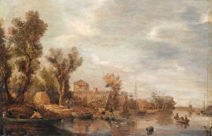
Background imageMaps Collection: River view, c. 1630 (oil on panel)

River view, c. 1630 (oil on panel)
6620698 River view, c.1630 (oil on panel) by Goyen, Jan Josephsz van (1596-1656) (follower of); 63--98 cm; Rijksmuseum, Amsterdam, The Netherlands

Background imageMaps Collection: Girl in Front of a Farm in Het Gooi, 1915 (oil on canvas)

Girl in Front of a Farm in Het Gooi, 1915 (oil on canvas)
6436378 Girl in Front of a Farm in Het Gooi, 1915 (oil on canvas) by Breman, Co (1865-1938); 40x55.5 cm; Private Collection

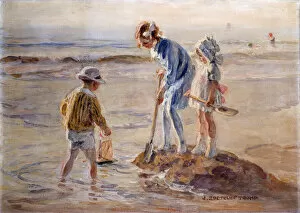
Background imageMaps Collection: Playing on the Katwijk Beach (oil on canvas)

Playing on the Katwijk Beach (oil on canvas)
6431716 Playing on the Katwijk Beach (oil on canvas) by Tromp, Johann Zoetelief (1872-1947); Private Collection

Background imageMaps Collection: Saint Francis Preaches to the Birds par Coppola Castaldo, Francesco (1845-1916)

Saint Francis Preaches to the Birds par Coppola Castaldo, Francesco (1845-1916)
FIA5404815 Saint Francis Preaches to the Birds par Coppola Castaldo, Francesco (1845-1916). Oil on canvas, 1878, Museum voor Religieuze Kunst, Uden by Coppola Castaldo

Background imageMaps Collection: Treaty Adjustments, 1713-1763 (colour litho)

Treaty Adjustments, 1713-1763 (colour litho)
6016386 Treaty Adjustments, 1713-1763 (colour litho) by Shepherd, William R. (1871-1934); Private Collection; (add.info.: Treaty Adjustments, 1713-1763)

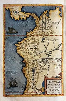
Background imageMaps Collection: Map of Peru, from the records of Hernando de Sotos expedition in 1570, 1588

Map of Peru, from the records of Hernando de Sotos expedition in 1570, 1588
AIS5365871 Map of Peru, from the records of Hernando de Sotos expedition in 1570, 1588 by Plantin, Christophe (1414 or 1420-1589); Biblioteca Universidad, Salamanca, Spain; (add.info.: Map of Peru)

Background imageMaps Collection: The Netherlands, 1559-1609 (colour litho)

The Netherlands, 1559-1609 (colour litho)
6016375 The Netherlands, 1559-1609 (colour litho) by Shepherd, William R. (1871-1934); Private Collection; (add.info.: The Netherlands, 1559-1609)

Background imageMaps Collection: Panorama of Munster, Germany, mid-17th century

Panorama of Munster, Germany, mid-17th century
7212203 Panorama of Munster, Germany, mid-17th century by Danckerts, Dancker (1634-1666); (add.info.: Panorama of Munster, Germany in the mid-17th century)

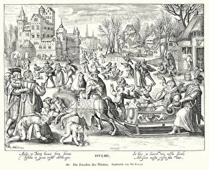
Background imageMaps Collection: Joys of winter (copper engraving)

Joys of winter (copper engraving)
7201563 Joys of winter (copper engraving) by Bruyn, Nicolaes de (1571-1656) (after); Private Collection; (add.info.: Joys of winter)

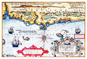
Background imageMaps Collection: Navigation chart of Brittany coast, 1583

Navigation chart of Brittany coast, 1583
3854275 Navigation chart of Brittany coast, 1583 by Janszoon Waghenaer, Lucas (c.1533-c.1606); Photo © Derek Bayes. All rights reserved 2022

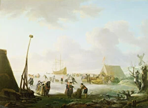
Background imageMaps Collection: An Extensive Landscape with Sleighs and Skaters with a Ship Locked in the Ice (oil on panel)

An Extensive Landscape with Sleighs and Skaters with a Ship Locked in the Ice (oil on panel)
259378 An Extensive Landscape with Sleighs and Skaters with a Ship Locked in the Ice (oil on panel) by Avercamp, Hendrick (1585-c.1663) (manner of); Private Collection

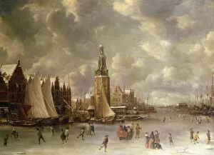
Background imageMaps Collection: Winter Landscape with the Montelbaanstoren, Amsterdam (oil on canvas)

Winter Landscape with the Montelbaanstoren, Amsterdam (oil on canvas)
259377 Winter Landscape with the Montelbaanstoren, Amsterdam (oil on canvas) by Beerstraaten, Jan Abrahamsz. (1622-1666); Private Collection; (add.info)

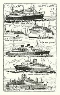
Background imageMaps Collection: Modern Liners (litho)

Modern Liners (litho)
7184086 Modern Liners (litho) by McDowell, William John Patton (1889-1950); Private Collection; (add.info.: Modern Liners)

Background imageMaps Collection: Maximilian I, King of Germany and ruler of the Netherlands, taken prisoner by the citizens of

Maximilian I, King of Germany and ruler of the Netherlands, taken prisoner by the citizens of Bruges, 1488 (engraving)
7147943 Maximilian I, King of Germany and ruler of the Netherlands, taken prisoner by the citizens of Bruges, 1488 (engraving) by Zick

Background imageMaps Collection: Memorial tablet, c. 1500 (oil on panel)

Memorial tablet, c. 1500 (oil on panel)
6620688 Memorial tablet, c. 1500 (oil on panel) by Master of the Spes Nostra (fl.1490-1520); 88.7--104.3 cm; Rijksmuseum, Amsterdam

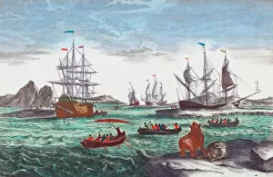
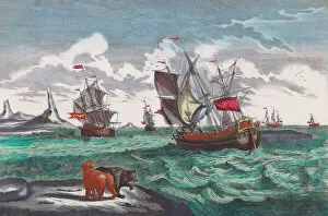
Background imageMaps Collection: Whaling fleet off Greenland in the 18th century (engraving)

Whaling fleet off Greenland in the 18th century (engraving)
7212129 Whaling fleet off Greenland in the 18th century (engraving) by Meulen, Sieuwert van der (1663-1730); (add.info.: Whaling fleet off Greenland in the 18th century)

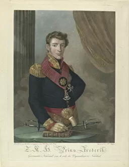
Background imageMaps Collection: Portrait of Prince Frederick of the Netherlands (1797-1881), 1817 (engraving)

Portrait of Prince Frederick of the Netherlands (1797-1881), 1817 (engraving)
FIA5405920 Portrait of Prince Frederick of the Netherlands (1797-1881), 1817 (engraving) by Langerveld, Harmanus (1777-1830); 55.9 -- 40.6 cm; Rijksmuseum, Amsterdam

Background imageMaps Collection: Livonie (Nord de la Lituanie actuelle) - Map of Livonia (Die custe va Lijfflandt met de eijlanden)

Livonie (Nord de la Lituanie actuelle) - Map of Livonia (Die custe va Lijfflandt met de eijlanden daer beneffens)
FIA5399638 Livonie (Nord de la Lituanie actuelle) - Map of Livonia (Die custe va Lijfflandt met de eijlanden daer beneffens...) - Waghenaer, Lucas Jansz

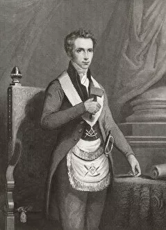
Background imageMaps Collection: Prince Frederick of the Netherlands, 19th century (engraving)

Prince Frederick of the Netherlands, 19th century (engraving)
7212177 Prince Frederick of the Netherlands, 19th century (engraving) by Lange, Johannes Philippus (1810-49); (add.info.: Prince Frederick of the Netherlands, 1797-1881)

Background imageMaps Collection: Whaling fleet off Greenland in the 18th century (engraving)

Whaling fleet off Greenland in the 18th century (engraving)
7212132 Whaling fleet off Greenland in the 18th century (engraving) by Meulen, Sieuwert van der (1663-1730); (add.info.: Whaling fleet off Greenland in the 18th century)

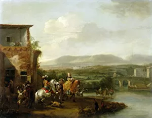
Background imageMaps Collection: An Elegant Riding Party outside a Farm by a River (oil on canvas)

An Elegant Riding Party outside a Farm by a River (oil on canvas)
147372 An Elegant Riding Party outside a Farm by a River (oil on canvas) by Wouwermans or Wouvermans, Philips (1619-1668); 48x62.2 cm; Private Collection

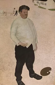
Background imageMaps Collection: Portrait of Valerius de Saedeleer, 1914 (oil on canvas)

Portrait of Valerius de Saedeleer, 1914 (oil on canvas)
7076529 Portrait of Valerius de Saedeleer, 1914 (oil on canvas) by Woestyne, Gustave van de (1881-1947); 220x140 cm; Private Collection

Background imageMaps Collection: Goat (oil on canvas)

Goat (oil on canvas)
7076462 Goat (oil on canvas) by Mankes, Jan (1899-1920); 15x18.8 cm; Private Collection

Background imageMaps Collection: Raven on a Birch Tree, 1913 (pencil and brush)

Raven on a Birch Tree, 1913 (pencil and brush)
7076461 Raven on a Birch Tree, 1913 (pencil and brush) by Mankes, Jan (1899-1920); Private Collection; Dutch, out of copyright

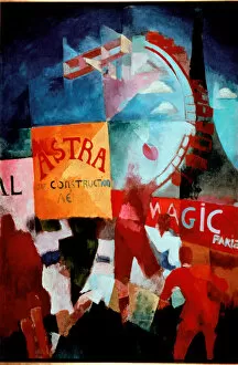
Background imageMaps Collection: Cardiff Team 1912-1913 (oil on canvas)

Cardiff Team 1912-1913 (oil on canvas)
LRI4637821 Cardiff Team 1912-1913 (oil on canvas) by Delaunay, Robert (1885-1941); 193.5x132 cm; Stedelijk van Abbe Museum, Eindhoven, The Netherlands; Luisa Ricciarini; French, out of copyright

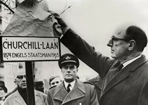
Background imageMaps Collection: Ambassador Peter Garren uncovers the plaque in tribute to the politician Winston Churchill

Ambassador Peter Garren uncovers the plaque in tribute to the politician Winston Churchill (1874-1965) in Harleem
AIS5333705 Ambassador Peter Garren uncovers the plaque in tribute to the politician Winston Churchill (1874-1965) in Harleem, Netherlands, c.1970 (b/w photo) by Unknown photographer

Background imageMaps Collection: 1883 British Isles Map

1883 British Isles Map

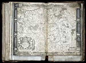
Background imageMaps Collection: Carte de la Pologne, 17eme siecle - Nova Poloniae delineation - (Map of Poland)

Carte de la Pologne, 17eme siecle - Nova Poloniae delineation - (Map of Poland)
FIA5391203 Carte de la Pologne, 17eme siecle - Nova Poloniae delineation - (Map of Poland) - Oeuvre de Jocodus Hondius l Ancien (Josse de Hond) (1563-1612), gravure (33, 7x47, 9 cm)

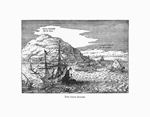
Background imageMaps Collection: The Cocos Islands Dutch Navigation, Victorian Illustration

The Cocos Islands Dutch Navigation, Victorian Illustration
Very Rare, Beautifully Illustrated Antique Engraved Victorian Illustration of The Cocos Islands. Copyright has expired on this artwork. Digitally restored

Background imageMaps Collection: Archduke Maximilian of Habsburg, greeted by his wife Mary, Duchess of Burgundy

Archduke Maximilian of Habsburg, greeted by his wife Mary, Duchess of Burgundy
7147942 Archduke Maximilian of Habsburg, greeted by his wife Mary, Duchess of Burgundy, on his return to Ghent after defeating the French at the Battle of Guinegate, 1479 (engraving) by Schram

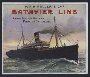
Background imageMaps Collection: Batavier Line, steam packet service, routes to Holland, the Rhine and Switzerland

Batavier Line, steam packet service, routes to Holland, the Rhine and Switzerland, William H Muller and Company
7153635 Batavier Line, steam packet service, routes to Holland, the Rhine and Switzerland, William H Muller and Company, advertisement (colour litho) by English School

Background imageMaps Collection: Primitive Timekeepers (colour litho)

Primitive Timekeepers (colour litho)
7163164 Primitive Timekeepers (colour litho) by English School, (20th century); Private Collection; (add.info.: Primitive Timekeepers)


All Professionally Made to Order for Quick Shipping


-

Maps Collection

The Netherlands is a country located in northwestern Europe, bordered by Germany to the east, Belgium to the south, and the North Sea to the northwest, and is known for its iconic windmills, tulip fields, and canals. Maps of Netherlands Europe show this small country in great detail. The maps typically include major cities such as Amsterdam and Rotterdam; rivers such as Rhine and Meuse; lakes including Ijsselmeer; national parks like Hoge Veluwe National Park; mountain ranges like Ardennes; coastal areas such as Wadden Sea Islands; and other attractions like Keukenhof Gardens. Maps of Netherlands Europe also provide information on transportation networks including highways, airports, railway lines and ferry routes. These they can essential for travelers who want to explore this beautiful country with its rich history and culture.
+

Our beautiful Wall Art and Photo Gifts include Framed Prints, Photo Prints, Poster Prints, Canvas Prints, Jigsaw Puzzles, Metal Prints and so much more

Media Storehouse offers a stunning collection of Maps of Netherlands Europe that are perfect for wall art and framed prints. Our collection features an extensive range of maps, including antique maps from the 16th century to modern-day satellite images. These maps showcase the beauty and diversity of the Netherlands, highlighting its cities, towns, waterways, and landscapes. The Maps of Netherlands Europe collection is ideal for those who appreciate history or geography or want to add a touch of sophistication to their home decor. Whether you're looking for a vintage map as a conversation starter or a contemporary print that captures the essence of modern-day Netherlands, our collection has something for everyone. Each map in the our Maps of Netherlands Europe collection is carefully curated by experts who ensure that only high-quality prints are included in their inventory. With so many options available at affordable prices, it's easy to find the perfect map to suit your style and taste.
+

What are Maps of Netherlands Europe art prints?

Maps of Netherlands Europe art prints are a beautiful and informative way to display the geography of the Netherlands. These prints showcase detailed maps of the country, highlighting its cities, rivers, lakes, and other important landmarks. They are perfect for anyone who loves history or geography, as they provide an accurate representation of the region's topography. These art prints come in a variety of styles and sizes to suit any decor. Some feature vintage designs that harken back to earlier times when cartographers were first mapping out this area. Others have modern graphics that use bright colors and bold lines to create a more contemporary look. Whether you're looking for something traditional or trendy, Maps of Netherlands Europe art prints offer something for everyone. They make great gifts for friends or family members who love travel or want to learn more about this fascinating part of Europe. So why not add one to your collection today?
+

What Maps of Netherlands Europe art prints can I buy from Media Storehouse?

We offer a wide range of Maps of Netherlands Europe art prints that are perfect for anyone who loves the beauty and history of this region. These maps come in various sizes, styles, and designs to suit different tastes and preferences. Some of the popular options include vintage maps, contemporary maps, topographical maps, political maps, and more. Whether you're looking for a stunning wall art piece or an educational tool for your classroom or office space, we have got you covered. You can choose from a variety of materials such as canvas prints, framed prints, metal prints, posters and photographic prints to ensure that your chosen map looks great wherever it is displayed. With its vast collection of high-quality Maps of Netherlands Europe art prints available at affordable prices with fast shipping times worldwide; Media Storehouse is the go-to destination for anyone looking to add some unique flair to their home or workspace décor.
+

How do I buy Maps of Netherlands Europe art prints?

To buy Maps of Netherlands Europe art prints from Media Storehouse, you can browse our extensive collection online. Simply search for "Maps of Netherlands Europe" in the search bar on our website and select your preferred print size and format. You can choose between a range of high-quality paper finishes, including matte, gloss, and satin. Once you have selected your desired print options, add them to your cart and proceed to checkout. At this stage, you will need to provide your shipping details and payment information. We offer secure payment options such as credit card or PayPal. Once your order has been processed, it will be printed on demand using state-of-the-art printing technology before being shipped directly to your address. Buying Maps of Netherlands Europe art prints from Media Storehouse is an easy process that allows you to enjoy stunning artwork in the comfort of your own home or office space.
+

How much do Maps of Netherlands Europe art prints cost?

We offer a wide range of Maps of Netherlands Europe art prints that cater to different tastes and preferences. Our collection includes vintage maps, contemporary designs, and everything in between. The cost of our Maps of Netherlands Europe art prints varies depending on the size, framing options, and other customization choices you make. However, we strive to keep our prices competitive while maintaining high-quality standards for all our products. Our Maps of Netherlands Europe art prints are perfect for adding a touch of sophistication and elegance to your home or office décor. Whether you're looking for a unique gift idea or want to treat yourself to something special, we have something that will suit your needs perfectly. So if you're interested in purchasing one of our beautiful Maps of Netherlands Europe art prints, browse through our collection today.
+

How will my Maps of Netherlands Europe art prints be delivered to me?

We take great care in delivering your Maps of Netherlands Europe art prints to you. We use high-quality packaging materials to ensure that your print arrives in perfect condition. Your print will be carefully rolled and placed into a sturdy cardboard tube for protection during transit. We work with trusted delivery partners who are experienced in handling delicate items such as art prints. Once your order has been dispatched, you will receive an email notification with tracking information so that you can keep track of the progress of your delivery. We understand how important it is for our customers to receive their orders promptly and securely. That's why we always strive to deliver on time and provide excellent customer service throughout the entire process. Whether you're purchasing a Maps of Netherlands Europe art print for yourself or as a gift for someone else, rest assured that it will be delivered safely and efficiently by our team at Media Storehouse.