Fraud Blocker Skip to main content

Home > Europe > Republic of Ireland > Maps

Maps Collection (page 4)

The Republic of Ireland is located in the North Atlantic Ocean and is part of Europe

1,486 items

Background imageMaps Collection: Plan of Lincoln (b/w photo)

Plan of Lincoln (b/w photo)
8651339 Plan of Lincoln (b/w photo) by English Photographer, (20th century); Private Collection; (add.info.: Plan of Lincoln)

Background imageMaps Collection: OS map, 1922: Cardiganshire, Pembrokeshire, Carmarthenshire (colour litho)

OS map, 1922: Cardiganshire, Pembrokeshire, Carmarthenshire (colour litho)
8650907 OS map, 1922: Cardiganshire, Pembrokeshire, Carmarthenshire (colour litho) by English School, (20th century); Private Collection; (add.info.: Cardiganshire, Pembrokeshire, Carmarthenshire)

Background imageMaps Collection: Waldorf Hotel, Aldwych, London (coloured photo)

Waldorf Hotel, Aldwych, London (coloured photo)
8635428 Waldorf Hotel, Aldwych, London (coloured photo) by English Photographer, (20th century); Private Collection; (add.info.: Waldorf Hotel, Aldwych, London)

Background imageMaps Collection: Empire Air Routes: England-India-Malaya-Australia Route, Map A (colour litho)

Empire Air Routes: England-India-Malaya-Australia Route, Map A (colour litho)
8659286 Empire Air Routes: England-India-Malaya-Australia Route, Map A (colour litho) by English School, (20th century); Private Collection; (add.info.: England-India-Malaya-Australia Route, Map A)

Background imageMaps Collection: Plan of Kensington and Chelsea (b/w photo)

Plan of Kensington and Chelsea (b/w photo)
8648807 Plan of Kensington and Chelsea (b/w photo) by English Photographer, (20th century); Private Collection; (add.info.: Plan of Kensington and Chelsea)

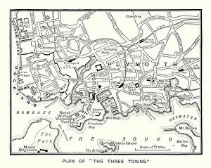
Background imageMaps Collection: Plan of 'The Three Towns' (b/w photo)

Plan of "The Three Towns" (b/w photo)
8648800 Plan of "The Three Towns" (b/w photo) by English Photographer, (20th century); Private Collection; (add.info)

Background imageMaps Collection: Plan of Bath (b/w photo)

Plan of Bath (b/w photo)
8648793 Plan of Bath (b/w photo) by English Photographer, (20th century); Private Collection; (add.info.: Plan of Bath. Illustration for The British Isles Depicted by Pen and Camera (Cassell)

Background imageMaps Collection: Plan of Exeter (b/w photo)

Plan of Exeter (b/w photo)
8648789 Plan of Exeter (b/w photo) by English Photographer, (20th century); Private Collection; (add.info.: Plan of Exeter)

Background imageMaps Collection: Plan of Sheffield (b/w photo)

Plan of Sheffield (b/w photo)
8648783 Plan of Sheffield (b/w photo) by English Photographer, (20th century); Private Collection; (add.info.: Plan of Sheffield)

Background imageMaps Collection: Map of the Peak Country (b/w photo)

Map of the Peak Country (b/w photo)
8648733 Map of the Peak Country (b/w photo) by English Photographer, (20th century); Private Collection; (add.info.: Map of the Peak Country)

Background imageMaps Collection: Plan of Cambridge (b/w photo)

Plan of Cambridge (b/w photo)
8648811 Plan of Cambridge (b/w photo) by English Photographer, (20th century); Private Collection; (add.info.: Plan of Cambridge)

Background imageMaps Collection: Plan of Canterbury (b/w photo)

Plan of Canterbury (b/w photo)
8648802 Plan of Canterbury (b/w photo) by English Photographer, (20th century); Private Collection; (add.info.: Plan of Canterbury)

Background imageMaps Collection: Map of the Dee Valley (b/w photo)

Map of the Dee Valley (b/w photo)
8648784 Map of the Dee Valley (b/w photo) by English Photographer, (20th century); Private Collection; (add.info.: Map of the Dee Valley)

Background imageMaps Collection: Map of the Isle of Wight (b/w photo)

Map of the Isle of Wight (b/w photo)
8648779 Map of the Isle of Wight (b/w photo) by English Photographer, (20th century); Private Collection; (add.info.: Map of the Isle of Wight)

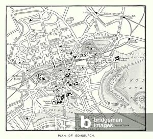
Background imageMaps Collection: Plan of Edinburgh (b/w photo)

Plan of Edinburgh (b/w photo)
8648774 Plan of Edinburgh (b/w photo) by English Photographer, (20th century); Private Collection; (add.info.: Plan of Edinburgh)

Background imageMaps Collection: OS map, 1922: Surrey, Kent (colour litho)

OS map, 1922: Surrey, Kent (colour litho)
8645566 OS map, 1922: Surrey, Kent (colour litho) by English School, (20th century); Private Collection; (add.info.: Surrey, Kent)

Background imageMaps Collection: OS map, 1922: Somerset, Wiltshire, Berkshire, Hampshire (colour litho)

OS map, 1922: Somerset, Wiltshire, Berkshire, Hampshire (colour litho)
8645564 OS map, 1922: Somerset, Wiltshire, Berkshire, Hampshire (colour litho) by English School, (20th century); Private Collection; (add.info.: Somerset, Wiltshire, Berkshire, Hampshire)

Background imageMaps Collection: Modern Turkey (litho)

Modern Turkey (litho)
8661150 Modern Turkey (litho) by English School, (20th century); Private Collection; (add.info.: Modern Turkey. The boundaries of the new Turkey were fixed by the Treaty of Lausanne, 1923)

Background imageMaps Collection: Ireland in the reign of Henry II (engraving)

Ireland in the reign of Henry II (engraving)
8636258 Ireland in the reign of Henry II (engraving) by English School, (19th century); Private Collection; (add.info.: Ireland in the reign of Henry II)

Background imageMaps Collection: Trade card for Charpentier, engraver, printer and stationer, Portsmouth (engraving)

Trade card for Charpentier, engraver, printer and stationer, Portsmouth (engraving)
8677584 Trade card for Charpentier, engraver, printer and stationer, Portsmouth (engraving) by English School, (19th century); Private Collection; (add.info.: Trade card for Charpentier, engraver)

Background imageMaps Collection: The principal Celtic sites in Sussex (litho)

The principal Celtic sites in Sussex (litho)
8676137 The principal Celtic sites in Sussex (litho) by English School, (20th century); Private Collection; (add.info.: The principal Celtic sites in Sussex)

Background imageMaps Collection: Map of the Mersey Tunnel (litho)

Map of the Mersey Tunnel (litho)
8675800 Map of the Mersey Tunnel (litho) by English School, (20th century); Private Collection; (add.info.: Map of the Mersey Tunnel)

Background imageMaps Collection: English Period Costumes: A Gentleman, Eighteenth Century (colour litho)

English Period Costumes: A Gentleman, Eighteenth Century (colour litho)
8668212 English Period Costumes: A Gentleman, Eighteenth Century (colour litho) by English School, (20th century); Private Collection; (add.info.: A Gentleman, Eighteenth Century)

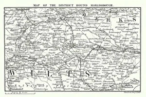
Background imageMaps Collection: Map of the District Round Marlborough (engraving)

Map of the District Round Marlborough (engraving)
8667282 Map of the District Round Marlborough (engraving) by English School, (19th century); Private Collection; (add.info.: Map of the District Round Marlborough)

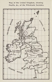
Background imageMaps Collection: Co-operative Wholesale Societies: Map of the United Kingdom, showing Depots, etc

Co-operative Wholesale Societies: Map of the United Kingdom, showing Depots, etc, of the Wholesale Societies (litho)
8668904 Co-operative Wholesale Societies: Map of the United Kingdom, showing Depots, etc, of the Wholesale Societies (litho) by English School

Background imageMaps Collection: Map of Scotland, England, Ireland in 1100 (Map of british islands, England)

Map of Scotland, England, Ireland in 1100 (Map of british islands, England)
ELD4930022 Map of Scotland, England, Ireland in 1100 (Map of british islands, England, Scotland and Ireland in 1100) Plate from Houze's Universal Atlas

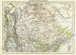
Background imageMaps Collection: Geographic map of the British-Dominion Territories of North America, c. 1870

Geographic map of the British-Dominion Territories of North America, c. 1870. Colour engraving, 19th century
NWI4867633 Geographic map of the British-Dominion Territories of North America, c. 1870. Colour engraving, 19th century.; (add.info)

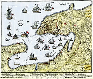
Background imageMaps Collection: Map showing Louisbourg, a Canadian city in the province of Nova Scotia, Canada

Map showing Louisbourg, a Canadian city in the province of Nova Scotia, Canada, under the British flag, 1745
NWI4867370 Map showing Louisbourg, a Canadian city in the province of Nova Scotia, Canada, under the British flag, 1745. Colouring engraving of the 19th century.; (add.info.: Map showing Louisbourg)

Background imageMaps Collection: Geographic map of Ireland or Eire (Great Britain), circa 1870. Colour engraving, 19th century

Geographic map of Ireland or Eire (Great Britain), circa 1870. Colour engraving, 19th century
NWI4874618 Geographic map of Ireland or Eire (Great Britain), circa 1870. Colour engraving, 19th century.; (add.info.: Geographic map of Ireland or Eire (Great Britain), circa 1870

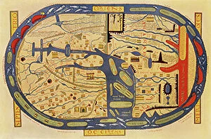
Background imageMaps Collection: World map of a flat earth, printed by Beatus Rhenanus (Bild aus Rheinau), early 1500 s

World map of a flat earth, printed by Beatus Rhenanus (Bild aus Rheinau), early 1500 s
NWI4901273 World map of a flat earth, printed by Beatus Rhenanus (Bild aus Rheinau), early 1500 s.; (add.info.: World map of a flat earth, printed by Beatus Rhenanus (Bild aus Rheinau)

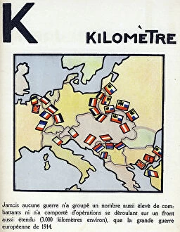
Background imageMaps Collection: First World War 1914-1918 (14-18): Letter K as kilometre. Map of countries at war extending over

First World War 1914-1918 (14-18): Letter K as kilometre. Map of countries at war extending over 3000 km
DUV4201478 First World War 1914-1918 (14-18): Letter K as kilometre. Map of countries at war extending over 3000 km. Engraving in " Alphabet of the Great War 1914-1916

Background imageMaps Collection: Elevation of the Mausoleum of Hadrian in its perfect state in Parco Adriano, Rome

Elevation of the Mausoleum of Hadrian in its perfect state in Parco Adriano, Rome
FLO4679377 Elevation of the Mausoleum of Hadrian in its perfect state in Parco Adriano, Rome. Copperplate engraving by Henry Moses from A Collection of Antique Vases, Altars, etc., London

Background imageMaps Collection: 16th Century map of Norwich

16th Century map of Norwich
3329550 16th Century map of Norwich; (add.info.: 16th Century map of Norwich, England. Dated 16th Century.); Universal History Archive/UIG

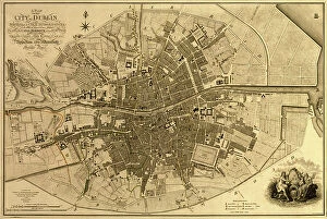
Background imageMaps Collection: Ireland, Dublin, 1791

Ireland, Dublin, 1791
2902832 Ireland, Dublin, 1791; (add.info.: Ireland, Dublin, 1791.); Buyenlarge Archive/UIG

Background imageMaps Collection: Panorama of harbor showing siege of Curacao by English sailors and soldiers in 1800

Panorama of harbor showing siege of Curacao by English sailors and soldiers in 1800
2902887 Panorama of harbor showing siege of Curacao by English sailors and soldiers in 1800; (add.info.: Panorama of harbor showing siege of Curacao by English sailors and soldiers in 1800)

Background imageMaps Collection: Tudor country woman with basket. c.1612 (engraving)

Tudor country woman with basket. c.1612 (engraving)
2911217 Tudor country woman with basket. c.1612 (engraving); (add.info.: Tudor country woman with basket, (detail), from a map of England and wales by John Speed; C1612

Background imageMaps Collection: Tudor noblewoman (detail), from a map of England and wales by John Speed, c.1612 (engraving)

Tudor noblewoman (detail), from a map of England and wales by John Speed, c.1612 (engraving)
2911210 Tudor noblewoman (detail), from a map of England and wales by John Speed, c.1612 (engraving); Universal History Archive/UIG

Background imageMaps Collection: A Map of British - French Settlements in America, 1755

A Map of British - French Settlements in America, 1755
2902786 A Map of British - French Settlements in America, 1755; (add.info.: A Map of British - French Settlements in America, 1755.); Buyenlarge Archive/UIG

Background imageMaps Collection: Map of European odds on the Atlantic Ocean, including Gibraltar, Portugal, Spain, England

Map of European odds on the Atlantic Ocean, including Gibraltar, Portugal, Spain, England, Ireland and Iceland
AIS5350370 Map of European odds on the Atlantic Ocean, including Gibraltar, Portugal, Spain, England, Ireland and Iceland, as well as North Africa

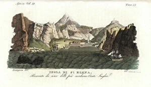
Background imageMaps Collection: View of the Island of Saint Helena, early 19th century, taken from a recent English map

View of the Island of Saint Helena, early 19th century, taken from a recent English map
FLO4620909 View of the Island of Saint Helena, early 19th century, taken from a recent English map. Handcoloured copperplate engraving by Andrea Bernieri after an illustration by Beaugean from Giulio

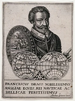
Background imageMaps Collection: Portrait of Francis Drake (Franciscus Draco Nobilissimus Angliae Eques)

Portrait of Francis Drake (Franciscus Draco Nobilissimus Angliae Eques, Rei Nauticae ac Bellicae Peritissimus)
MMM5478531 Portrait of Francis Drake (Franciscus Draco Nobilissimus Angliae Eques, Rei Nauticae ac Bellicae Peritissimus) (1542-1596)

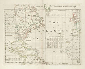
Background imageMaps Collection: Chart of the Atlantic Ocean, with the British, French & Spanish settlements in North America

Chart of the Atlantic Ocean, with the British, French & Spanish settlements in North America and the West Indies
7295390 Chart of the Atlantic Ocean, with the British, French & Spanish settlements in North America and the West Indies, 1753 (engraving) by Jefferys

Background imageMaps Collection: Falkland's Islands, c.1805 (coloured manuscript)

Falkland's Islands, c.1805 (coloured manuscript)
7295386 Falkland's Islands, c.1805 (coloured manuscript) by Unknown Artist, (19th century); 30x34.5 cm; National Maritime Museum, London, UK; (add.info.: Creator: Anonymous Single sheet)

Background imageMaps Collection: Map of Virginia, 1585 (etching)

Map of Virginia, 1585 (etching)
7295569 Map of Virginia, 1585 (etching); 30x41.2 cm; National Maritime Museum, London, UK; (add.info.: This map was drawn by John White)

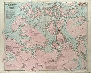
Background imageMaps Collection: The Arctic shores of America from Baffin Bay to Cape Bathurst, showing the coasts

The Arctic shores of America from Baffin Bay to Cape Bathurst, showing the coasts
7295391 The Arctic shores of America from Baffin Bay to Cape Bathurst, showing the coasts and rivers explored by the officers of the several British expeditions, between 1818 & 1859

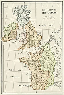
Background imageMaps Collection: Geographic map of England and France during the Angevins dynasty, 12th-15th century

Geographic map of England and France during the Angevins dynasty, 12th-15th century. Lithograph of the 19th century
NWI4874543 Geographic map of England and France during the Angevins dynasty, 12th-15th century. Lithograph of the 19th century.; (add.info)

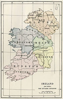
Background imageMaps Collection: Geographic map of Ireland with decoupage of the regions of Ulster, Connaught, Meath

Geographic map of Ireland with decoupage of the regions of Ulster, Connaught, Meath
NWI4873064 Geographic map of Ireland with decoupage of the regions of Ulster, Connaught, Meath, Munster and Leinster before the English invasion, circa 1850

Background imageMaps Collection: Geographic map of Brittany after saxon invasion, 500 AD Engraving from 'Atlas Universel' by Houze

Geographic map of Brittany after saxon invasion, 500 AD Engraving from "Atlas Universel" by Houze
ELD4925007 Geographic map of Brittany after saxon invasion, 500 AD Engraving from "Atlas Universel" by Houze, 1851 Private collection; (add.info)


All Professionally Made to Order for Quick Shipping


-

Maps Collection

The Republic of Ireland is located in the North Atlantic Ocean and is part of Europe. Maps of the Republic of Ireland are widely available, both online and in print. These maps typically show the country's major cities, rivers, lakes, mountains, national parks and other features. They also often include information about roads and other transportation networks as well as political boundaries. They can useful for travelers who wish to explore the country or plan a route from one destination to another. Additionally, they can be used by businesses looking to expand their operations into new markets or investors seeking potential opportunities in different parts of the country.
+

Our beautiful pictures are available as Framed Prints, Photos, Wall Art and Photo Gifts

The Maps of Republic of Ireland Europe collection from Media Storehouse is a stunning range of wall art and framed prints that showcase the beauty and diversity of Ireland's landscapes. Our collection features an extensive selection of maps, including antique maps, topographical maps, and modern-day roadmaps. Each print in our collection is carefully crafted to capture the unique character and charm of Ireland's cities, towns, villages, mountains, lakes, rivers and coastlines. Whether you are looking for a striking piece to hang in your home or office or want to give a thoughtful gift to someone special who loves Irish culture and history - our collection has something for everyone. From Dublin's bustling streets to the rugged beauty of Connemara National Park; from the ancient ruins at Newgrange to the rolling hillsides dotted with sheep - these prints offer a glimpse into one of Europe's most enchanting countries. With its rich history, vibrant culture and breathtaking scenery - it's no wonder why so many people fall in love with Ireland.
+

What are Maps of Republic of Ireland Europe art prints?

Maps of Republic of Ireland Europe art prints are high-quality reproductions of maps that depict the geography and topography of the Republic of Ireland. These prints showcase intricate details such as cities, towns, rivers, mountains, and other landmarks that make up the Irish landscape. They are designed to be visually appealing and informative at the same time. These art prints are perfect for anyone who loves history or geography or has an interest in exploring new places. They can be used to decorate homes, offices, schools or any space where a touch of sophistication is needed. Maps of Republic of Ireland Europe art prints come in various sizes and styles to suit different preferences. These art prints offer a unique way to appreciate the beauty and complexity of one's surroundings while also providing valuable information about them. Whether you're looking for a decorative piece or something more educational, Maps of Republic of Ireland Europe art prints from Media Storehouse are sure to impress.
+

What Maps of Republic of Ireland Europe art prints can I buy from Media Storehouse?

We offer a wide range of Republic of Ireland Europe art prints that are perfect for those who want to add a touch of elegance and sophistication to their home or office. These maps showcase the beauty and intricacy of the region, highlighting its unique features and landmarks. Some popular options include vintage-style maps that capture the history and charm of Ireland, as well as modern designs that offer a fresh take on this stunning country. You can choose from different sizes, styles, and finishes to suit your preferences. Whether you're looking for a statement piece or something more subtle, we have plenty of options to choose from. Their high-quality prints are made using premium materials that ensure they look great for years to come. So if you want to bring some Irish flair into your space, be sure to check out their selection today.
+

How do I buy Maps of Republic of Ireland Europe art prints?

To buy Maps of Republic of Ireland Europe art prints from Media Storehouse, you can browse our extensive collection online. Simply search for the specific map or artwork that you are interested in and add it to your cart. You can also refine your search by selecting different categories such as size, orientation, and color. Once you have added all the items to your cart, proceed to checkout where you will be prompted to enter your shipping and payment information. After completing the purchase process, Media Storehouse will process your order and ship it directly to your desired location. We offer a wide range of high-quality art prints featuring maps of Republic of Ireland Europe that are perfect for decorating any space in your home or office. Whether you're looking for a vintage-style map or a modern interpretation, they have something for everyone's taste and budget. So start exploring our collection today.
+

How much do Maps of Republic of Ireland Europe art prints cost?

As We offer a wide range of maps of the Republic of Ireland and Europe art prints, the cost may vary depending on factors such as size, framing options, and printing materials. However, you can be assured that they will receive high-quality prints at reasonable prices. The company sources its images from top photographers and archives worldwide to ensure that our collection is diverse and unique. Our maps of the Republic of Ireland and Europe art prints are perfect for those who want to add a touch of sophistication to their home or office decor. These prints come in various sizes ranging from small to large formats, making them suitable for any space. You can choose between unframed or framed options based on their preferences. We provide excellent value for money when it comes to purchasing maps of the Republic of Ireland and Europe art prints. Their products are affordable yet maintain exceptional quality standards that meet customer expectations.
+

How will my Maps of Republic of Ireland Europe art prints be delivered to me?

Your Maps of Republic of Ireland Europe art prints will be delivered to you in a safe and secure manner. We take great care in packaging your order so that it arrives at your doorstep without any damage. The prints are carefully rolled and placed inside a sturdy tube, which is then sealed with protective caps on both ends. We use reliable courier services to deliver your order, ensuring that it reaches you within the estimated delivery time frame. You can track your package using the tracking number provided once it has been dispatched from our warehouse. We understand how important it is for our customers to receive their orders promptly and in perfect condition. That's why we have partnered with trusted shipping companies who share our commitment to quality service. Rest assured that when you order Maps of Republic of Ireland Europe art prints from us, they will be delivered to you safely and efficiently.