Fraud Blocker Skip to main content

Home > Europe > Republic of Ireland > Maps

Maps Collection (page 3)

The Republic of Ireland is located in the North Atlantic Ocean and is part of Europe

1,486 items

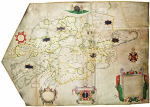
Background imageMaps Collection: Map of Lismore, Ireland, 1589 (paper, linen)

Map of Lismore, Ireland, 1589 (paper, linen)
7339819 Map of Lismore, Ireland, 1589 (paper, linen) by Unknown Artist, (16th century); 104.5x117.5 cm; National Maritime Museum, London

Background imageMaps Collection: Ireland sourth of the Shannon, c.1585 (vellum, linen)

Ireland sourth of the Shannon, c.1585 (vellum, linen)
7339816 Ireland sourth of the Shannon, c.1585 (vellum, linen) by Unknown Artist, (16th century); 70.5x102 cm; National Maritime Museum, London

Background imageMaps Collection: The harbour of Dublin in Ireland, 1673 (paper, linen)

The harbour of Dublin in Ireland, 1673 (paper, linen)
7339815 The harbour of Dublin in Ireland, 1673 (paper, linen) by Unknown Artist, (17th century); 73.5x91 cm; National Maritime Museum, London, UK; (add.info.: Creator: unknown Scale: [ca)

Background imageMaps Collection: The citty and suburbs of Dublin from Kilmainham to Rings-End, werein the rivers, streets, lanes

The citty and suburbs of Dublin from Kilmainham to Rings-End, werein the rivers, streets, lanes, allys, churches
7339813 The citty and suburbs of Dublin from Kilmainham to Rings-End, werein the rivers, streets, lanes, allys, churches, gates &c are exactly described 15th No

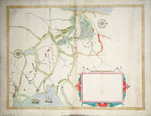
Background imageMaps Collection: Central Ireland, Dublin to Sligo, c.1600 (laid on linen)

Central Ireland, Dublin to Sligo, c.1600 (laid on linen)
7339811 Central Ireland, Dublin to Sligo, c.1600 (laid on linen) by Boazio, Baptista (fl.1588-1606); 58x63 cm; National Maritime Museum, London

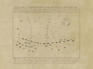
Background imageMaps Collection: Plan of the Commencement of the Battle of Trafalgar, 19th century (etching)

Plan of the Commencement of the Battle of Trafalgar, 19th century (etching)
7342311 Plan of the Commencement of the Battle of Trafalgar, 19th century (etching) by Unknown Artist, (19th century); 29.5x35.8 cm; National Maritime Museum, London

Background imageMaps Collection: Pocket atlas and nautical almanac, c.1546 (vellum)

Pocket atlas and nautical almanac, c.1546 (vellum)
7340753 Pocket atlas and nautical almanac, c.1546 (vellum) by Brouscon, Guillaume (16th century); National Maritime Museum, London

Background imageMaps Collection: Chart of area from Dover and Calais to Orfordness, 1906-10 (manuscript)

Chart of area from Dover and Calais to Orfordness, 1906-10 (manuscript)
7340551 Chart of area from Dover and Calais to Orfordness, 1906-10 (manuscript) by British School, (20th century) ; 69.6x103.1 cm; National Maritime Museum, London

Background imageMaps Collection: Map of Hounslow, Twickenham and Richmond, 1746 (coloured engraving)

Map of Hounslow, Twickenham and Richmond, 1746 (coloured engraving)
7340518 Map of Hounslow, Twickenham and Richmond, 1746 (coloured engraving) by Rocque, John (c.1704-d.1762); 51x67 cm; National Maritime Museum, London

Background imageMaps Collection: Chart of Yarmouth and the sands about it, c.1700 (coloured engraving)

Chart of Yarmouth and the sands about it, c.1700 (coloured engraving)
7340607 Chart of Yarmouth and the sands about it, c.1700 (coloured engraving) by Collins, Greenvile (1643-94); National Maritime Museum, London

Background imageMaps Collection: England East Coast: Harwich to Kingston Upon Hull, 1857 (print)

England East Coast: Harwich to Kingston Upon Hull, 1857 (print)
7340600 England East Coast: Harwich to Kingston Upon Hull, 1857 (print) by Hobbs, J.S. (19th century); 81x65.5 cm; National Maritime Museum, London, UK; (add.info.: Creator: J.S)

Background imageMaps Collection: England-East Coast. Outer Gabbard to Outer Dowsing, 1919 (engraving)

England-East Coast. Outer Gabbard to Outer Dowsing, 1919 (engraving)
7340581 England-East Coast. Outer Gabbard to Outer Dowsing, 1919 (engraving) by British School, (20th century) ; 98.5x66 cm; National Maritime Museum, London

Background imageMaps Collection: Map of Bow, Stratford, Blackwall and Plaistow, 1746 (coloured engraving)

Map of Bow, Stratford, Blackwall and Plaistow, 1746 (coloured engraving)
7340506 Map of Bow, Stratford, Blackwall and Plaistow, 1746 (coloured engraving) by Rocque, John (c.1704-d.1762); 51x67 cm; National Maritime Museum, London

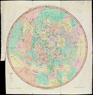
Background imageMaps Collection: Chart of the Heavens for the Latitude of London, Urania's Mirror or a View of the Heavens

Chart of the Heavens for the Latitude of London, Urania's Mirror or a View of the Heavens, c.1825 (card, paper)
7340086 Chart of the Heavens for the Latitude of London, Urania's Mirror or a View of the Heavens, c.1825 (card, paper, tissue, engraving) by Hall

Background imageMaps Collection: A Dutch map showing areas devastated by the Great Fire of London, 1666, 17th century (manuscript)

A Dutch map showing areas devastated by the Great Fire of London, 1666, 17th century (manuscript)
7340111 A Dutch map showing areas devastated by the Great Fire of London, 1666, 17th century (manuscript) by Unknown Artist, (17th century); National Maritime Museum, London

Background imageMaps Collection: 'A new mappe of the sea coasts of England, France and Holland, wherein the English names, situation

'A new mappe of the sea coasts of England, France and Holland, wherein the English names, situation
7340046 'A new mappe of the sea coasts of England, France and Holland, wherein the English names, situation, point of the compass, and distance of the several ports, harbours, havens, creeks

Background imageMaps Collection: The coast of England from the Southforeland to Orfordness, 1675 (coloured engraving)

The coast of England from the Southforeland to Orfordness, 1675 (coloured engraving)
7340045 The coast of England from the Southforeland to Orfordness, 1675 (coloured engraving) by Seller, John (1632-97); 43.5x54 cm; National Maritime Museum, London

Background imageMaps Collection: A new chart of the coast from Lowestoff to Hasbrough including Yarmouth Roads and Sands

A new chart of the coast from Lowestoff to Hasbrough including Yarmouth Roads and Sands, Hasbrough Gatt
7340040 A new chart of the coast from Lowestoff to Hasbrough including Yarmouth Roads and Sands, Hasbrough Gatt, and the new lights, 1797 (technical drawing) by Diston

Background imageMaps Collection: Title page to 'Expeditionis Hispanorum in Angliam vera descriptio anno domini MDLXXXVIII'

Title page to 'Expeditionis Hispanorum in Angliam vera descriptio anno domini MDLXXXVIII', 1590 (engraving)
7340022 Title page to 'Expeditionis Hispanorum in Angliam vera descriptio anno domini MDLXXXVIII', 1590 (engraving) by Adams, Robert (1540-95) (after); 43x53.5 cm; National Maritime Museum, London

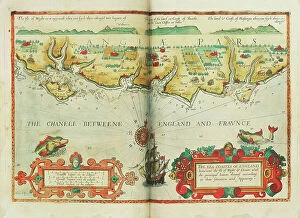
Background imageMaps Collection: The sea coastes of England between the Isle of Wight and Dover

The sea coastes of England between the Isle of Wight and Dover, with the principal havens thereof according to their
7340013 The sea coastes of England between the Isle of Wight and Dover, with the principal havens thereof according to their situation and appearing, c.1588 (chart) by Janszoon Waghenaer

Background imageMaps Collection: A survey of the entrance to the River Humber by Commander Williamm Hewett, R.N

A survey of the entrance to the River Humber by Commander Williamm Hewett, R.N
7339966 A survey of the entrance to the River Humber by Commander Williamm Hewett, R.N. made by order of the Lords Commisioners of the Admiralty 1828, 1830-41 (technical drawing) by Walker, J. & C

Background imageMaps Collection: Battle of Copenhagen, 2 April 1801, 1801 (engraving)

Battle of Copenhagen, 2 April 1801, 1801 (engraving)
7339858 Battle of Copenhagen, 2 April 1801, 1801 (engraving) by Gibson, Francis (19th century); 40x45.5 cm; National Maritime Museum, London

Background imageMaps Collection: The south west coast of Ireland from the Staggs of Castle Haven to Dursey I

The south west coast of Ireland from the Staggs of Castle Haven to Dursey I. Surveyed and navigated by M
7339857 The south west coast of Ireland from the Staggs of Castle Haven to Dursey I. Surveyed and navigated by M. Mackenzie Sen

Background imageMaps Collection: Rear-Admiral Sir John Jervis, 1st Earl of St Vincent (1735-1823), 1806 (oil on canvas)

Rear-Admiral Sir John Jervis, 1st Earl of St Vincent (1735-1823), 1806 (oil on canvas)
7338043 Rear-Admiral Sir John Jervis, 1st Earl of St Vincent (1735-1823), 1806 (oil on canvas) by Pellegrini, Domenico (1759-1840); 237.5x147.5 cm; National Maritime Museum, London

Background imageMaps Collection: Formerly called 'Nevil Maskelyne, Astronomer Royal (1732-1811)', 1779 (oil painting)

Formerly called 'Nevil Maskelyne, Astronomer Royal (1732-1811)', 1779 (oil painting)
7337966 Formerly called 'Nevil Maskelyne, Astronomer Royal (1732-1811)', 1779 (oil painting) by Downman, John (c.1750-1824); 91.4x71.1 cm; National Maritime Museum, London

Background imageMaps Collection: River Thames from London to Gravesend, 1830-33 (print)

River Thames from London to Gravesend, 1830-33 (print)
7337575 River Thames from London to Gravesend, 1830-33 (print) by Bullock, F. & Burstal, E. (fl.c.1830); National Maritime Museum, London, UK; (add.info.: Creator: Captain F. Bullock; Lieutenant E)

Background imageMaps Collection: Plan Of Stonehenge As If Restored, Left. Plan Of Stonehenge As It Was

Plan Of Stonehenge As If Restored, Left. Plan Of Stonehenge As It Was. Both Plans From The Late 19Th Century
UIG5420285 Plan Of Stonehenge As If Restored, Left. Plan Of Stonehenge As It Was. Both Plans From The Late 19Th Century. From Our Own Country Published 1898 ©UIG/Leemage

Background imageMaps Collection: Plan of Deptford Dockyard, 1774 (technical drawing)

Plan of Deptford Dockyard, 1774 (technical drawing)
7340916 Plan of Deptford Dockyard, 1774 (technical drawing) by Unknown artist, (18th century); National Maritime Museum, London, UK; (add.info.: Creator: unknown); © National Maritime Museum

Background imageMaps Collection: Britain and Ireland, c.1550 (vellum)

Britain and Ireland, c.1550 (vellum)
7339594 Britain and Ireland, c.1550 (vellum) by Martines, Joan (1556-1590); 1.6x19 cm; National Maritime Museum, London, UK; (add.info.: Creator: Joan Martines); © National Maritime Museum

Background imageMaps Collection: Chart of Plymouth Sound, from Greenville Collins's 1693 chart of the English Channel

Chart of Plymouth Sound, from Greenville Collins's 1693 chart of the English Channel, 1695 (coloured engraving)
7339508 Chart of Plymouth Sound, from Greenville Collins's 1693 chart of the English Channel, 1695 (coloured engraving) by Keulen, Gerard van (1678-1726); 51x60 cm; National Maritime Museum, London

Background imageMaps Collection: A map of the British and French dominions in North America with the roads, distances

A map of the British and French dominions in North America with the roads, distances
7339367 A map of the British and French dominions in North America with the roads, distances, limits and extent of the settlements

Background imageMaps Collection: 'A chart of the islands in the China Sea near the Straits of Malacca with the positions of

'A chart of the islands in the China Sea near the Straits of Malacca with the positions of the English fleet
7339495 'A chart of the islands in the China Sea near the Straits of Malacca with the positions of the English fleet and the squadron of Admiral Linois on the 14 & 15th February 1804'

Background imageMaps Collection: Chart of Milford Haven in St Georges and Bristol Channel, 1595 (pencil, ink and watercolour)

Chart of Milford Haven in St Georges and Bristol Channel, 1595 (pencil, ink and watercolour)
7339469 Chart of Milford Haven in St Georges and Bristol Channel, 1595 (pencil, ink and watercolour) by Ive, Paul (16th century); 44x58 cm; National Maritime Museum, London

Background imageMaps Collection: Kingstown Harbour, east coast of Ireland, 1903 (engraving)

Kingstown Harbour, east coast of Ireland, 1903 (engraving)
7339443 Kingstown Harbour, east coast of Ireland, 1903 (engraving) by British School, (20th century) ; 49x66 cm; National Maritime Museum, London, UK; (add.info.: Creator: W.F)

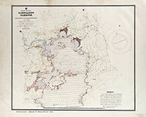
Background imageMaps Collection: Ireland - West Coast, Glengariff Harbour. Surveyed by Qualifying Class

Ireland - West Coast, Glengariff Harbour. Surveyed by Qualifying Class, Navigation School Sept - Oct 1912
7339437 Ireland - West Coast, Glengariff Harbour. Surveyed by Qualifying Class, Navigation School Sept - Oct 1912., 1912 (paper, ink, watercolour, linen) by British School

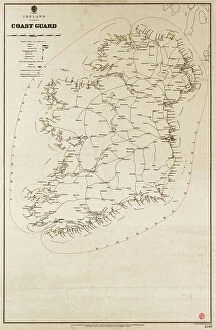
Background imageMaps Collection: Ireland Coast Guard, 1897 (Paper, Linen)

Ireland Coast Guard, 1897 (Paper, Linen)
7339436 Ireland Coast Guard, 1897 (Paper, Linen) by British School, (19th century); 77x49.5 cm; National Maritime Museum, London

Background imageMaps Collection: London: The National Gallery of British Art, Tate Gallery (litho)

London: The National Gallery of British Art, Tate Gallery (litho)
8629743 London: The National Gallery of British Art, Tate Gallery (litho) by English Photographer, (20th century); Private Collection; (add.info.: The National Gallery of British Art, Tate Gallery)

Background imageMaps Collection: London: Hampstead Heath (litho)

London: Hampstead Heath (litho)
8629748 London: Hampstead Heath (litho) by English Photographer, (20th century); Private Collection; (add.info.: Hampstead Heath)

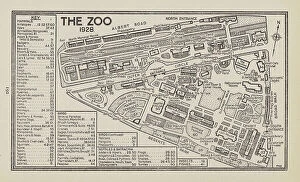
Background imageMaps Collection: London: The Zoo, 1928 (litho)

London: The Zoo, 1928 (litho)
8629740 London: The Zoo, 1928 (litho) by English Photographer, (20th century); Private Collection; (add.info.: The Zoo, 1928)

Background imageMaps Collection: Allocation of Building Sites in the Square, 1676 (litho)

Allocation of Building Sites in the Square, 1676 (litho)
8629065 Allocation of Building Sites in the Square, 1676 (litho) by English School, (19th century); Private Collection; (add.info.: Allocation of Building Sites in the Square, 1676)

Background imageMaps Collection: Waterloo Station, Plan and Key to Running Lines, c.1948 (b/w photo)

Waterloo Station, Plan and Key to Running Lines, c.1948 (b/w photo)
8641438 Waterloo Station, Plan and Key to Running Lines, c.1948 (b/w photo) by English School, (20th century); Private Collection; (add.info.: Waterloo Station, Plan and Key to Running Lines, c.1948)

Background imageMaps Collection: Battle of Edgehill, 23 October 1642 (litho)

Battle of Edgehill, 23 October 1642 (litho)
8652530 Battle of Edgehill, 23 October 1642 (litho) by Bartholomew, John George (1860-1920) ; Private Collection; (add.info.: Battle of Edgehill, 23 October 1642)

Background imageMaps Collection: Land of Burns (litho)

Land of Burns (litho)
8652522 Land of Burns (litho) by Bartholomew, John George (1860-1920) ; Private Collection; (add.info.: Land of Burns. Illustration for A Literary)

Background imageMaps Collection: Ivanhoe (litho)

Ivanhoe (litho)
8652518 Ivanhoe (litho) by Bartholomew, John George (1860-1920) ; Private Collection; (add.info.: Ivanhoe. Illustration for A Literary and Historical Atlas of Europe by J G Bartholomew [1860-1920])

Background imageMaps Collection: France, Norman to Tudor Period, illustrating the French and English Wars (colour litho)

France, Norman to Tudor Period, illustrating the French and English Wars (colour litho)
8652273 France, Norman to Tudor Period, illustrating the French and English Wars (colour litho) by English School, (19th century); Private Collection; (add.info.: France, Norman to Tudor Period)

Background imageMaps Collection: North America, illustrating the Conquest of Canada and the War of Independence

North America, illustrating the Conquest of Canada and the War of Independence, 1757-1783 (colour litho)
8652272 North America, illustrating the Conquest of Canada and the War of Independence, 1757-1783 (colour litho) by English School, (19th century); Private Collection; (add.info.: North America)

Background imageMaps Collection: World showing British Possessions and Dependencies (colour litho)

World showing British Possessions and Dependencies (colour litho)
8652268 World showing British Possessions and Dependencies (colour litho) by English School, (19th century); Private Collection; (add.info.: World showing British Possessions and Dependencies)

Background imageMaps Collection: OS map, 1922: Sussex, Strait of Dover (colour litho)

OS map, 1922: Sussex, Strait of Dover (colour litho)
8651671 OS map, 1922: Sussex, Strait of Dover (colour litho) by English School, (20th century); Private Collection; (add.info.: Sussex, Strait of Dover)


All Professionally Made to Order for Quick Shipping


-

Maps Collection

The Republic of Ireland is located in the North Atlantic Ocean and is part of Europe. Maps of the Republic of Ireland are widely available, both online and in print. These maps typically show the country's major cities, rivers, lakes, mountains, national parks and other features. They also often include information about roads and other transportation networks as well as political boundaries. They can useful for travelers who wish to explore the country or plan a route from one destination to another. Additionally, they can be used by businesses looking to expand their operations into new markets or investors seeking potential opportunities in different parts of the country.
+

Our beautiful pictures are available as Framed Prints, Photos, Wall Art and Photo Gifts

The Maps of Republic of Ireland Europe collection from Media Storehouse is a stunning range of wall art and framed prints that showcase the beauty and diversity of Ireland's landscapes. Our collection features an extensive selection of maps, including antique maps, topographical maps, and modern-day roadmaps. Each print in our collection is carefully crafted to capture the unique character and charm of Ireland's cities, towns, villages, mountains, lakes, rivers and coastlines. Whether you are looking for a striking piece to hang in your home or office or want to give a thoughtful gift to someone special who loves Irish culture and history - our collection has something for everyone. From Dublin's bustling streets to the rugged beauty of Connemara National Park; from the ancient ruins at Newgrange to the rolling hillsides dotted with sheep - these prints offer a glimpse into one of Europe's most enchanting countries. With its rich history, vibrant culture and breathtaking scenery - it's no wonder why so many people fall in love with Ireland.
+

What are Maps of Republic of Ireland Europe art prints?

Maps of Republic of Ireland Europe art prints are high-quality reproductions of maps that depict the geography and topography of the Republic of Ireland. These prints showcase intricate details such as cities, towns, rivers, mountains, and other landmarks that make up the Irish landscape. They are designed to be visually appealing and informative at the same time. These art prints are perfect for anyone who loves history or geography or has an interest in exploring new places. They can be used to decorate homes, offices, schools or any space where a touch of sophistication is needed. Maps of Republic of Ireland Europe art prints come in various sizes and styles to suit different preferences. These art prints offer a unique way to appreciate the beauty and complexity of one's surroundings while also providing valuable information about them. Whether you're looking for a decorative piece or something more educational, Maps of Republic of Ireland Europe art prints from Media Storehouse are sure to impress.
+

What Maps of Republic of Ireland Europe art prints can I buy from Media Storehouse?

We offer a wide range of Republic of Ireland Europe art prints that are perfect for those who want to add a touch of elegance and sophistication to their home or office. These maps showcase the beauty and intricacy of the region, highlighting its unique features and landmarks. Some popular options include vintage-style maps that capture the history and charm of Ireland, as well as modern designs that offer a fresh take on this stunning country. You can choose from different sizes, styles, and finishes to suit your preferences. Whether you're looking for a statement piece or something more subtle, we have plenty of options to choose from. Their high-quality prints are made using premium materials that ensure they look great for years to come. So if you want to bring some Irish flair into your space, be sure to check out their selection today.
+

How do I buy Maps of Republic of Ireland Europe art prints?

To buy Maps of Republic of Ireland Europe art prints from Media Storehouse, you can browse our extensive collection online. Simply search for the specific map or artwork that you are interested in and add it to your cart. You can also refine your search by selecting different categories such as size, orientation, and color. Once you have added all the items to your cart, proceed to checkout where you will be prompted to enter your shipping and payment information. After completing the purchase process, Media Storehouse will process your order and ship it directly to your desired location. We offer a wide range of high-quality art prints featuring maps of Republic of Ireland Europe that are perfect for decorating any space in your home or office. Whether you're looking for a vintage-style map or a modern interpretation, they have something for everyone's taste and budget. So start exploring our collection today.
+

How much do Maps of Republic of Ireland Europe art prints cost?

As We offer a wide range of maps of the Republic of Ireland and Europe art prints, the cost may vary depending on factors such as size, framing options, and printing materials. However, you can be assured that they will receive high-quality prints at reasonable prices. The company sources its images from top photographers and archives worldwide to ensure that our collection is diverse and unique. Our maps of the Republic of Ireland and Europe art prints are perfect for those who want to add a touch of sophistication to their home or office decor. These prints come in various sizes ranging from small to large formats, making them suitable for any space. You can choose between unframed or framed options based on their preferences. We provide excellent value for money when it comes to purchasing maps of the Republic of Ireland and Europe art prints. Their products are affordable yet maintain exceptional quality standards that meet customer expectations.
+

How will my Maps of Republic of Ireland Europe art prints be delivered to me?

Your Maps of Republic of Ireland Europe art prints will be delivered to you in a safe and secure manner. We take great care in packaging your order so that it arrives at your doorstep without any damage. The prints are carefully rolled and placed inside a sturdy tube, which is then sealed with protective caps on both ends. We use reliable courier services to deliver your order, ensuring that it reaches you within the estimated delivery time frame. You can track your package using the tracking number provided once it has been dispatched from our warehouse. We understand how important it is for our customers to receive their orders promptly and in perfect condition. That's why we have partnered with trusted shipping companies who share our commitment to quality service. Rest assured that when you order Maps of Republic of Ireland Europe art prints from us, they will be delivered to you safely and efficiently.