Fraud Blocker Skip to main content

Home > Europe > United Kingdom > England > Maps

Maps Collection (page 9)

Maps of England, United Kingdom and Europe are essential tools for navigation and exploration

10,598 items

Background imageMaps Collection: United States of America Independence War (1775-1783): Route of American ships 'Ranger'

United States of America Independence War (1775-1783): Route of American ships "Ranger"
NWI4842352 United States of America Independence War (1775-1783): Route of American ships "Ranger" and "Bonhomme Richard" near the British islands during the war

Background imageMaps Collection: Map of Arctic trips by Henry Hudson, English explorer (1570-1611) published in 1612 in ' Voyages'

Map of Arctic trips by Henry Hudson, English explorer (1570-1611) published in 1612 in " Voyages"
NWI4849415 Map of Arctic trips by Henry Hudson, English explorer (1570-1611) published in 1612 in " Voyages". Colouring engraving of the 19th century.; (add.info)

Background imageMaps Collection: First World War: Patriotic map showing three sailors of the allies: French, English and Russian

First World War: Patriotic map showing three sailors of the allies: French, English and Russian
LUX4745102 First World War: Patriotic map showing three sailors of the allies: French, English and Russian, hand in hand on a warship, declaring: 'But let's always go and hand in hand a babord

Background imageMaps Collection: First World War: France, Patriotic Map showing a dog lying down with writing

First World War: France, Patriotic Map showing a dog lying down with writing, Who said german sausage
LUX4741340 First World War: France, Patriotic Map showing a dog lying down with writing, Who said german sausage? (who said German sausage)

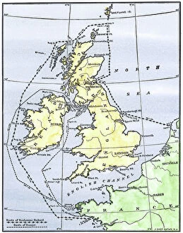
Background imageMaps Collection: Geographic map of Great Britain, Scotland and Ireland, the Atlantic Ocean and the North Sea

Geographic map of Great Britain, Scotland and Ireland, the Atlantic Ocean and the North Sea
NWI4832911 Geographic map of Great Britain, Scotland and Ireland, the Atlantic Ocean and the North Sea, showing the route of the Spanish Great Armada (Invincible Armada) in 1588

Background imageMaps Collection: The English pilot the first book: describing the northern navigation, c.1671 (paper)

The English pilot the first book: describing the northern navigation, c.1671 (paper)
7342407 The English pilot the first book: describing the northern navigation, c.1671 (paper) by Seller, John (1632-97); National Maritime Museum, London

Background imageMaps Collection: 'Lord Nelson explaining to the Officers the Plan of Attack previous to the Battle of Trafalgar'

'Lord Nelson explaining to the Officers the Plan of Attack previous to the Battle of Trafalgar'
7341799 'Lord Nelson explaining to the Officers the Plan of Attack previous to the Battle of Trafalgar', 1806 (coloured aquatint) by Craig

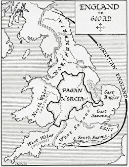
Background imageMaps Collection: Map of England in 640 A.D. (print)

Map of England in 640 A.D. (print)
7420045 Map of England in 640 A.D. (print); (add.info.: Map of England in 640 A.D. From the book Outline of History by H.G. Wells, published 1920.); Photo © Ken Welsh. All rights reserved 2024

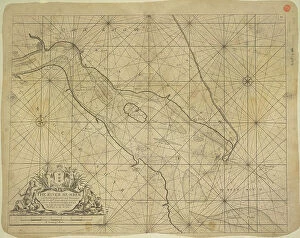
Background imageMaps Collection: Printed chart of the estuary of the River Humber, 1686 (technical drawing)

Printed chart of the estuary of the River Humber, 1686 (technical drawing)
7339965 Printed chart of the estuary of the River Humber, 1686 (technical drawing) by Collins, Greenvile (1643-94); 57x45 cm; National Maritime Museum, London

Background imageMaps Collection: The harbour of Fowey, Cornwall, 1698 (manuscript)

The harbour of Fowey, Cornwall, 1698 (manuscript)
7339664 The harbour of Fowey, Cornwall, 1698 (manuscript) by Dummer, Edmond (17th century); 31x20 cm; National Maritime Museum, London

Background imageMaps Collection: Plan of the City of London after the Great Fire of 1666 (print)

Plan of the City of London after the Great Fire of 1666 (print)
7339524 Plan of the City of London after the Great Fire of 1666 (print) by Wren, Christopher (1632-1723); 47.7x56.6 cm; National Maritime Museum, London

Background imageMaps Collection: A plan of the city and harbour of Louisburg, Cape Breton, 1750 (engraving)

A plan of the city and harbour of Louisburg, Cape Breton, 1750 (engraving)
7339513 A plan of the city and harbour of Louisburg, Cape Breton, 1750 (engraving) by Hinton, J. (18th century); 27x37 cm; National Maritime Museum, London, UK; (add.info.: Creator: J)

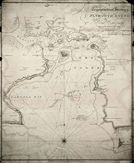
Background imageMaps Collection: A trigonometrical survey of Plymouth Sound, 1809 (engraving)

A trigonometrical survey of Plymouth Sound, 1809 (engraving)
7339359 A trigonometrical survey of Plymouth Sound, 1809 (engraving) by Chapman, William & Heather, William (fl.c.1809); 79x65 cm; National Maritime Museum, London

Background imageMaps Collection: Chart of the English Channel and the Atlantic coasts of southern Britain and northern France

Chart of the English Channel and the Atlantic coasts of southern Britain and northern France, 1692 (coloured engraving)
7339354 Chart of the English Channel and the Atlantic coasts of southern Britain and northern France, 1692 (coloured engraving) by Sanson D'Abbeville

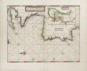
Background imageMaps Collection: A chart of the sea coast from England to the Streights, 1702 (print)

A chart of the sea coast from England to the Streights, 1702 (print)
7339455 A chart of the sea coast from England to the Streights, 1702 (print) by Moll, Hermann (fl.1678-1732); 57x69 cm; National Maritime Museum, London, UK; (add.info.: Creator: H)

Background imageMaps Collection: St.Helen's Road, Spithead, Portsmouth and Langstone harbours

St.Helen's Road, Spithead, Portsmouth and Langstone harbours. Surveyed in 1783 by Lieutenant Murdoch Mackenzie
7339405 St.Helen's Road, Spithead, Portsmouth and Langstone harbours. Surveyed in 1783 by Lieutenant Murdoch Mackenzie Junior., 1808 (Paper, Linen) by British School

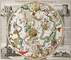
Background imageMaps Collection: Part of a southern hemisphere star chart from Reiner Ottens's Atlas Maior (1730)

Part of a southern hemisphere star chart from Reiner Ottens's Atlas Maior (1730)
7339165 Part of a southern hemisphere star chart from Reiner Ottens's Atlas Maior (1730), with the Greenwich Observatory (left) and the Round Tower observatory in Copenhagen (right)

Background imageMaps Collection: First World War: Patriotic map showing soldiers from Africa and India in the aid of the allies

First World War: Patriotic map showing soldiers from Africa and India in the aid of the allies, 1916, Baker
LUX4744489 First World War: Patriotic map showing soldiers from Africa and India in the aid of the allies, 1916, Baker; (add.info.: World War I - War 14-18 (1914-1918) - World War I (WWI or WW1)

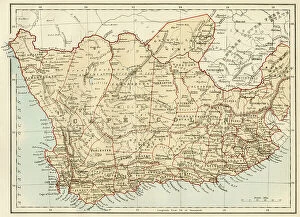
Background imageMaps Collection: South Africa when the country was a British colony, 1870s. Lithograph of the 19th century

South Africa when the country was a British colony, 1870s. Lithograph of the 19th century
NWI4855278 South Africa when the country was a British colony, 1870s. Lithograph of the 19th century.; (add.info.: South Africa when the country was a British colony, 1870s)

Background imageMaps Collection: Geographic map of England and France after the Brittany trade in the Hundred Years War in 1360

Geographic map of England and France after the Brittany trade in the Hundred Years War in 1360
NWI4874497 Geographic map of England and France after the Brittany trade in the Hundred Years War in 1360. Lithograph of the 19th century.; (add.info)

Background imageMaps Collection: Geographic map of England and Wales, circa 1870. 19th century colour engraving

Geographic map of England and Wales, circa 1870. 19th century colour engraving
NWI4874357 Geographic map of England and Wales, circa 1870. 19th century colour engraving; (add.info.: Geographic map of England and Wales, circa 1870)

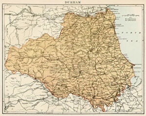
Background imageMaps Collection: Map of the Count of Durham England), circa 1870. 19th century lithography

Map of the Count of Durham England), circa 1870. 19th century lithography
NWI4874845 Map of the Count of Durham England), circa 1870. 19th century lithography.; (add.info.: Map of the Count of Durham England), circa 1870

Background imageMaps Collection: Map of England and Wales, circa 1870. 19th century lithography

Map of England and Wales, circa 1870. 19th century lithography
NWI4874691 Map of England and Wales, circa 1870. 19th century lithography.; (add.info.: Map of England and Wales, circa 1870. 19th century lithography.); Photo © North Wind Pictures

Background imageMaps Collection: Map of the Earl of Middlesex (England), circa 1870. 19th century lithography

Map of the Earl of Middlesex (England), circa 1870. 19th century lithography
NWI4875178 Map of the Earl of Middlesex (England), circa 1870. 19th century lithography.; (add.info.: Map of the Earl of Middlesex (England), circa 1870

Background imageMaps Collection: Map of the Earl of Wiltshire (England), circa 1870. 19th century lithography

Map of the Earl of Wiltshire (England), circa 1870. 19th century lithography
NWI4875514 Map of the Earl of Wiltshire (England), circa 1870. 19th century lithography.; (add.info.: Map of the Earl of Wiltshire (England), circa 1870

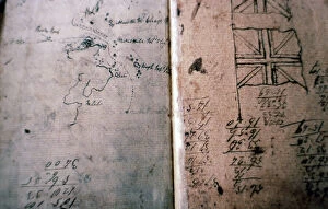
Background imageMaps Collection: Mutinerie du Bounty: log of Lieutenant William Bligh (1754-1817)

Mutinerie du Bounty: log of Lieutenant William Bligh (1754-1817) redige in the boat after the mutinerie du Bounty of 29
ELD4881297 Mutinerie du Bounty: log of Lieutenant William Bligh (1754-1817) redige in the boat after the mutinerie du Bounty of 29 April 1789 - Detail avec drapeau et dessin des contours d'une cote

Background imageMaps Collection: Patriotic map showing the three allied nations France, England and Russia holding hands

Patriotic map showing the three allied nations France, England and Russia holding hands and heading towards Victory
LUX4743785 Patriotic map showing the three allied nations France, England and Russia holding hands and heading towards Victory

Background imageMaps Collection: Patriotic map showing France and England contemplating a sphere titled sister nations, 1915

Patriotic map showing France and England contemplating a sphere titled sister nations, 1915
LUX4743748 Patriotic map showing France and England contemplating a sphere titled sister nations, 1915; (add.info.: Patriotic map showing France)

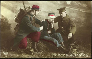
Background imageMaps Collection: First World War: Patriotic map showing a French soldier and an English soldier consoling a Belgian

First World War: Patriotic map showing a French soldier and an English soldier consoling a Belgian soldier
LUX4743971 First World War: Patriotic map showing a French soldier and an English soldier consoling a Belgian soldier and titled Brother of Arms

Background imageMaps Collection: Plans and views of lock gates in operation on canals, 18th century, England

Plans and views of lock gates in operation on canals, 18th century, England
FLO4685683 Plans and views of lock gates in operation on canals, 18th century, England. Copperplate engraving by Mutlow from John Mason Good's Pantologia, a New Encyclopedia, G

Background imageMaps Collection: The map room at the United Service Club. Steel engraving by Henry Melville after an illustration

The map room at the United Service Club. Steel engraving by Henry Melville after an illustration by Llewellyn Jewitt
FLO4669351 The map room at the United Service Club. Steel engraving by Henry Melville after an illustration by Llewellyn Jewitt from London Interiors, Their Costumes and Ceremonies, Joshua Mead

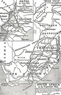
Background imageMaps Collection: Map of South Africa at the time of the Transvaal War in 1901

Map of South Africa at the time of the Transvaal War in 1901. From The Story of England, published 1930
3058426 Map of South Africa at the time of the Transvaal War in 1901. From The Story of England, published 1930.; Photo © Hilary Morgan

Background imageMaps Collection: Map of Napoleon's Empire in 1812. From The Story of England, published 1930

Map of Napoleon's Empire in 1812. From The Story of England, published 1930
3058424 Map of Napoleon's Empire in 1812. From The Story of England, published 1930.; Photo © Hilary Morgan

Background imageMaps Collection: British Empire in North America, 1783

British Empire in North America, 1783
2902816 British Empire in North America, 1783; (add.info.: Bowless new map of North America and the West Indies, exhibiting the British Empire therein with the limits)

Background imageMaps Collection: Railroad Map of the Eastern States, New England, 1856

Railroad Map of the Eastern States, New England, 1856
2902812 Railroad Map of the Eastern States, New England, 1856; (add.info.: Map of New England, part of eastern Canada, New York, Pennsylvania, New Jersey, Delaware, most of Maryland)

Background imageMaps Collection: British and French dominions in North America, 1755

British and French dominions in North America, 1755
2902800 British and French dominions in North America, 1755; (add.info.: A map of the British and French dominions in North America, with the roads, distances, limits)

Background imageMaps Collection: Tudor nobleman (detail), from a map of England and wales by John Speed, c.1612 (engraving)

Tudor nobleman (detail), from a map of England and wales by John Speed, c.1612 (engraving)
2911216 Tudor nobleman (detail), from a map of England and wales by John Speed, c.1612 (engraving); Universal History Archive/UIG

Background imageMaps Collection: Map of central London after the 'Great Fire of London'

Map of central London after the 'Great Fire of London'
1577228 Map of central London after the 'Great Fire of London'; (add.info.: Map of central London, England dated 1677 shows the re-built areas of the city after the 'Great Fire of London')

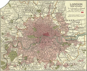
Background imageMaps Collection: Map of London and Vicinity, 1902, c.1900 (engraving)

Map of London and Vicinity, 1902, c.1900 (engraving)
533273 Map of London and Vicinity, 1902, c.1900 (engraving); (add.info.: Map of London, England, circa 1902, from the 10th edition of Encyclopaedia Britannica.); Encyclopaedia Britannica/UIG

Background imageMaps Collection: Map of Liverpool, Manchester, c.1900 (engraving)

Map of Liverpool, Manchester, c.1900 (engraving)
533270 Map of Liverpool, Manchester, c.1900 (engraving); (add.info.: Map of Liverpool and Manchester, England, circa 1902)

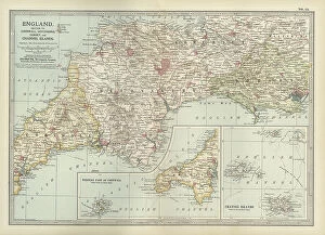
Background imageMaps Collection: Map of England, c.1900 (engraving)

Map of England, c.1900 (engraving)
532930 Map of England, c.1900 (engraving); (add.info.: Map of England, with Cornwall, Devonshire, Dorset, and an inset of the Channel Islands, circa 1902)

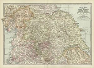
Background imageMaps Collection: Map of England, c.1900 (engraving)

Map of England, c.1900 (engraving)
532911 Map of England, c.1900 (engraving); (add.info.: Map of England with Yorkshire, Lancashire, and Westmorland, circa 1902)

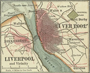
Background imageMaps Collection: Map of Liverpool, c.1900 (engraving)

Map of Liverpool, c.1900 (engraving)
532785 Map of Liverpool, c.1900 (engraving); (add.info.: Map of Liverpool, circa 1900, from the 10th edition of Encyclopaedia Britannica.); Encyclopaedia Britannica/UIG

Background imageMaps Collection: London: St James's Park and the Government Buildings (litho)

London: St James's Park and the Government Buildings (litho)
8629751 London: St James's Park and the Government Buildings (litho) by English Photographer, (20th century); Private Collection; (add.info.: St James's Park and the Government Buildings)

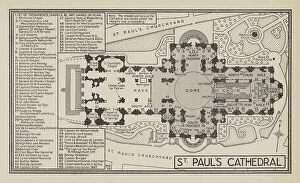
Background imageMaps Collection: London: St Paul's Cathedral (litho)

London: St Paul's Cathedral (litho)
8629749 London: St Paul's Cathedral (litho) by English Photographer, (20th century); Private Collection; (add.info.: St Paul's Cathedral)

Background imageMaps Collection: London: Kew Gardens (litho)

London: Kew Gardens (litho)
8629737 London: Kew Gardens (litho) by English Photographer, (20th century); Private Collection; (add.info.: Kew Gardens. Illustration for London Town and Country)

Background imageMaps Collection: Plan of the Square at the passing of the Improvement Act of 1726 (litho)

Plan of the Square at the passing of the Improvement Act of 1726 (litho)
8629066 Plan of the Square at the passing of the Improvement Act of 1726 (litho) by English School, (19th century); Private Collection; (add.info)

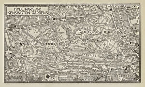
Background imageMaps Collection: London: Hyde Park and Kensigton Gardens (litho)

London: Hyde Park and Kensigton Gardens (litho)
8629753 London: Hyde Park and Kensigton Gardens (litho) by English Photographer, (20th century); Private Collection; (add.info.: Hyde Park and Kensigton Gardens)


All Professionally Made to Order for Quick Shipping


-

Maps Collection

Maps of England, United Kingdom and Europe are essential tools for navigation and exploration. They provide a visual representation of the geography, topography and political boundaries of these regions, and are be used to plan routes, identify landmarks, locate cities and towns, measure distances between locations and understand the physical features of an area. They also help to illustrate historical events such as wars or migrations, and are be printed in various formats such as paper or digital versions which can be accessed on computers or mobile devices. With the help we can gain a better understanding about our environment and its history which is invaluable for both educational purposes as well as practical applications.
+

Our beautiful pictures are available as Framed Prints, Photos, Wall Art and Photo Gifts

The Maps of England United Kingdom Europe collection from Media Storehouse is a stunning array of wall art, framed prints, photo prints, canvas prints, jigsaw puzzles and greeting cards that showcase the beauty and history of these regions. Our collection features an extensive range of maps dating back to the 16th century up to modern times. These maps are not only visually appealing but also provide valuable insights into the geography, topography and political boundaries of these areas. Whether you're looking for a vintage map to add character to your home or want a contemporary piece that reflects current borders and landmarks, our collection has something for everyone. The high-quality printing techniques used by Media Storehouse ensure that each piece is vibrant in color and detail-rich. From antique world maps to detailed street plans of London or Paris, there's no shortage of options when it comes to choosing your perfect print. With its wide variety of sizes and formats available at affordable prices, our collection provides an excellent opportunity for anyone interested in exploring the rich history and culture encapsulated within these regions through beautiful artwork.
+

What are Maps of England United Kingdom Europe art prints?

Maps of England, United Kingdom, and Europe art prints are high-quality reproductions of historical maps that depict the geography and topography of these regions. These maps showcase the evolution of cartography over time, from early hand-drawn sketches to more detailed and accurate depictions created with modern technology. These art prints are not only visually stunning but also serve as a valuable educational resource for historians, geographers, and anyone interested in exploring the history and culture of these regions. They can be used to trace the development of cities, transportation networks, political boundaries, natural resources, and other important features that have shaped these areas throughout history. Whether you're looking to decorate your home or office with a unique piece of artwork or want to add an educational element to your collection, Maps of England United Kingdom Europe art prints offer something for everyone. With their timeless appeal and rich historical significance, they are sure to be cherished by generations to come.
+

What Maps of England United Kingdom Europe art prints can I buy from Media Storehouse?

We offer a wide range of Maps of England, United Kingdom and Europe art prints that are perfect for decorating your home or office. You can choose from a variety of styles, including antique maps, modern maps, political maps and topographical maps. These prints are available in different sizes to suit your needs and preferences. If you're looking for something specific, we have an extensive collection of city maps such as London, Paris or Rome which will add sophistication to any room. They also have country-specific maps like Scotland or Wales which would be great for those who love travelling. In addition to traditional paper prints, Media Storehouse also offers canvas prints which give the artwork a more textured look. The canvas print is stretched over a wooden frame making it ready-to-hang on your wall. There's no shortage of options when it comes to Maps of England United Kingdom Europe art prints at Media Storehouse.
+

How do I buy Maps of England United Kingdom Europe art prints?

To buy Maps of England, United Kingdom, and Europe art prints from Media Storehouse, you can browse our extensive collection of maps on their website. You can search for specific locations or browse by category to find the perfect map print for your needs. Once you have found a map that you like, simply select the size and format that you prefer. We offer a range of printing options including canvas prints, framed prints, and poster prints. We also offer customization options such as adding text or choosing different color schemes to make your map print unique. When purchasing your map print from Media Storehouse, be sure to check out their secure checkout process which accepts various payment methods. Additionally, we offer international shipping so no matter where you are in the world; you can enjoy beautiful maps of England and Europe in your home or office.
+

How much do Maps of England United Kingdom Europe art prints cost?

The cost of Maps of England, United Kingdom and Europe art prints can vary depending on various factors such as the size, quality, and type of print. The prices may also differ from one seller to another. However, we offer a wide range of Map art prints that are affordable for everyone. Our collection includes vintage maps, contemporary maps, antique maps among others. The price range is reasonable and caters to different budgets without compromising on the quality of the print. Whether you're looking for a small or large map print to decorate your home or office space with an artistic touch or gift someone special with something unique and meaningful - there's something for everyone at Media Storehouse. Their selection features some stunning pieces that capture the beauty and history of England, United Kingdom and Europe in intricate detail making them perfect conversation starters too. So why not browse our collection today?
+

How will my Maps of England United Kingdom Europe art prints be delivered to me?

Your Maps of England United Kingdom Europe art prints will be delivered to you in a secure and protective packaging. The prints are carefully rolled and placed inside a sturdy tube to ensure that they arrive at your doorstep in pristine condition. The package will also include instructions on how to unroll the print without damaging it. Media Storehouse takes great care in delivering your artwork, ensuring that it is handled with utmost care during transit. Your package can be tracked online so you can monitor its progress until it reaches you. The delivery service used by Media Storehouse varies depending on your location and the size of the print ordered. However, rest assured that all deliveries are made using reputable courier services known for their reliability and efficiency. Your Maps of England United Kingdom Europe art prints will be delivered safely and securely to your doorstep via a trusted courier service in protective packaging designed specifically for artwork transportation.