Fraud Blocker Skip to main content

Home > Europe > United Kingdom > England > Maps

Maps Collection (page 5)

Maps of England, United Kingdom and Europe are essential tools for navigation and exploration

10,598 items

Background imageMaps Collection: Map - The Broads

Map - The Broads
Map by M. F. Peck - The Broads

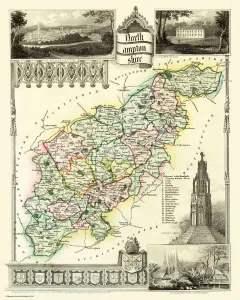
Background imageMaps Collection: Old County Map of Northamptonshire 1836 by Thomas Moule

Old County Map of Northamptonshire 1836 by Thomas Moule
This is a fine decorative reproduction County Map of Northamptonshire from the First Edition series of Thomas Moule Maps, originally Published in 1836

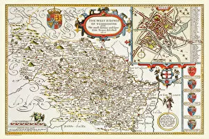
Background imageMaps Collection: Old County Map of Yorkshire West Riding 1611 by John Speed

Old County Map of Yorkshire West Riding 1611 by John Speed
A facimile of John Speeds historical map of Yorkshire West Riding originally published for the " Theatre of the Empire of Great Britain"

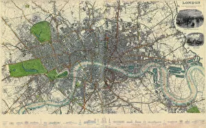
Background imageMaps Collection: Map of London

Map of London 1836

Background imageMaps Collection: Antique map of Cambridgeshire

Antique map of Cambridgeshire
An antique map of Cambridgeshire 1840.ašJames Pigot (1794-1842)aš showing the whole county and all its major towns and cities.Pigot started as an engraver for Deans Manchester Directory

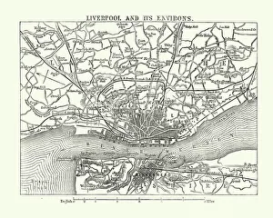
Background imageMaps Collection: Map of Liverpool and its environs, England, 1870s

Map of Liverpool and its environs, England, 1870s
Vintage engraving of Map of Liverpool and its environs, England, 1870s, 19th Century

Background imageMaps Collection: Map of Cork, County Cork, Ireland Victorian Engraving, 1840

Map of Cork, County Cork, Ireland Victorian Engraving, 1840
Very Rare, Beautifully Illustrated Antique Engraving of Map of Exmoor, England Victorian Engraving, 1840. Source: Original edition from my own archives. Copyright has expired on this artwork

Background imageMaps Collection: Maps Wrens London

Maps Wrens London
Christopher Wren seizes the opportunity of the Great Fire to draw up plans for a brave new London - which alas will be only partially realised. Date: 1666

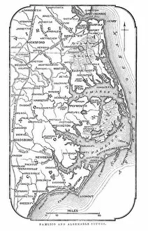
Background imageMaps Collection: Map of Pamlico and Albemarle Sounds

Map of Pamlico and Albemarle Sounds
Vintage engraving from 1863 of a map of Map of Pamlico and Albemarle Sounds at the time of the American Civil War

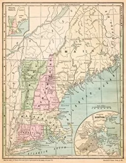
Background imageMaps Collection: USA New England states map 1875

USA New England states map 1875
The Independent Course Comprehensive Geography by James Monteith, A.S. Barnes & Co, New York & Chicago 1875

Background imageMaps Collection: Southampton England map 1895

Southampton England map 1895
Meyers Konversations-Lexikon. Ein Nachschlagewerk des allgemeinen Wissens, 5th edition 17 volumes Bibliographisches Institut - Leipzig 1895-1897

Background imageMaps Collection: Edburton tithe map, 1842

Edburton tithe map, 1842
By E. & G. N. Driver, Parliament Street, London. 13.3 in. to 1m. 49 × 28 Tithe Award Map Collection West Sussex Record Office Ref No: TD/W168

Background imageMaps Collection: Eartham tithe map, 1840

Eartham tithe map, 1840
Enlarged from the Inclosure Map made in 1813. Revised and corrected to the present time for the Commutation of the Tithes of the Parish of Eartham. By J. Butler, Chichester. 13.3 in. to 1m

Background imageMaps Collection: East Grinstead tithe map, 1840

East Grinstead tithe map, 1840
Surveyor unknown. 13.3 in to 1 m. 89 × 83 Tithe Award Map Collection West Sussex Record Office Ref No: TD/E45

Background imageMaps Collection: Cuckfield tithe map, 1845

Cuckfield tithe map, 1845
Surveyor unknown. 8 in. to 1m. 53 × 42 Tithe Award Map Collection West Sussex Record Office Ref No: TD/E91

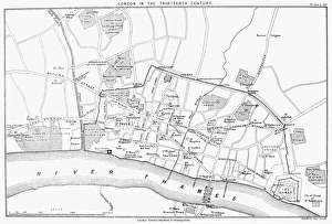
Background imageMaps Collection: Reconstructed map of 13th century London, England

Reconstructed map of 13th century London, England
MAP: LONDON, 13th CENTURY. Reconstructed map of 13th century London, England

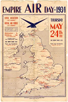
Background imageMaps Collection: Poster for Empire Air Day, 1934

Poster for Empire Air Day, 1934
Shows aerodromes in England, Wales, southern Scotland and Northern Ireland, all of which were open for Empire Air Day. Admission one shilling for adults, sixpence for children

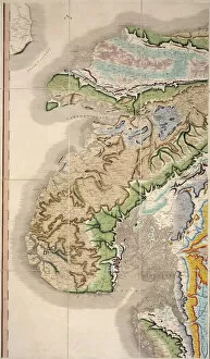
Background imageMaps Collection: William Smiths Geological Map

William Smiths Geological Map
Fig. 6 from Delineation of Strata of England and Wales (1815) by William Smith

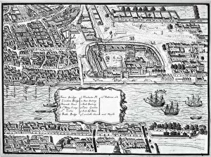
Background imageMaps Collection: TOWER OF LONDON, 1560. Detail from the Agas map of 1560 showing the Tower of London on the Thames

TOWER OF LONDON, 1560. Detail from the Agas map of 1560 showing the Tower of London on the Thames River

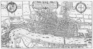
Background imageMaps Collection: LONDON: MAP, 1575. Engraved map of London, England, 1575

LONDON: MAP, 1575. Engraved map of London, England, 1575

Background imageMaps Collection: Railway Map of England

Railway Map of England
London & North Western Railway Co rail map of England, 1899 Date: 1899

Background imageMaps Collection: Ordnance Survey map cover - Dorking and Leith Hill

Ordnance Survey map cover - Dorking and Leith Hill
Front cover of an Ordnance Survey map covering the Dorking and Leith Hill area of Surrey. The cover features a hiker or rambler leaning against a wall and smoking a pipe as he consults his map

Background imageMaps Collection: London Map 1560 / Aggas

London Map 1560 / Aggas
Map of London at the time of Queen Elizabeth I

Background imageMaps Collection: Inland navigation of England and Wales by

Inland navigation of England and Wales by
Map of the inland navigation of England and Wales by the canals and principal rivers, 1809. Copperplate engraving by Mutlow from John Mason Goods Pantologia, a New Encyclopedia, G

Background imageMaps Collection: Old County Map of Devonshire 1836 by Thomas Moule

Old County Map of Devonshire 1836 by Thomas Moule
This is a fine decorative reproduction County Map of Devonshire from the First Edition series of Thomas Moule Maps, originally Published in 1836

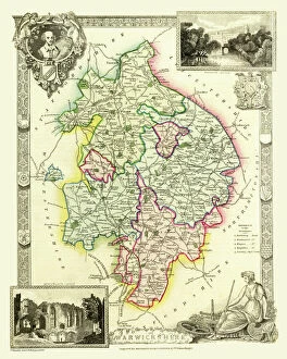
Background imageMaps Collection: Old County Map of Warwickshire 1836 by Thomas Moule

Old County Map of Warwickshire 1836 by Thomas Moule
This is a fine decorative reproduction County Map of Warwickshire from the First Edition series of Thomas Moule Maps, originally Published in 1836

Background imageMaps Collection: Old County Map of Sussex 1836 by Thomas Moule

Old County Map of Sussex 1836 by Thomas Moule
This is a fine decorative reproduction County Map of Sussex from the First Edition series of Thomas Moule Maps, originally Published in 1836

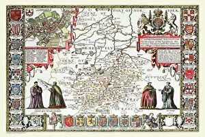
Background imageMaps Collection: Old County Map of Cambridgeshire 1611 by John Speed

Old County Map of Cambridgeshire 1611 by John Speed
A facimile of John Speeds historical map of Cambridgeshire originally published for the " Theatre of the Empire of Great Britain"

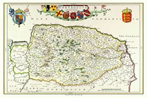
Background imageMaps Collection: Old County Map of Norfolk 1648 by Johan Blaeu from the Atlas Novus

Old County Map of Norfolk 1648 by Johan Blaeu from the Atlas Novus
This detailed and most attractive reproduction map of Norfolk has been carefully art worked from a scan of an antique original

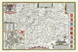
Background imageMaps Collection: Old County Map of Leicestershire 1611 by John Speed

Old County Map of Leicestershire 1611 by John Speed
A facimile of John Speeds historical map of Leicestershire originally published for the " Theatre of the Empire of Great Britain"

Background imageMaps Collection: Map of Sussex, England

Map of Sussex, England

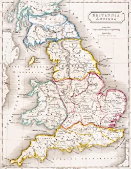
Background imageMaps Collection: Map of England Britannia Antiqua From The Atlas of Ancient Geography by Samuel Butler published

Map of England Britannia Antiqua From The Atlas of Ancient Geography by Samuel Butler published London circa 1829

Background imageMaps Collection: Cartouche on W. Mayos Map of Barbados, 1722, (1944). Creator: William Mayo

Cartouche on W. Mayos Map of Barbados, 1722, (1944). Creator: William Mayo
Cartouche on W. Mayos Map of Barbados, 1722, (1944). A New & Exact Map of the Island of Barbadoes in America. According to an Actual & Accurate Survey

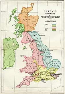
Background imageMaps Collection: Map Of Britain In The Midst Of The English Conquest From A Short History Of The English People By

Map Of Britain In The Midst Of The English Conquest From A Short History Of The English People By John Richard Green Published By Macmillan And Co 1911

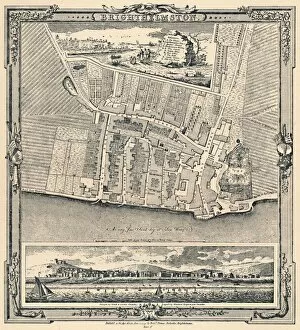
Background imageMaps Collection: Brighthelmston, c1779, (1939)

Brighthelmston, c1779, (1939). From A History of the Royal Pavilion, Brighton, by Henry D. Roberts. [Country Life Limited, London, 1939]

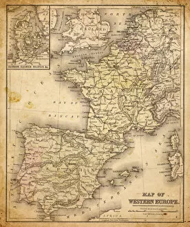
Background imageMaps Collection: western europe map 1883

western europe map 1883
a map of Western europe from 1883

Background imageMaps Collection: western europe 1867

western europe 1867
a map of Western europe from 1867, overlay with grunge burnt texture paper

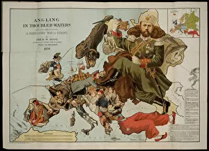
Background imageMaps Collection: Angling in Troubled Waters. A Serio-Comic Map of Europe. Artist: Fred W

Angling in Troubled Waters. A Serio-Comic Map of Europe. Artist: Fred W. Rose (active End of 19th cen. )
Angling in Troubled Waters. A Serio-Comic Map of Europe. Private Collection

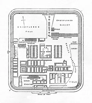
Background imageMaps Collection: Plan of Bremenium, 1902

Plan of Bremenium, 1902. Bremenium was an ancient Roman fort (castra) located at Rochester, Northumberland, England. The fort was one of the defensive structures built along Dere Street

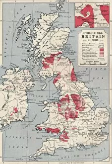
Background imageMaps Collection: Map of industrial Britain in 1881, 1906

Map of industrial Britain in 1881, 1906. From Cassells Illustrated History of England, Vol. VII. [Cassell and Company, Limited, London, Paris, New York & Melbourne, 1906]

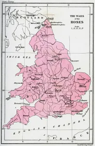
Background imageMaps Collection: Map of the Wars of the Roses, 15th century (1893)

Map of the Wars of the Roses, 15th century (1893). The Wars of the Roses was a civil war fought over the throne of England between adherents of the House of Lancaster and the House of York

Background imageMaps Collection: Victorian Map of Leeds, England Engraving, Circa 1840

Victorian Map of Leeds, England Engraving, Circa 1840
Very Rare, Beautifully Illustrated Antique Engraving of Victorian Map of Leeds, England from Our Own Country, Great Britain, Descriptive, Historical, Pictorial. Published in 1880

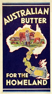
Background imageMaps Collection: Advert, Australian Butter for the Homeland

Advert, Australian Butter for the Homeland. 1936

Background imageMaps Collection: London Map 1806

London Map 1806
London extending from the head of the Paddington Canal West, and to the West India Docks East. Date: 1806

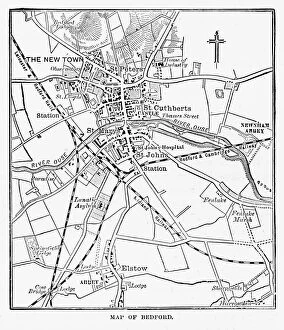
Background imageMaps Collection: Map of the City of Bedford, England Victorian Engraving, 1840

Map of the City of Bedford, England Victorian Engraving, 1840
Very Rare, Beautifully Illustrated Antique Engraving of Map of the City of Bedford, England Victorian Engraving, 1840. Source: Original edition from my own archives

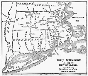
Background imageMaps Collection: MAP: NEW ENGLAND COLONIES. Early settlements in New England and distribution of

MAP: NEW ENGLAND COLONIES. Early settlements in New England and distribution of Native American tribes

Background imageMaps Collection: 210714LNE

210714LNE
York Station, 210714LNE

Background imageMaps Collection: East Marden tithe map, 1842

East Marden tithe map, 1842
By Edward Fuller, Surveyor, Chichester. 20 in. to 1 m. 56 × 39 Tithe Award Map Collection West Sussex Record Office Ref No: TD/W49


All Professionally Made to Order for Quick Shipping


-

Maps Collection

Maps of England, United Kingdom and Europe are essential tools for navigation and exploration. They provide a visual representation of the geography, topography and political boundaries of these regions, and are be used to plan routes, identify landmarks, locate cities and towns, measure distances between locations and understand the physical features of an area. They also help to illustrate historical events such as wars or migrations, and are be printed in various formats such as paper or digital versions which can be accessed on computers or mobile devices. With the help we can gain a better understanding about our environment and its history which is invaluable for both educational purposes as well as practical applications.
+

Our beautiful pictures are available as Framed Prints, Photos, Wall Art and Photo Gifts

The Maps of England United Kingdom Europe collection from Media Storehouse is a stunning array of wall art, framed prints, photo prints, canvas prints, jigsaw puzzles and greeting cards that showcase the beauty and history of these regions. Our collection features an extensive range of maps dating back to the 16th century up to modern times. These maps are not only visually appealing but also provide valuable insights into the geography, topography and political boundaries of these areas. Whether you're looking for a vintage map to add character to your home or want a contemporary piece that reflects current borders and landmarks, our collection has something for everyone. The high-quality printing techniques used by Media Storehouse ensure that each piece is vibrant in color and detail-rich. From antique world maps to detailed street plans of London or Paris, there's no shortage of options when it comes to choosing your perfect print. With its wide variety of sizes and formats available at affordable prices, our collection provides an excellent opportunity for anyone interested in exploring the rich history and culture encapsulated within these regions through beautiful artwork.
+

What are Maps of England United Kingdom Europe art prints?

Maps of England, United Kingdom, and Europe art prints are high-quality reproductions of historical maps that depict the geography and topography of these regions. These maps showcase the evolution of cartography over time, from early hand-drawn sketches to more detailed and accurate depictions created with modern technology. These art prints are not only visually stunning but also serve as a valuable educational resource for historians, geographers, and anyone interested in exploring the history and culture of these regions. They can be used to trace the development of cities, transportation networks, political boundaries, natural resources, and other important features that have shaped these areas throughout history. Whether you're looking to decorate your home or office with a unique piece of artwork or want to add an educational element to your collection, Maps of England United Kingdom Europe art prints offer something for everyone. With their timeless appeal and rich historical significance, they are sure to be cherished by generations to come.
+

What Maps of England United Kingdom Europe art prints can I buy from Media Storehouse?

We offer a wide range of Maps of England, United Kingdom and Europe art prints that are perfect for decorating your home or office. You can choose from a variety of styles, including antique maps, modern maps, political maps and topographical maps. These prints are available in different sizes to suit your needs and preferences. If you're looking for something specific, we have an extensive collection of city maps such as London, Paris or Rome which will add sophistication to any room. They also have country-specific maps like Scotland or Wales which would be great for those who love travelling. In addition to traditional paper prints, Media Storehouse also offers canvas prints which give the artwork a more textured look. The canvas print is stretched over a wooden frame making it ready-to-hang on your wall. There's no shortage of options when it comes to Maps of England United Kingdom Europe art prints at Media Storehouse.
+

How do I buy Maps of England United Kingdom Europe art prints?

To buy Maps of England, United Kingdom, and Europe art prints from Media Storehouse, you can browse our extensive collection of maps on their website. You can search for specific locations or browse by category to find the perfect map print for your needs. Once you have found a map that you like, simply select the size and format that you prefer. We offer a range of printing options including canvas prints, framed prints, and poster prints. We also offer customization options such as adding text or choosing different color schemes to make your map print unique. When purchasing your map print from Media Storehouse, be sure to check out their secure checkout process which accepts various payment methods. Additionally, we offer international shipping so no matter where you are in the world; you can enjoy beautiful maps of England and Europe in your home or office.
+

How much do Maps of England United Kingdom Europe art prints cost?

The cost of Maps of England, United Kingdom and Europe art prints can vary depending on various factors such as the size, quality, and type of print. The prices may also differ from one seller to another. However, we offer a wide range of Map art prints that are affordable for everyone. Our collection includes vintage maps, contemporary maps, antique maps among others. The price range is reasonable and caters to different budgets without compromising on the quality of the print. Whether you're looking for a small or large map print to decorate your home or office space with an artistic touch or gift someone special with something unique and meaningful - there's something for everyone at Media Storehouse. Their selection features some stunning pieces that capture the beauty and history of England, United Kingdom and Europe in intricate detail making them perfect conversation starters too. So why not browse our collection today?
+

How will my Maps of England United Kingdom Europe art prints be delivered to me?

Your Maps of England United Kingdom Europe art prints will be delivered to you in a secure and protective packaging. The prints are carefully rolled and placed inside a sturdy tube to ensure that they arrive at your doorstep in pristine condition. The package will also include instructions on how to unroll the print without damaging it. Media Storehouse takes great care in delivering your artwork, ensuring that it is handled with utmost care during transit. Your package can be tracked online so you can monitor its progress until it reaches you. The delivery service used by Media Storehouse varies depending on your location and the size of the print ordered. However, rest assured that all deliveries are made using reputable courier services known for their reliability and efficiency. Your Maps of England United Kingdom Europe art prints will be delivered safely and securely to your doorstep via a trusted courier service in protective packaging designed specifically for artwork transportation.