Fraud Blocker Skip to main content

Photo Mug > Europe > United Kingdom > Scotland > Maps

Maps Photo Mug Collection (page 3)

Discover the beauty of Scotland, the United Kingdom, and Europe with our Maps of Scotland, United Kingdom, Europe Photo Mugs from Media Storehouse. These high-quality mugs showcase intricately detailed maps of these beloved regions, printed directly onto both sides. Perfect for tea or coffee breaks, these mugs make great gifts for travel enthusiasts, history buffs, or anyone who appreciates the art of cartography. Each mug holds 11 oz. and comes in a gift box. Let your morning brew take you on a journey with these unique and captivating map mugs.

Scotland is a country located in the United Kingdom and Europe

1,186 Photo Mugs

Background imageMaps Photo Mug Collection: Tameside OL6 6 Map

Tameside OL6 6 Map
Postcode Sector Map of Tameside OL6 6

Background imageMaps Photo Mug Collection: SC0503reduced

SC0503reduced

Background imageMaps Photo Mug Collection: Map of British Isles, lithograph, lithograph, published in 1876

Map of British Isles, lithograph, lithograph, published in 1876
Map of British Isles. Lithograph, published in 1876

Background imageMaps Photo Mug Collection: Magnifying glass above an Ordnance Survey map

Magnifying glass above an Ordnance Survey map, Scotland, United Kingdom, Europe

Background imageMaps Photo Mug Collection: Glasgow: Broomielaw Bridge (litho)

Glasgow: Broomielaw Bridge (litho)
7181093 Glasgow: Broomielaw Bridge (litho) by English School, (19th century); Private Collection; (add.info.: Broomielaw Bridge. Illustration for The Cabinet Album of Glasgow, c 1895)

Background imageMaps Photo Mug Collection: Dunkeld (engraving)

Dunkeld (engraving)
7163806 Dunkeld (engraving) by English School, (19th century); Private Collection; (add.info.: Dunkeld. Illustration for The Scots Worthies edited by J A Wylie (William Mackenzie)

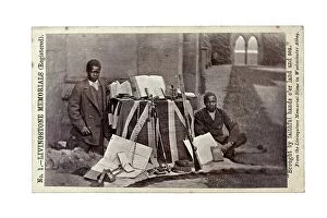
Background imageMaps Photo Mug Collection: James Chuma and Abdullah Susi with David Livingstone artefacts, Newstead Abbey, England

James Chuma and Abdullah Susi with David Livingstone artefacts, Newstead Abbey, England
622820 James Chuma and Abdullah Susi with David Livingstone artefacts, Newstead Abbey, England, June 1874 (albumen print) by Allen, R

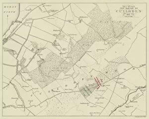
Background imageMaps Photo Mug Collection: Map to illustrate The Battle of Culloden, 17 April 1746 (engraving)

Map to illustrate The Battle of Culloden, 17 April 1746 (engraving)
2814695 Map to illustrate The Battle of Culloden, 17 April 1746 (engraving) by English School, (19th century); Private Collection; (add.info.: Map to illustrate The Battle of Culloden, 17 April 1746)

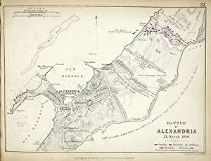
Background imageMaps Photo Mug Collection: Map of the Battle of Alexandria, published by William Blackwood and Sons

Map of the Battle of Alexandria, published by William Blackwood and Sons
746917 Map of the Battle of Alexandria, published by William Blackwood and Sons, Edinburgh & London, 1848 (hand-coloured engraving) by Johnston

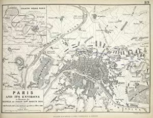
Background imageMaps Photo Mug Collection: Paris and its Environs, to illustrate the Battle of Paris, 30th March, 1814

Paris and its Environs, to illustrate the Battle of Paris, 30th March, 1814
617389 Paris and its Environs, to illustrate the Battle of Paris, 30th March, 1814, published c.1830s (engraving) by Johnston, Alexander Keith (1804-71); Private Collection; Scottish, out of copyright

Background imageMaps Photo Mug Collection: The Forth Bridge (engraving)

The Forth Bridge (engraving)
1623795 The Forth Bridge (engraving) by English School, (19th century); Private Collection; (add.info.: The Forth Bridge. Illustration for The Illustrated London News, 28 January 1882)

Background imageMaps Photo Mug Collection: Old County Map of Kurkcudbright Scotland 1847 by A&C Black

Old County Map of Kurkcudbright Scotland 1847 by A&C Black
A finely detailed facimile remastered in full colour from an antique original map of Kurkcudbright featured in A&C Blacks Atlas of 1847

Background imageMaps Photo Mug Collection: Scottish Borders TD11 3 Map

Scottish Borders TD11 3 Map
Postcode Sector Map of Scottish Borders TD11 3

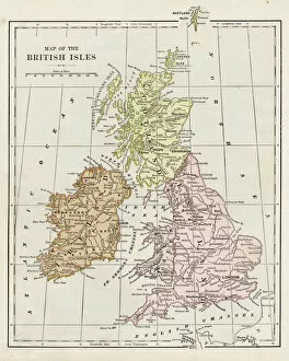
Background imageMaps Photo Mug Collection: Map of the British isles 1889

Map of the British isles 1889
Indiana Educational Series The Complete Geography - Indianapolis 1889

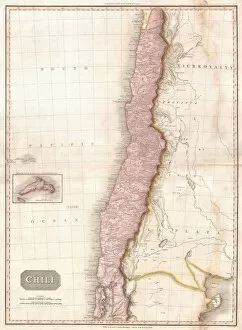
Background imageMaps Photo Mug Collection: 1818, Pinkerton Map of Chile, John Pinkerton, 1758 - 1826, Scottish antiquarian, cartographer

1818, Pinkerton Map of Chile, John Pinkerton, 1758 - 1826, Scottish antiquarian, cartographer, UK

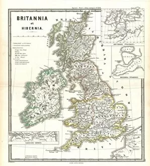
Background imageMaps Photo Mug Collection: 1865, Spruner Map of the British Isles, England, Scotland, Ireland, topography, cartography

1865, Spruner Map of the British Isles, England, Scotland, Ireland, topography, cartography
1865, Spruner Map of the British Isles, England, Scotland, Ireland

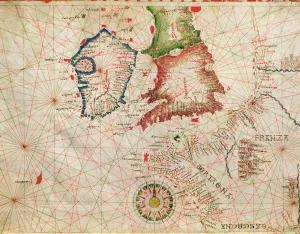
Background imageMaps Photo Mug Collection: The French Coast, England, Scotland and Ireland, from a nautical atlas, 1520 (ink on vellum)

The French Coast, England, Scotland and Ireland, from a nautical atlas, 1520 (ink on vellum)
XOT330911 The French Coast, England, Scotland and Ireland, from a nautical atlas, 1520 (ink on vellum) (detail from 330910) by Giovanni Xenodocus da Corfu (fl)

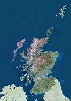
Background imageMaps Photo Mug Collection: Scotland with Shetland, United Kingdom, True Colour Satellite Image

Scotland with Shetland, United Kingdom, True Colour Satellite Image
Satellite view of Scotland including Shetland, United Kingdom. This image was compiled from data acquired by LANDSAT 5 & 7 satellites

Background imageMaps Photo Mug Collection: 1818, Pinkerton Map of Persia, Iran, Afghanistan, John Pinkerton, 1758 - 1826, Scottish

1818, Pinkerton Map of Persia, Iran, Afghanistan, John Pinkerton, 1758 - 1826, Scottish antiquarian, cartographer, UK

Background imageMaps Photo Mug Collection: Scotland Vector Map

Scotland Vector Map
Highly detailed vector map of Scotland. File was created on July 20, 2011. The colors in the.eps-file are ready for print (CMYK). Included files: EPS (v8) and Hi-Res JPG

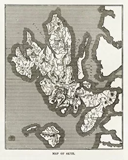
Background imageMaps Photo Mug Collection: Map of the Isle of Skye, Scotland Victorian Engraving, 1840

Map of the Isle of Skye, Scotland Victorian Engraving, 1840
Very Rare, Beautifully Illustrated Antique Engraving of Map of the Isle of Skye, Scotland Victorian Engraving, 1840. Source: Original edition from my own archives

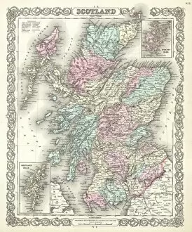
Background imageMaps Photo Mug Collection: 1855, Colton Map of Scotland, topography, cartography, geography, land, illustration

1855, Colton Map of Scotland, topography, cartography, geography, land, illustration
1855, Colton Map of Scotland

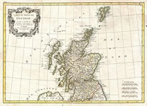
Background imageMaps Photo Mug Collection: 1772, Bonne Map of Scotland, Rigobert Bonne 1727 - 1794, one of the most important

1772, Bonne Map of Scotland, Rigobert Bonne 1727 - 1794, one of the most important cartographers of the late 18th century

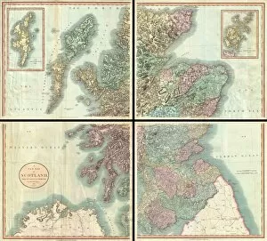
Background imageMaps Photo Mug Collection: 1801, Cary Map of Scotland, 4 Sheets, John Cary, 1754 - 1835, English cartographer

1801, Cary Map of Scotland, 4 Sheets, John Cary, 1754 - 1835, English cartographer

Background imageMaps Photo Mug Collection: Map of Scotland, 1819, J. Mawman

Map of Scotland, 1819, J. Mawman

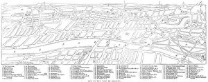
Background imageMaps Photo Mug Collection: Map of Glasgow, 1864. Creator: Unknown

Map of Glasgow, 1864. Creator: Unknown
Map of Glasgow, 1864. 'This city is the largest in Scotland, and one of the greatest provincial towns in the United Kingdom

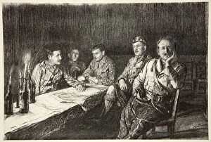
Background imageMaps Photo Mug Collection: Gordon Highlander officers mess, illustration from The Western Front, pub

Gordon Highlander officers mess, illustration from The Western Front, pub. by Country Life Ltd, 1917 (litho)
STC404034 Gordon Highlander officers mess, illustration from The Western Front, pub. by Country Life Ltd, 1917 (litho) by Bone, David Muirhead (1876-1953); Private Collection; The Stapleton Collection

Background imageMaps Photo Mug Collection: Land of Burns (litho)

Land of Burns (litho)
8652522 Land of Burns (litho) by Bartholomew, John George (1860-1920) ; Private Collection; (add.info.: Land of Burns. Illustration for A Literary)

Background imageMaps Photo Mug Collection: Ivanhoe (litho)

Ivanhoe (litho)
8652518 Ivanhoe (litho) by Bartholomew, John George (1860-1920) ; Private Collection; (add.info.: Ivanhoe. Illustration for A Literary and Historical Atlas of Europe by J G Bartholomew [1860-1920])

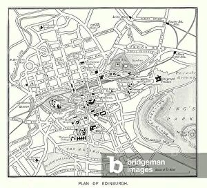
Background imageMaps Photo Mug Collection: Plan of Edinburgh (b/w photo)

Plan of Edinburgh (b/w photo)
8648774 Plan of Edinburgh (b/w photo) by English Photographer, (20th century); Private Collection; (add.info.: Plan of Edinburgh)

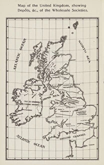
Background imageMaps Photo Mug Collection: Co-operative Wholesale Societies: Map of the United Kingdom, showing Depots, etc

Co-operative Wholesale Societies: Map of the United Kingdom, showing Depots, etc, of the Wholesale Societies (litho)
8668904 Co-operative Wholesale Societies: Map of the United Kingdom, showing Depots, etc, of the Wholesale Societies (litho) by English School

Background imageMaps Photo Mug Collection: Map of Scotland, England, Ireland in 1100 (Map of british islands, England)

Map of Scotland, England, Ireland in 1100 (Map of british islands, England)
ELD4930022 Map of Scotland, England, Ireland in 1100 (Map of british islands, England, Scotland and Ireland in 1100) Plate from Houze's Universal Atlas

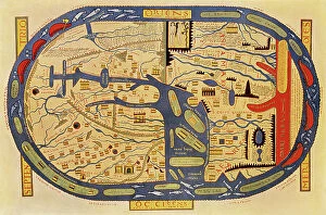
Background imageMaps Photo Mug Collection: World map of a flat earth, printed by Beatus Rhenanus (Bild aus Rheinau), early 1500 s

World map of a flat earth, printed by Beatus Rhenanus (Bild aus Rheinau), early 1500 s
NWI4901273 World map of a flat earth, printed by Beatus Rhenanus (Bild aus Rheinau), early 1500 s.; (add.info.: World map of a flat earth, printed by Beatus Rhenanus (Bild aus Rheinau)

Background imageMaps Photo Mug Collection: Map of proposed railway lines to run through Britain

Map of proposed railway lines to run through Britain
3733987 Map of proposed railway lines to run through Britain.; (add.info.: Map of proposed railway lines to run through Britain. Dated 19th century.); Universal History Archive/UIG

Background imageMaps Photo Mug Collection: 18th century map of Scotland

18th century map of Scotland
5322612 18th century map of Scotland; (add.info.: Map of Scotland dating from the early 18th century decorated with 14 small drawings or plans of important cities. Anonymous engraver.)

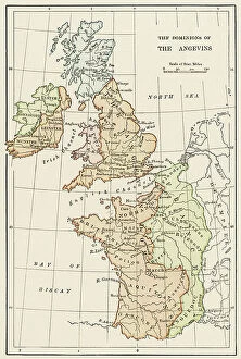
Background imageMaps Photo Mug Collection: Geographic map of England and France during the Angevins dynasty, 12th-15th century

Geographic map of England and France during the Angevins dynasty, 12th-15th century. Lithograph of the 19th century
NWI4874543 Geographic map of England and France during the Angevins dynasty, 12th-15th century. Lithograph of the 19th century.; (add.info)

Background imageMaps Photo Mug Collection: Map of Scotland in the 1520s, showing Highland (Highlander) territories

Map of Scotland in the 1520s, showing Highland (Highlander) territories. Colouring engraving of the 19th century
NWI4874428 Map of Scotland in the 1520s, showing Highland (Highlander) territories. Colouring engraving of the 19th century.; (add.info.: Map of Scotland in the 1520s)

Background imageMaps Photo Mug Collection: Geographic map of Brittany after saxon invasion, 500 AD Engraving from 'Atlas Universel' by Houze

Geographic map of Brittany after saxon invasion, 500 AD Engraving from "Atlas Universel" by Houze
ELD4925007 Geographic map of Brittany after saxon invasion, 500 AD Engraving from "Atlas Universel" by Houze, 1851 Private collection; (add.info)

Background imageMaps Photo Mug Collection: Pascaart van de Noort Zee verthoonende in zich alle de Custen en havens daer rontom gelegen

Pascaart van de Noort Zee verthoonende in zich alle de Custen en havens daer rontom gelegen. 1654 (print, paper)
7340057 Pascaart van de Noort Zee verthoonende in zich alle de Custen en havens daer rontom gelegen. 1654 (print, paper) by Wit, Frederick de (1630-1706); 50.5x58.5 cm; National Maritime Museum

Background imageMaps Photo Mug Collection: Treasure Island, with the map of the island on the frontispiece, 1900-1920 (print)

Treasure Island, with the map of the island on the frontispiece, 1900-1920 (print)
8615298 Treasure Island, with the map of the island on the frontispiece, 1900-1920 (print); (add.info.: Title page of an old Cassell and Company edition (early 20th century)

Background imageMaps Photo Mug Collection: A commercial map of Scotland with the roads, stages and distances, 1782 (engraving)

A commercial map of Scotland with the roads, stages and distances, 1782 (engraving)
7340440 A commercial map of Scotland with the roads, stages and distances, 1782 (engraving) by Knox, J. (18th century); 73x56 cm; National Maritime Museum, London, UK; (add.info.: Creator: J)

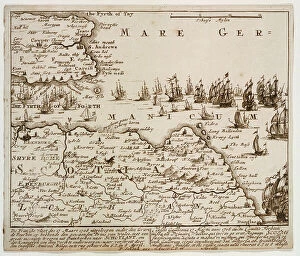
Background imageMaps Photo Mug Collection: Forbin's attempt against Scotland, 17 March 1708, early 18th century (etching)

Forbin's attempt against Scotland, 17 March 1708, early 18th century (etching)
7341655 Forbin's attempt against Scotland, 17 March 1708, early 18th century (etching) by Amstel, Cornelis Ploos Van (1726-98); 16.1x19 cm; National Maritime Museum, London

Background imageMaps Photo Mug Collection: Chart of South Shetland including Coronation Island, from the exploration of the sloop Dove in

Chart of South Shetland including Coronation Island, from the exploration of the sloop Dove in the years 1821
7339411 Chart of South Shetland including Coronation Island, from the exploration of the sloop Dove in the years 1821 and 1822 by George Powell Commander of the same, 1822 (engraving) by Powell

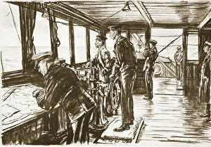
Background imageMaps Photo Mug Collection: The Bridge of a Merchant Ship at Sea, illustration from The Western Front, pub

The Bridge of a Merchant Ship at Sea, illustration from The Western Front, pub. by Country Life Ltd, 1917 (litho)
STC403999 The Bridge of a Merchant Ship at Sea, illustration from The Western Front, pub. by Country Life Ltd, 1917 (litho) by Bone

Background imageMaps Photo Mug Collection: Map of the Three Lothians (b/w photo)

Map of the Three Lothians (b/w photo)
8648699 Map of the Three Lothians (b/w photo) by English Photographer, (20th century); Private Collection; (add.info.: Map of the Three Lothians)

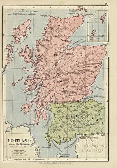
Background imageMaps Photo Mug Collection: Scotland under the Romans (colour litho)

Scotland under the Romans (colour litho)
8652279 Scotland under the Romans (colour litho) by English School, (19th century); Private Collection; (add.info.: Scotland under the Romans)

Background imageMaps Photo Mug Collection: A general chart of the northern navigation, 1675 (coloured engraving)

A general chart of the northern navigation, 1675 (coloured engraving)
7340043 A general chart of the northern navigation, 1675 (coloured engraving) by Seller, John (1632-97); 43.5x54 cm; National Maritime Museum, London

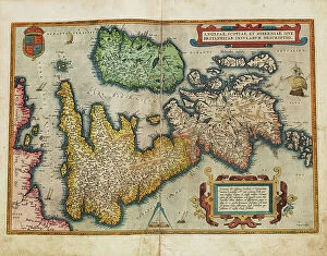
Background imageMaps Photo Mug Collection: Angliae, Scotiae, et Hiberniae, sive Britannicar: Insularum descriptio (England)

Angliae, Scotiae, et Hiberniae, sive Britannicar: Insularum descriptio (England, Scotland and Ireland)
7340123 Angliae, Scotiae, et Hiberniae, sive Britannicar: Insularum descriptio (England, Scotland and Ireland, otherwise known as the British Isles)


All Professionally Made to Order for Quick Shipping


-

Maps Photo Mug Collection

Scotland is a country located in the United Kingdom and Europe. Maps of Scotland are available to show its physical features, such as mountains, rivers, lakes, and cities. It also shows the political boundaries of Scotland within the UK and Europe. Maps of Scotland can be used to plan trips or explore its history and culture and can also help people understand how Scotland fits into the wider context of Europe. The maps provide an overview of the country's geography, climate, population density, transportation networks, and more. Additionally they may include information about attractions such as castles or other landmarks that make Scotland unique.
+

Our beautiful Wall Art and Photo Gifts include Framed Prints, Photo Prints, Poster Prints, Canvas Prints, Jigsaw Puzzles, Metal Prints and so much more

The Maps of Scotland United Kingdom Europe collection is a stunning assortment of wall art, framed prints, photo prints, canvas prints, jigsaw puzzles and greeting cards that showcase the beauty and rich history of Scotland. Our collection features an array of maps dating back to the 16th century, including antique maps depicting Scottish landscapes and seascapes as well as modern-day cartography showcasing cities such as Edinburgh and Glasgow. Each piece in our collection is carefully curated to provide a unique perspective on Scotland's geography, culture and heritage. Whether you are looking for a striking centrepiece for your living room or office or seeking a thoughtful gift for someone special who loves Scotland's history and landscape, the Maps of Scotland United Kingdom Europe collection has something for everyone. With its high-quality printing techniques that capture every detail with precision and clarity, our collection offers an unparalleled visual experience that will transport you to another time and place.
+

What are Maps of Scotland United Kingdom Europe art prints?

Maps of Scotland United Kingdom Europe art prints are high-quality reproductions of antique and contemporary maps that depict the geography, topography, and landmarks of Scotland, the United Kingdom, and Europe. These prints are created using advanced printing techniques to ensure vivid colors and sharp details that capture every nuance of the original map. These art prints serve as both decorative pieces for homes or offices as well as educational tools for students or history enthusiasts. We offer a unique perspective on how these regions have evolved over time while also highlighting their cultural significance. The collection includes various types of maps such as political maps, physical maps, vintage maps, city plans, and more. The selection ranges from classic designs to modern interpretations with something suitable for all tastes. Whether you're looking to decorate your home or office space with a piece of history or want to learn more about Scottish geography and culture through visual representation – Maps of Scotland United Kingdom Europe art prints provide an excellent option.
+

What Maps of Scotland United Kingdom Europe art prints can I buy from Media Storehouse?

We offer a wide range of Maps of Scotland United Kingdom Europe art prints for sale. These maps are available in various sizes and styles, including vintage, antique, and contemporary designs. You can choose from different types of maps, such as political maps that show the borders between countries or physical maps that display geographical features like mountains and rivers. Our collection includes detailed street maps of Scottish cities like Edinburgh and Glasgow, as well as regional maps that highlight popular tourist destinations like the Highlands and Islands. We also offer historical maps dating back to the 16th century which showcase how Scotland has changed over time. Whether you're looking for a map to hang in your home or office, we have something for everyone. With their vast selection of Maps of Scotland United Kingdom Europe art prints, you're sure to find the perfect piece to suit your taste and style.
+

How do I buy Maps of Scotland United Kingdom Europe art prints?

To buy Maps of Scotland United Kingdom Europe art prints, you can visit our online platform. We offer a wide range of high-quality maps that are perfect for decorating your home or office space. You can browse through our extensive collection and choose the map that best suits your taste and preferences. Once you have selected the map, you can add it to your cart and proceed to checkout. The process is simple and straightforward, with easy payment options available for your convenience. Media Storehouse takes pride in providing excellent customer service, so if you have any questions or concerns about purchasing a map print from them, feel free to reach out to their friendly support team who will be happy to assist you. Buying Maps of Scotland United Kingdom Europe art prints from Media Storehouse is an effortless process that offers quality products at affordable prices.
+

How much do Maps of Scotland United Kingdom Europe art prints cost?

We offer a wide range of Maps of Scotland United Kingdom Europe art prints that are available for purchase. The cost of these prints varies depending on the size and type of print you choose. We have a variety of options to suit all budgets, from affordable paper prints to high-quality canvas prints. Our Maps of Scotland United Kingdom Europe art prints are perfect for those who love history, geography or simply want to add some unique artwork to their home or office decor. They make great gifts too. We take pride in offering our customers top-quality products at competitive prices. Our team works hard to ensure that every customer is satisfied with their purchase and we strive to provide excellent customer service throughout the entire buying process. If you're interested in purchasing one of our Maps of Scotland United Kingdom Europe art prints, please visit our website today.
+

How will my Maps of Scotland United Kingdom Europe art prints be delivered to me?

We take pride in delivering our Maps of Scotland United Kingdom Europe art prints to you in the best possible condition. We use high-quality packaging materials and reliable delivery services to ensure that your order arrives safely and securely. Your art print will be carefully rolled and packaged in a sturdy tube to prevent any damage during transit. Our team works diligently to process your order promptly, so you can expect your package to arrive within a reasonable timeframe. We understand how important it is for our customers to receive their orders on time, which is why we work closely with trusted courier partners who have an excellent track record of timely deliveries. You can rest assured that your Maps of Scotland United Kingdom Europe art print will be delivered directly to your doorstep without any hassle or inconvenience. Weprioritize customer satisfaction by ensuring that all orders are delivered safely and efficiently using reliable shipping methods.